Hebron (CDP), Wisconsin

Last updated
Hebron, Wisconsin
Hebron Town Hall 2.jpg
WIMap-doton-Hebron.png
Location of Hebron, Wisconsin
Coordinates: 42°55′34″N88°41′16″W / 42.92611°N 88.68778°W / 42.92611; -88.68778 Coordinates: 42°55′34″N88°41′16″W / 42.92611°N 88.68778°W / 42.92611; -88.68778
Country United States
State Wisconsin
County Jefferson
Town Hebron
Area
  Total2.5 sq mi (6.5 km2)
  Land2.5 sq mi (6.4 km2)
  Water0.04 sq mi (0.1 km2)
Elevation
[1]
827 ft (252 m)
Population
 (2020)
  Total209
  Density84/sq mi (32/km2)
Time zone UTC-6 (Central (CST))
  Summer (DST) UTC-5 (CDT)
GNIS feature ID2393044 [1]

Hebron is a census-designated place (CDP) in the town of Hebron, Jefferson County, Wisconsin, United States. The population was 224 at the 2010 census. [2] It is located on the Bark River.

Contents

Geography

Hebron is located at 42°55′34″N88°41′16″W / 42.92611°N 88.68778°W / 42.92611; -88.68778 (42.926205, -88.688025). [3]

According to the United States Census Bureau, the CDP has a total area of 2.5 square miles (6.5 km2), of which 2.5 square miles (6.4 km2) is land and 0.04 square mile (0.1 km2) (1.60%) is water.

Demographics

As of the census [4] of 2000, there were 243 people, 87 households, and 64 families residing in the CDP. The population density was 98.9 people per square mile (38.1/km2). There were 93 housing units at an average density of 37.8/sq mi (14.6/km2). The racial makeup of the CDP was 97.53% White, 0.41% Black or African American and 2.06% Native American. Hispanic or Latino of any race were 2.06% of the population.

There were 87 households, out of which 37.9% had children under the age of 18 living with them, 65.5% were married couples living together, 2.3% had a female householder with no husband present, and 26.4% were non-families. 21.8% of all households were made up of individuals, and 11.5% had someone living alone who was 65 years of age or older. The average household size was 2.79 and the average family size was 3.23.

In the CDP, the population was spread out, with 30.0% under the age of 18, 7.4% from 18 to 24, 30.0% from 25 to 44, 20.2% from 45 to 64, and 12.3% who were 65 years of age or older. The median age was 35 years. For every 100 females, there were 109.5 males. For every 100 females age 18 and over, there were 97.7 males.

The median income for a household in the CDP was $56,250, and the median income for a family was $54,821. Males had a median income of $31,667 versus $22,292 for females. The per capita income for the CDP was $19,484. None of the population or families were below the poverty line.

Related Research Articles

<span class="mw-page-title-main">Fox River, Alaska</span> Census-designated place in Alaska, United States

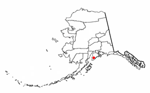
Fox River is a census-designated place (CDP) in Kenai Peninsula Borough, Alaska, United States. At the 2010 census the population was 685, up from 616 in 2000. It was first reported by the U.S. Geological Survey in 1895. The Fox River, which flows by the CDP, might have been named for Theodore Fox, a local mining magnate.

<span class="mw-page-title-main">Mount Hebron, California</span> Census-designated place in California

Mount Hebron is a census-designated place in Siskiyou County, California, United States. Its population is 103 as of the 2020 census, up from 95 from the 2010 census.

<span class="mw-page-title-main">Channel Lake, Illinois</span> Census-designated place in Illinois, United States

Channel Lake is an unincorporated community and census-designated place (CDP) in Antioch Township, Lake County, Illinois, United States. Per the 2020 census, the population was 1,581.

Lake Catherine is an unincorporated community and census-designated place (CDP) in Lake County, Illinois, United States. Per the 2020 census, the population was 1,279.

Venetian Village is a census-designated place (CDP) in Lake County, Illinois, United States. Per the 2020 census, the population was 2,761.

<span class="mw-page-title-main">Lake Summerset, Illinois</span> Census Designated Place in Illinois, United States

Lake Summerset is a census-designated place (CDP) in Stephenson and Winnebago counties in Illinois. The population was 2,048 at the 2010 census.

<span class="mw-page-title-main">Hebron, Maryland</span> Town in Maryland, United States

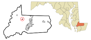
Hebron is a town in Wicomico County, Maryland, United States. The population was 1,084 at the 2010 census. It is included in the Salisbury, Maryland-Delaware Metropolitan Statistical Area. It is the hometown of pro-wrestler Mark Hildreth and politician Scott Taylor.

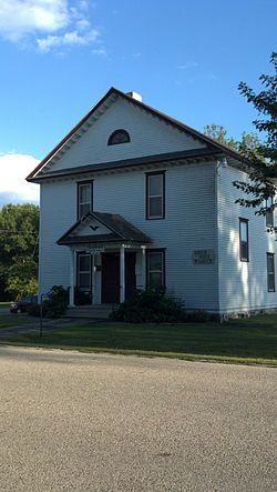
Elroy is a census-designated place (CDP) in Wayne County, North Carolina, United States. In 2007, the estimated population was 3,905. It is included in the Goldsboro, North Carolina Metropolitan Statistical Area.

<span class="mw-page-title-main">Sandusky South, Ohio</span> Unincorporated community in Ohio, United States

Sandusky South is an unincorporated community in Perkins Township, Erie County, Ohio, United States. The population was 6,599 at the 2000 census. It was not delineated as a CDP for the 2010 census. It is part of the Sandusky, Ohio Metropolitan Statistical Area.

<span class="mw-page-title-main">Lake Wissota, Wisconsin</span> CDP in Wisconsin, United States

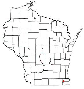
Lake Wissota is a census-designated place (CDP) in the town of Lafayette in Chippewa County in the U.S. state of Wisconsin. The population was 2,738 at the 2010 census. The CDP, known locally as Lake Wissota Village, is located along the southern shores of Lake Wissota.

<span class="mw-page-title-main">Lake Koshkonong, Wisconsin</span> Census-designated place in Wisconsin, United States

Lake Koshkonong is a census-designated place (CDP) in the towns of Koshkonong and Sumner, Jefferson County, Wisconsin, United States. The population was 1,239 at the 2020 census. Lake Koshkonong is in the area.

Rome is a census-designated place (CDP) in the town of Sullivan, Jefferson County, Wisconsin, along the Bark River. The population was 689 at the 2010 census.

<span class="mw-page-title-main">Bohners Lake, Wisconsin</span> CDP in Wisconsin, United States

Bohners Lake is a census-designated place (CDP) in Racine County, Wisconsin, United States. Its first syllable is pronounced as in "bone". The population of the CDP was 2,374 at the 2020 census. It is politically part of the Town of Burlington, together with Browns Lake, Wisconsin. There has been discussion of incorporating Bohners Lake as a village to prevent annexation by the City of Burlington. It was named for Antony Bohner, a French immigrant who established a resort on the lake of the same name.

<span class="mw-page-title-main">Browns Lake, Wisconsin</span> CDP in Wisconsin, United States

Browns Lake is a census-designated place (CDP) in Racine County, Wisconsin around a lake of the same name. The population was 1,879 at the 2020 census. It is politically a part of the town of Burlington, along with Bohners Lake.

<span class="mw-page-title-main">Tichigan, Wisconsin</span> Census-designated place in Wisconsin, United States

Tichigan is a census-designated place (CDP) in Racine County, Wisconsin, United States. The population was 5,277 at the 2020 census.

<span class="mw-page-title-main">Wind Lake, Wisconsin</span> CDP in Wisconsin, United States

Wind Lake is a census-designated place (CDP) in Racine County, Wisconsin, United States. The population was 5,355 at the 2020 census. Wind Lake is in the town of Norway.

<span class="mw-page-title-main">Como, Wisconsin</span> CDP in Wisconsin, United States

Como is a census-designated place (CDP), in the town of Geneva, Walworth County, Wisconsin, United States. The population was 2,356 at the 2020 census.

<span class="mw-page-title-main">Potter Lake, Wisconsin</span> CDP in Wisconsin, United States

Potter Lake is a census-designated place (CDP) in the town of East Troy, Walworth County, Wisconsin, United States. The population was 1,117 at the 2020 census.

<span class="mw-page-title-main">Tonawanda (CDP), New York</span> Census-designated place in New York, United States

Tonawanda is a census-designated place (CDP) in Erie County, New York, United States. The CDP comprises the town of Tonawanda minus its subsidiary village of Kenmore. As of the 2010 census, the CDP population was 58,144.

<span class="mw-page-title-main">Glastonbury Center, Connecticut</span> Census-designated place in Connecticut, United States

Glastonbury Center is a census-designated place (CDP) that constitutes the densely populated center of the town of Glastonbury in Hartford County, Connecticut, United States. The population was 7,387 at the 2010 census, out of a total town population of 34,427.

References

  1. 1 2 U.S. Geological Survey Geographic Names Information System: Hebron (CDP), Wisconsin
  2. "U.S. Census website". U.S. Census Bureau . Retrieved 5 April 2011.
  3. "US Gazetteer files: 2010, 2000, and 1990". United States Census Bureau. 2011-02-12. Retrieved 2011-04-23.
  4. "U.S. Census website". United States Census Bureau . Retrieved 2008-01-31.