Lake Lac La Belle, Wisconsin

Last updated

Lake Lac La Belle, Wisconsin
WIMap-doton-Lake Lac La Belle.png
Location of Lake Lac La Belle, Wisconsin
Coordinates: 43°7′57″N88°32′32″W / 43.13250°N 88.54222°W / 43.13250; -88.54222
Country Flag of the United States.svg  United States
State Flag of Wisconsin.svg  Wisconsin
County Jefferson
Town Ixonia
Area
  Total1.0 sq mi (2.5 km2)
  Land1.0 sq mi (2.5 km2)
  Water0.0 sq mi (0.0 km2)
Elevation
[1]
919 ft (280 m)
Population
 (2000)
  Total833
  Density876.1/sq mi (338.3/km2)
Time zone UTC-6 (Central (CST))
  Summer (DST) UTC-5 (CDT)
FIPS code 55-41591 [2]
GNIS feature ID1852245 [1]

Lake Lac La Belle is a former census-designated place (CDP) in Jefferson County, Wisconsin, United States. [3] The population was 833 at the 2000 census.

Contents

Geography

Lake Lac La Belle is located at 43°7′57″N88°32′32″W / 43.13250°N 88.54222°W / 43.13250; -88.54222 (43.132436, -88.542215). [4]

According to the United States Census Bureau, the CDP has a total area of 0.9 square mile (2.5 km2), all land.

Demographics

As of the census [2] of 2000, there were 833 people, 302 households, and 260 families residing in the CDP. The population density was 876.1 people per square mile (338.6/km2). There were 305 housing units at an average density of 320.8/sq mi (124.0/km2). The racial makeup of the CDP was 98.68% White, 0.12% African American, 0.36% Native American, 0.12% Asian, 0.24% from other races, and 0.48% from two or more races. Hispanic or Latino of any race were 1.32% of the population.

There were 302 households, out of which 34.8% had children under the age of 18 living with them, 78.1% were married couples living together, 5.6% had a female householder with no husband present, and 13.6% were non-families. 11.6% of all households were made up of individuals, and 5.3% had someone living alone who was 65 years of age or older. The average household size was 2.76 and the average family size was 2.97.

In the CDP, the population was spread out, with 25.6% under the age of 18, 5.6% from 18 to 24, 27.9% from 25 to 44, 31.2% from 45 to 64, and 9.7% who were 65 years of age or older. The median age was 39 years. For every 100 females, there were 99.8 males. For every 100 females age 18 and over, there were 102.6 males.

The median income for a household in the CDP was $67,917, and the median income for a family was $71,406. Males had a median income of $45,500 versus $29,375 for females. The per capita income for the CDP was $25,461. None of the families and 0.5% of the population were living below the poverty line, including no under eighteens and none of those over 64.

Related Research Articles

Plantation Mobile Home Park is a census-designated place (CDP) in Palm Beach County, Florida, United States. It is part of the Miami metropolitan area of South Florida. The population was 1,462 at the 2020 US census.

Forest Lake is an unincorporated community and census-designated place (CDP) in Ela Township of Lake County, Illinois, United States. It is about 35 miles (56 km) northwest of downtown Chicago. Per the 2020 census, the population was 1,784. The community was founded in 1935 as a vacation community for Chicago residents.

<span class="mw-page-title-main">Willow Brook Estates, Illinois</span> Census-designated place in Illinois, United States

Willow Brook Estates is an unincorporated census-designated place in Will County, Illinois, United States. The population was 1,346 at the 2020 census. it is considered a far south suburb of Chicago.

<span class="mw-page-title-main">Seconsett Island, Massachusetts</span> Census-designated place in Massachusetts, United States

Seconsett Island is a census-designated place (CDP) in the town of Mashpee in Barnstable County, Massachusetts, United States. The population was 100 at the 2010 census.

Vineland is an unincorporated community and census-designated place (CDP) in the Mille Lacs Indian Reservation portion of Mille Lacs County, Minnesota, United States. The population was 1,001 at the 2010 census. Its name in the Ojibwe language is Neyaashiing, meaning "on the point of land" due to its location on Indian Point of Mille Lacs Lake. It serves as the administrative center for the Mille Lacs Band of Ojibwe.

<span class="mw-page-title-main">Jette, Montana</span> Census-designated place in Montana, United States

Jette is a census-designated place (CDP) in Lake County, Montana, United States. The population was 253 at the 2010 census.

<span class="mw-page-title-main">Ashland, New Jersey</span> Populated place in Camden County, New Jersey, US

Ashland is an unincorporated community and census-designated place (CDP) located within Cherry Hill, in Camden County, in the U.S. state of New Jersey. As of the 2010 United States Census, the CDP's population was 8,302.

<span class="mw-page-title-main">Seneca Knolls, New York</span> Census-designated place in New York, United States

Seneca Knolls is a hamlet in Onondaga County, New York, United States. The population was 2,011 at the 2010 census.

<span class="mw-page-title-main">Fairdale, Pennsylvania</span> Census-designated place in Pennsylvania, United States

Fairdale is a community and census-designated place (CDP) in Greene County, Pennsylvania, United States. The population was 2,059 at the 2010 census.

<span class="mw-page-title-main">Ashland Heights, South Dakota</span> CDP in South Dakota, United States

Ashland Heights is a census-designated place (CDP) and unincorporated community in Pennington County, South Dakota, United States. The population was 678 at the 2020 census.

<span class="mw-page-title-main">Lozano, Texas</span> Census-designated place in Texas, United States

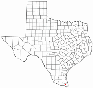
Lozano is a census-designated place (CDP) in Cameron County, Texas, United States. The population was 404 at the 2010 census, up from 324 at the 2000 census. It is part of the Brownsville–Harlingen Metropolitan Statistical Area.

<span class="mw-page-title-main">La Paloma-Lost Creek, Texas</span> CDP in Texas, United States

La Paloma-Lost Creek is a census-designated place (CDP) in Nueces County, Texas, United States. The population was 408 at the 2010 census, up from 323 at the 2000 census.

<span class="mw-page-title-main">Silver Summit, Utah</span> CDP in Utah, United States

Silver Summit is a census-designated place (CDP) in Summit County, Utah, United States. Prior to the 2010 Census, the area was designated as North Snyderville Basin CDP. The population was 1,821 at the 2000 census.

<span class="mw-page-title-main">Brush Prairie, Washington</span> Census-designated place in Washington, United States

Brush Prairie is a census-designated place (CDP) in Clark County, Washington, United States. The population was 2,652 at the 2010 census, up from 2,384 at the 2000 census.

<span class="mw-page-title-main">Lake Ripley, Wisconsin</span> Census-designated place in Wisconsin, United States

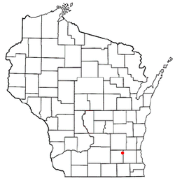
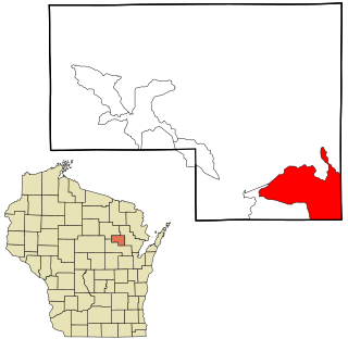
Lake Ripley is a census-designated place (CDP), in the town of Oakland, Jefferson County, Wisconsin, United States. The population was 1,911 at the 2020 census.

<span class="mw-page-title-main">Legend Lake, Wisconsin</span> CDP in Wisconsin, United States

Legend Lake is a census-designated place (CDP) in Menominee County, Wisconsin, Wisconsin, United States, on the Menominee Indian Reservation. The population was 1,670 at the 2020 census.

<span class="mw-page-title-main">Wind Lake, Wisconsin</span> CDP in Wisconsin, United States

Wind Lake is a census-designated place (CDP) in Racine County, Wisconsin, United States. The population was 5,355 at the 2020 census. Wind Lake is in the town of Norway.

<span class="mw-page-title-main">Lac La Belle, Wisconsin</span> Village in Wisconsin, United States

Lac La Belle is a village located mostly in Waukesha County in the U.S. state of Wisconsin. The population was 281 at the 2020 census. The village is located mostly within the town of Oconomowoc in Waukesha County. On March 28, 2002, the village annexed a portion of land in the town of Ixonia in Jefferson County.

<span class="mw-page-title-main">Okauchee Lake, Wisconsin</span> CDP in Wisconsin, United States

Okauchee Lake is a census-designated place (CDP) in Waukesha County, Wisconsin, United States. The population was 5,094 at the 2020 census. Okauchee Lake is located in the town of Oconomowoc.

<span class="mw-page-title-main">Lac du Flambeau (CDP), Wisconsin</span> CDP in Wisconsin, United States

Lac du Flambeau is a census-designated place (CDP) in the town of Lac du Flambeau in Vilas County, Wisconsin, United States. The population was 1,845 at the 2020 census. Lac du Flambeau is the major community for the Lac du Flambeau Band of Lake Superior Chippewa tribe.

References

  1. 1 2 "US Board on Geographic Names". United States Geological Survey. October 25, 2007. Retrieved January 31, 2008.
  2. 1 2 "U.S. Census website". United States Census Bureau . Retrieved January 31, 2008.
  3. "Lake Lac La Belle, Wisconsin". Geographic Names Information System . United States Geological Survey, United States Department of the Interior.
  4. "US Gazetteer files: 2010, 2000, and 1990". United States Census Bureau. February 12, 2011. Retrieved April 23, 2011.