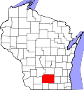
Belleville, Wisconsin

Last updated

Belleville, Wisconsin
Belleville Library Park.jpg
Library Park, with the old Village Hall (1894) in its center, is listed on the National Register of Historic Places
Dane County Wisconsin Incorporated and Unincorporated areas Belleville Highlighted.svg
Location of Belleville in Dane County, Wisconsin.
Coordinates: 42°51′42″N89°32′12″W / 42.86167°N 89.53667°W / 42.86167; -89.53667
Country Flag of the United States.svg  United States
State Flag of Wisconsin.svg  Wisconsin
Counties Dane, Green
Area
[1]
  Total1.81 sq mi (4.68 km2)
  Land1.59 sq mi (4.11 km2)
  Water0.22 sq mi (0.57 km2)
Elevation
[2]
873 ft (266 m)
Population
 (2020) [3]
  Total2,491
  Density1,551.98/sq mi (599.35/km2)
Time zone UTC-6 (Central (CST))
  Summer (DST) UTC-5 (CDT)
Area code 608
FIPS code 55-06300 [4]
GNIS feature ID1561535 [2]
Website bellevillewi.org

Belleville is a village in Dane and Green counties in the U.S. state of Wisconsin. The population was 2,491 at the 2020 census. Of this, 1,909 were in Dane County, and 582 were in Green County.

Contents

The Dane County portion of Belleville is part of the Madison Metropolitan Statistical Area, while the Green County portion is part of the Monroe Micropolitan Statistical Area.

Geography

According to the United States Census Bureau, the village has a total area of 1.78 square miles (4.61 km2), of which, 1.58 square miles (4.09 km2) of it is land and 0.20 square miles (0.52 km2) is water. [5] [6]

Demographics

Historical population
CensusPop.Note
1860 164
1870 132−19.5%
1890 319
1900 38520.7%
1910 4229.6%
1920 62548.1%
1930 564−9.8%
1940 5945.3%
1950 73523.7%
1960 84414.8%
1970 1,06325.9%
1980 1,30222.5%
1990 1,45611.8%
2000 1,90831.0%
2010 2,38525.0%
2020 2,4914.4%
U.S. Decennial Census [7]

2010 census

At the 2010 census there were 2,385 people, 986 households, and 658 families living in the village. The population density was 1,509.5 inhabitants per square mile (582.8/km2). There were 1,030 housing units at an average density of 651.9 per square mile (251.7/km2). The racial makeup of the village was 96.0% White, 0.3% African American, 0.2% Native American, 0.8% Asian, 1.7% from other races, and 1.0% from two or more races. Hispanic or Latino of any race were 3.8%. [3]

Of the 986 households 36.3% had children under the age of 18 living with them, 52.1% were married couples living together, 9.3% had a female householder with no husband present, 5.3% had a male householder with no wife present, and 33.3% were non-families. 26.9% of households were one person and 10.2% were one person aged 65 or older. The average household size was 2.42 and the average family size was 2.96.

The median age in the village was 34.9 years. 26.9% of residents were under the age of 18; 6.4% were between the ages of 18 and 24; 32.4% were from 25 to 44; 24.2% were from 45 to 64; and 10.1% were 65 or older. The gender makeup of the village was 49.1% male and 50.9% female.

2000 census

At the 2000 census there were 1,908 people, 764 households, and 540 families living in the village. The population density was 1,648.2 people per square mile (635.1/km2). There were 788 housing units at an average density of 680.7 per square mile (262.3/km2). The racial makup of the village was 98.32% White, 0.21% African American, 0.16% Native American, 0.31% Asian, 0.31% from other races, and 0.68% from two or more races. Hispanic or Latino of any race were 0.79%. [4]

Of the 764 households 37.2% had children under the age of 18 living with them, 56.3% were married couples living together, 10.2% had a female householder with no husband present, and 29.2% were non-families. 23.3% of households were one person and 12.3% were one person aged 65 or older. The average household size was 2.48 and the average family size was 2.96.

The age distribution was 28.1% under the age of 18, 5.8% from 18 to 24, 34.2% from 25 to 44, 19.7% from 45 to 64, and 12.2% 65 or older. The median age was 35 years. For every 100 females, there were 94.7 males. For every 100 females age 18 and over, there were 92.8 males.

The median household income was $49,274 and the median family income was $55,909. Males had a median income of $33,897 versus $26,038 for females. The per capita income for the village was $21,784. About 2.3% of families and 5.2% of the population were below the poverty line, including 8.5% of those under age 18 and 10.2% of those age 65 or over.

History

At least some of the land the village now occupies was owned between 1838 and 1841 by Daniel Webster, the American statesman, who also speculated in land on the frontier. [8] In 1845, John Frederick acquired property around the Sugar River and commenced construction of a dam and sawmill, and later a grist mill. By 1850, along with John Mitchell, Frederick platted the village and named it Belleville after his hometown of Belleville, Ontario. [9]

Media

The Post Messenger Recorder is the area's weekly newspaper.

Culture

Belleville hosts the Belleville Music Festival in conjunction with ultra running races sponsored by Ten Junk Miles Racing in late July/Early August. In August, Belleville holds its annual Community Picnic featuring activities such as live entertainment, a softball tournament, and a car show. The annual UFO day festival and parade is held the last Saturday in October.

Notable people

Related Research Articles

<span class="mw-page-title-main">Belleville, Kansas</span> City in Republic County, Kansas

Belleville is a city in and the county seat of Republic County, Kansas, United States. As of the 2020 census, the population of the city was 2,007.

<span class="mw-page-title-main">Munden, Kansas</span> City in Republic County, Kansas

Munden is a city in Republic County, Kansas, United States. As of the 2020 census, the population of the city was 96.

<span class="mw-page-title-main">Belleville, Michigan</span> City in Michigan, United States

Belleville is a city in Wayne County in the U.S. state of Michigan. A western suburb of Detroit, Belleville is located roughly 29 miles (46.7 km) southwest of downtown Detroit, and 18 miles (29.0 km) southeast of Ann Arbor, and is completely surrounded by Van Buren Township. As of the 2010 census, the city had a population of 3,991.

<span class="mw-page-title-main">Dannebrog, Nebraska</span> Town in Nebraska, United States

Dannebrog is a village in Howard County, Nebraska, United States. It is part of the Grand Island, Nebraska Micropolitan Statistical Area. The population was 303 at the 2010 census.

<span class="mw-page-title-main">Addyston, Ohio</span> Village in Ohio, United States

Addyston is a village in Miami Township, Hamilton County, Ohio, United States. Located along the Ohio River, it is a western suburb of the neighboring city of Cincinnati. The population was 927 at the 2020 census.

<span class="mw-page-title-main">Christiana, Dane County, Wisconsin</span> Town in Wisconsin, United States

The Town of Christiana is located in Dane County, Wisconsin, United States. The population was 1,235 at the 2020 census. It is named after Oslo, Norway and has one of the highest percentages of Norwegian ancestry in the United States. The unincorporated community of Utica and the village of Rockdale are located within the town. The village of Cambridge is located partly within the Town.

<span class="mw-page-title-main">Rockdale, Wisconsin</span> Village in Wisconsin, United States

Rockdale is a village in Dane County, Wisconsin, United States. The population was 207 at the 2020 census, making it the smallest incorporated municipality in Dane County. The village is split in half by the Koshkonong Creek. It is part of the Madison Metropolitan Statistical Area.

<span class="mw-page-title-main">Shorewood Hills, Wisconsin</span> Village in Wisconsin, United States

Shorewood Hills is a village in Dane County, Wisconsin, United States. It was established in 1927. The population was 2,169 at the 2020 census. Entirely surrounded by the city of Madison and Lake Mendota, it is part of the Madison Metropolitan Statistical Area.

<span class="mw-page-title-main">Black Earth, Wisconsin</span> Village in Wisconsin, United States

Black Earth is a village in Dane County, Wisconsin, United States. The population was 1,338 at the 2010 census. The village is located within the Town of Black Earth. It is part of the Madison Metropolitan Statistical Area.

<span class="mw-page-title-main">Blue Mounds, Wisconsin</span> Village in U.S. state of Wisconsin

Blue Mounds is a village in Dane County, Wisconsin, United States. As of the 2020 census, the village had a population of 950. The village is adjacent to the Town of Blue Mounds, and is part of the Madison Metropolitan Statistical Area.

<span class="mw-page-title-main">Blue Mounds (town), Wisconsin</span> Town in Wisconsin, United States

Blue Mounds is a town in Dane County, Wisconsin, United States. The population was 899 at the 2020 census. The Village of Blue Mounds is located within the town.

<span class="mw-page-title-main">Cottage Grove, Wisconsin</span> Village in Wisconsin, United States

Cottage Grove is a village in Dane County, Wisconsin, United States. Its population was 7,303 at the 2020 census. A suburb of Madison, it shares a school district with Monona. The village is located partially within the survey township of Cottage Grove.

<span class="mw-page-title-main">Cross Plains (town), Wisconsin</span>

Cross Plains is a town in Dane County, Wisconsin, United States. The population was 1,419 at the 2000 census. The Village of Cross Plains is located partially within the town. The unincorporated community of Pine Bluff is located in the town.

<span class="mw-page-title-main">Cross Plains, Wisconsin</span> Village in Wisconsin, United States

Cross Plains is a village in Dane County, Wisconsin, United States. The population was 4,104 at the 2020 census. The village is located partially within the Town of Cross Plains. It is part of the Madison Metropolitan Statistical Area.

<span class="mw-page-title-main">Dane, Wisconsin</span> Village in Wisconsin, United States

Dane is a village in Dane County, Wisconsin, United States. The population was 1,117 at the 2020 census. Located in the Town of Dane, the village is part of the Madison Metropolitan Statistical Area.

<span class="mw-page-title-main">Dane (town), Wisconsin</span>

Dane is a town in Dane County, Wisconsin, United States. The population was 968 at the 2000 census. The unincorporated community of Lutheran Hill is located partially in the town.

<span class="mw-page-title-main">Deerfield, Wisconsin</span> City in Wisconsin, United States

Deerfield is a city in Dane County, Wisconsin. The population was 2,319 at the time of the 2010 census. The city is located within the Town of Deerfield. It is part of the Madison Metropolitan Statistical Area. Towns and villages near Deerfield include Marshall, Medina, London, Cambridge, and Cottage Grove, Wisconsin.

<span class="mw-page-title-main">Mazomanie (town), Wisconsin</span>

Mazomanie is a town in Dane County, Wisconsin. The population was 1,185 at the time of the 2000 census. The Village of Mazomanie is located within the town.

<span class="mw-page-title-main">Windsor, Wisconsin</span> Village in Wisconsin, United States

Windsor is a village and former town in Dane County, Wisconsin. The population was 8,754 at the time of the 2020 census. The communities of Lake Windsor, Morrisonville, and Token Creek are located within the village. Windsor voted to incorporate as a village on November 3, 2015; prior to its incorporation, it was a town, and a portion of the town was a census-designated place. Windsor is a part of the Census Bureau's Madison metropolitan statistical area.

<span class="mw-page-title-main">Brooklyn (village), Wisconsin</span> Place in Wisconsin, United States

Brooklyn is a village in Dane and Green counties in Wisconsin, United States. The population was 1,524 at the 2020 census, with 1,026 residents in Dane County and 498 in Green County.

References

  1. "2019 U.S. Gazetteer Files". United States Census Bureau. Retrieved August 7, 2020.
  2. 1 2 "US Board on Geographic Names". United States Geological Survey. October 25, 2007. Retrieved January 31, 2008.
  3. 1 2 "U.S. Census website". United States Census Bureau . Retrieved November 18, 2012.
  4. 1 2 "U.S. Census website". United States Census Bureau . Retrieved January 31, 2008.
  5. "US Gazetteer files 2010". United States Census Bureau. Archived from the original on January 25, 2012. Retrieved November 18, 2012.
  6. "US Gazetteer files: 2010, 2000, and 1990". United States Census Bureau. February 12, 2011. Retrieved April 23, 2011.
  7. "Census of Population and Housing". Census.gov. Retrieved June 4, 2015.
  8. Dane County Deeds, Vol. 4, Pp. 319, 324.
  9. A History of Belleville and Surroundings, Belleville Area Historical Society, 2001
  10. 'Illinois Blue Book 1983,' Biographical Sketch of William F. Mahar, pg. 78