Ontario, Wisconsin

Last updated

Ontario, Wisconsin
Ontario, Wisconsin.jpg
Monroe County Wisconsin Incorporated and Unincorporated areas Ontario Highlighted.svg
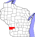
Location of Ontario in Vernon County, Wisconsin.
Coordinates: 43°43′24″N90°35′31″W / 43.72333°N 90.59194°W / 43.72333; -90.59194
Country Flag of the United States.svg  United States
State Flag of Wisconsin.svg  Wisconsin
County Vernon
Area
[1]
  Total1.01 sq mi (2.62 km2)
  Land1.00 sq mi (2.60 km2)
  Water0.01 sq mi (0.02 km2)
Elevation
[2]
919 ft (280 m)
Population
 (2010) [3]
  Total554
  Estimate 
(2019) [4]
555
  Density552.79/sq mi (213.46/km2)
Time zone UTC-6 (Central (CST))
  Summer (DST) UTC-5 (CDT)
Area code 608
FIPS code 55-60075 [5]
GNIS feature ID1570841 [2]
Website ontariowi.com

Ontario is a village in Vernon County, Wisconsin, United States. The population was 554 at the 2010 census.

Contents

Geography

Ontario is located at 43°43′24″N90°35′31″W / 43.72333°N 90.59194°W / 43.72333; -90.59194 (43.723396, -90.591999). [6]

According to the United States Census Bureau, the village has a total area of 1.01 square miles (2.62 km2), of which, 1.00 square mile (2.59 km2) of it is land and 0.01 square miles (0.03 km2) is water. [7]

Demographics

Historical population
CensusPop.Note
1880 179
1900 389
1910 304−21.9%
1920 3112.3%
1930 3306.1%
1940 53361.5%
1950 527−1.1%
1960 448−15.0%
1970 392−12.5%
1980 3981.5%
1990 4072.3%
2000 47617.0%
2010 55416.4%
2019 (est.)555 [4] 0.2%
U.S. Decennial Census [8]

2010 census

As of the census [3] of 2010, there were 554 people, 210 households, and 135 families living in the village. The population density was 554.0 inhabitants per square mile (213.9/km2). There were 253 housing units at an average density of 253.0 per square mile (97.7/km2). The racial makeup of the village was 88.3% White, 1.3% Native American, 1.1% Asian, 7.8% from other races, and 1.6% from two or more races. Hispanic or Latino of any race were 14.8% of the population.

There were 210 households, of which 34.3% had children under the age of 18 living with them, 45.2% were married couples living together, 11.0% had a female householder with no husband present, 8.1% had a male householder with no wife present, and 35.7% were non-families. 29.5% of all households were made up of individuals, and 15.8% had someone living alone who was 65 years of age or older. The average household size was 2.64 and the average family size was 3.28.

The median age in the village was 31.5 years. 31.9% of residents were under the age of 18; 7.5% were between the ages of 18 and 24; 23.5% were from 25 to 44; 19.5% were from 45 to 64; and 17.5% were 65 years of age or older. The gender makeup of the village was 47.8% male and 52.2% female.

2000 census

As of the census [5] of 2000, there were 476 people, 225 households, and 134 families living in the village. The population density was 470.1 people per square mile (182.0/km2). There were 254 housing units at an average density of 250.9 per square mile (97.1/km2). The racial makeup of the village was 94.96% White, 0.84% Native American, 3.78% from other races, and 0.42% from two or more races. Hispanic or Latino of any race were 4.83% of the population.

There were 225 households, out of which 24.4% had children under the age of 18 living with them, 43.6% were married couples living together, 11.6% had a female householder with no husband present, and 40.4% were non-families. 36.4% of all households were made up of individuals, and 21.8% had someone living alone who was 65 years of age or older. The average household size was 2.12 and the average family size was 2.73.

In the village, the population was spread out, with 21.4% under the age of 18, 7.8% from 18 to 24, 21.8% from 25 to 44, 24.2% from 45 to 64, and 24.8% who were 65 years of age or older. The median age was 44 years. For every 100 females, there were 93.5 males. For every 100 females age 18 and over, there were 92.8 males.

The median income for a household in the village was $23,194, and the median income for a family was $28,750. Males had a median income of $23,333 versus $17,083 for females. The per capita income for the village was $13,893. About 14.2% of families and 22.4% of the population were below the poverty line, including 35.1% of those under age 18 and 24.1% of those age 65 or over.

Attractions

See also

Related Research Articles

<span class="mw-page-title-main">Pawnee, Illinois</span> Village in Illinois, United States

Pawnee is a village in Sangamon County, Illinois, United States. Its population was 2,739 at the 2010 census, and 2,651 at a 2018 estimate. It is part of the Springfield, Illinois Metropolitan Statistical Area.

<span class="mw-page-title-main">Wallace, Kansas</span> City in Wallace County, Kansas

Wallace is a city in Wallace County, Kansas, United States. As of the 2020 census, the population of the city was 41.

<span class="mw-page-title-main">Hubbard, Nebraska</span> Village in Dakota County, Nebraska, United States

Hubbard is a village in Dakota County, Nebraska, United States. It is part of the Sioux City, IA–NE–SD Metropolitan Statistical Area. The population was 236 at the 2010 census.

<span class="mw-page-title-main">Haywood City, Missouri</span> Village in Missouri, United States

Haywood City is a village in Scott County, Missouri, United States. The population was 206 at the 2010 census.

Rensselaer Falls is a village located in St. Lawrence County, New York. As of the 2010 census, the village had a total population of 332. The current name came from mill owner Henry Van Rensselaer.

<span class="mw-page-title-main">Sodus Point, New York</span> Village in New York, United States

Sodus Point is a village in Wayne County, New York, United States. The population was 900 at the 2010 census. However, the last official US Census in 2020 recorded the population at 822. The name is derived from a nearby body of water, Sodus Bay. It is considered to be within the larger Rochester metropolitan area.

<span class="mw-page-title-main">Rossburg, Ohio</span> Village in Ohio, United States

Rossburg is a village in Darke County, Ohio, United States. The population was 159 at the 2020 census.

<span class="mw-page-title-main">Sankertown, Pennsylvania</span> Borough in Pennsylvania, United States

Sankertown is a borough in Cambria County, Pennsylvania, United States. It is part of the Johnstown, Pennsylvania Metropolitan Statistical Area. The population was 675 at the 2010 census.

<span class="mw-page-title-main">Fall River, Wisconsin</span> Village in Wisconsin, United States

Fall River is a village in Columbia County, Wisconsin, United States, along the North Fork of the Crawfish River. The population was 1,712 at the 2010 census. It is part of the Madison Metropolitan Statistical Area.

<span class="mw-page-title-main">Rock Springs, Wisconsin</span> Village in Wisconsin, United States

Rock Springs is a village in Sauk County, Wisconsin, United States, along the Baraboo River. The population was 362 at the 2010 census.

<span class="mw-page-title-main">Cascade, Wisconsin</span> Village in Wisconsin, United States

Cascade is a village in Sheboygan County, Wisconsin, United States. The population was 709 at the 2010 census. It is included in the Sheboygan, Wisconsin Metropolitan Statistical Area. Wisconsin Highway 28 passes through Cascade.

<span class="mw-page-title-main">Random Lake, Wisconsin</span> Village in Wisconsin, United States

Random Lake is a village in Sheboygan County, Wisconsin, United States. The population was 1,594 at the 2010 census. It is part of the Sheboygan, Wisconsin Metropolitan Statistical Area.

<span class="mw-page-title-main">Chaseburg, Wisconsin</span> Village in Wisconsin, United States

Chaseburg is a village in Vernon County, Wisconsin, United States. The population was 284 at the 2010 census.

<span class="mw-page-title-main">Butler, Waukesha County, Wisconsin</span> Village in Wisconsin, United States

Butler is a village in Waukesha County, Wisconsin, United States. The population was 1,787 at the 2020 census.

<span class="mw-page-title-main">De Soto, Wisconsin</span> Village in Wisconsin, United States

De Soto is a village mostly in Vernon County but also in Crawford County in Wisconsin. The population was 287 at the 2010 census. Of this, 179 were in living in Vernon County, and 108 were living in Crawford County. The downtown and business area is located in Crawford County.

<span class="mw-page-title-main">Cazenovia, Wisconsin</span> Village in Wisconsin, United States

Cazenovia is a village in Richland and Sauk Counties in the U.S. state of Wisconsin. The population was 318 at the 2010 census. Of this, 314 were in Richland County, and only 4 were in Sauk County.

<span class="mw-page-title-main">Kingston, Wisconsin</span> Village in Wisconsin, United States

Kingston is a village in Green Lake County, Wisconsin, United States. The population was 326 at the 2010 census. The village is located within the Town of Kingston. The unincorporated community of Dalton, Wisconsin is near Kingston.

<span class="mw-page-title-main">Arena, Wisconsin</span> Village in Wisconsin, United States

Arena is a village in Iowa County, Wisconsin, United States. The population was 834 at the 2010 census. The village is located within the Town of Arena. It is part of the Madison Metropolitan Statistical Area.

<span class="mw-page-title-main">Oxford, Wisconsin</span> Village in Wisconsin, United States

Oxford is a village in Marquette County, Wisconsin, United States. The population was 537 at the 2020 census. The village is located within the Town of Oxford. The Union Pacific Railroad runs through the town and over Neenah Lake to the northwest.

<span class="mw-page-title-main">Ironton, Wisconsin</span> Village in Wisconsin, United States

Ironton is a village in Sauk County, Wisconsin, United States, along the Little Baraboo River. The population was 253 at the 2010 census. The village is located within the Town of Ironton.

References

  1. "2019 U.S. Gazetteer Files". United States Census Bureau. Retrieved August 7, 2020.
  2. 1 2 "US Board on Geographic Names". United States Geological Survey. October 25, 2007. Retrieved January 31, 2008.
  3. 1 2 "U.S. Census website". United States Census Bureau . Retrieved November 18, 2012.
  4. 1 2 "Population and Housing Unit Estimates". United States Census Bureau. May 24, 2020. Retrieved May 27, 2020.
  5. 1 2 "U.S. Census website". United States Census Bureau . Retrieved January 31, 2008.
  6. "US Gazetteer files: 2010, 2000, and 1990". United States Census Bureau. February 12, 2011. Retrieved April 23, 2011.
  7. "US Gazetteer files 2010". United States Census Bureau. Archived from the original on January 25, 2012. Retrieved November 18, 2012.
  8. "Census of Population and Housing". Census.gov. Retrieved June 4, 2015.