Victory, Wisconsin | |
|---|---|
 | |
 Victory, Wisconsin  Victory, Wisconsin | |
| Coordinates: 43°29′08″N91°12′45″W / 43.48556°N 91.21250°W | |
| Country | |
| State | |
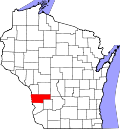
| County | Vernon |
| Elevation | 650 ft (200 m) |
| Time zone | UTC-6 (Central (CST)) |
| • Summer (DST) | UTC-5 (CDT) |
| Area code | 608 |
| GNIS feature ID | 1576083 [1] |
Victory is an unincorporated community in the Town of Wheatland in Vernon County, Wisconsin, United States. [1] [2] It is located 4.5 miles north of De Soto and 6.2 miles south of Genoa on the Mississippi River along the Great River Road (WIS 35). It also is served by the BNSF Railway.