La Farge, Wisconsin

Last updated

La Farge, Wisconsin
La Farge, Wisconsin.jpg
Vernon County Wisconsin Incorporated and Unincorporated areas La Farge Highlighted.svg
Location of La Farge in Vernon County, Wisconsin.
Coordinates: 43°34′36″N90°38′18″W / 43.57667°N 90.63833°W / 43.57667; -90.63833
Country Flag of the United States.svg  United States
State Flag of Wisconsin.svg  Wisconsin
County Vernon
Area
[1]
  Total1.03 sq mi (2.68 km2)
  Land1.01 sq mi (2.61 km2)
  Water0.03 sq mi (0.07 km2)
Elevation
[2]
797 ft (243 m)
Population
 (2020) [3]
  Total730
  Estimate 
(2022) [4]
720
  Density752.23/sq mi (290.54/km2)
Time zone UTC-6 (Central (CST))
  Summer (DST) UTC-5 (CDT)
Area code 608
FIPS code 55-40875 [5]
GNIS feature ID1567689 [2]
Website www.lafarge-wisconsin.com
La Farge schools La Farge schools.jpg
La Farge schools

La Farge is a village along the Kickapoo River in Vernon County, Wisconsin, United States. Its population was 730 at the 2020 census.

Contents

Geography

La Farge is located at 43°34′36″N90°38′18″W / 43.57667°N 90.63833°W / 43.57667; -90.63833 (43.576572, -90.638239). [6]

According to the United States Census Bureau, the village has a total area of 1.10 square miles (2.85 km2), of which 0.03 square miles (0.08 km2) is covered by water. [7] The Kickapoo River flows through the village.

Demographics

Historical population
CensusPop.Note
1900 488
1910 65434.0%
1920 78820.5%
1930 756−4.1%
1940 92121.8%
1950 905−1.7%
1960 833−8.0%
1970 748−10.2%
1980 746−0.3%
1990 7662.7%
2000 7751.2%
2010 746−3.7%
2020 730−2.1%
2022 (est.)720 [4] −1.4%
U.S. Decennial Census [8]

2010 census

As of the census [3] of 2010, 746 people, 332 households, and 186 families lived in the village. The population density was 697.2 inhabitants per square mile (269.2/km2). The 375 housing units had an average density of 350.5 per square mile (135.3/km2). The racial makeup of the village was 97.1% White, 0.3% African American, 1.6% Native American, 0.1% Asian, 0.1% from other races, and 0.8% from two or more races. Hispanics or Latinos of any race were 0.4% of the population.

Of the 332 households, 24.7% had children under 18 living with them, 38.0% were married couples living together, 11.7% had a female householder with no husband present, 6.3% had a male householder with no wife present, and 44.0% were not families. About 37.3% of all households were made up of individuals, and 15.9% had someone living alone who was 65 or older. The average household size was 2.17, and the average family size was 2.78.

The median age in the village was 42.8 years; 20.5% of residents were under 18; 7.7% were 18 to 24; 24.7% were 25 to 44; 28.1% were 45 to 64; and 19% were 65 or older. The gender makeup of the village was 50.7% male and 49.3% female.

2000 census

As of the census [5] of 2000, 775 people, 342 households, and 200 families resided in the village. The population density was 745.4 people per square mile (287.7/km2). The 366 housing units had an average density of 352.0 per square mile (135.9/km2). The racial makeup of the village was 97.29% White, 0.13% African American, 0.65% Native American, 0.13% Pacific Islander, 0.52% from other races, and 1.29% from two or more races. Hispanics or Latinos of any race were 0.65% of the population.

There were 342 households, out of which 26.3% had children under the age of 18 living with them, 43.6% were married couples living together, 9.4% had a female householder with no husband present, and 41.5% were non-families. 38.6% of all households were made up of individuals, and 22.2% had someone living alone who was 65 years of age or older. The average household size was 2.20 and the average family size was 2.90.

In the village, the age distribution was 25.7% under 18, 7.9% from 18 to 24, 22.1% from 25 to 44, 24.5% from 45 to 64, and 19.9% who were 65 or older. The median age was 41 years. For every 100 females, there were 95.2 males. For every 100 females 18 and over, there were 96.6 males.

The median income for a household in the village was $23,083, and for a family was $33,750. Males had a median income of $26,818 versus $19,833 for females. The per capita income for the village was $14,191. About 12.1% of families and 14.4% of the population were below the poverty line, including 18.3% of those under 18 and 10.7% of those 65 or over.

Transportation

La Farge is located at "the Corners", the intersection and concurrency of Wisconsin Highway 82 and Wisconsin Highway 131.

Economy

La Farge is home to the headquarters of Organic Valley, a farmer-owned organic-culture cooperative.

The economy of the Kickapoo Vally above La Farge has evolved slowly over the past 150 years. Fur trading was the first economic activity. The Ho-Chunk and other Native Americans sold pelts of beaver, muskrat, to European and then American traders in exchange for European and American goods. Fur trading was common from the late 1600s to the 1840s, when logging surpassed its importance.

Organic Valley's global headquarters, also known as "the modern barn" in La Farge, Wisconsin Organic Valley headquarters La Farge.jpg
Organic Valley's global headquarters, also known as "the modern barn" in La Farge, Wisconsin
Organic Valley retail store in La Farge Organic Valley in La Farge-2.jpg
Organic Valley retail store in La Farge

Related Research Articles

<span class="mw-page-title-main">Vernon County, Wisconsin</span> County in Wisconsin, United States

Vernon County is a county in the U.S. state of Wisconsin. As of the 2020 census, the population was 30,714. Its county seat is Viroqua.

<span class="mw-page-title-main">Fall River, Wisconsin</span> Village in Wisconsin, United States

Fall River is a village in Columbia County, Wisconsin, United States, along the North Fork of the Crawfish River. The population was 1,712 at the 2010 census. It is part of the Madison Metropolitan Statistical Area.

<span class="mw-page-title-main">Poynette, Wisconsin</span> Village in Wisconsin, United States

Poynette is a village in Columbia County, Wisconsin, United States. The population was 2,590 at the 2020 census. It is part of the Madison Metropolitan Statistical Area.

<span class="mw-page-title-main">Gays Mills, Wisconsin</span> Village in Wisconsin, United States

Gays Mills is a village in Crawford County, Wisconsin, United States. The population was 491 at the 2010 census.

<span class="mw-page-title-main">Soldiers Grove, Wisconsin</span> Village in Wisconsin, United States

Soldiers Grove is a village situated along the Kickapoo River in Crawford County, Wisconsin, in the United States. The population was 592 at the 2010 census. The town is notable for having relocated its central business district due to flooding on the nearby Kickapoo River during the 1970s, and has become a case study in best practices for managed retreat.

<span class="mw-page-title-main">Neosho, Wisconsin</span> Village in Wisconsin, United States

Neosho is a village in Dodge County, Wisconsin, United States. The population was 574 at the 2010 census.

<span class="mw-page-title-main">Brandon, Wisconsin</span> Village in Wisconsin, United States

Brandon is a village in Fond du Lac County, Wisconsin, United States. The population was 879 at the 2010 census.

<span class="mw-page-title-main">Cashton, Wisconsin</span> Village in Wisconsin, United States

Cashton is a village in Monroe County, Wisconsin, United States. The population was 1,158 at the 2020 census.

<span class="mw-page-title-main">Glenbeulah, Wisconsin</span> Village in Wisconsin, United States

Glenbeulah is a village in Sheboygan County, Wisconsin, United States. The population was 463 at the 2010 census. It is included in the Sheboygan, Wisconsin Metropolitan Statistical Area. Glenbeulah is situated on the Mullet River.

<span class="mw-page-title-main">Chaseburg, Wisconsin</span> Village in Wisconsin, United States

Chaseburg is a village in Vernon County, Wisconsin, United States. The population was 284 at the 2010 census.

<span class="mw-page-title-main">Ontario, Wisconsin</span> Village in Wisconsin, United States

Ontario is a village in Vernon County, Wisconsin, United States. The population was 554 at the 2010 census.

<span class="mw-page-title-main">Nashotah, Wisconsin</span> Village in Wisconsin, United States

Nashotah is a village in Waukesha County, Wisconsin, United States. The population was 1,321 at the 2020 census. The village took its name from the nearby Nashotah Lakes.

<span class="mw-page-title-main">De Soto, Wisconsin</span> Village in Wisconsin, United States

De Soto is a village mostly in Vernon County but also in Crawford County in Wisconsin. The population was 287 at the 2010 census. Of this, 179 were in living in Vernon County, and 108 were living in Crawford County. The downtown and business area is located in Crawford County.

<span class="mw-page-title-main">Viola, Wisconsin</span> Village in Wisconsin, United States

Viola is a village in Richland (mostly) and Vernon Counties in the U.S. state of Wisconsin, United States. The population was 699 at the 2010 census. Of this, 477 were in Richland County, and 222 were in Vernon County.

<span class="mw-page-title-main">Wauzeka, Wisconsin</span> Village in Wisconsin, United States

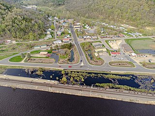
Wauzeka is a village in Crawford County, Wisconsin, United States. The population was 628 at the 2020 census. The village is located within the Town of Wauzeka near the confluence of the Kickapoo River and Wisconsin River.

<span class="mw-page-title-main">Lowell, Wisconsin</span> Village in Wisconsin, United States

Lowell is a village in Dodge County, Wisconsin, United States, along the Beaver Dam River. The population was 340 at the 2010 census. The village is located within the Town of Lowell.

<span class="mw-page-title-main">Theresa, Wisconsin</span> Village in Wisconsin, United States

Theresa is a village in Dodge County, Wisconsin, United States. The population was 1,262 at the 2010 census. The village is within the Town of Theresa.

<span class="mw-page-title-main">Monroe (town), Green County, Wisconsin</span> Town in Wisconsin, United States

Monroe is a town in Green County, Wisconsin, United States. The population was 10,142 at the 2000 census. The City of Monroe is located partially within the town. The unincorporated community of Stearns is also located in the town.

<span class="mw-page-title-main">Highland (village), Iowa County, Wisconsin</span> Village in Wisconsin, United States

Highland is a village in Iowa County, Wisconsin, United States. The population was 842 at the 2010 census. It is part of the Madison Metropolitan Statistical Area. The village is located within the Town of Highland.

<span class="mw-page-title-main">Genoa, Wisconsin</span> Village in Wisconsin, United States

Genoa is a village in Vernon County, Wisconsin, United States. The population was 232 at the 2020 census. The village is within the Town of Genoa.

References

  1. "2019 U.S. Gazetteer Files". United States Census Bureau. Retrieved August 7, 2020.
  2. 1 2 "US Board on Geographic Names". United States Geological Survey. October 25, 2007. Retrieved January 31, 2008.
  3. 1 2 "U.S. Census website". United States Census Bureau . Retrieved November 18, 2012.
  4. 1 2 "City and Town Population Totals: 2020-2022". U.S. Census Bureau. June 13, 2023.
  5. 1 2 "U.S. Census website". United States Census Bureau . Retrieved January 31, 2008.
  6. "US Gazetteer files: 2010, 2000, and 1990". United States Census Bureau. February 12, 2011. Retrieved April 23, 2011.
  7. "US Gazetteer files 2010". United States Census Bureau. Archived from the original on January 25, 2012. Retrieved November 18, 2012.
  8. "Census of Population and Housing". Census.gov. Retrieved June 4, 2015.