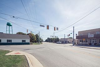
Siren is a village in, and the county seat of, Burnett County in the U.S. state of Wisconsin. The population was 806 at the 2010 census. The village is surrounded by the Town of Siren.

Bloomingdale is an unincorporated community in Vernon County, Wisconsin. The community is located on the border of the towns of Clinton and Webster.

Ireland is an unincorporated community in Madison Township, Dubois County, in the U.S. state of Indiana.

Abington is an unincorporated community in Abington Township, Wayne County, in the U.S. state of Indiana.

Tanner is an unincorporated community in central southern Limestone County, Alabama, United States, and is included in the Huntsville-Decatur Combined Statistical Area. It lies nine miles north of the city of Decatur and the Tennessee River, and four miles south of the city of Athens.

The Black River is a river in west-central Wisconsin and tributary of the Mississippi River. The river is approximately 190 miles (310 km) long. During the 19th century, pine logs were rafted down the Black, heading for sawmills at La Crosse and points beyond.

Victory is an unincorporated community in the Town of Wheatland in Vernon County, Wisconsin. It is located 4.5 miles north of De Soto and 6.2 miles south of Genoa on the Mississippi River along the Great River Road. It also is served by the BNSF Railway.
Hollis is an unincorporated community in Cloud County, Kansas, United States.

Red Mound is an unincorporated community in the Town of Wheatland, Vernon County, Wisconsin, United States.

Liberty Pole is an unincorporated community in Vernon County, Wisconsin in the town of Franklin.

Retreat, Wisconsin is an unincorporated community in Vernon County, Wisconsin in the town of Sterling.

Bentonville is an unincorporated community in central Posey Township, Fayette County, Indiana, United States.

Newry is an unincorporated community, in the town of Christiana, Vernon County, Wisconsin, United States.

Calamine is an unincorporated community in the town of Willow Springs in Lafayette County, Wisconsin, United States. The Cheese Country Trail runs through the community, as does the Pecatonica River. The community is home to 100 year old St. Michael Church, within the Roman Catholic Diocese of Madison. Next to the church is the Willow Springs township hall which was the former one room school house until 1961, when the new Willow Springs school opened. Many scholars were produced between its walls.

Washington Charter Township, located within Metro Detroit, is a charter township of Macomb County in the U.S. state of Michigan. The population was 25,139 at the 2010 census. Washington Township is bordered by the village of Romeo as well as Ray Township, Shelby Township, and Oakland Township in Oakland County and is 18 miles north of Detroit. The historic Octagon House and Stony Creek Metro Park are popular destinations for visitors.

Vernon is an unincorporated community in Winston County, Mississippi, United States. On April 27, 2011, a tornado hit 5 miles (8 km) southeast of Vernon as part of the 2011 Super Outbreak, damaging between 10 and 20 homes, knocking down numerous trees that blocked roads, and injuring seven people.

Goerke's Corners is a former unincorporated community in the Town of Brookfield, in Waukesha County, Wisconsin, United States, at latitude 43°02'11" N and longitude 088°09'58" W. It is now the location of a major highway intersection, and the site of a park-and-ride lot.
Anita is an unincorporated community in Jefferson County, Pennsylvania, in the United States.

Orpheus is an unincorporated community in Bloomfield Township, Jackson County, Ohio, United States.


