Sterling, Vernon County, Wisconsin

Last updated

Sterling, Wisconsin
Sterling town hall area.jpg
Sterling town hall area
On Wis 82
Vernon County Wisconsin incorporated and unincorporated areas Sterling highlighted.svg
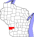
Location in Vernon County and the state of Wisconsin.
Coordinates: 43°29′0″N91°2′29″W / 43.48333°N 91.04139°W / 43.48333; -91.04139
Country Flag of the United States.svg  United States
State Flag of Wisconsin.svg  Wisconsin
County Vernon
Area
  Total45.5 sq mi (117.7 km2)
  Land45.5 sq mi (117.7 km2)
  Water0.0 sq mi (0.0 km2)
Elevation
[1]
1,122 ft (342 m)
Population
 (2000)
  Total713
  Density15.7/sq mi (6.1/km2)
Time zone UTC-6 (Central (CST))
  Summer (DST) UTC-5 (CDT)
Area code 608
FIPS code 55-77075 [2]
GNIS feature ID1584219 [1]

Sterling is a town in Vernon County, Wisconsin, United States. The population was 713 at the 2000 census. The unincorporated communities of Purdy, Retreat, and West Prairie are located in the town.

Contents

Geography

According to the United States Census Bureau, the town has a total area of 45.5 square miles (117.7 km2), all of it land.

Demographics

As of the census [2] of 2000, there were 713 people, 234 households, and 179 families residing in the town. The population density was 15.7 people per square mile (6.1/km2). There were 278 housing units at an average density of 6.1 per square mile (2.4/km2). The racial makeup of the town was 99.44% White, 0.14% African American, 0.14% Asian, and 0.28% from two or more races.

There were 234 households, out of which 40.2% had children under the age of 18 living with them, 67.9% were married couples living together, 2.6% had a female householder with no husband present, and 23.5% were non-families. 20.9% of all households were made up of individuals, and 9.4% had someone living alone who was 65 years of age or older. The average household size was 3.00 and the average family size was 3.54.

In the town, the population was spread out, with 35.2% under the age of 18, 6.0% from 18 to 24, 24.5% from 25 to 44, 22.6% from 45 to 64, and 11.6% who were 65 years of age or older. The median age was 35 years. For every 100 females, there were 110.9 males. For every 100 females age 18 and over, there were 108.1 males.

The median income for a household in the town was $28,125, and the median income for a family was $31,563. Males had a median income of $23,958 versus $19,583 for females. The per capita income for the town was $13,402. About 14.5% of families and 24.2% of the population were below the poverty line, including 33.2% of those under age 18 and 27.9% of those age 65 or over.

Notable people

Related Research Articles

<span class="mw-page-title-main">Etna Green, Indiana</span> Town in Indiana, United States

Etna Green is a town in Etna Township, Kosciusko County, in the U.S. state of Indiana. The population was 586 at the 2010 census.

<span class="mw-page-title-main">St. Francis, Maine</span> Town in the state of Maine, United States

St. Francis is a town in Aroostook County, Maine, United States on the Canada–United States border at the junction of the St. Francis River and the Saint John River. The population was 438 at the 2020 census. First settled by English speakers from southern Maine, the original population has been supplanted by French-speaking Acadians.

<span class="mw-page-title-main">Gerlach–Empire, Nevada</span> Former CDP in Nevada, United States

Gerlach–Empire was a census-designated place (CDP) in Washoe County, Nevada, United States. It was replaced by the separate CDPs of Gerlach and Empire for the 2010 census. The combined population was 499 at the 2000 census. A former company town for United States Gypsum Corporation, Empire was once home to more than 750 people. It is part of the Reno–Sparks Metropolitan Statistical Area. Most of the population lives in the two tiny settlements of Gerlach, a neighboring hamlet with fewer than 200 people that shares its schools with Empire; the rest live on outlying rural ranching properties. The nearest town, Nixon, is 60 miles to the south on a reservation owned by the Pyramid Lake Paiute Tribe.

<span class="mw-page-title-main">Caledonia, Columbia County, Wisconsin</span> Town in Wisconsin, United States

Caledonia is a town in Columbia County, Wisconsin, United States. The population was 1,495 at the 2020 census. The unincorporated community of Durwards Glen is located in the town.

<span class="mw-page-title-main">Montrose, Wisconsin</span> Town in Wisconsin, United States

The Town of Montrose is located in Dane County, Wisconsin, United States. The population was 1,134 at the 2000 census. The unincorporated communities of Basco and Paoli are located within the town.

<span class="mw-page-title-main">South Lancaster, Wisconsin</span> Town in Wisconsin, United States

South Lancaster is a town in Grant County, Wisconsin, United States. The population was 808 at the 2000 census.

<span class="mw-page-title-main">Waterloo, Grant County, Wisconsin</span> Town in Wisconsin, United States

Waterloo is a town in Grant County in the U.S. state of Wisconsin. The population was 557 at the 2000 census. The unincorporated communities of Burton and McCartney is located in the town.

<span class="mw-page-title-main">Centerville, Manitowoc County, Wisconsin</span> Town in Wisconsin, United States

Centerville is a town in Manitowoc County, Wisconsin, United States. The population was 713 at the 2000 census. The town is divided by I-43 and surrounds the Village of Cleveland.

<span class="mw-page-title-main">Brighton, Marathon County, Wisconsin</span> Town in Wisconsin, United States

Brighton is a town in Marathon County, Wisconsin, United States. It is part of the Wausau, Wisconsin Metropolitan Statistical Area. The population was 620 at the 2020 census.

<span class="mw-page-title-main">Day, Wisconsin</span> Town in Wisconsin, United States

Day is a town in southwest Marathon County, Wisconsin, United States. It is part of the Wausau, Wisconsin Metropolitan Statistical Area. The population was 1,085 at the 2010 census. The unincorporated community of Rozellville is located in the town. The unincorporated community of Rangeline is also located partially in the town.

<span class="mw-page-title-main">Stratford, Wisconsin</span> Village in Wisconsin, United States

Stratford is a village in Marathon County, Wisconsin, United States. It is part of the Wausau, Wisconsin Metropolitan Statistical Area. The population was 1,578 at the 2010 census.

<span class="mw-page-title-main">Maple Creek, Wisconsin</span> Town in Wisconsin, United States

Maple Creek is a town in Outagamie County, Wisconsin, United States. The population was 687 at the 2000 census. The unincorporated community of Sugar Bush is located in the town.

<span class="mw-page-title-main">Frankfort, Pepin County, Wisconsin</span> Town in Wisconsin, United States

Frankfort is a town in Pepin County, Wisconsin, United States. The population was 325 at the 2020 census. The unincorporated communities of Ella, and Porcupine are located in the town.

<span class="mw-page-title-main">Hartland, Shawano County, Wisconsin</span> Town in Wisconsin, United States

Hartland is a town in Shawano County, Wisconsin, United States. The population was 825 at the 2000 census. The unincorporated community of Slab City is located within the town. The unincorporated communities of Frazer Corners and Zachow are also located partially in the town. Hartland was established in 1859.

<span class="mw-page-title-main">Erin Prairie, Wisconsin</span> Town in Wisconsin, United States

Erin Prairie is a town in St. Croix County, Wisconsin, United States. The population was 658 at the 2000 census. The unincorporated communities of Erin Corner and Jewitt are located in the town.

<span class="mw-page-title-main">Bear Creek, Waupaca County, Wisconsin</span> Town in Wisconsin, United States

Bear Creek is a town in Waupaca County, Wisconsin, United States. The population was 838 at the 2000 census. The unincorporated communities of Bear Creek Corners and Nicholson are located in the town. The village of Bear Creek is located immediately east of the town, across the county line in Outagamie County.

<span class="mw-page-title-main">Deerfield, Wisconsin</span> Village in Wisconsin, United States

Deerfield is a village in Dane County, Wisconsin. The population was 2,319 at the time of the 2010 census. The village is located within the Town of Deerfield. It is part of the Madison Metropolitan Statistical Area. Towns and villages near Deerfield include Marshall, Medina, London, Cambridge, and Cottage Grove, Wisconsin.

The Town of Potosi is located in Grant County, Wisconsin, United States. The population was 831 at the 2000 census. The Village of Potosi and the unincorporated communities of British Hollow, Buena Vista, Rockville, and Van Buren are located in the town.

<span class="mw-page-title-main">Linden, Wisconsin</span> Village in Wisconsin, United States

Linden is a village in Iowa County, Wisconsin, United States. The population was 549 at the 2010 census. The village is located within the Town of Linden.

<span class="mw-page-title-main">Hancock, Wisconsin</span> Village in Wisconsin, United States

Hancock is a village in Waushara County, Wisconsin, United States. The population was 417 at the 2010 census. The village is located within the Town of Hancock.

References

  1. 1 2 "US Board on Geographic Names". United States Geological Survey. October 25, 2007. Retrieved January 31, 2008.
  2. 1 2 "U.S. Census website". United States Census Bureau . Retrieved January 31, 2008.
  3. 'Wisconsin Blue Book 1933,' Biographical Sketch of Robert A. Nixon, pg. 228