New Jersey Scenic Byways | |
---|---|
Highway names | |
Interstates | Interstate X (I-X) |
US Highways | U.S. Route X (US X) |
State | Route X |
County routes: | County Route X (CR X) |
System links | |
The New Jersey Scenic Byways system consists of roads in the U.S. state of New Jersey that have been recognized for their historical or natural qualities. [1]
There are currently eight scenic byways in the state of New Jersey:
Location | Cape May Point–Mannington Township |
---|---|
Length | 122 mi [2] (196 km) |
The Bayshore Heritage Byway runs along the Delaware Bay and Delaware River in Cape May, Cumberland, and Salem counties, providing access to natural and historical sites. The byway begins in Cape May Point, Cape May County, following CR 629, CR 606, CR 626, Route 162, CR 626, and Route 47. In Cumberland County, the Bayshore Heritage Byway continues along Route 47, CR 616 (with a spur along East Point Road that serves the East Point Light), Menhaden Road, River Road, CR 616, Route 47, CR 670, CR 744, CR 676, CR 633, CR 649, CR 553 (with spurs along CR 631 to Bivalve and along CR 656 and CR 637 to Fortescue), CR 609, Route 49, Fayette Street, CR 650, CR 607, and CR 623 (with a spur along CR 642 and Bayside Road to the Bayside Tract Preservation Site). In Salem County, the byway follows CR 623, CR 658, CR 624, CR 625, CR 661, Grieves Parkway, and South Front Street to Route 49 in Salem. At this point, a spur heads along Route 49, Freas Road, Supawna Road, Route 49, CR 632, and CR 630 to Fort Mott State Park. From Salem, the mainline continues along Route 49, Route 45, and CR 540 to its northern terminus in Mannington Township. [2]
Location | Trenton–Frenchtown |
---|---|
Length | 34 mi [3] (55 km) |
The Delaware River Scenic Byway follows Route 29 along the Delaware River between Trenton and Frenchtown. It provides scenic views of the Delaware River and passes through Washington Crossing State Park, Titusville, Lambertville, Stockton, and Raven Rock. This byway is also part of the national program. [3] [4]
Location | Kingston–Millstone |
---|---|
Length | 27.5 mi [5] (44.3 km) |
The Millstone Valley Scenic Byway is a 25-mile (40 km) historic scenic route located in the Millstone River Valley which lies in north central New Jersey. The byway offers a glimpse into the past where skirmishes between the local militia and British troops played a key role in the American Revolutionary War. This byway has been designated by the National Scenic Byways Program of the Federal Highway Administration as of 2009. [5] [6]
The route travels along CR 605 (River Road) in Princeton, Montgomery Township, and Rocky Hill, Montgomery Road in Rocky Hill and Montgomery Township, and CR 533 along the west bank of the Millstone River. It travels along CR 603 (Kingston-Rocky Hill Road) and Canal Road on the east side of the Delaware and Raritan Canal. The route loops back on the south side at Route 27 in Princeton and Kingston and connects near the northern end via CR 514 between Millstone and East Millstone. [5]
Attractions along the route include the Delaware and Raritan Canal State Park, the relocated Rockingham site in Kingston, a section of Franklin Township, Somerset County, and the 1860 House on Montgomery Road near Rocky Hill. The Kingston Village Historic District and the Kingston Mill Historic District are both located in the historic area of Kingston. [5]
Henry Hudson Drive | |
---|---|
Location | Edgewater-Alpine |
Length | 8 mi [7] (13 km) |
Henry Hudson Drive is a scenic bypass of the nearby Palisades Parkway, U.S. 9W, and Hudson Terrace (CR 505). It runs along the bottom of the Palisades Cliffs on the western bank of the Hudson River, and also goes underneath the George Washington Bridge. While it is much smaller and isolated than nearby roads, it still provides a scenic view of New York on the other side of the river, and connects to many picnic areas and parks. [8]
Location | Fort Lee–Alpine |
---|---|
Length | 12 mi [9] (19 km) |
The Palisades Scenic Byway follows the Palisades Interstate Parkway between Fort Lee and the New York border, running along the New Jersey Palisades on the Hudson River in Bergen County and offering scenic overlooks. [9]
Location | Tuckerton–Estell Manor |
---|---|
Length | 130 mi [10] (210 km) |
The Pine Barrens Byway consists of three routes that run through the Pine Barrens in southern New Jersey. The northern route of the byway begins in Tuckerton in Ocean County and follows US 9 and Stage Road into Burlington County, where it continues along CR 653 and CR 542 to Green Bank. Here, the Pine Barrens Byway splits into a longer northern loop and a shorter northern loop. The longer northern loop follows CR 542 through Batsto into Mullica Township, Atlantic County. The shorter northern loop follows CR 563 into Mullica Township. The first leg of the northern loop begins at CR 542 in Mullica Township, following CR 643 and CR 612 to CR 563. From here, the final leg of the northern loop follows CR 563, CR 624, Mill Street, Riverside Drive, CR 575, CR 610, US 9, the Garden State Parkway into Burlington County, and US 9 back to Tuckerton, Ocean County. [10]
The central connector of the Pine Barrens Byway begins at CR 542 in Mullica Township, Atlantic County and follows CR 542, CR 658, CR 623, CR 559, CR 616, CR 559, US 40/Route 50, Route 50, and CR 611 to Corbin City. [10]
The southern route of the byway begins in Corbin City, Atlantic County and follows CR 611 and Route 50 into Tuckahoe, Cape May County. From here, the byway follows Route 49, CR 632, and Route 49 to an intersection with CR 548, where it splits into a longer southern loop and a shorter southern loop. The longer southern loop follows CR 548 into Cumberland County, where it heads south on Route 47 back into Cape May County. The byway continues along Route 47, CR 610, CR 550, CR 557, CR 550, and CR 605 back to CR 548. The shorter southern loop follows Route 49 into Estell Manor, Atlantic County and continues along Head of River Road and Aetna Drive to CR 611. [10]
Upper Freehold Historic Farmland Byway | |
---|---|
Location | Allentown–Walnford |
Length | 24 mi [11] (39 km) |
The Upper Freehold Historic Farmland Byway runs through areas of farmland between Allentown and Walnford in Monmouth County. The byway follows CR 539, CR 524, Chambers Road, Rues Road, CR 526, Red Valley Road, CR 27, Arneystown-Hornerstown Road, Hill Road, Waln's Mill Road, Walnford Road, Polhemustown Road, Holmes Mill Road, and Walnford Road. [11]
Warren Heritage Scenic Byway | |
---|---|
Location | Greenwich Township–Hackettstown |
Length | 19 mi [12] (31 km) |
The Warren Heritage Scenic Byway follows Route 57 through mountain and valley areas between Greenwich Township and Hackettstown in Warren County, following the route of the historic Morris Canal. [12]
Location | Franklin Borough–Vernon Township |
---|---|
Length | 23 mi [13] (37 km) |
The Western Highlands Scenic Byway runs through mountain areas in Sussex County. The main segment of the byway begins at Route 23 in Franklin Borough and follows CR 515 north to Vernon Township, where it follows Route 94 north to the New York border. A loop of the byway branches from Route 94 in Vernon Township and runs northwest on CR 644, southwest on CR 517, and northeast on Route 94. [13]
U.S. Route 9 (US 9) is a north–south United States Numbered Highway in the states of Delaware, New Jersey, and New York in the Northeastern United States. It is one of only two U.S. Highways with a ferry connection ; the other is US 10. US 9 is signed east–west in Delaware and north–south on the rest of its route. The southern terminus of the route is in Laurel, Delaware, at an intersection with US 13, while the highway's northern terminus is at a junction with Interstate 87 (I-87) in Champlain, New York, where the roadway continues north as the unsigned New York State Route 971B (NY 971B), which ends in a cul-de-sac just short of the Canadian border.
Route 29 is a state highway in the U.S. state of New Jersey. Signed north-south, it runs 34.76 mi (55.94 km) from an interchange with Interstate 295 (I-295) in Hamilton Township in Mercer County, where the road continues east as I-195, northwest to Route 12 in Frenchtown, Hunterdon County. Between the southern terminus and I-295 in Ewing Township, the route is a mix of freeway and expressway that runs along the Delaware River through Trenton. This section includes a truck-restricted tunnel that was built along the river near historic houses and Riverview Cemetery. North of I-295, Route 29 turns into a scenic and mostly two-lane highway. North of the South Trenton Tunnel, it is designated the Delaware River Scenic Byway, a New Jersey Scenic Byway and National Scenic Byway, that follows the Delaware River in mostly rural sections of Mercer County and Hunterdon County. The obsolete Delaware & Raritan Canal usually stands between the river and the highway. Most sections of this portion of Route 29 are completely shaded due to the tree canopy. Route 29 also has a spur, Route 129, which connects Route 29 to U.S. Route 1 (US 1) in Trenton.
Route 45 is a state highway in the southern part of New Jersey. It runs 28.51 mi (45.88 km) from Route 49 in Salem, Salem County, northeast to U.S. Route 130 in Westville, Gloucester County. The route is signed as a north-south highway. Much of the southern part of the route runs through rural areas of Salem and Gloucester counties, passing through the communities of Woodstown and Mullica Hill. North of Mullica Hill, Route 45 runs through suburban areas, with the portion of the route between the northern border of Mantua Township and the southern border of Woodbury a four-lane divided highway. The route intersects many highways, including US 40 in Woodstown, Route 77 and US 322 in Mullica Hill, and Interstate 295 (I-295) in West Deptford Township.
Route 50 is a state highway in the southern part of the U.S. state of New Jersey. It runs 26.02 mi (41.88 km) from an intersection with U.S. Route 9 and the Garden State Parkway in Upper Township, Cape May County, north to an intersection with US 30 and County Route 563 in Egg Harbor City, Atlantic County. The route, which is mostly a two-lane undivided road, passes through mostly rural areas of Atlantic and Cape May counties as well as the communities of Tuckahoe, Corbin City, Estell Manor, and Mays Landing. Route 50 intersects several roads, including Route 49 in Tuckahoe, US 40 in Mays Landing, and US 322 and the Atlantic City Expressway in Hamilton Township.
The Palisades Interstate Parkway (PIP) is a 38.25-mile-long (61.56 km) controlled-access parkway in the U.S. states of New Jersey and New York. The parkway is a major commuter route into New York City from Rockland and Orange counties in New York and Bergen County in New Jersey. The southern terminus of the route is at the George Washington Bridge in Fort Lee, New Jersey, where it connects to Interstate 95 (I-95), New Jersey Route 4, U.S. 1, U.S. 9, and US 46. Its northern terminus is at a traffic circle in Fort Montgomery, New York, where the PIP meets US 9W and US 202 at the Bear Mountain Bridge. At exit 18, the PIP forms a concurrency with US 6 for the remaining duration of its run.
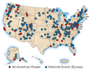
A National Scenic Byway is a road recognized by the United States Department of Transportation for one or more of six "intrinsic qualities": archeological, cultural, historic, natural, recreational, and scenic. The program was established by Congress in 1991 to preserve and protect the nation's scenic but often less-traveled roads and promote tourism and economic development. The National Scenic Byways Program (NSBP) is administered by the Federal Highway Administration (FHWA).
County Route 563 is a county highway in the U.S. state of New Jersey. The highway extends 43.87 miles (70.60 km) from CR 629 in Margate City, Atlantic County north to Route 72 in Woodland Township, Burlington County. In Atlantic County, the road runs through a mix of suburban and rural areas, passing through Northfield, Egg Harbor Township, and Egg Harbor City. North of Egg Harbor City into Burlington County, CR 563 runs through the heavily forested Pine Barrens. Between Margate and Northfield, CR 563 runs along the Downbeach Express, a toll bridge that is maintained by Ole Hansen & Sons, Inc.
County Route 542 is a county highway in the U.S. state of New Jersey. The highway extends 20.57 miles (33.10 km) from Route 54 in Hammonton to U.S. Route 9 (US 9) in Bass River Township.
County Route 533 is a county highway in the U.S. state of New Jersey. The highway extends 32.78 miles (52.75 km) from the White Horse Circle, in Hamilton Township to Middlesex CR 607 on the border of Bound Brook and Middlesex Borough. CR 533 shares a long concurrency with U.S. Route 206 through Princeton and Montgomery Township, while portions of the roadway in Somerset County are part of the Millstone River Valley Scenic Byway.
U.S. Route 9 (US 9) is a United States Numbered Highway in the Mid-Atlantic United States, running from Laurel, Delaware, north to Champlain, New York. In New Jersey, the route runs 166.80 miles (268.44 km) from the Cape May–Lewes Ferry terminal in North Cape May, Cape May County, where the ferry carries US 9 across the Delaware Bay to Lewes, Delaware, north to the George Washington Bridge in Fort Lee, Bergen County, where the route along with Interstate 95 (I-95) and US 1 continue into New York City. US 9 is the longest U.S. Highway in the state. From North Cape May north to Toms River in Ocean County, US 9 is mostly a two-lane undivided road that closely parallels the Garden State Parkway and runs near the Jersey Shore. Along this stretch, it passes through the communities of Rio Grande, Cape May Court House, Somers Point, Pleasantville, Absecon, Tuckerton, Manahawkin, Beachwood, and Berkeley Township. In the Toms River area, US 9 runs along the Garden State Parkway for a short distance before heading northwest away from it and the Jersey Shore into Lakewood Township. Upon entering Monmouth County, the route transitions into a multilane suburban divided highway and continues through Howell Township, Freehold Township, Manalapan Township, Marlboro Township, Old Bridge Township, Sayreville, and South Amboy. In Woodbridge Township, US 9 merges with US 1 and the two routes continue through northern New Jersey as US 1/9 to the George Washington Bridge.
The Arkansas Scenic Byways Program is a list of highways, mainly state highways, that have been designated by the Arkansas Department of Transportation (ArDOT) as scenic highways. The Arkansas General Assembly designates routes for scenic byway status upon successful nomination. For a highway to be declared scenic, a group interested in preserving the scenic, cultural, recreational, and historic qualities of the route must be created. Mayors of all communities along the route and county judges from each affected county must be included in the organization. Scenic highways are marked with a circular shield in addition to regular route markers.
Crowley's Ridge Parkway is a 212.0-mile-long (341.2 km) National Scenic Byway in northeast Arkansas and the Missouri Bootheel along Crowley's Ridge in the United States. Motorists can access the parkway from US Route 49 (US 49) at its southern terminus near the Helena Bridge over the Mississippi River outside Helena-West Helena, Arkansas, or from Missouri Route 25 (Route 25) near Kennett, Missouri. The parkway runs along Crowley's Ridge, a unique geological formation, and also parts of the St. Francis National Forest, the Mississippi River and the Mississippi Alluvial Plain. Along the route are many National Register of Historic Places properties, Civil War battlefields, parks, and other archeological and culturally significant points.
U.S. Route 322 is a spur of U.S. Route 22, running from Cleveland, Ohio, east to Atlantic City, New Jersey. The easternmost segment of the route in New Jersey runs 62.64 miles (100.81 km) from the Commodore Barry Bridge over the Delaware River in Logan Township, Gloucester County, where it continues southeast to Atlantic Avenue and Pacific Avenue in Atlantic City, Atlantic County. The portion of the route between the Commodore Barry Bridge and Route 42 in Williamstown is mostly a two-lane undivided road that is concurrently signed with County Route 536 (CR 536), passing through Mullica Hill and Glassboro. From Williamstown, US 322 follows the Black Horse Pike, a four-lane road, southeast to Atlantic City. In Hamilton Township, Atlantic County, US 322 forms a concurrency with U.S. Route 40, continuing with that route all the way to Atlantic City. US 322 intersects several major roads including U.S. Route 130 and Interstate 295 (I-295) in Logan Township, the New Jersey Turnpike in Woolwich Township, Route 55 in Harrison Township, Route 42 in Williamstown, Route 50 and U.S. Route 40 in Hamilton Township, the Garden State Parkway in Egg Harbor Township, and U.S. Route 9 in Pleasantville.
The Mohawk Towpath Scenic Byway is a National Scenic Byway in the Capital District region of New York in the United States. It extends from Schenectady to Waterford by way of a series of local, county, and state highways along the Mohawk River and the Erie Canal. The byway is intended to showcase the history of the waterway, from Native American times through the creation of the Erie Canal and the role the waterside communities played in the Industrial Revolution and the westward expansion of the United States. At its east end, the byway connects to the Lakes to Locks Passage, an All-American Road.
The Assunpink Trail was a Native American trail in what later became Middlesex, Somerset, and Mercer counties in the central and western part of New Jersey. Like Assunpink Creek, the trail takes its name from the Algonquian language Ahsën'pink, meaning "stony, watery place".
Minnesota Scenic Byways are a system of roads in the U.S. state of Minnesota which pass through areas of scenic, cultural, or recreational significance. There are currently 22 scenic byways in the system with a total length of 2,948 miles (4,744 km). Eight of these byways are also designated as National Scenic Byways, and the North Shore Scenic Drive is further designated as an All-American Road.