East Millstone, New Jersey

Last updated

East Millstone, New Jersey
East Millstone, NJ.jpg
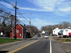
East Millstone along Amwell Road (CR 514)
Location map of Somerset County, New Jersey.svg
Red pog.svg
East Millstone
Location in Somerset County
USA New Jersey relief location map.svg
Red pog.svg
East Millstone
Location in New Jersey
Usa edcp relief location map.png
Red pog.svg
East Millstone
Location in the United States
Coordinates: 40°29′47″N74°33′58″W / 40.496445°N 74.565986°W / 40.496445; -74.565986 [1] [2]
Country Flag of the United States.svg  United States
State Flag of New Jersey.svg  New Jersey
County Somerset
Township Franklin
Incorporated February 18, 1873
DissolvedDecember 31, 1949
Area
[3]
  Total2.30 sq mi (5.95 km2)
  Land2.23 sq mi (5.78 km2)
  Water0.06 sq mi (0.16 km2)  2.70%
Elevation
[4]
85 ft (26 m)
Population
 (2020) [5]
  Total588
  Density263.21/sq mi (101.65/km2)
Time zone UTC−05:00 (Eastern (EST))
  Summer (DST) UTC−04:00 (Eastern (EDT))
Area code(s) 609/640 and 732/848
FIPS code 34-19330 [1] [6]
GNIS feature ID02583985 [1]

East Millstone is an unincorporated community and census-designated place (CDP) [7] located in Franklin Township in Somerset County, in the U.S. state of New Jersey. [8] [9] [10]

Contents

As of the 2010 U.S. census, the CDP's population was 579. [11] It is a small rural community that grew and prospered with a small industrial base in the 19th Century, centered on the Delaware and Raritan Canal at Amwell Road and the long-abandoned Millstone and New Brunswick Railroad that terminated in East Millstone. East Millstone was an independent municipality from 1873–1949. The East Millstone Historic District was listed on the National Register of Historic Places in 1983.

History

East Millstone existed as an independent municipality for more than 75 years. It was incorporated as a town by an act of the New Jersey Legislature on February 18, 1873, from portions of Franklin Township, and existed on its own until December 31, 1949, when it was returned to Franklin Township. [12] The residents voted 11928 in favor of dissolution on March 9, 1949. [13]

The independent municipality of Millstone, New Jersey, a borough which is not part of Franklin Township, is located across the Millstone River, which is directly west of the Delaware and Raritan Canal.

East Millstone maintains its rural character into the 21st Century, with a firehouse, a post office and just a handful of local businesses. The housing stock is also quite old, with no new development in the East Millstone section of Franklin Township in recent years. [14]

Historic district

East Millstone Historic District
15 Market Street, East Millstone, NJ.jpg
Victorian style house
LocationAmwell Road and Delaware & Raritan Canal
Area62 acres (25 ha)
Architectural styleGreek Revival, Late Victorian, Federal
NRHP reference No. 83001613 [15]
NJRHP No.2494 [16]
Significant dates
Added to NRHPMarch 17, 1983
Designated NJRHPFebruary 3, 1983

The East Millstone Historic District is a historic district encompassing the village. It was added to the National Register of Historic Places on March 17, 1983 for its significance in architecture, commerce, industry, and transportation. It includes 109 contributing buildings. The Franklin Inn, historically known as the Van Liew Farmhouse, is among the oldest houses in the village. [17]

Geography

According to the U.S. Census Bureau, East Millstone had a total area of 2.296 square miles (5.946 km2), including 2.234 square miles (5.785 km2) of land and 0.062 square miles (0.161 km2) of water (2.70%). [1] [2]

Demographics

Historical population
CensusPop.Note
1880 432
1890 47510.0%
1900 447−5.9%
1910 356−20.4%
1920 42719.9%
1930 364−14.8%
1940 3876.3%
2010 579
2020 5881.6%
Population sources:
1880-1890 [18] 1890-1910 [19]
1910-1930 [20] 1920-1940 [21]
2010 [11] 2020 [5]

2010 census

The 2010 United States census counted 579 people, 233 households, and 161 families in the CDP. The population density was 259.2 per square mile (100.1/km2). There were 246 housing units at an average density of 110.1 per square mile (42.5/km2). The racial makeup was 78.58% (455) White, 10.54% (61) Black or African American, 0.00% (0) Native American, 7.77% (45) Asian, 0.00% (0) Pacific Islander, 0.35% (2) from other races, and 2.76% (16) from two or more races. Hispanic or Latino of any race were 2.94% (17) of the population. [11]

Of the 233 households, 23.6% had children under the age of 18; 60.5% were married couples living together; 6.0% had a female householder with no husband present and 30.9% were non-families. Of all households, 22.7% were made up of individuals and 5.2% had someone living alone who was 65 years of age or older. The average household size was 2.48 and the average family size was 2.94. [11]

16.4% of the population were under the age of 18, 5.0% from 18 to 24, 23.1% from 25 to 44, 39.6% from 45 to 64, and 15.9% who were 65 years of age or older. The median age was 47.5 years. For every 100 females, the population had 101.7 males. For every 100 females ages 18 and older there were 99.2 males. [11]

Related Research Articles

<span class="mw-page-title-main">Somerset County, New Jersey</span> County in New Jersey, United States

Somerset County is a county located in the north-central part of the U.S. state of New Jersey. As of the 2020 census, the county was the state's 13th-most-populous county, with a population of 345,361, its highest decennial count ever and an increase of 21,917 (+6.8%) from the 2010 census count of 323,444. Somerset County constitutes part of the New York metropolitan area. Its county seat is Somerville. The most populous place in the county was Franklin Township, with 68,364 residents at the time of the 2020 census, while Hillsborough Township, with 55.00 square miles (142.4 km2), covered the largest total area of any municipality.

<span class="mw-page-title-main">Kingston, New Jersey</span> Populated place in Middlesex and Somerset counties, New Jersey, US

Kingston is an unincorporated community and census designated place (CDP) along the border of South Brunswick Township in Middlesex County and Franklin Township in Somerset County, and also located relatively near Princeton in Mercer County in the U.S. state of New Jersey. The historic settlement is in the Raritan Valley region, located along the course of the Millstone River. As of the 2010 United States Census, the CDP's population was 1,493, of which 1,222 were in South Brunswick Township and 271 in Franklin Township.

<span class="mw-page-title-main">Plainsboro Center, New Jersey</span> Populated place in Middlesex County, New Jersey, US

Plainsboro Center is an unincorporated community and census-designated place (CDP) located within Plainsboro Township, in Middlesex County, in the U.S. state of New Jersey. As of the 2010 United States Census, the CDP's population was 2,712.

<span class="mw-page-title-main">West Freehold, New Jersey</span> Census-designated place in New Jersey, United States

West Freehold is an unincorporated community and census-designated place (CDP) within Freehold Township, in Monmouth County, New Jersey, United States. As of the 2010 United States Census, the CDP's population was 13,613. Due to the community's close proximity to the Battle of Monmouth, West Freehold is home to several important historical structures, which have been preserved in the 'West Freehold Village Historic District'. The historically preserved Monmouth Battlefield, along with the historic villages of Clarksburg, Englishtown, Smithburg and Tennent are a short distance away.

<span class="mw-page-title-main">Bridgewater Township, New Jersey</span> Township in Somerset County, New Jersey, United States

Bridgewater Township is a township in Somerset County in the U.S. state of New Jersey, located within the heart of the Raritan Valley region. Situated within Central New Jersey and crisscrossed by several major highways, the township is known for being both the regional commercial hub for Somerset County and as a suburban bedroom community of New York City within the New York Metropolitan Area. The township is located roughly 32 miles (51 km) away from Manhattan and about 20 miles (32 km) away from Staten Island.

<span class="mw-page-title-main">Franklin Township, Somerset County, New Jersey</span> Township in Somerset County, New Jersey, United States

Franklin Township is a township in Somerset County, in the U.S. state of New Jersey. It is centrally located in the Raritan Valley region, within the New York Metropolitan Area. As of the 2020 United States census, the township's population was 68,364, an increase of 6,064 (+9.7%) from the 2010 census count of 62,300, which in turn reflected an increase of 11,397 (+22.4%) from the 50,903 counted in the 2000 census. The township was the state's 19th most-populous municipality in 2020, after being ranked 22nd in 2010.

<span class="mw-page-title-main">Millstone, New Jersey</span> Borough in Somerset County, New Jersey, United States

Millstone is a borough in Somerset County, in the U.S. state of New Jersey. The borough was originally known as Somerset Courthouse and was the county seat. As of the 2020 United States census, the borough's population was 448, an increase of 30 (+7.2%) from the 2010 census count of 418, which in turn reflected an increase of 8 (+2.0%) from the 410 counted in the 2000 census.

<span class="mw-page-title-main">Blackwells Mills, New Jersey</span> Populated place in Somerset County, New Jersey, US

Blackwells Mills is an unincorporated community and census-designated place (CDP) located in Franklin Township in Somerset County, in the U.S. state of New Jersey. As of the 2010 U.S. census, the CDP's population was 803.

<span class="mw-page-title-main">Zarephath, New Jersey</span> Populated place in Somerset County, New Jersey, US

Zarephath is an unincorporated community and census-designated place (CDP) and located in Franklin Township, in Somerset County, in the U.S. state of New Jersey, about 15 mi (24 km) north of Princeton. As of the 2020 United States census, the CDP's population was 69, an increase of 32 (+86.5%) from the 37 enumerated at the 2010 census.

Six Mile Run is an unincorporated community and census-designated place (CDP) located in Franklin Township, in Somerset County, in the U.S. state of New Jersey. As of the 2010 United States Census, the CDP's population was 3,184.

<span class="mw-page-title-main">Griggstown, New Jersey</span> Populated place in Somerset County, New Jersey, US

Griggstown is an unincorporated community and census-designated place (CDP) located within Franklin Township, in Somerset County, in the U.S. state of New Jersey. As of the 2010 United States Census, the CDP's population was 819. The area was first settled around 1733.

<span class="mw-page-title-main">Middlebush, New Jersey</span> Populated place in Somerset County, New Jersey, US

Middlebush is an unincorporated community and census-designated place (CDP) located in Franklin Township, in Somerset County, in the U.S. state of New Jersey. As of the 2010 United States Census, the CDP's population was 2,326. It is perhaps most distinguished as being the host section for Franklin Township's municipal complex.

<span class="mw-page-title-main">Blawenburg, New Jersey</span> Populated place in Somerset County, New Jersey, US

Blawenburg is an unincorporated community and census-designated place (CDP) located within Montgomery Township, in Somerset County, in the U.S. state of New Jersey. As of the 2010 United States Census, the CDP's population was 280. It is located at the juncture of two large roads, CR 518 and CR 601.

<span class="mw-page-title-main">Franklin Park, New Jersey</span> Populated place in Somerset County, New Jersey, US

Franklin Park is an unincorporated community and census-designated place (CDP) located within Franklin Township, in Somerset County, in the U.S. state of New Jersey. As of the 2010 United States Census, the CDP's population was 13,295. Route 27 bisects the village and serves as the dividing line between the two counties. The adjacent sections of South Brunswick and North Brunswick, Middlesex County on the east side of Route 27 are also known as Franklin Park, but are not included within the CDP's boundaries.

<span class="mw-page-title-main">Pleasant Plains, New Jersey</span> Populated place in Somerset County, New Jersey, US

Pleasant Plains is an unincorporated community and census-designated place (CDP) located in Franklin Township, in Somerset County, in the U.S. state of New Jersey. As of the 2010 United States Census, the CDP's population was 922. Having no distinct boundaries, a large area in the center of Franklin Township centered on the intersections of South Middlebush Road with Claremont and Suydam Roads is generally considered Pleasant Plains.

Weston is an unincorporated community and census-designated place (CDP) located in Franklin Township, in Somerset County, in the U.S. state of New Jersey. As of the 2010 United States Census, the CDP's population was 1,235.

Clyde is an unincorporated community and census-designated place (CDP) located in Franklin Township, in Somerset County, in the U.S. state of New Jersey. It was a station stop on the Penna RR's Millstone Branch. As of the 2010 United States Census, the CDP's population was 213.

East Franklin is an unincorporated community and census-designated place (CDP) located in Franklin Township, in Somerset County, in the U.S. state of New Jersey. At the 2010 United States Census, East Franklin's population was 8,669.

<span class="mw-page-title-main">Finderne, New Jersey</span> Populated place in Somerset County, New Jersey, US

Finderne is an unincorporated community and census-designated place (CDP) located within Bridgewater Township, in Somerset County, in the U.S. state of New Jersey. As of the 2010 United States Census, the CDP's population was 5,600.

<span class="mw-page-title-main">Ten Mile Run, New Jersey</span> Populated place in Somerset County, New Jersey, US

Ten Mile Run is an unincorporated community and census-designated place (CDP) located in Franklin Township, in Somerset County, in the U.S. state of New Jersey. As of the 2010 United States Census, the CDP's population was 1,959.

References

  1. 1 2 3 4 Gazetteer of New Jersey Places, United States Census Bureau. Accessed July 21, 2016.
  2. 1 2 US Gazetteer files: 2010, 2000, and 1990, United States Census Bureau. Accessed September 4, 2014.
  3. "ArcGIS REST Services Directory". United States Census Bureau. Retrieved October 11, 2022.
  4. U.S. Geological Survey Geographic Names Information System: East Millstone Census Designated Place, Geographic Names Information System. Accessed August 23, 2012.
  5. 1 2 Census Data Explorer: East Millstone CDP, New Jersey, United States Census Bureau. Accessed June 15, 2023.
  6. Geographic Codes Lookup for New Jersey, Missouri Census Data Center. Accessed June 9, 2023.
  7. State of New Jersey Census Designated Places - BVP20 - Data as of January 1, 2020, United States Census Bureau. Accessed December 1, 2022.
  8. GCT-PH1 - Population, Housing Units, Area, and Density: 2010 - County -- County Subdivision and Place from the 2010 Census Summary File 1 for Somerset County, New Jersey Archived 2020-02-12 at archive.today , United States Census Bureau. Accessed February 11, 2013.
  9. 2006-2010 American Community Survey Geography for New Jersey, United States Census Bureau. Accessed February 11, 2013.
  10. New Jersey: 2010 - Population and Housing Unit Counts - 2010 Census of Population and Housing (CPH-2-32), United States Census Bureau, August 2012. Accessed February 11, 2013.
  11. 1 2 3 4 5 DP-1 - Profile of General Population and Housing Characteristics: 2010 Demographic Profile Data for East Millstone CDP, New Jersey Archived 2020-02-12 at archive.today , United States Census Bureau. Accessed August 23, 2012.
  12. Snyder, John P. The Story of New Jersey's Civil Boundaries: 1606-1968, John P. Snyder, Bureau of Geology and Topography; Trenton, New Jersey; 1969. p. 223. Accessed August 23, 2012.
  13. "Voters Erase Town of East Millstone". The Courier-News. March 10, 1949. p. 1. Retrieved October 24, 2017 via Newspapers.com. Open Access logo PLoS transparent.svg
  14. Brahms, William B., Franklin Township, Somerset County, NJ: A History, FTPL; ISBN   0-9668586-0-3
  15. "National Register Information System  (#83001613)". National Register of Historic Places . National Park Service. November 2, 2013.
  16. "New Jersey and National Registers of Historic Places – Somerset County" (PDF). New Jersey Department of Environmental Protection – Historic Preservation Office. September 30, 2020. p. 6.
  17. Gibson, David; Bauer, Steven (November 1, 1981). "National Register of Historic Places Inventory/Nomination: East Millstone Historic District". National Park Service. With accompanying 48 photos
  18. Report on Population of the United States at the Eleventh Census: 1890. Part I, p. 239. United States Census Bureau, 1895. Accessed October 20, 2016.
  19. Thirteenth Census of the United States, 1910: Population by Counties and Minor Civil Divisions, 1910, 1900, 1890, United States Census Bureau, p. 338. Accessed August 23, 2012.
  20. Fifteenth Census of the United States : 1930 - Population Volume I, United States Census Bureau, p. 718. Accessed August 23, 2012.
  21. Sixteenth Census of the United States : 1940 - Population Volume I, United States Census Bureau, p. 674. Accessed February 12, 2013.