Gladstone, New Jersey | |
---|---|
![]() Gladstone Station | |
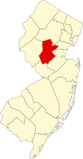
Location in Somerset County Location in New Jersey | |
Coordinates: 40°43′21″N74°39′56″W / 40.7226007°N 74.6654381°W | |
Country | ![]() |
State | ![]() |
County | Somerset |
Borough | Peapack-Gladstone |
Elevation | 262 ft (80 m) |
Population | |
• Total | 1,501 |
Time zone | UTC−05:00 (Eastern (EST)) |
• Summer (DST) | UTC−04:00 (Eastern (EDT)) |
ZIP code | 07934 [3] |
GNIS feature ID | 876615 [1] |
Gladstone is an unincorporated community located within Peapack-Gladstone in Somerset County, in the U.S. state of New Jersey. [4] The area is served as United States Postal Service ZIP Code 07934. [3] Gladstone was named in honor of William Ewart Gladstone, who served as British Prime Minister several times between 1868 and 1894. [5] [6]
The community is home to the Hamilton Farm Golf Club, the Stronghold Soccer Club, the United States Equestrian Team and the Gill St. Bernard's School, a private, nonsectarian, coeducational day school, serving students in pre-kindergarten through twelfth grade. [7] [8] [9] [10]
In the Forbes magazine 2017 ranking of the Most Expensive ZIP Codes in the United States, Gladstone was ranked as the 457th most expensive in the country, with its median home sale price of $938,042. [11] In 2018, New Jersey Business Magazine listed Gladstone at 46th in its listing of "The Most Expensive ZIP Codes in New Jersey", with a median sale price 2017 of $627,500. [12]
As of the 2010 United States census, the population for ZIP Code Tabulation Area 07934 was 1,501. [2]
Gladstone is home to the United States Equestrian Team [7] and the Stronghold Soccer Club, which plays its matches at Mount St. John's on the grounds of Montgomery Academy. [13]
The Hamilton Farm Golf Club is located in Gladstone and has been the site of the Sybase Match Play Championship since its inception in 2010. It is the only match play format event on the LPGA Tour. [14]
As part of Peapack-Gladstone, residents of Gladstone are served by the Somerset Hills Regional School District. [15] [16]
Located along the border with Chester Township is the Gill St. Bernard's School, a private, nonsectarian, coeducational day school, serving students in pre-kindergarten through twelfth grade. [17] Situated on Pottersville Road and Route 206 is the Willow School, which serves students in preschool through eight grade. [18]
A few major roads pass through the community including U.S. Route 206 and County Route 512. [19] [20]
Gladstone is an NJ Transit station that is the western terminus of the Gladstone Branch of the Morris and Essex line. Out of 23 inbound and 26 outbound daily weekday trains, 2 inbound and 2 outbound trains (about 8%) use the Kearny Connection to Secaucus Junction and New York Penn Station in Midtown Manhattan; the rest go to Hoboken Terminal. Passengers can transfer at Newark Broad Street or Summit stations to reach the other destination if necessary.
The Gladstone train station building was re-labeled "Boston," and its surroundings were supplied with peat-moss dirt, period vehicles and extras in Victorian dress, for a 1962 movie shoot. In the Oscar-winning film The Miracle Worker, Anne Bancroft in the role of Annie Sullivan boards a long-distance steam train there to take the job as Helen Keller's teacher. [21]
People who were born in, residents of, or otherwise closely associated with Gladstone include:
Somerset County is a county located in the north-central part of the U.S. state of New Jersey. As of the 2020 census, the county was the state's 13th-most-populous county, with a population of 345,361, its highest decennial count ever and an increase of 21,917 (+6.8%) from the 2010 census count of 323,444. Somerset County constitutes part of the New York metropolitan area. Its county seat is Somerville. The most populous place in the county was Franklin Township, with 68,364 residents at the time of the 2020 census, while Hillsborough Township, with 55.00 square miles (142.4 km2), covered the largest total area of any municipality. The county is part of the Central Jersey region of the state.
Chester Township is a township in Morris County, in the U.S. state of New Jersey. As of the 2020 United States census, the township's population was 7,713, a decrease of 125 (−1.6%) from the 2010 census count of 7,838, which in turn reflected an increase of 556 (+7.6%) from the 7,282 counted in the 2000 census. The township's name is derived from Chestershire in England.
Bedminster is a township in Somerset County, in the U.S. state of New Jersey. As of the 2020 United States census, the township's population was 8,272, an increase of 107 (+1.3%) from the 2010 census count of 8,165, which in turn reflected a decline of 137 (−1.7%) from the 8,302 counted in the 2000 census. Located within the Raritan Valley region, Bedminster is part of the Somerset Hills of northern Somerset County, bordering both Hunterdon and Morris counties.
Bernards Township is a township in Somerset County, in the U.S. state of New Jersey. As of the 2020 United States census, the township's population was 27,830, an increase of 1,178 (+4.4%) from the 2010 census count of 26,652, reflecting an increase of 2,077 (+8.5%) from the 24,575 counted in the 2000 census.
Bernardsville is the northernmost borough in Somerset County, in the U.S. state of New Jersey. Situated in the heart of the Raritan Valley region, the borough is part of the Somerset Hills. As of the 2020 United States census, the borough's population was 7,893, an increase of 186 (+2.4%) from the 2010 census count of 7,707, which in turn reflected an increase of 362 (+4.9%) from the 7,345 counted in the 2000 census. Bernardsville is often mispronounced as "Ber-NARDS-ville" as opposed to the correct pronunciation "BER-nards-ville".
Far Hills is a borough in the Somerset Hills of northern Somerset County in the U.S. state of New Jersey. As of the 2020 United States census, the borough's population was 924, an increase of 5 (+0.5%) from the 2010 census count of 919, which in turn reflected an increase of 60 (+7.0%) from the 859 counted in the 2000 census. The borough is located within the Raritan Valley region.
Peapack-Gladstone is a borough in the Somerset Hills region of northern Somerset County in the U.S. state of New Jersey. As of the 2020 United States census, the borough's population was 2,558, a decrease of 24 (−0.9%) from the 2010 census count of 2,582, which in turn reflected an increase of 149 (+6.1%) from the 2,433 counted in the 2000 census.
Watchung is a borough in Somerset County, in the U.S. state of New Jersey, located approximately 29 miles (47 km) west of New York City. As of the 2020 United States census, the borough's population was 6,449, an increase of 648 (+11.2%) from the 2010 census count of 5,801, which in turn reflected an increase of 188 (+3.3%) from the 5,613 counted in the 2000 census. It is located within the Raritan Valley region.
Natirar is an estate spanning 491 acres (1.99 km2) in Peapack-Gladstone, Far Hills and Bedminster, in Somerset County, New Jersey, United States. Its name is a reverse spelling of Raritan. The complex was built between 1910 and 1912. In 2003 it was sold by the estate of Hassan II, late King of Morocco, to Somerset County, New Jersey, and is now administered by the Somerset County Park Commission. Approximately 90 acres (360,000 m2) of the estate have been leased to develop that portion of the estate into an exclusive hotel, spa, restaurant complex.
Basking Ridge is an unincorporated community and census-designated place (CDP) located within Bernards Township in the Somerset Hills region of Somerset County, in the U.S. state of New Jersey.
The Somerset Hills Regional School District is a comprehensive regional public school district serving students in pre-kindergarten through twelfth grade from four communities in Somerset County, New Jersey, United States. The district serves students from the boroughs of Bernardsville, Far Hills and Peapack-Gladstone, along with students from the township of Bedminster who attend the district's high school as part of a sending/receiving relationship.
Far Hills is a NJ Transit station in Far Hills, in Somerset County, New Jersey, United States located at the intersection of Route 202 and CR 512, one-half mile (0.80 km) east of Route 206.
Gill St. Bernard's School is a private, nonsectarian, coeducational, college preparatory day school located along the Somerset-Morris county line between the Gladstone section of Peapack-Gladstone and Chester Township, in the U.S. state of New Jersey. Established in 1900, Gill St. Bernard's is the result of the merger of two Somerset Hills institutions: St. Bernard's School for boys in Gladstone and The Gill School for girls. The school serves students in primary through twelfth grade. The school has been accredited by the Middle States Association of Colleges and Schools Commission on Elementary and Secondary Schools since 1979 and is accredited until January 2028.
Peapack is an active commuter railroad train station in the borough of Peapack–Gladstone, Somerset County, New Jersey. Located on Holland Avenue in the Peapack section of the municipality, the station serves trains of New Jersey Transit's Gladstone Branch.
Gladstone is a New Jersey Transit station in Peapack-Gladstone, Somerset County, New Jersey, United States. It is the western terminus of the Gladstone Branch of the Morris and Essex line. A yard is to the east of the station.
The Somerset Hills is known as the northern region of Somerset County located in the U.S. state of New Jersey and includes the municipalities of Bedminster, Bernardsville, Bernards Township, Far Hills, and Peapack-Gladstone. The Morris County municipalities of the Chesters and the Mendhams are periodically recognized as part of the Somerset Hills.
County Route 512 is a county highway in the U.S. state of New Jersey. The highway extends 32.96 miles (53.04 km) from High Bridge Road in Califon to Springfield Avenue / Route 24 in Summit.
Millington is an unincorporated community and census-designated place (CDP) located within Long Hill Township in Morris County, in the U.S. state of New Jersey.
Liberty Corner is an unincorporated community and census-designated place (CDP) located in Bernards Township, in Somerset County, in the U.S. state of New Jersey. Liberty Corner is about 3+3⁄4 miles (6.0 km) south of Bernardsville. Liberty Corner has a post office with ZIP code 07938. The Liberty Corner Historic District was listed on the state and national registers of historic places in 1991.
Lyons is an unincorporated community and census-designated place (CDP) located within Bernards Township, in Somerset County, in the U.S. state of New Jersey. As of the 2010 United States Census, the population was 228. Lyons is 2.5 miles (4.0 km) south-southeast of Bernardsville. Lyons has a post office with ZIP Code 07939.