Blawenburg, New Jersey

Last updated

Blawenburg, New Jersey
404 County Route 518, Blawenburg, NJ.jpg
Blawenburg Tavern
Location map of Somerset County, New Jersey.svg
Red pog.svg
Blawenburg
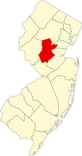
Location in Somerset County
USA New Jersey relief location map.svg
Red pog.svg
Blawenburg
Location in New Jersey
Usa edcp relief location map.png
Red pog.svg
Blawenburg
Location in the United States
Coordinates: 40°24′10″N74°41′55″W / 40.402646°N 74.698566°W / 40.402646; -74.698566 [1] [2]
Country Flag of the United States.svg  United States
State Flag of New Jersey.svg  New Jersey
County Somerset
Township Montgomery
Area
[3]
  Total0.61 sq mi (1.59 km2)
  Land0.61 sq mi (1.58 km2)
  Water0.00 sq mi (0.01 km2)  0.69%
Elevation
[4]
118 ft (36 m)
Population
 (2020) [5]
  Total287
  Density472.04/sq mi (182.20/km2)
Time zone UTC−05:00 (Eastern (EST))
  Summer (DST) UTC−04:00 (Eastern (EDT))
ZIP Code
08504 [6] [7]
Area codes 609/640 and 732/848
FIPS code 3406190 [1] [8] [9]
GNIS feature ID02583970 [1] [10]

Blawenburg is an unincorporated community and census-designated place (CDP) [11] located within Montgomery Township, in Somerset County, in the U.S. state of New Jersey. [12] [13] [14] As of the 2010 United States Census, the CDP's population was 280. [15] It is located at the juncture of two large roads, CR 518 and CR 601.

Contents

History

The area that was eventually known as Blawenburg was settled by John Blaw prior to 1742 when he purchased 400 acres (160 ha) of farmland from Abraham Van Horn, a merchant of New York City and a large New Jersey landholder, and 95 acres (38 ha) adjacent to this tract from Nicholas Lake of New Brunswick. John's father was Jan Frederickse Blaw, a refugee from Holland, born in Recife, Pernambuco, Brazil, who settled in New Amsterdam where John Blaw was born. John had a son Michael who ran a mill at the point where the Great Road crosses Beden's Brook, and it is believed that Blaw's Mill was the origin of the name Blawenburg.

The Blawenburg Reformed Church was established here in 1832. The James Van Zandt Mansion was built 1860–1865. [16]

Geography

According to the United States Census Bureau, Blawenburg had a total area of 0.612 square miles (1.586 km2), including 0.608 square miles (1.575 km2) of land and 0.004 square miles (0.011 km2) of water (0.69 percent). [1] [2]

Demographics

Historical population
CensusPop.Note
2010 216
2020 28732.9%
Population sources: 2010 [15] [5]

2010 census

The 2010 United States census counted 280 people, 107 households, and 73 families in the CDP. The population density was 460.4 per square mile (177.8/km2). There were 115 housing units at an average density of 189.1 per square mile (73.0/km2). The racial makeup was 75.36% (211) White, 0.00% (0) Black or African American, 0.00% (0) Native American, 19.29% (54) Asian, 0.00% (0) Pacific Islander, 0.00% (0) from other races, and 5.36% (15) from two or more races. Hispanic or Latino of any race were 1.43% (4) of the population. [15]

Of the 107 households, 31.8% had children under the age of 18; 61.7% were married couples living together; 4.7% had a female householder with no husband present and 31.8% were non-families. Of all households, 27.1% were made up of individuals and 9.3% had someone living alone who was 65 years of age or older. The average household size was 2.62 and the average family size was 3.23. [15]

24.3% of the population were under the age of 18, 5.4% from 18 to 24, 20.4% from 25 to 44, 31.4% from 45 to 64, and 18.6% who were 65 years of age or older. The median age was 45.0 years. For every 100 females, the population had 87.9 males. For every 100 females ages 18 and older there were 87.6 males. [15]

Historic district

Blawenburg Historic District
James Van Zandt Mansion, Blawenburg, NJ.jpg
James Van Zandt Mansion
LocationGeorgetown-Franklin Turnpike/CR 518, Great Road/CR 601, and Mountain View Road
Area336 acres (136 ha)
Architectural styleColonial Revival, Mid 19th Century Revival, Late Victorian
NRHP reference No. 88000632 [17]
NJRHP No.2538 [18]
Significant dates
Added to NRHPDecember 7, 1990
Designated NJRHPFebruary 8, 1988

The Blawenburg Historic District is a 336-acre (136 ha) historic district encompassing the community along Georgetown-Franklin Turnpike/County Route 518, Great Road/County Route 601, and Mountain View Road. It was added to the National Register of Historic Places on December 7, 1990, for its significance in agriculture, architecture, religion and exploration/settlement. The district includes 46 contributing buildings, two contributing structures and two contributing sites. [16]

The Reformed Dutch Church of Blawenburg was added individually to the NRHP in 1985 and contributes to the district. The Blawenburg Tavern, also known as the William M. Griggs House, was built c.1815. The village schoolhouse was built in 1853. The William Sherman House, built c.1856, features Greek Revival and Italianate style. The 1860s James Van Zandt Mansion is a Victorian style Italian Villa. [16]

See also

Related Research Articles

<span class="mw-page-title-main">Kingston, New Jersey</span> Populated place in Middlesex and Somerset counties, New Jersey, US

Kingston is an unincorporated community and census designated place (CDP) along the border of South Brunswick Township in Middlesex County and Franklin Township in Somerset County, and also located relatively near Princeton in Mercer County in the U.S. state of New Jersey. The historic settlement is in the Raritan Valley region, located along the course of the Millstone River. As of the 2010 United States Census, the CDP's population was 1,493, of which 1,222 were in South Brunswick Township and 271 in Franklin Township.

<span class="mw-page-title-main">Plainsboro Center, New Jersey</span> Census-designated place in New Jersey, United States

Plainsboro Center is an unincorporated community and census-designated place (CDP) located within Plainsboro Township, in Middlesex County, in the U.S. state of New Jersey. As of the 2010 United States Census, the CDP's population was 2,712.

<span class="mw-page-title-main">Lincroft, New Jersey</span> Populated place in Monmouth County, New Jersey, US

Lincroft is an unincorporated community and census-designated place (CDP) within Middletown Township, in Monmouth County, in the U.S. state of New Jersey. As of the 2020 United States census, the CDP had a population of 7,060, teflecting a 15.1% increase from the 6,135 residents enumerated at the 2010 U.S. Census, in turn a decline of 120 residents (-1.9%) from the 6,255 counted in the 2000 U.S. Census.

<span class="mw-page-title-main">Blackwells Mills, New Jersey</span> Populated place in Somerset County, New Jersey, US

Blackwells Mills is an unincorporated community and census-designated place (CDP) located in Franklin Township in Somerset County, in the U.S. state of New Jersey. As of the 2010 U.S. census, the CDP's population was 803.

Six Mile Run is an unincorporated community and census-designated place (CDP) located in Franklin Township, in Somerset County, in the U.S. state of New Jersey. As of the 2010 United States Census, the CDP's population was 3,184.

<span class="mw-page-title-main">Griggstown, New Jersey</span> Populated place in Somerset County, New Jersey, US

Griggstown is an unincorporated community and census-designated place (CDP) located within Franklin Township, in Somerset County, in the U.S. state of New Jersey. As of the 2010 United States Census, the CDP's population was 819. The area was first settled around 1733.

<span class="mw-page-title-main">Middlebush, New Jersey</span> Census-designated place in New Jersey, United States

Middlebush is an unincorporated community and census-designated place (CDP) located in Franklin Township, in Somerset County, in the U.S. state of New Jersey. As of the 2010 United States Census, the CDP's population was 2,326. It is perhaps most distinguished as being the host section for Franklin Township's municipal complex.

<span class="mw-page-title-main">East Millstone, New Jersey</span> Populated place in Somerset County, New Jersey, US

East Millstone is an unincorporated community and census-designated place (CDP) located in Franklin Township in Somerset County, in the U.S. state of New Jersey.

<span class="mw-page-title-main">Pleasant Plains, New Jersey</span> Census-designated place in New Jersey, United States

Pleasant Plains is an unincorporated community and census-designated place (CDP) located in Franklin Township, in Somerset County, in the U.S. state of New Jersey. As of the 2010 United States Census, the CDP's population was 922. Having no distinct boundaries, a large area in the center of Franklin Township centered on the intersections of South Middlebush Road with Claremont and Suydam Roads is generally considered Pleasant Plains.

<span class="mw-page-title-main">Roebling, New Jersey</span> Populated place in Burlington County, New Jersey, US

Roebling is an unincorporated community and census-designated place (CDP) located within Florence Township, in Burlington County, in the U.S. state of New Jersey, that was established as part of the 2010 United States census. As of the 2000 United States census, the CDP was combined as Florence-Roebling, which had a total population of 8,200. As of the 2010 Census, the Florence-Roebling CDP was split into its components, Florence and Roebling. As of the 2010 Census, the population of the Florence CDP was 4,426.

<span class="mw-page-title-main">Asbury, New Jersey</span> Populated place in Warren County, New Jersey, US

Asbury is an unincorporated community and census-designated place (CDP) located within Franklin Township in Warren County, in the U.S. state of New Jersey, that was created as part of the 2010 United States Census. As of the 2010 Census, the CDP's population was 273.

<span class="mw-page-title-main">Stewartsville, New Jersey</span> Populated place in Warren County, New Jersey, US

Stewartsville is an unincorporated community and census-designated place (CDP) located within Greenwich Township in Warren County, in the U.S. state of New Jersey, that was created as part of the 2010 United States Census. As of the 2010 Census, the CDP's population was 349.

<span class="mw-page-title-main">Port Murray, New Jersey</span> Census-designated place in Warren County, New Jersey, United States

Port Murray is an unincorporated community and census-designated place (CDP) located within Mansfield Township in Warren County, in the U.S. state of New Jersey, that was created as part of the 2010 United States Census. As of the 2010 Census, the CDP's population was 129.

<span class="mw-page-title-main">Barclay, New Jersey</span> Populated place in Camden County, New Jersey, US

Barclay Farm is an unincorporated community and census-designated place (CDP) located within Cherry Hill, in Camden County, in the U.S. state of New Jersey, that had been part of the Barclay-Kingston CDP until 2000, which was split to form the CDPs of Barclay and Kingston Estates as of the 2010 Census. Until the 2000 census, Barclay was included as part of the Barclay-Kingston CDP. As of the 2010 United States Census, the CDP's population was 4,428.

East Franklin is an unincorporated community and census-designated place (CDP) located in Franklin Township, in Somerset County, in the U.S. state of New Jersey. At the 2010 United States Census, East Franklin's population was 8,669.

East Rocky Hill is an unincorporated community and census-designated place (CDP) located in Franklin Township, in Somerset County, in the U.S. state of New Jersey. As of the 2010 United States Census, the CDP's population was 469.

<span class="mw-page-title-main">Finderne, New Jersey</span> Populated place in Somerset County, New Jersey, US

Finderne is an unincorporated community and census-designated place (CDP) located within Bridgewater Township, in Somerset County, in the U.S. state of New Jersey. As of the 2010 United States Census, the CDP's population was 5,600.

Green Knoll is an unincorporated community and census-designated place (CDP) located within Bridgewater Township, in Somerset County, in the U.S. state of New Jersey. As of the 2010 United States Census, the CDP's population was 6,200.

Voorhees is an unincorporated community and census-designated place (CDP) located in Franklin Township, in Somerset County, in the U.S. state of New Jersey. As of the 2010 United States Census, the CDP's population was 1,959.

<span class="mw-page-title-main">Finesville, New Jersey</span> Populated place in Warren County, New Jersey, US

Finesville is an unincorporated community and census-designated place (CDP) located within Pohatcong Township in Warren County, New Jersey, United States, that was defined as part of the 2010 United States Census. As of the 2010 Census, the CDP's population was 175.

References

  1. 1 2 3 4 Gazetteer of New Jersey Places, United States Census Bureau. Accessed July 21, 2016.
  2. 1 2 US Gazetteer files: 2010, 2000, and 1990, United States Census Bureau. Accessed September 4, 2014.
  3. "ArcGIS REST Services Directory". United States Census Bureau. Retrieved October 11, 2022.
  4. U.S. Geological Survey Geographic Names Information System: Blawenburg Census Designated Place, Geographic Names Information System. Accessed August 23, 2012.
  5. 1 2 "Census Population API". United States Census Bureau. Retrieved October 11, 2022.
  6. Look Up a ZIP Code for Blawenburg, NJ, United States Postal Service. Accessed August 23, 2012.
  7. Zip Codes, State of New Jersey. Accessed August 27, 2013.
  8. U.S. Census website, United States Census Bureau. Accessed September 4, 2014.
  9. Geographic codes for New Jersey, Missouri Census Data Center. Accessed June 9, 2023.
  10. US Board on Geographic Names, United States Geological Survey. Accessed September 4, 2014.
  11. State of New Jersey Census Designated Places - BVP20 - Data as of January 1, 2020, United States Census Bureau. Accessed December 1, 2022.
  12. GCT-PH1 - Population, Housing Units, Area, and Density: 2010 - County -- County Subdivision and Place from the 2010 Census Summary File 1 for Somerset County, New Jersey Archived 2020-02-12 at archive.today , United States Census Bureau. Accessed February 13, 2013.
  13. 2006-2010 American Community Survey Geography for New Jersey, United States Census Bureau. Accessed February 13, 2013.
  14. New Jersey: 2010 - Population and Housing Unit Counts - 2010 Census of Population and Housing (CPH-2-32), United States Census Bureau, August 2012. Accessed February 13, 2013.
  15. 1 2 3 4 5 DP-1 - Profile of General Population and Housing Characteristics: 2010 Demographic Profile Data for Blawenburg CDP, New Jersey Archived 2020-02-12 at archive.today , United States Census Bureau. Accessed February 13, 2013.
  16. 1 2 3 Brecknell, Ursula C. (October 1984). "National Register of Historic Places Inventory/Nomination: Blawenburg Historic District". National Park Service. With accompanying 43 photos
  17. "National Register Information System  (#88000632)". National Register of Historic Places . National Park Service. November 2, 2013.
  18. "New Jersey and National Registers of Historic Places – Somerset County" (PDF). New Jersey Department of Environmental Protection – Historic Preservation Office. June 23, 2021. p. 10.