Pluckemin, New Jersey

Last updated

Pluckemin, New Jersey
Pluckemin Inn Tavern, Pluckemin, NJ - east view.jpg
Pluckemin Inn
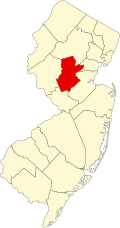
Location map of Somerset County, New Jersey.svg
Red pog.svg
Pluckemin
Location in Somerset County
USA New Jersey relief location map.svg
Red pog.svg
Pluckemin
Location in New Jersey
Usa edcp relief location map.png
Red pog.svg
Pluckemin
Location in the United States
Coordinates: 40°38′44″N74°38′21″W / 40.64556°N 74.63917°W / 40.64556; -74.63917
CountryFlag of the United States.svg  United States
State Flag of New Jersey.svg  New Jersey
County Somerset
Township Bedminster
Area
[1]
  Total0.70 sq mi (1.80 km2)
  Land0.69 sq mi (1.80 km2)
  Water0.00 sq mi (0.01 km2)
Elevation
[2]
184 ft (56 m)
Population
 (2020) [3]
  Total359
  Density518.04/sq mi (199.93/km2)
FIPS code 34-59730 [4]
GNIS feature ID879376 [2]

Pluckemin is an unincorporated community and census-designated place (CDP) [5] located within Bedminster Township, in Somerset County, in the U.S. state of New Jersey. [6] It was also known historically as Pluckamin. [2] [7] It was the site of several historic events during the American Revolutionary War.

Contents

Demographics

Historical population
CensusPop.Note
2020 359
U.S. Decennial Census [8]
2020 [3]

History

Gravestone of British Captain William Leslie, died during the Battle of Princeton, January 3, 1777 William Leslie Gravestone, Pluckemin, NJ.jpg
Gravestone of British Captain William Leslie, died during the Battle of Princeton, January 3, 1777

After the victory at Princeton, General George Washington and his army camped nearby from January 4 to 6, 1777 on the march to Morristown. [9] [10] On January 5, General Washington set up his headquarters in a local Pluckemin house, which later became known as the John Fenner House, and wrote his battle report to John Hancock. [11] He also ordered military honors for the battle death of British Captain William Leslie, a friend of the American Dr. Benjamin Rush. [12] The gravestone is in the graveyard of the former St. Paul's Lutheran Church (built 1757), where the Pluckemin Presbyterian Church is now located. [13]

During the winter of 1778–79, the Pluckemin Continental Artillery Cantonment Site, commanded by General Henry Knox, was located nearby. [14]

On February 18, 1779, General Knox organized a grand celebration, The French Alliance Ball, for the first anniversary of the alliance with France. In attendance were General Washington and his wife Martha. Over four hundred people enjoyed dancing, drinking and fireworks. [15] [16]

Historic district

The Pluckemin Village Historic District was added to the National Register of Historic Places on July 26, 1982.

Transportation

Pluckemin is intersected by two major roads: U.S. Route 202 / U.S. Route 206 (north-south) and County Route 620 / Burnt Mills Road / Washington Valley Road (east-west). [13]

See also

Related Research Articles

<span class="mw-page-title-main">Bedminster, New Jersey</span> Township in Somerset County, New Jersey, United States

Bedminster is a township in Somerset County, in the U.S. state of New Jersey. As of the 2020 United States census, the township's population was 8,272, an increase of 107 (+1.3%) from the 2010 census count of 8,165, which in turn reflected a decline of 137 (−1.7%) from the 8,302 counted in the 2000 census. Located within the Raritan Valley region, Bedminster is part of the Somerset Hills of northern Somerset County, bordering both Hunterdon and Morris counties.

<span class="mw-page-title-main">Franklin Township, Somerset County, New Jersey</span> Township in Somerset County, New Jersey, United States

Franklin Township is a township in Somerset County, in the U.S. state of New Jersey. It is centrally located in the Raritan Valley region, within the New York Metropolitan Area. As of the 2020 United States census, the township's population was 68,364, an increase of 6,064 (+9.7%) from the 2010 census count of 62,300, which in turn reflected an increase of 11,397 (+22.4%) from the 50,903 counted in the 2000 census. The township was the state's 19th most-populous municipality in 2020, after being ranked 22nd in 2010.

<span class="mw-page-title-main">Millstone, New Jersey</span> Borough in Somerset County, New Jersey, United States

Millstone is a borough in Somerset County, in the U.S. state of New Jersey. The borough was originally known as Somerset Courthouse and was the county seat. As of the 2020 United States census, the borough's population was 448, an increase of 30 (+7.2%) from the 2010 census count of 418, which in turn reflected an increase of 8 (+2.0%) from the 410 counted in the 2000 census.

<span class="mw-page-title-main">Blackwells Mills, New Jersey</span> Populated place in Somerset County, New Jersey, US

Blackwells Mills is an unincorporated community and census-designated place (CDP) located in Franklin Township in Somerset County, in the U.S. state of New Jersey. As of the 2010 U.S. census, the CDP's population was 803.

<span class="mw-page-title-main">Middlebrook encampment</span> United States historic place

"Middlebrook encampment" may refer to one of two different seasonal stays of the Continental Army in central New Jersey near the Middlebrook in Bridgewater Township in Somerset County. They are usually differentiated by either the date of the encampment or their chronological order.

<span class="mw-page-title-main">Griggstown, New Jersey</span> Populated place in Somerset County, New Jersey, US

Griggstown is an unincorporated community and census-designated place (CDP) located within Franklin Township, in Somerset County, in the U.S. state of New Jersey. As of the 2010 United States Census, the CDP's population was 819. The area was first settled around 1733.

<span class="mw-page-title-main">Lamington, New Jersey</span> Populated place in Somerset County, New Jersey, US

Lamington is an unincorporated community and census-designated place (CDP) located within Bedminster Township in Somerset County, in the U.S. state of New Jersey. It contains the Lamington Presbyterian Church Cemetery and the Lamington Black Cemetery.

<span class="mw-page-title-main">Somerset Hills</span>

The Somerset Hills is known as the northern region of Somerset County located in the U.S. state of New Jersey and includes the municipalities of Bedminster, Bernardsville, Bernards Township, Far Hills, and Peapack-Gladstone. The Morris County communities of the Chesters and the Mendhams are periodically recognized as part of the Somerset Hills.

<span class="mw-page-title-main">Mercerville, New Jersey</span> Populated place in Mercer County, New Jersey, US

Mercerville is an unincorporated community and census-designated place (CDP) located within Hamilton Township, in Mercer County, in the U.S. state of New Jersey. As of the 2010 United States Census, the CDP's population was 13,230. Until after the 2000 census, the area was part of the Mercerville-Hamilton Square CDP. For the 2010 Census it was split into two CDPs, Mercerville and Hamilton Square.

<span class="mw-page-title-main">Liberty Corner, New Jersey</span> Populated place in Somerset County, New Jersey, US

Liberty Corner is an unincorporated community and census-designated place (CDP) located in Bernards Township, in Somerset County, in the U.S. state of New Jersey. Liberty Corner is about 3+34 miles (6.0 km) south of Bernardsville. Liberty Corner has a post office with ZIP code 07938. The Liberty Corner Historic District was listed on the state and national registers of historic places in 1991.

Weston is an unincorporated community and census-designated place (CDP) located in Franklin Township, in Somerset County, in the U.S. state of New Jersey. As of the 2010 United States Census, the CDP's population was 1,235.

<span class="mw-page-title-main">Jacobus Vanderveer House</span> Historic house in New Jersey, United States

The Jacobus Vanderveer House, also known as Knox House, is a U.S. Federal style house located just north of the community of Pluckemin in Bedminster Township, Somerset County, New Jersey at the junction of US 202 and 206 north of River Road. The house was added to the National Register of Historic Places on September 29, 1995, and noted as an "excellent example of a Dutch–American house". The Vanderveer /Knox House & Museum while owned by Bedminster Township, is operated under the direction of the Friends of the Jacobus Vanderveer House, a 501-C3 non-profit organization. The Jacobus Vanderveer House is situated on part of the 218 acres (0.88 km2) that make up River Road Park. The house was thought to be built somewhere in the mid-1770s by James (Jacobus) Vanderveer, son to Jacobus Vanderveer after the property was willed to him by his father.

The Pluckemin Continental Artillery Cantonment Site in Pluckemin, New Jersey, at the southern section of Bedminster Township, New Jersey, holds historic American Revolutionary War importance as the Continental Army's artillery winter cantonment during the winter of 1778–79. It was nestled on the western side of the Second Watchung Mountain just to the North of the village of Pluckemin. The major significance of the site lies with the very different picture it yields of military organization during the Revolutionary War, although some point to it as the birthplace of the American military academy, 24 years prior to the founding of the United States Military Academy at West Point.

<span class="mw-page-title-main">Finderne, New Jersey</span> Populated place in Somerset County, New Jersey, US

Finderne is an unincorporated community and census-designated place (CDP) located within Bridgewater Township, in Somerset County, in the U.S. state of New Jersey. As of the 2010 United States Census, the CDP's population was 5,600.

<span class="mw-page-title-main">Staats House (South Bound Brook, New Jersey)</span> Historic house in New Jersey, United States

The Staats House, also known as the General Baron von Steuben Headquarters, is a historic building located at 17 Von Steuben Lane in South Bound Brook, Somerset County, New Jersey. Constructed c. 1740, it is now known as the Abraham Staats House after its second owner. In 1779, during the second Middlebrook encampment of the American Revolutionary War, it served as the headquarters for Prussian-American General Friedrich Wilhelm von Steuben. The house was added to the National Register of Historic Places on December 4, 2002, and noted as representing "one of the finest remaining buildings from the second phase of Dutch immigration and settlement in the Raritan Valley".

<span class="mw-page-title-main">William Leslie (British Army officer)</span> British army officer (1751–1777)

The Honourable William Leslie was a British nobleman and soldier. He was the second son of the Earl of Leven and Melville from Scotland and a captain in the 17th Foot of the British Army during the American War of Independence. He was mortally wounded during the Battle of Princeton and buried with military honours by American General George Washington at Pluckemin, New Jersey.

<span class="mw-page-title-main">Van Veghten House</span> Historic house in New Jersey

The Van Veghten House is a historic building in the Finderne section of Bridgewater Township, New Jersey. It was built around 1725 and served as the headquarters of Quartermaster General Nathanael Greene during the second Middlebrook encampment (1778–79) in the American Revolutionary War. The Somerset County Historical Society owns the house and uses it as its headquarters, including a museum and library. The early 18th-century Old York Road passed by here connecting Philadelphia to New York City. The house was added to the National Register of Historic Places on October 10, 1979 and noted as representing "one of the few remaining Raritan River mansions".

<span class="mw-page-title-main">Van Horne House</span> Historic house in New Jersey, United States

The Van Horne House is a historic building at 941 East Main Street near Bound Brook in Bridgewater Township, Somerset County, New Jersey. The house was built c. 1750 and also known as Phil's Hill, after its owner, Philip Van Horne. It served as the headquarters for American General Benjamin Lincoln in 1777, during the American Revolutionary War, in particular the Battle of Bound Brook. Later, it served as the headquarters for American General William Alexander, Lord Stirling during the second Middlebrook encampment (1778–79). The house, on the early-18th-century Old York Road that connected Philadelphia to New York City, was a New Jersey landmark during the war. Since 2002, the Heritage Trail Association has used the house as its headquarters, including an exhibit space. It was added to the National Register of Historic Places on March 8, 2002, for its locally significant Colonial Revival architecture from 1937 to 1944.

The Hills is a planned community and census-designated place (CDP) in Bedminster and Bernards townships, Somerset County, in the U.S. state of New Jersey. It was first listed as a CDP prior to the 2020 census.

References

  1. "ArcGIS REST Services Directory". United States Census Bureau. Retrieved October 11, 2022.
  2. 1 2 3 "Pluckemin". Geographic Names Information System . United States Geological Survey, United States Department of the Interior.
  3. 1 2 Census Data Explorer: Pluckemin CDP, New Jersey, United States Census Bureau. Accessed June 15, 2023.
  4. Geographic Codes Lookup for New Jersey, Missouri Census Data Center. Accessed June 9, 2023.
  5. State of New Jersey Census Designated Places - BVP20 - Data as of January 1, 2020, United States Census Bureau. Accessed December 1, 2022.
  6. Locality Search, State of New Jersey. Accessed June 9, 2016.
  7. Samuel Parry (1912). "The Origin of the Name 'Pluckemin'". In Honeyman, A. Van Doren (ed.). Somerset County Historical Quarterly. Vol. 1. p. 196.
  8. Census of Population and Housing, United States Census Bureau. Accessed June 1, 2023.
  9. Fischer, David Hackett (2006). Washington's Crossing. New York: Oxford University Press. p. 342. ISBN   0-19-517034-2.
  10. "John Fenner House" (PDF). HABS NJ-188. Historic American Buildings Survey. 1937.{{cite journal}}: Cite journal requires |journal= (help)
  11. "From George Washington to John Hancock, 5 January 1777". National Historical Publications & Records Commission.
  12. Rodney, Thomas; Rodney, Caesar Augustus (1776–1777). Diary of Captain Thomas Rodney. pp. 39–40.
  13. 1 2 Ashton, Charles H. (July 26, 1982). "NRHP Nomination: Pluckemin Village Historic District". National Park Service: 17.{{cite journal}}: Cite journal requires |journal= (help)
  14. "Pluckemin Artillery Cantonment". Jacobus Vanderveer House & Museum.
  15. Barber, John Warner; Howe, Henry (1868). Historical Collections of New Jersey: Past and Present. J.W. Barber. pp.  441–2.
  16. Honeyman, A. Van Doren, ed. (1918). Somerset County Historical Quarterly. Vol. 7. p. 17.