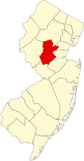
Basking Ridge, New Jersey | |
---|---|
Location in Somerset County Location in New Jersey | |
Coordinates: 40°42′22″N74°32′57″W / 40.7062°N 74.5493°W | |
Country | United States |
State | New Jersey |
County | Somerset |
Township | Bernards |
Area | |
• Total | 6.80 sq mi (17.60 km2) |
• Land | 6.75 sq mi (17.48 km2) |
• Water | 0.05 sq mi (0.12 km2) |
Elevation | 335 ft (102 m) |
Population | |
• Total | 7,196 |
• Density | 1,066.07/sq mi (411.60/km2) |
Time zone | UTC−05:00 (Eastern (EST)) |
• Summer (DST) | UTC−04:00 (Eastern (EDT)) |
ZIP Code | |
Area code | 908 |
FIPS code | 34-03340 [6] |
GNIS feature ID | 2806230 [7] |
Basking Ridge is an unincorporated community and census-designated place (CDP) [8] located within Bernards Township in the Somerset Hills region of Somerset County, in the U.S. state of New Jersey. [9]
Settled during colonial times, Basking Ridge is in the Raritan Valley and is a commercial hub for northern-central New Jersey and is a commuter town of New York City. [10] It was home to the old AT&T Headquarters, now operated by Verizon. Basking Ridge is the current headquarters for Collabera, Verizon Wireless, Peraton Labs, Lawyer.com, and Barnes & Noble College Booksellers. The community also hosts a train station along the Gladstone Branch (one of the two branches of the Morris & Essex Lines), which connects to Hoboken Terminal and New York Penn Station.
The community of Basking Ridge is part of greater Bernards Township, which also includes the neighborhoods of Liberty Corner, Lyons and West Millington.
It was first listed as a CDP in the 2020 census [7] with a population of 7,196. [11]
Basking Ridge was originally settled in the 1720s by British Presbyterians escaping religious persecution. The land was bought from the Lenape Native Americans. [12]
Bernards Township was officially chartered on May 21, 1760, granted by King George II and granted to Sir Francis Bernard, first governor of the noted section which includes Basking Ridge.
On the morning of December 13, 1776, General Charles Lee was captured by the British at Widow White's tavern. Lee had ranked next to Washington in command. [13]
A referendum to create an independent borough of Basking Ridge failed in June 1921. [14] Voters rejected the proposed borough by a more than 4–1 margin. [15]
The downtown area of Bernards Township known as Basking Ridge was added to the New Jersey and National Registries as a Historic District. on August 8, 1974.
Census | Pop. | Note | %± |
---|---|---|---|
2020 | 7,196 | — | |
U.S. Decennial Census [16] 2020 [3] |
Basking Ridge first appeared as a census designated place in the 2020 U.S. Census. [17] [18]
Race / Ethnicity (NH = Non-Hispanic) | Pop 2020 [18] | % 2020 |
---|---|---|
White alone (NH) | 5,666 | 78.74% |
Black or African American alone (NH) | 46 | 0.64% |
Native American or Alaska Native alone (NH) | 1 | 0.01% |
Asian alone (NH) | 671 | 9.32% |
Pacific Islander alone (NH) | 0 | 0.00% |
Other race alone (NH) | 21 | 0.29% |
Mixed race or Multiracial (NH) | 272 | 3.78% |
Hispanic or Latino (any race) | 519 | 7.21% |
Total | 7,196 | 100.00% |
Prior to 2020, demographic data was based on the United States Census Bureau figures for the ZIP Code Tabulation Area (ZCTA) for the 07920 ZIP Code. As of the 2010 census, the population for the ZIP Code Tabulation Area (ZCTA) 07920 was 26,747. [19]
As of the 2000 United States census [20] there were 24,600 people, 9,300 households, and 6,517 families residing in the ZCTA. The population density was 1,137.1 inhabitants per square mile (439.0/km2). There were 9,537 housing units at an average density of 440.8 per square mile (170.2/km2). The racial makeup of the ZCTA was 89.2% Caucasian, 1.4% African American, 0.1% Native American, 7.8% Asian, 0.0% Pacific Islander, 0.4% from other races, and 1.1% from two or more races. 2.6% of the population were Hispanic or Latino of any race. [21]
There were 9,300 households, out of which 37.1% had children under the age of 18 living with them, 62.8% were married couples living together, 5.8% had a female householder with no husband present, and 29.9% were non-families. 26.5% of all households were made up of individuals, and 9.1% had someone living alone who was 65 years of age or older. The average household size was 2.56 and the average family size was 3.15. [21]
In the ZCTA the population was spread out, with 27.3% under the age of 18 , 3.2% from 18 to 24 , 31.2% from 25 to 44 , 25.4% from 45 to 64 , and 12.7% who were 65 years of age or older. The median age was 39.3 years. [21]
The median income for a household in the ZCTA was $105,471, and the median income for a family was $131,618. Males had a median income of $93,436 versus $60,101 for females. The per capita income for the ZCTA was $54,753. 1.4% of the population and 0.6% of families were below the poverty line. Out of the total population, 1.2% of those under the age of 18 and 2.8% of those 65 and older were living below the poverty line. [21]
Demographic | Basking Ridge | United States |
---|---|---|
Population | 21,424 | 308,745,538 [22] |
Median Age | 37.13 years | 37.2 years [22] |
Median Household Income | $183,611 | $51,144 [23] |
% of Single Households | 37.39% | 30.22% |
% of Married Households | 62.61% | 69.78% |
% Families | 70.72% | 69.40% |
Avg. Household Size | 2.42 people | 2.58 people |
% College or Higher | 59.76% | 26.46% |
% White Collar | 82.53% | 55.54% |
Homes Owner Occupied | 79.84% | 57.72% |
Avg. Dwelling Size | 6 rooms | 4.5 rooms |
Basking Ridge has an annual event in May called Charter Day. Many rides are set up in the Oak Street field—a bounce house, inflatable race tracks, and spinning rides. Also, in the center of the town hundreds of stands are set up mostly promoting school sports, but there are also many kettle corn stands, which is a traditional food children eat during Charter Day. At night, the traditional Battle of the Bands takes place, which many teenagers sign up for to play their favorite songs.
Basking Ridge has several properties on the National Register of Historic Places. [34]
There are several parks within Basking Ridge. Four are county parks: Lord Stirling Park, Rebel Hill, Southard, and Harry Dunham. The fifth is Pleasant Valley Park which contains the town pool and miles of woodchip trails. [35]
Bernards High School was founded by the Bernards Township Board of Education in 1924. When Bernardsville separated from Bernards Township, the schools still remained one system until 1947 when the original high school became the property of Bernardsville. From 1948, however, township students continued attending Bernards High School as tuition students. [36] In 1960, a contract was issued for the construction of a new Ridge High School and Cedar Hill School which were built on approximately 60 acres (24 ha) of land.
William Annin Middle School was originally named after a colonial patriot who settled in Basking Ridge in 1722. Construction started in 1968 and the school was dedicated on September 28, 1969, as William Annin Junior High School and contained grades 6 through 8. The following year it shifted to grades 7 through 9. It became a middle school in 1982. It currently contains grades 6 through 8. [37] The school is one of the few in the United States to have a seismograph. [38] [39]
There are four elementary schools in Basking Ridge.
Saint James School is a parochial elementary school for students in preschool through eighth grade that operates under the supervision of the Roman Catholic Diocese of Metuchen. [45] [46] In 2024, the school was one of 11 statewide that was recognized as a Blue Ribbon School of Excellence by the United States Department of Education. [47] [48]
NJ Transit's Gladstone Branch runs through Basking Ridge. There are two stations that residents can use to get to New York City and Hoboken Terminal: [49]
Lakeland Bus Lines (Route 78) provides service to and from the Port Authority Bus Terminal in Midtown Manhattan during peak commuting hours. [52]
Two Interstates are located near Basking Ridge:
People who were born in, residents of, or otherwise closely associated with Basking Ridge include:
Somerset County is a county located in the north-central part of the U.S. state of New Jersey. As of the 2020 census, the county was the state's 13th-most-populous county, with a population of 345,361, its highest decennial count ever and an increase of 21,917 (+6.8%) from the 2010 census count of 323,444. Somerset County constitutes part of the New York metropolitan area. Its county seat is Somerville. The most populous place in the county was Franklin Township, with 68,364 residents at the time of the 2020 census, while Hillsborough Township, with 55.00 square miles (142.4 km2), covered the largest total area of any municipality. The county is part of the Central Jersey region of the state.
Bedminster is a township in Somerset County, in the U.S. state of New Jersey. As of the 2020 United States census, the township's population was 8,272, an increase of 107 (+1.3%) from the 2010 census count of 8,165, which in turn reflected a decline of 137 (−1.7%) from the 8,302 counted in the 2000 census. Located within the Raritan Valley region, Bedminster is part of the Somerset Hills of northern Somerset County, bordering both Hunterdon and Morris counties.
Bernards Township is a township in Somerset County, in the U.S. state of New Jersey. As of the 2020 United States census, the township's population was 27,830, an increase of 1,178 (+4.4%) from the 2010 census count of 26,652, reflecting an increase of 2,077 (+8.5%) from the 24,575 counted in the 2000 census.
Bernardsville is the northernmost borough in Somerset County, in the U.S. state of New Jersey. Situated within the heart of the Raritan Valley and Somerset Hills regions, the borough is an historic and wealthy bedroom community of New York City in the New York metropolitan area. As of the 2020 United States census, the borough's population was 7,893, an increase of 186 (+2.4%) from the 2010 census count of 7,707, which in turn had reflected an increase of 362 (+4.9%) from the 7,345 counted at the 2000 census. Bernardsville is often mispronounced as "Ber-NARDS-ville" as opposed to the correct pronunciation, "BER-nards-ville".
Far Hills is a borough in the Somerset Hills of northern Somerset County in the U.S. state of New Jersey. As of the 2020 United States census, the borough's population was 924, an increase of 5 (+0.5%) from the 2010 census count of 919, which in turn reflected an increase of 60 (+7.0%) from the 859 counted in the 2000 census. The borough is located within the Raritan Valley region.
Peapack-Gladstone is a borough in the Somerset Hills region of northern Somerset County in the U.S. state of New Jersey. As of the 2020 United States census, the borough's population was 2,558, a decrease of 24 (−0.9%) from the 2010 census count of 2,582, which in turn reflected an increase of 149 (+6.1%) from the 2,433 counted in the 2000 census.
Gladstone is an unincorporated community located within Peapack-Gladstone in Somerset County, in the U.S. state of New Jersey. The area is served as United States Postal Service ZIP Code 07934. Gladstone was named in honor of William Ewart Gladstone, who served as British Prime Minister several times between 1868 and 1894.
Martinsville is an unincorporated community and census-designated place (CDP) located within Bridgewater Township, in Somerset County, in the U.S. state of New Jersey. As of the 2010 United States Census, the CDP's population was 11,980.
The Bernards Township School District is a comprehensive community public school district, serving students in pre-kindergarten through twelfth grade from Bernards Township in Somerset County, in the U.S. state of New Jersey.
Ridge High School is a four-year comprehensive community public high school serving students in ninth through twelfth grades from Bernards Township in Somerset County, in the U.S. state of New Jersey, operating as the lone secondary school of the Bernards Township School District.
Lyons is a New Jersey Transit station in Basking Ridge, New Jersey along the Gladstone Branch of the Morris & Essex Lines. The station serves south Basking Ridge as well as the Hills and Liberty Corner.
The Somerset Hills is known as the northern region of Somerset County located in the central portion of the U.S. state of New Jersey and includes the municipalities of Bedminster, Bernardsville, Bernards Township, Far Hills, and Peapack-Gladstone. The southwestern Morris County municipalities of the Chesters and the Mendhams are periodically recognized as part of the Somerset Hills.
Pottersville is an unincorporated community and census-designated place (CDP) split between Bedminster Township in Somerset County and Tewksbury Township in Hunterdon County, in the U.S. state of New Jersey. The area is served as United States Postal Service ZIP Code 07979. As of the 2010 United States Census, the population for ZIP Code Tabulation Area 07979 was 589. In 1990, most of the village was listed on the National Register of Historic Places as the Pottersville Village Historic District.
Liberty Corner is an unincorporated community and census-designated place (CDP) located in Bernards Township, in Somerset County, in the U.S. state of New Jersey. Liberty Corner is about 3+3⁄4 miles (6.0 km) south of Bernardsville. Liberty Corner has a post office with ZIP code 07938. The Liberty Corner Historic District was listed on the state and national registers of historic places in 1991.
Brick Academy is the nickname for a Federal-style brick building built in 1809 to meet the growing needs of the Basking Ridge Classical School located in the Basking Ridge section of Bernards Township, Somerset County, New Jersey. That school existed prior to 1799, at least 10 years before the construction of this building in 1809. The brick building was constructed for the elementary school run by local Presbyterian pastor, Rev. Robert Finley. This was about halfway through Rev. Finley's time at Basking Ridge. During the time he ran the school, attendance grew from fewer than 12 to an average near 25 students, and sometimes as high as 40 students. Students came from near & far, mostly from prominent families. The school was a high end preparatory school for boys who generally continued on to the College of New Jersey, later, known as Princeton University. In 1817, Rev. Finley quit Basking Ridge to briefly become president of the University of Georgia in Athens, GA. By 1828, the "Brick Academy" corporation was formed and the building continued use as a private, then public school in 1853, before being used for other purposes.
The Presbyterian Church in Basking Ridge is a historic church at 1 E. Oak Street in the Basking Ridge section of Bernards Township in Somerset County, New Jersey, United States. The church congregation was founded in 1717. The present church, which was constructed in 1839 in a Greek Revival style, is listed in the U.S. National Register of Historic Places. Until 2017, the churchyard held the Old Oak Tree of Basking Ridge, which was estimated to be 600 years old.
Historical Society Somerset Hills (THSSH) is a historical organization in Somerset County, New Jersey, United States. It was founded in 1928 as the Historical Society of Basking Ridge.
The Basking Ridge white oak was a white oak tree that stood in the churchyard of the Presbyterian Church in Basking Ridge, New Jersey. The tree was over 600 years old and died in 2016, before being cut down in 2017. It stood at 97 feet tall, and may have been the oldest white oak in the world.
Franklin Corners is an unincorporated community located along the Passaic River at the intersection of County Route 613 and U.S. Route 202 in Bernards Township of Somerset County, New Jersey. In the 19th century, it had a grist mill, saw mill, general store, school, and several houses. The Franklin Corners Historic District, featuring Van Dorn's Mill, was listed on the National Register of Historic Places in 1975.