Franklin Park, New Jersey | |
---|---|
Location in Somerset County Location in New Jersey | |
Coordinates: 40°26′40″N74°32′33″W / 40.444481°N 74.542572°W [1] [2] | |
Country | United States |
State | New Jersey |
County | Somerset |
Township | Franklin |
Area | |
• Total | 2.607 sq mi (6.750 km2) |
• Land | 2.605 sq mi (6.746 km2) |
• Water | 0.002 sq mi (0.004 km2) 0.06% |
Elevation | 118 ft (36 m) |
Population | |
• Total | 13,430 |
• Density | 5,155.5/sq mi (1,990.5/km2) |
Time zone | UTC−05:00 (Eastern (EST)) |
• Summer (DST) | UTC−04:00 (Eastern (EDT)) |
ZIP Code | 08823 [5] |
Area code(s) | 732/848 |
FIPS code | 34-25020 [1] [2] [6] |
GNIS feature ID | 02583991 [1] [2] |
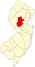
Franklin Park is an unincorporated community and census-designated place (CDP) [7] located within Franklin Township, in Somerset County, in the U.S. state of New Jersey. [8] [9] [10] [11] As of the 2010 United States Census, the CDP's population was 13,295. [12] Route 27 (historically known as Old Road/King's Highway and once part of the Lincoln Highway system) bisects the village and serves as the dividing line between the two counties. [13] The adjacent sections of South Brunswick and North Brunswick, Middlesex County on the east side of Route 27 are also known as Franklin Park, but are not included within the CDP's boundaries. [11] [14]
The area is served as United States Postal Service ZIP Code 08823. [5]
The original name for Franklin Park was "Six Mile Run", which was named for the tributary of the Millstone River that flows through the area and first came to importance about 1710. [13]
In that year a congregation of the Six Mile Run Reformed Church was formed making it the oldest congregation in Franklin Township and remains an important part of the community. The first building was replaced by a new building in 1766 and was later replaced in 1817 by a third structure on the same site. The current building replaced the 1817 church that was destroyed by fire in 1879. The Frelinghuysen Memorial Chapel was added in 1907 and the Fellowship Hall was dedicated in 1958. [15]
Franklin Park, then Six Mile Run, served as the first site of the Somerset County Courthouse and jail from 1714 until 1737 when a fire destroyed the building and the county seat was moved to Millstone, New Jersey. Occasionally Franklin Park was referred to as Somerset Courthouse during the time the courthouse was located here. A commemorative marker is located on Route 27 between Clover Place and Bennington Parkway near the original courthouse site. [13]
Several early taverns were established here and welcomed travelers using King's Highway while headed towards New Brunswick and New York City going north and Princeton, Trenton and Philadelphia going south. Wood's Tavern was operating by 1745 and Gifford's Tavern by the 1760s. John Quincy Adams and Andrew Jackson are known to have stopped at Gifford's Tavern. In 1874, Gifford's Tavern was replaced by the 26-room Beekman's Hotel, aka Franklin House, which operated until it was destroyed by a major fire in 1929. The building occupied by Chauncey's Restaurant (now demolished) was purportedly once a barn of the Beekman's Hotel. [16]
The first post office in Franklin Township was established here in 1826. [17]
The name of the community was formally changed from Six Mile Run to Franklin Park on June 25, 1872. [18]
In the late 19th century in addition to the Beekman's Hotel and another known as Manley's Hotel and the Six Mile Run Reformed Church, the community included a wagon factory, blacksmith, wheelwright, butcher, hay scales, ice house, a school, and a general store called Hullfish's Store, as well as residences for about 110 people. [18]
Today many of the historic commercial buildings are gone but newer commercial buildings have taken their place to serve the rapidly growing population in the surrounding area.
The former Franklin Park School on Route 27, built in 1909, was a two-room building until three more rooms were added in 1931. Renamed the Phillips School in 1954 in honor of Jane E. Phillips, who had earlier invested in a school to be built by that name in honor of her late husband at Ten Mile Run (closed since 1931) and established a trust fund for graduates of the Phillips school to attend New Jersey State Teachers College at Trenton (most recently known as The College of New Jersey), it ceased being used as a public school in 1976. The building was then used by Franklin Township's Recreation Department until 1993 when it was abandoned due to structural problems. [19] After being sold and renovated, it reopened as a privately run pre-school.
The current Franklin Park School section located between Hillview and Central Avenue is the original ten room building constructed in 1957. In 1998, a major expansion, accessed from Eden Road, was completed increasing enrollment capacity from about 130 to over 900 students. [20]
Franklin Park has been served by the Franklin Park Volunteer Fire Company since 1936. Originally housed in the converted South Middlebush one-room schoolhouse that had been relocated to Route 27 in Franklin Park, the company had to build a new building after an oil stove fire destroyed the first firehouse in 1946. [21]
Most of the 2001 anthrax attacks letters had the address of Franklin Park. [22]
According to the United States Census Bureau, Franklin Park had a total area of 2.607 square miles (6.750 km2), including 2.605 square miles (6.746 km2) of land and 0.002 square miles (0.004 km2) of water (0.06%). [1] [2]
Census | Pop. | Note | %± |
---|---|---|---|
2010 | 13,295 | — | |
2020 | 13,430 | 1.0% | |
Population sources: 2010 [12] 2020 [4] |
The 2010 United States census counted 13,295 people, 5,310 households, and 3,478 families in the CDP. The population density was 5,104.3 per square mile (1,970.8/km2). There were 5,529 housing units at an average density of 2,122.7 per square mile (819.6/km2). The racial makeup was 31.87% (4,237) White, 27.34% (3,635) Black or African American, 0.33% (44) Native American, 34.53% (4,591) Asian, 0.00% (0) Pacific Islander, 2.29% (305) from other races, and 3.63% (483) from two or more races. Hispanic or Latino of any race were 7.82% (1,040) of the population. [12]
Of the 5,310 households, 34.7% had children under the age of 18; 49.1% were married couples living together; 12.9% had a female householder with no husband present and 34.5% were non-families. Of all households, 27.8% were made up of individuals and 3.4% had someone living alone who was 65 years of age or older. The average household size was 2.48 and the average family size was 3.09. [12]
22.9% of the population were under the age of 18, 5.9% from 18 to 24, 40.6% from 25 to 44, 23.5% from 45 to 64, and 7.1% who were 65 years of age or older. The median age was 34.6 years. For every 100 females, the population had 87.9 males. For every 100 females ages 18 and older there were 83.0 males. [12]
People who were born in, residents of, or otherwise closely associated with Franklin Park include:
Somerset County is a county located in the north-central part of the U.S. state of New Jersey. As of the 2020 census, the county was the state's 13th-most-populous county, with a population of 345,361, its highest decennial count ever and an increase of 21,917 (+6.8%) from the 2010 census count of 323,444. Somerset County constitutes part of the New York metropolitan area. Its county seat is Somerville. The most populous place in the county was Franklin Township, with 68,364 residents at the time of the 2020 census, while Hillsborough Township, with 55.00 square miles (142.4 km2), covered the largest total area of any municipality. The county is part of the Central Jersey region of the state.
Kingston is an unincorporated community and census designated place (CDP) along the border of South Brunswick Township in Middlesex County and Franklin Township in Somerset County, and also located relatively near Princeton in Mercer County in the U.S. state of New Jersey. The historic settlement is in the Raritan Valley region, located along the course of the Millstone River. As of the 2010 United States Census, the CDP's population was 1,493, of which 1,222 were in South Brunswick Township and 271 in Franklin Township.
Franklin Township is a township in Somerset County, in the U.S. state of New Jersey. It is centrally located in the Raritan Valley region, within the New York Metropolitan Area. As of the 2020 United States census, the township's population was 68,364, an increase of 6,064 (+9.7%) from the 2010 census count of 62,300, which in turn reflected an increase of 11,397 (+22.4%) from the 50,903 counted in the 2000 census. The township was the state's 19th most-populous municipality in 2020, after being ranked 22nd in 2010.
Montgomery Township is a township in southern Somerset County, in the U.S. state of New Jersey. It is located in the New York Metropolitan Area. As of the 2020 United States census, the township's population was 23,690, an increase of 1,436 (+6.5%) from the 2010 census count of 22,254, which in turn reflected an increase of 4,773 (+27.3%) from the 17,481 counted in the 2000 census.
Somerset is an unincorporated community and census-designated place (CDP) located within Franklin Township, in Somerset County, in the U.S. state of New Jersey. As of the 2010 United States Census, the CDP's population was 22,083.
Matthew Leydt (1755–1783) was the first graduate of Queen's College in New Brunswick, New Jersey.
Belle Mead is an unincorporated community and census-designated place (CDP) located within Montgomery Township, in Somerset County, in the U.S. state of New Jersey. As of the 2020 United States census, the CDP's population was 5,569, reflecting an expansion of the CDP from 0.74 square miles (1.9 km2) in 2010 to 4.03 square miles (10.4 km2) in 2020.
Blackwells Mills is an unincorporated community and census-designated place (CDP) located in Franklin Township in Somerset County, in the U.S. state of New Jersey. As of the 2010 U.S. census, the CDP's population was 803.
Routh Goshen, born Arthur James Caley, was most commonly known as Colonel Routh Goshen or the Arabian Giant or the Palestine Giant. He was billed as the tallest man in the world at 7 ft 11 in (2.41 m) and 620 pounds (280 kg) but was most likely no more than 7 ft 5 in (2.26 m) and 400 pounds (180 kg). His true origins were kept secret from the public during his performance years in the United States and were obscured by the many apocryphal biographies that were created to publicize him. His actual origins came out slowly after his death. His birth name was Arthur James Caley and he was born on the Isle of Man in 1824. His fictional biographies said he was born in Jerusalem on May 5, 1837. After his retirement in the 1880s, he settled in Middlebush, New Jersey, and gained the nickname the Middlebush Giant.
Zarephath is an unincorporated community and census-designated place (CDP) and located in Franklin Township, in Somerset County, in the U.S. state of New Jersey, about 15 mi (24 km) north of Princeton. As of the 2020 United States census, the CDP's population was 69, an increase of 32 (+86.5%) from the 37 enumerated at the 2010 census.
The Six Mile Run Reservoir Site, part of the Delaware and Raritan Canal State Park, is located in Franklin Township, Somerset County, New Jersey, United States. It is adjacent to the Delaware and Raritan Canal. It covers 3,037 acres (12.29 km2). The reservoir plan was to flood the Six Mile Run watershed. The Six Mile Run is a tributary of the Millstone River that, with its tributaries, drains a large area in central Franklin Township, Somerset County, New Jersey and western portions of North Brunswick and South Brunswick Townships in Middlesex County, New Jersey. It derives its name, along with other streams, from the distance early surveyors estimated it was from the point where the historic King's Highway left the Raritan River at New Brunswick to the point the roadway crossed the stream. The estimates were not very accurate but the stream names have remained in use ever since.
Six Mile Run is an unincorporated community and census-designated place (CDP) located in Franklin Township, in Somerset County, in the U.S. state of New Jersey. As of the 2010 United States Census, the CDP's population was 3,184.
Griggstown is an unincorporated community and census-designated place (CDP) located within Franklin Township, in Somerset County, in the U.S. state of New Jersey. As of the 2010 United States Census, the CDP's population was 819. The area was first settled around 1733. The Millstone River and the Delaware and Raritan Canal both flow through Griggstown.
Middlebush is an unincorporated community and census-designated place (CDP) located in Franklin Township, in Somerset County, in the U.S. state of New Jersey. As of the 2010 United States Census, the CDP's population was 2,326. It is perhaps most distinguished as being the host section for Franklin Township's municipal complex.
Blawenburg is an unincorporated community and census-designated place (CDP) located within Montgomery Township, in Somerset County, in the U.S. state of New Jersey. As of the 2010 United States Census, the CDP's population was 280. It is located at the juncture of two large roads, CR 518 and CR 601.
East Millstone is an unincorporated community and census-designated place (CDP) located in Franklin Township in Somerset County, in the U.S. state of New Jersey.
Johnsonburg is an unincorporated community and census-designated place (CDP) located within Frelinghuysen Township in Warren County, in the U.S. state of New Jersey, that was created as part of the 2010 United States Census. As of the 2020 Census, the CDP's population was 381, up from 101 in the 2010 Census.
Pleasant Plains is an unincorporated community and census-designated place (CDP) located in Franklin Township, in Somerset County, in the U.S. state of New Jersey. As of the 2010 United States Census, the CDP's population was 922. Having no distinct boundaries, a large area in the center of Franklin Township centered on the intersections of South Middlebush Road with Claremont and Suydam Roads is generally considered Pleasant Plains.
Liberty Corner is an unincorporated community and census-designated place (CDP) located in Bernards Township, in Somerset County, in the U.S. state of New Jersey. Liberty Corner is about 3+3⁄4 miles (6.0 km) south of Bernardsville. Liberty Corner has a post office with ZIP code 07938. The Liberty Corner Historic District was listed on the state and national registers of historic places in 1991.
Weston is an unincorporated community and census-designated place (CDP) located in Franklin Township, in Somerset County, in the U.S. state of New Jersey. As of the 2010 United States Census, the CDP's population was 1,235.