
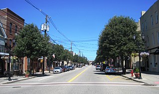
Middlesex County is a county located in the north-central part of the U.S. state of New Jersey, extending inland from the Raritan Valley region to the northern portion of the Jersey Shore. As of the 2020 United States census, the county was the state's third-most populous county with a population of 863,162, its highest decennial count ever and an increase of 53,304 (+6.6%) from the 2010 census count of 809,858, which in turn reflected an increase of 59,696 (8.0%) from the 750,162 counted in the 2000 census. Middlesex is part of the New York metropolitan area. Many communities within the county serve as commuter towns to and from New York City and other points north. The county is part of the Central Jersey region of the state.

Route 26 is a state highway in New Jersey, United States, running 2.54 miles (4.09 km) along Livingston Avenue from U.S. Route 1 (US 1) in North Brunswick Township northeast to Nassau Street at the border of New Brunswick. Prior to the 1953 renumbering, the route continued southwest along US 1 to Trenton. Livingston Avenue inside New Brunswick, southwest of Suydam Street, is the 1.08-mile (1.74 km) County Route 691 (CR 691). The 0.39 miles (0.63 km) from Suydam Street to its end at George Street is part of Route 171, also maintained by Middlesex County.

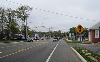
Monroe Township is a township located in southern Middlesex County, in the U.S. state of New Jersey. The township is centrally located within the Raritan Valley region and is an outer-ring suburb of New York City within the New York metropolitan area. As of the 2020 United States census, the township's population was 48,594, its highest decennial count ever and an increase of 9,462 (+24.2%) from the 39,132 recorded at the 2010 census, which in turn reflected an increase of 11,133 (+39.8%) from the 27,999 counted in the 2000 census. Monroe Township also comprises the largest land area of any municipality in Middlesex County, at approximately 42 square miles (110 km2).
South Amboy is a suburban city in Middlesex County, in the U.S. state of New Jersey, located on Raritan Bay. As of the 2020 United States census, the city's population was 9,411, an increase of 780 (+9.0%) from the 2010 census count of 8,631, which in turn reflected an increase of 718 (+9.1%) from the 7,913 counted in the 2000 census.

U.S. Route 130 is a U.S. Highway that is a spur route of US 30, located completely within the state of New Jersey. It is signed with north and south cardinal directions, following a general northeast–southwest diagonal path, with north corresponding to the general eastward direction and vice versa. The route runs 83.46 mi (134.32 km) from Interstate 295 (I-295) and US 40 at Deepwater in Pennsville Township, Salem County, where the road continues south as Route 49, north to US 1 in North Brunswick Township, Middlesex County, where Route 171 continues north into New Brunswick. The route briefly runs concurrent with US 30 near Camden, about one-third of the way to New Brunswick. The road runs within a close distance of I-295 south of Bordentown and a few miles from the New Jersey Turnpike for its entire length, serving as a major four- to six-lane divided local road for most of its length. US 130 passes through many towns including Penns Grove, Bridgeport, Westville, Camden, Pennsauken, Burlington, Bordentown, Hightstown, and North Brunswick.
Conrail Shared Assets Operations (CSAO) is the commonly used name for modern-day Conrail, an American railroad company. It operates three networks, the North Jersey, South Jersey/Philadelphia, and Detroit Shared Assets Areas, where it serves as a contract local carrier and switching company for its owners, CSX Transportation and the Norfolk Southern Railway. When most of the former Conrail's track was split between these two railroads, the three shared assets areas were kept separate to avoid giving one railroad an advantage in those areas. The company operates using its own employees and infrastructure but owns no equipment outside MOW equipment.
The United New Jersey Railroad and Canal Company (UNJ&CC) was a United States-based railroad company established in 1872. It was formed by the consolidation of three existing companies: the Camden and Amboy Railroad, Delaware and Raritan Canal Company, and New Jersey Rail Road and Transportation Company. The Camden and Amboy and New Jersey Rail Road were among the earliest North American railroads. The Pennsylvania Railroad leased the United New Jersey Railroad and Canal Company in 1872.
Whiting is an unincorporated community located on the west side of Manchester Township in Ocean County, New Jersey, United States. It is in the Eastern Standard time zone with an elevation of 180 ft. It is home to various retirement communities. The ZIP Code Tabulation Area for the Whiting 08759 ZIP code has a population of 33,180 as of the 2019 Population Estimates Program from the United States Census Bureau. The majority of the township's population of 43,070 lives here.
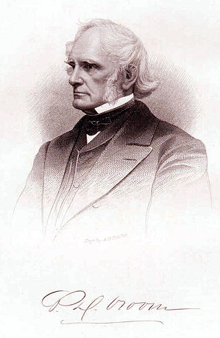
Peter Dumont Vroom, an American Democratic Party politician, served as the ninth governor of New Jersey and as a member of the United States House of Representatives for a single term, from 1839 to 1841.

County Route 551 is a county highway in the U.S. state of New Jersey. The highway extends 34.57 miles (55.64 km) from Pennsville-Salem Road in Pennsville Township to Penn Street in Camden.

Roebling station is a station on the River Line light rail system, located in Roebling, New Jersey. The station opened on March 15, 2004 together with the line. A previous station, operated by the Pennsylvania Railroad, was located at the site from around 1907 until the 1950s. The station consists of one side platform serving the single-track line; an adjacent parking lot originally intended to support nearby developments is used by local commuters.
The Freehold and Jamesburg Agricultural Railroad was a short-line railroad in New Jersey. The railroad traversed through the communities of Freehold Borough, Freehold Township, Manalapan Township, Englishtown Borough, Monroe Township, and Jamesburg Borough, en route to Monmouth Junction in South Brunswick Township.

North Pemberton is a disused railway station located in Pemberton Township, Burlington County, New Jersey, United States. The station was built in 1892 by John S. Rogers and added to the National Register of Historic Places on May 23, 1978, for its significance in architecture and transportation. The station became inactive in 1969 when rail service between Pemberton and Camden ended. The Township of Pemberton now owns the station and operates it as the North Pemberton Railroad Station Museum, a museum of regional history and a Welcome and Information Center for both the Pinelands and the Pemberton area.

Cranbury Station is an unincorporated community located within Cranbury Township in Middlesex County, in the U.S. state of New Jersey. The area immediately around the site of the former railroad station along the Camden and Amboy Railroad contains agricultural businesses and small homes. Hightstown-Cranbury Station Road is the main road through the settlement paralleling the railroad and Station Road as a major road heading east and west through the area. Modern warehouses line Station Road and the nearby New Jersey Turnpike west of the station while large housing developments are located east of here in Monroe Township.

Hoffman is an unincorporated community located within Monroe Township in Middlesex County, in the U.S. state of New Jersey. The settlement is located at the site of a former railroad station on the Freehold and Jamesburg Agricultural Railroad. Today, most of the area is made up of homes and housing developments along Hoffman Station Road and Gravel Hill-Spotswood Road. Forestland and the Manalapan Brook valley make up the remainder of the area.
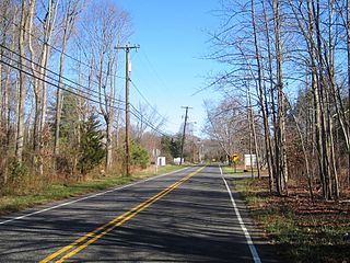
Tracy is an unincorporated community located within Monroe Township in Middlesex County, in the U.S. state of New Jersey. The settlement is located at the site of a former station on the Freehold and Jamesburg Agricultural Railroad in the southeastern edge of the township. Most of the area is forestland with some homes and light commercial businesses located along Federal Road and Tracy Station Road.

Woodbury is a defunct commuter railroad station in the city of Woodbury, Gloucester County, New Jersey. Located at the junction of Station Road and Cooper Street, the station served multiple lines of the Pennsylvania-Reading Seashore Lines and the Pennsylvania Railroad. Trains out of Woodbury serviced lines to Salem, Millville, Penns Grove/Carneys Point and Cape May. Woodbury station consisted of two side platforms and a 72-by-20-foot brick station depot.

Westville is a defunct commuter railroad station in the borough of Westville, Gloucester County, New Jersey. The station served trains on the former Pennsylvania-Reading Seashore Line branch between Millville and Camden. Westville station contained two side platforms located next to U.S. Route 130 and Station Avenue. The next station to the north was Brooklawn, while South Westville served as the next station to the south.


