
Route 27 is a state highway in New Jersey, United States. It runs 38.5 mi (61.96 km) from US 206 in Princeton, Mercer County northeast to an interchange with McCarter Highway and Broad Street in Newark, Essex County. The route passes through many communities along the way, including New Brunswick, Highland Park, Edison, Metuchen, Rahway, and Elizabeth. Route 27 is a two- to four-lane undivided highway for most of its length, passing through a variety of urban and suburban environments. It intersects many roads along the way, including Route 18 in New Brunswick, I-287 in Edison, the Garden State Parkway in Woodbridge, Route 35 in Rahway, Route 28 in Elizabeth, and U.S. Route 22 in Newark. Route 27 crosses the Raritan River on the Albany Street Bridge, which connects Highland Park on the east with New Brunswick on the west.
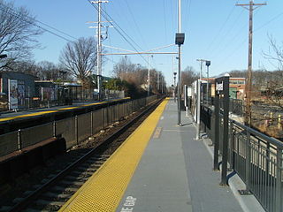
Avenel is an unincorporated community and census-designated place (CDP) located within Woodbridge Township, in Middlesex County, in the U.S. state of New Jersey. Avenel is approximately 25 miles (40 km) southwest of Midtown Manhattan along the North Jersey Coast rail line
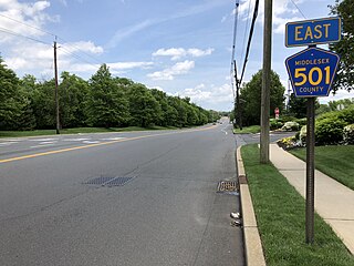
Colonia is an unincorporated community and census-designated place (CDP) in Woodbridge Township, Middlesex County, New Jersey, United States. As of the 2020 United States census, the CDP's population was 18,609.

Iselin is an unincorporated community and census-designated place (CDP) located within Woodbridge Township, in Middlesex County, in the U.S. state of New Jersey. As of the 2010 United States census, Iselin's population was 18,695.

Port Reading is an unincorporated community and census-designated place (CDP) located within Woodbridge Township, in Middlesex County, in the U.S. state of New Jersey. As of the 2010 U.S. census, Port Reading's population was 3,728.

Woodbridge is an unincorporated community and census-designated place (CDP) within Woodbridge Township, in Middlesex County, in the U.S. state of New Jersey. As of the 2010 United States Census, the CDP's population was 19,265. Despite the similarity in the name of the CDP and the township, the two are not coextensive; the CDP occupies 15.7% of the township's 24.51 square miles (63.5 km2).

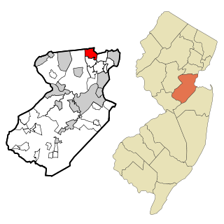
Woodbridge Township is a township in northern Middlesex County, in the U.S. state of New Jersey. The township is a regional hub of transportation and commerce for central New Jersey and a major bedroom suburb of New York City, within the New York metropolitan area. Located within the core of the Raritan Valley region, Woodbridge Township hosts the junction of the New Jersey Turnpike and the Garden State Parkway, the two busiest highways in the state, and also serves as the headquarters for the New Jersey Turnpike Authority, which operates both highways.

The Raritan River is the longest and largest river of the U.S. state of New Jersey. Its watershed drains much of the mountainous area of the central region and a smaller portion of the northern region of the state, emptying into the Raritan Bay near Staten Island on the Atlantic Ocean.
Menlo Park Terrace is an unincorporated community and census-designated place (CDP) and census-designated place located within Woodbridge Township in Middlesex County, in the U.S. state of New Jersey. It is located off U.S. Route 1 in between Menlo Park Mall and Woodbridge Center at Exit 130 of the Garden State Parkway.
Hopelawn is an unincorporated community and census-designated place (CDP) located within Woodbridge Township in Middlesex County, in the U.S. state of New Jersey.

County Route 514 is a county highway in the U.S. state of New Jersey. The highway extends 42.86 miles (68.98 km) from its western terminus U.S. Route 202 (US 202) and Route 31 in East Amwell Township to its eastern terminus Edgar Road in Elizabeth. West of its western terminus, CR 514 continues as Route 179.

Stelton is an unincorporated community located within Edison Township in Middlesex County, in the U.S. state of New Jersey.
Bonhamtown is a section of Edison Township in Middlesex County, New Jersey, United States.
Wilburtha is a section of Ewing Township in Mercer County, in the U.S. state of New Jersey. Located where Wilburtha Road crosses the Delaware and Raritan Canal, it is one of the oldest settlements in Ewing Township and developed due to the construction of the canal in the early 19th century. The community was known as Greensburg before adopting its current name in 1883. The Yardley–Wilburtha Bridge once connected Wilburtha to Yardley, Pennsylvania on the other side of the Delaware River. The Belvidere Delaware Railroad once passed through the village. Today, Wilburtha is primarily a residential neighborhood consisting of detached, single-family homes, the majority of which were built in the 1950s through the early 1980s. There are still many Georgian and Federal-style homes found in the area.
New Dover is an unincorporated community located within Edison Township in Middlesex County, in the U.S. state of New Jersey. The neighborhood began as colonial village that was part of adjacent Woodbridge Township. Along with Bonhamtown, New Durham and Stelton, it is one of the older historical communities of the township.
New Durham was an unincorporated community and now a neighborhood located within Edison in Middlesex County, New Jersey, United States, south of Dismal Swamp.

Piscatawaytown is the oldest neighborhood in Edison in Middlesex County, New Jersey. It was established in the 1660s as the original village in what was then within Piscataway. Piscatawaytown is centered around St. James Church, the Piscatawaytown Burial Ground and the Piscatawaytown Common, near the intersection of Plainfield and Woodbridge Avenues.


