Sewaren, New Jersey

Last updated

Sewaren, New Jersey
Middlesex County New Jersey Incorporated and Unincorporated areas Sewaren Highlighted.svg
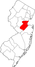
Map of Sewaren highlighted within Middlesex County. Right: Location of Middlesex County in New Jersey.
Location map of Middlesex County, New Jersey.svg
Red pog.svg
Sewaren
Location in Middlesex County
USA New Jersey relief location map.svg
Red pog.svg
Sewaren
Location in New Jersey
Usa edcp relief location map.png
Red pog.svg
Sewaren
Location in the United States
Coordinates: 40°33′03″N74°15′36″W / 40.550726°N 74.259885°W / 40.550726; -74.259885
Country Flag of the United States.svg  United States
State Flag of New Jersey.svg  New Jersey
County Middlesex
Township Woodbridge
Area
[1]
  Total1.66 sq mi (4.30 km2)
  Land1.22 sq mi (3.16 km2)
  Water0.44 sq mi (1.13 km2)  5.02%
Elevation
[2]
16 ft (5 m)
Population
 (2020) [3]
  Total2,885
  Density2,360.88/sq mi (911.70/km2)
Time zone UTC−05:00 (Eastern (EST))
  Summer (DST) UTC−04:00 (Eastern (EDT))
ZIP Code
07077 [4]
Area code(s) 732/848
FIPS code 34-66720 [5] [6] [7]
GNIS feature ID02390280 [5] [8]

Sewaren (pronounced SEE-waren) is an unincorporated community and census-designated place (CDP) within Woodbridge Township, in Middlesex County, in the U.S. state of New Jersey. [9] [10] [11] As of the 2010 United States Census, the CDP's population was 2,756. [12]

Contents

PSE&G's Sewaren Generating Station is a 538 megawatt facility on 152 acres (62  ha ) along the Arthur Kill. The facility had five steam generators and one combustion turbine. Four of the steam units were installed during and just after World War II, from 1942 to 1951. [13] Generator 5, which included a gas/oil-fired boiler and two turbine generators, was dismantled in 2002. [14] Seawaren Unit #7: installed 2018, 538 MW, Combined cycle combustion turbine, with one combustion turbine, one heat recovery steam generator, HRSG, And one steam turbine..

Geography

Baseball in Ferry Street Park, with Shell Oil's tank farm in the background, 1973 BASEBALL GAME IN FERRY STREET PARK, ONE OF THE TWO PLAYGROUNDS IN SEWAREN. THE COMMUNITY INSISTED ON THIS PLAYGROUND... - NARA - 552024.jpg
Baseball in Ferry Street Park, with Shell Oil's tank farm in the background, 1973

According to the United States Census Bureau, the CDP had a total area of 1.004 square miles (2.601 km2), including 0.954 square miles (2.471 km2) of land and 0.050 square miles (0.131 km2) of water (5.02%). [5] [15] Sewaren is located between Perth Amboy and Carteret, on the waterfront across the Arthur Kill waterway from Staten Island, New York, which is accessible via the Outerbridge Crossing just minutes away.

Demographics

Historical population
CensusPop.Note
1990 2,569
2000 2,7808.2%
2010 2,756−0.9%
2020 2,8854.7%
Population sources:
1990-2010 [9] 2000 [16] 2010 [12] [3]

Census 2010

The 2010 United States census counted 2,756 people, 1,005 households, and 722 families in the CDP. The population density was 2,889.2 per square mile (1,115.5/km2). There were 1,043 housing units at an average density of 1,093.4 per square mile (422.2/km2). The racial makeup was 79.54% (2,192) White, 7.98% (220) Black or African American, 0.15% (4) Native American, 6.20% (171) Asian, 0.18% (5) Pacific Islander, 3.74% (103) from other races, and 2.21% (61) from two or more races. Hispanic or Latino of any race were 18.69% (515) of the population. [12]

Of the 1,005 households, 30.0% had children under the age of 18; 53.1% were married couples living together; 14.7% had a female householder with no husband present and 28.2% were non-families. Of all households, 22.2% were made up of individuals and 7.4% had someone living alone who was 65 years of age or older. The average household size was 2.74 and the average family size was 3.26. [12]

21.8% of the population were under the age of 18, 8.6% from 18 to 24, 26.3% from 25 to 44, 30.8% from 45 to 64, and 12.5% who were 65 years of age or older. The median age was 40.5 years. For every 100 females, the population had 92.6 males. For every 100 females ages 18 and older there were 92.4 males. [12]

Census 2000

As of the 2000 United States Census [6] there were 2,780 people, 1,019 households, and 768 families living in the CDP. The population density was 1,129.9/km2 (2,920.9/mi2). There were 1,046 housing units at an average density of 425.1/km2 (1,099.0/mi2). The racial makeup of the CDP was 85.36% White, 5.72% African American, 0.18% Native American, 4.71% Asian, 0.04% Pacific Islander, 2.73% from other races, and 1.26% from two or more races. Hispanic or Latino of any race were 9.57% of the population. [16]

There were 1,019 households, out of which 34.5% had children under the age of 18 living with them, 57.0% were married couples living together, 13.5% had a female householder with no husband present, and 24.6% were non-families. 20.6% of all households were made up of individuals, and 7.0% had someone living alone who was 65 years of age or older. The average household size was 2.73 and the average family size was 3.16. [16]

In the CDP the population was spread out, with 23.8% under the age of 18, 7.5% from 18 to 24, 31.5% from 25 to 44, 24.6% from 45 to 64, and 12.6% who were 65 years of age or older. The median age was 38 years. For every 100 females, there were 92.8 males. For every 100 females age 18 and over, there were 88.1 males. [16]

The median income for a household in the CDP was $62,381, and the median income for a family was $72,685. Males had a median income of $46,683 versus $35,655 for females. The per capita income for the CDP was $24,681. About 2.5% of families and 3.5% of the population were below the poverty line, including 0.6% of those under age 18 and 4.6% of those age 65 or over. [16]

Education

Sewaren has one elementary school, Matthew Jago School #28.

Notable people

People who were born in, residents of, or otherwise closely associated with Sewaren include:

Related Research Articles

<span class="mw-page-title-main">Moorestown-Lenola, New Jersey</span> Populated place in Burlington County, New Jersey, US

Moorestown-Lenola is an unincorporated community and census-designated place (CDP) located within Moorestown Township in Burlington County, in the U.S. state of New Jersey. As of the 2010 United States Census, the CDP's population was 14,217.

<span class="mw-page-title-main">Pemberton Heights, New Jersey</span> Populated place in Burlington County, New Jersey, US

Pemberton Heights is an unincorporated community and census-designated place (CDP) located within Pemberton Township, in Burlington County, in the U.S. state of New Jersey. As of the 2010 United States Census, the CDP's population was 2,423.

<span class="mw-page-title-main">Brownville, New Jersey</span> Populated place in Middlesex County, New Jersey, US

Brownville is an unincorporated community and census-designated place (CDP) located within Old Bridge Township, in Middlesex County, in the U.S. state of New Jersey. As of the 2010 United States Census, the CDP's population was 2,383.

<span class="mw-page-title-main">Madison Park, New Jersey</span> Populated place in Middlesex County, New Jersey, US

Madison Park is an unincorporated community and census-designated place (CDP) located within Old Bridge Township, in Middlesex County, in the U.S. state of New Jersey. As of the 2010 United States Census, the CDP's population was 7,144. The name "Madison Park" reflects Old Bridge's original name of "Madison Township" which it had when it was formed on March 2, 1869 from portions of South Amboy Township, until November 5, 1975, when voters approved a referendum changing the township's name to Old Bridge Township.

<span class="mw-page-title-main">Plainsboro Center, New Jersey</span> Populated place in Middlesex County, New Jersey, US

Plainsboro Center is an unincorporated community and census-designated place (CDP) located within Plainsboro Township, in Middlesex County, in the U.S. state of New Jersey. As of the 2010 United States Census, the CDP's population was 2,712.

<span class="mw-page-title-main">Port Reading, New Jersey</span> Populated place in Middlesex County, New Jersey, US

Port Reading is a census-designated place and unincorporated community located within Woodbridge Township, in Middlesex County, in the U.S. state of New Jersey. As of the 2010 U.S. census, Port Reading's population was 3,728.

<span class="mw-page-title-main">Society Hill, Middlesex County, New Jersey</span> Populated place in Middlesex County, New Jersey, US

Society Hill is an unincorporated community and census-designated place (CDP) located within Piscataway Township, in Middlesex County, in the U.S. state of New Jersey. As of the 2010 United States Census, the CDP's population was 3,829.

<span class="mw-page-title-main">Fairview, Monmouth County, New Jersey</span> Populated place in Monmouth County, New Jersey, US

Fairview is an unincorporated community and census-designated place (CDP) located within Middletown Township, in Monmouth County, in the U.S. state of New Jersey. As of the 2010 United States Census, the CDP's population was 3,806.

<span class="mw-page-title-main">Oakhurst, New Jersey</span> Place in Monmouth County, New Jersey, United States

Oakhurst is an unincorporated community and census-designated place (CDP) within Ocean Township, in Monmouth County, in the U.S. state of New Jersey. As of the 2010 United States Census, the CDP's population was 3,995.

<span class="mw-page-title-main">West Belmar, New Jersey</span> Census-designated place in New Jersey, United States

West Belmar is an unincorporated community and census-designated place (CDP) within Wall Township, in Monmouth County, in the U.S. state of New Jersey. At the 2010 census, the CDP's population was 2,493.

<span class="mw-page-title-main">Strathmore, New Jersey</span> Populated place in Monmouth County, New Jersey, US

Strathmore is an unincorporated community and census-designated place (CDP) within Aberdeen Township, in Monmouth County, in the U.S. state of New Jersey. At the 2010 census, the CDP's population was 7,258.

<span class="mw-page-title-main">Cedar Glen West, New Jersey</span> Populated place in Ocean County, New Jersey, US

Cedar Glen West is an unincorporated community and census-designated place (CDP) located within Manchester Township, in Ocean County, in the U.S. state of New Jersey. As of the 2010 United States Census, the CDP's population was 1,267.

<span class="mw-page-title-main">Leisure Knoll, New Jersey</span> Populated place in Ocean County, New Jersey, US

Leisure Knoll is an unincorporated community and census-designated place (CDP) located within Manchester Township, in Ocean County, in the U.S. state of New Jersey. As of the 2010 United States Census, the CDP's population was 2,490.

<span class="mw-page-title-main">Silver Ridge, New Jersey</span> Populated place in Ocean County, New Jersey, US

Silver Ridge is an unincorporated community and census-designated place (CDP) located within Berkeley Township, in Ocean County, in the U.S. state of New Jersey. As of the 2010 United States Census, the CDP's population was 1,133.

<span class="mw-page-title-main">Waretown, New Jersey</span> Census-designated place in New Jersey, United States

Waretown is an unincorporated community and census-designated place (CDP) located within Ocean Township, in Ocean County, in the U.S. state of New Jersey. As of the 2010 United States Census, the CDP's population was 1,569. Waretown is home to Albert Music Hall.

<span class="mw-page-title-main">Beattystown, New Jersey</span> Populated place in Warren County, New Jersey, US

Beattystown is an unincorporated community and census-designated place (CDP) located within Mansfield Township, in Warren County, in the U.S. state of New Jersey. As of the 2010 United States Census, the CDP's population was 4,554.

<span class="mw-page-title-main">Browns Mills, New Jersey</span> School district in Burlington County, New Jersey, US

Browns Mills is an unincorporated community and census-designated place (CDP) located in Pemberton Township, in Burlington County, in the U.S. state of New Jersey. As of the 2020 United States census the CDP's population was 10,734, a decrease of 489 (-4.4%) from the 11,223 counted at the 2010 United States census, which in turn reflected a decrease of 34 (-0.3%) from the 2000 census. Browns Mills is known as the home of Deborah Heart and Lung Center.

<span class="mw-page-title-main">Ramtown, New Jersey</span> Populated place in Monmouth County, New Jersey, US

Ramtown is a census-designated place and unincorporated community located within Howell Township, in Monmouth County, in the U.S. state of New Jersey. As of the 2010 United States Census, the CDP's population was 6,242.

<span class="mw-page-title-main">Lakewood (CDP), New Jersey</span> Populated place in Ocean County, New Jersey, US

Lakewood is an unincorporated community and census-designated place (CDP) located within Lakewood Township, in Ocean County, in the U.S. state of New Jersey. As of the 2010 United States Census, the CDP's population was 53,805.

<span class="mw-page-title-main">Oxford (CDP), New Jersey</span> Populated place in Warren County, New Jersey, US

Oxford is an unincorporated community and census-designated place (CDP) located within Oxford Township in Warren County, New Jersey, United States, that was created as part of the 2010 United States Census. As of the 2010 Census, the CDP's population was 1,090.

References

  1. "ArcGIS REST Services Directory". United States Census Bureau. Retrieved October 11, 2022.
  2. U.S. Geological Survey Geographic Names Information System: Sewaren Census Designated Place, Geographic Names Information System. Accessed November 30, 2012.
  3. 1 2 "Census Population API". United States Census Bureau. Retrieved October 11, 2022.
  4. Look Up a ZIP Code for Avenel, NJ, United States Postal Service. Accessed November 30, 2012.
  5. 1 2 3 Gazetteer of New Jersey Places, United States Census Bureau. Accessed July 21, 2016.
  6. 1 2 U.S. Census website, United States Census Bureau. Accessed September 4, 2014.
  7. Geographic Codes Lookup for New Jersey, Missouri Census Data Center. Accessed June 9, 2023.
  8. US Board on Geographic Names, United States Geological Survey. Accessed September 4, 2014.
  9. 1 2 New Jersey: 2010 - Population and Housing Unit Counts - 2010 Census of Population and Housing (CPH-2-32), United States Census Bureau, August 2012. Accessed November 30, 2012.
  10. GCT-PH1 - Population, Housing Units, Area, and Density: 2010 - County -- County Subdivision and Place from the 2010 Census Summary File 1 for Middlesex County, New Jersey Archived 2020-02-12 at archive.today , United States Census Bureau. Accessed November 30, 2012.
  11. Locality Search, State of New Jersey. Accessed April 19, 2015.
  12. 1 2 3 4 5 DP-1 - Profile of General Population and Housing Characteristics: 2010 Demographic Profile Data for Sewaren CDP, New Jersey Archived 2020-02-12 at archive.today , United States Census Bureau. Accessed November 30, 2012.
  13. Sewaren Generating Station Archived 2006-09-11 at the Wayback Machine , accessed August 9, 2006
  14. PSE&G Sewaren Unit #5, Brandenburg. Accessed July 22, 2016. "In 2002, Brandenburg was retained by Public Service Enterprise Group (PSE&G) todecontaminate and demolish their Sewaren Unit #5 boiler, located on the Arthur Kill."
  15. US Gazetteer files: 2010, 2000, and 1990, United States Census Bureau. Accessed September 4, 2014.
  16. 1 2 3 4 5 DP-1 - Profile of General Demographic Characteristics: 2000 from the Census 2000 Summary File 1 (SF 1) 100-Percent Data for Sewaren CDP, New Jersey Archived 2020-02-12 at archive.today , United States Census Bureau. Accessed November 30, 2012.
  17. Obituary Record of Yale Graduates 1919-1920, p. 239. Yale University, 1920. Accessed January 29, 2020. "Haven At the time of his death Mr. Hall was returning from his summer home at Atlantic Highlands, N. J., to his winter home at Sewaren, N. J."