Middlesex County, New Jersey

Last updated

Middlesex County
Bishop House, New Brunswick, NJ - campus gate.jpg
The main campus of Rutgers University, New Jersey's flagship of higher education, in New Brunswick, a center for the sciences, arts, and cultural activities, and the county seat of Middlesex County
Middlesx County Flag.png
Middle Seal.JPG
Nickname: 
The Greatest County in the Land [1]
Map of New Jersey highlighting Middlesex County.svg
Location within the U.S. state of New Jersey
New Jersey in United States.svg
New Jersey's location within the U.S.
Coordinates: 40°26′N74°25′W / 40.44°N 74.41°W / 40.44; -74.41
CountryFlag of the United States.svg United States
StateFlag of New Jersey.svg  New Jersey
Founded1683
Named for Middlesex, England
Seat New Brunswick [2]
Largest municipality Edison (population)
Monroe Township (area)
Government
  Commissioner directorRonald G. Rios (D, term ends December 31, 2024)
Area
[3]
  Total322.87 sq mi (836.2 km2)
  Land309.22 sq mi (800.9 km2)
  Water13.65 sq mi (35.4 km2)  4.2%
Population
 (2020) [4] [5]
  Total863,162 (3rd in NJ)
  Estimate 
(2023) [4] [6]
863,623
  Density2,794.2/sq mi (1,078.8/km2)
Time zone UTC−5 (Eastern)
  Summer (DST) UTC−4 (EDT)
Congressional districts 6th, 12th
Website www.co.middlesex.nj.us
Middlesex County, New Jersey
Interactive map of Middlesex County, New Jersey

Middlesex County is located in the north-central part of the U.S. state of New Jersey, extending inland from the Raritan Valley region to the northern portion of the Jersey Shore. As of the 2020 United States census, the county was the state's third-most populous county [7] with a population of 863,162, [4] [5] its highest decennial count ever and an increase of 53,304 (+6.6%) from the 2010 census count of 809,858, [8] which in turn reflected an increase of 59,696 (8.0%) from the 750,162 counted in the 2000 census. [9] [10] Middlesex is part of the New York metropolitan area. Many communities within the county serve as commuter towns to and from New York City and other points north. The county is part of the Central Jersey region of the state. [11] [12]

Contents

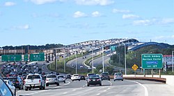
The county is located in the middle of the Northeast megalopolis of the U.S. Its county seat is the city of New Brunswick, [2] a center for the sciences, arts, and cultural activities, and the headquarters of the state's flagship academic institution, Rutgers University. [13] The county's most populous place, with 107,588 residents as of the 2020 census, is Edison Township, [14] while Monroe Township covers the largest area of any municipality, at 42.19 square miles (109.3 km2). [15] Since the 2010 census, the state's center of population is in East Brunswick; the center of population for New Jersey has been in Middlesex County since the 1900 census. [16] Middlesex County hosts an extensive transportation network, including several rail stations along the heavily traveled Northeast Corridor Line of the New Jersey Transit commuter rail system, as well as the intersection of the New Jersey Turnpike and the Garden State Parkway, the state's two busiest motor vehicle roadways, in Woodbridge Township. Middlesex County calls itself The Greatest County in the Land. [1]

The county was primarily settled due to its optimal location along the Raritan River. [17] Middlesex was originally formed as one of four administrative districts within Province of East Jersey in 1675, together with Bergen, Essex and Monmouth districts. Middlesex County was formed within East Jersey on March 7, 1683. [18] The population increased so the county was partitioned on October 31, 1693, into the townships of Piscataway, Perth Amboy, and Woodbridge. Adjacent Somerset County was established on May 14, 1688, created from portions of Middlesex County. [18]

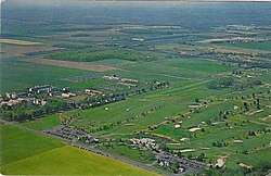
The county's first court met in June 1683 in Piscataway, and held session at alternating sites over the next century in Perth Amboy, Piscataway, and Woodbridge before relocating permanently to New Brunswick in 1778. [19] Despite its status as a residential, commercial, and industrial stronghold and a centrally accessible transportation hub, Middlesex is also home to an extensive public park system with expansive greenways, totaling more than 6,300 acres (2,500 ha). [20] Middlesex County is most demographically notable as the U.S. county with the highest concentration of Asian Indians, at nearly 20% in 2020, spanning the county's boundaries between Little India, Edison/Iselin in the north and Monroe Township at its southern tip.

Geography and climate

Middlesex has a hot-summer humid continental climate (Dfa) which borders a humid subtropical climate (Cfa) on Raritan Bay and Arthur Kill. Average monthly temperatures in downtown New Brunswick range from 31.9 °F (−0.1 °C) in January to 75.6 °F (24.2 °C) in July, while in South Amboy they range from 32.3 °F (0.2 °C) in January to 75.9 °F (24.4 °C) in July. [21] In recent years, average temperatures in the county seat of New Brunswick have ranged from a low of 22 °F (−6 °C) in January to a high of 86 °F (30 °C) in July, although a record low of −13 °F (−25 °C) was recorded in January 1984 and a record high of 103 °F (39 °C) was recorded in July 1999. Average monthly precipitation ranged from 2.98 inches (76 mm) in February to 5.08 inches (129 mm) in July. [22]

According to the U.S. Census Bureau, as of the 2020 Census, the county had a total area of 322.87 square miles (836.2 km2), of which 309.22 square miles (800.9 km2) was land (95.8%) and 13.65 square miles (35.4 km2) was water (4.2%). [3] The county is named after the historic English county of Middlesex. [23]

Bisected by the Raritan River, the county is topographically typical of Central Jersey in that it is largely flat. The majority of the county is located on the inner coastal plain, with the remainder of the county being located on the Eastern Piedmont. The elevation ranges from sea level to 300 feet (91 m) above sea level on a hill scaled by Major Road/ Sand Hill Road near Route 1 in South Brunswick Township. [24]

Another area with higher elevation in the county is the Perth Amboy Moraine, left by the southern limit of the Laurentide Ice Sheet. Only the far northeastern area of the county was glaciated, and the Perth Amboy Moraine stretches from Perth Amboy, through Woodbridge, Edison and Metutchen, and stradles the border of Edison and South Plainfield before exiting the county. The area includes peaks of over 200 feet.[ citation needed ]

New Brunswick, New Jersey
Climate chart (explanation)
J
F
M
A
M
J
J
A
S
O
N
D
 
 
3.6
 
 
39
22
 
 
3
 
 
43
24
 
 
4.2
 
 
51
30
 
 
4.2
 
 
62
40
 
 
4.2
 
 
72
50
 
 
4.4
 
 
81
60
 
 
5.1
 
 
86
65
 
 
4.2
 
 
84
64
 
 
4.5
 
 
77
55
 
 
3.8
 
 
66
43
 
 
3.8
 
 
55
36
 
 
4.1
 
 
44
27
Average max. and min. temperatures in °F
Precipitation totals in inches
Source: The Weather Channel [22]
Metric conversion
J
F
M
A
M
J
J
A
S
O
N
D
 
 
92
 
 
4
−6
 
 
76
 
 
6
−4
 
 
106
 
 
11
−1
 
 
107
 
 
17
4
 
 
106
 
 
22
10
 
 
112
 
 
27
16
 
 
129
 
 
30
18
 
 
105
 
 
29
18
 
 
115
 
 
25
13
 
 
97
 
 
19
6
 
 
97
 
 
13
2
 
 
103
 
 
7
−3
Average max. and min. temperatures in °C
Precipitation totals in mm

Demographics

Indian cuisine is ubiquitously available in Middlesex County. New Punjab Club food spread.jpg
Indian cuisine is ubiquitously available in Middlesex County.
Historical population
CensusPop.Note
1790 15,956
1800 17,89012.1%
1810 20,38113.9%
1820 21,4705.3%
1830 23,1577.9%
1840 21,893*−5.5%
1850 28,63530.8%
1860 34,81221.6%
1870 45,02929.3%
1880 52,28616.1%
1890 61,75418.1%
1900 79,76229.2%
1910 114,42643.5%
1920 162,33441.9%
1930 212,20830.7%
1940 217,0772.3%
1950 264,87222.0%
1960 433,85663.8%
1970 583,81334.6%
1980 595,8932.1%
1990 671,78012.7%
2000 750,16211.7%
2010 809,8588.0%
2020 863,1626.6%
2023 (est.)863,623 [4] [6] 0.1%
Historical sources: 1790-1990 [25]
1970-2010 [26] 2000 [9]
2010 [8] [10] 2020 [4] [5]
* = Lost territory in previous decade. [18]

Indian community

Middlesex County is prominently known for its significant concentration of Indians. The growing Little India is a Desi-focused commercial strip in Middlesex County, the U.S. county with the highest concentration o Indians. [27] [28] [29] The Oak Tree Road strip runs for about one-and-a-half miles through Edison and neighboring Iselin in Woodbridge Township, near the area's sprawling Chinatown and Koreatown, running along New Jersey Route 27. [30] It is the largest and most diverse Desi cultural hub in the United States. [31] [32] Monroe Township in Middlesex County has experienced a particularly rapid growth rate in its Indian American population, with an estimated 5,943 (13.6%) as of 2017, [33] which was 23 times the 256 (0.9%) counted as of the 2000 Census; and Diwali is celebrated by the township as a Hindu holiday. Carteret's Punjabi Sikh community, variously estimated at upwards of 3,000, is the largest concentration of Sikhs in New Jersey. [34] In Middlesex County, election ballots are printed in English, Spanish, Gujarati, Hindi, and Punjabi. [35]

2020 census

As of the Census of 2020, the county had 863,162 people, 285,906 households, and 209,808 families. The population density was 2,794 inhabitants per square mile (1,078.8/km2). There were 315,521 housing units at an average density of 1,021.4 per square mile (394.4/km2). The county's racial makeup was 41.9% White, 9.8% African American, 0.53% Native American, 26.5% Asian, and 9.06% from two or more races. Hispanic or Latino of any race were 22.4% of the population.

There were 285,906 households, of which 34.6% had children under the age of 18 living with them, 56.9% were married couples living together, 24.2% had a female householder with no husband present, 14.2% had a male householder with no wife present and 26.6% were non-families. 14.8% of all households were made up of individuals, and 10.8% had someone living alone who was 65 years of age or older. The average household size was 2.80 and the average family size was 3.32.

About 21.6% of the county's population was under age 18, 9.3% was from age 18 to 24, 40.1% was from age 15 to 44, and 15.5% was age 65 or older. The median age was 39.3 years. The gender makeup of the county was 49.4% male and 50.5% female. For every 100 females, there were 97.8 males.

The county's median household income was $93,418, and the median family income was $107,149. About 8.8% of the population were below the poverty line, including 11.1% of those under age 18 and 8.8% of those age 65 or over. [36]

2010 census

Aerial view of Monroe Township housing tracts at the previously exurban southern tip of Middlesex County in 2010. Since then, significant new housing construction is rendering this area of the county with an increasingly suburban environment. Fcc2.jpg
Aerial view of Monroe Township housing tracts at the previously exurban southern tip of Middlesex County in 2010. Since then, significant new housing construction is rendering this area of the county with an increasingly suburban environment.

The 2010 United States census counted 809,858 people, 281,186 households, and 203,016 families in the county. The population density was 2,621.6 per square mile (1,012.2/km2). There were 294,800 housing units at an average density of 954.3 per square mile (368.5/km2). The racial makeup was 58.60% (474,589) White, 9.69% (78,462) Black or African American, 0.34% (2,777) Native American, 21.40% (173,293) Asian, 0.03% (251) Pacific Islander, 6.99% (56,569) from other races, and 2.95% (23,917) from two or more races. Hispanic or Latino of any race were 18.40% (148,975) of the population. [8]

Of the 281,186 households, 34.4% had children under the age of 18; 55.9% were married couples living together; 11.8% had a female householder with no husband present and 27.8% were non-families. Of all households, 22.5% were made up of individuals and 8.9% had someone living alone who was 65 years of age or older. The average household size was 2.8 and the average family size was 3.29. [8]

22.9% of the population were under the age of 18, 10.2% from 18 to 24, 28.3% from 25 to 44, 26.3% from 45 to 64, and 12.3% who were 65 years of age or older. The median age was 37.2 years. For every 100 females, the population had 96.4 males. For every 100 females ages 18 and older there were 94 males. [8]

Economy

The Bureau of Economic Analysis calculated that the county's gross domestic product was $59.0 billion in 2021, which was ranked second in the state and was a 6.8% increase from the prior year. [37]

Major non-governmental employers in Middlesex County include the following, grouped by ranges of employees: [38] [39]

History

Etymology

Middlesex County is named after the county of the same name in England.

Government

County government

New Brunswick, nicknamed the Hub City of the state of New Jersey, is also Middlesex County's seat of government. The city is experiencing new high-rise construction and gentrification amidst an academic and cultural renaissance. Downtown New Brunswick (2022).jpg
New Brunswick, nicknamed the Hub City of the state of New Jersey, is also Middlesex County's seat of government. The city is experiencing new high-rise construction and gentrification amidst an academic and cultural renaissance.

Middlesex County is governed by a Board of Commissioners, which is comprised of seven members who are elected at-large on a partisan basis to serve three-year terms of office on a staggered basis, with either two or three seats coming up for election each year as part of the November general election. At an annual reorganization meeting held in January, the board selects from among its members a Commissioner Director and deputy director. The Commissioner Director appoints commissioners to serve as chairpersons and members on the various committees which oversee county departments. [40] Middlesex County also elects three "constitutional officers" whose existence is laid out in the New Jersey Constitution. The County Clerk and Surrogate serve five-year terms and the Sheriff serves a three-year term of office. [41] [42] [43] In 2016, freeholders were paid $23,438 and the freeholder director was paid an annual salary of $24,428, though Ronald Rios has accepted a salary of $8,340 as director. [44]

As of 2024, Middlesex County's Commissioners (with terms for director and deputy ending every December 31) are: [40] [45] [46]

CommissionerParty, Residence, Term
Director Ronald G. Rios D, Carteret, 2024 [47]
Deputy Director Shanti NarraD, North Brunswick, 2024 [48]
Claribel A. "Clary" Azcona-BarberD, New Brunswick, 2025 [49]
Charles KennyD, Woodbridge Township, 2025 [50]
Leslie KoppelD, Monroe Township, 2024 [51]
Chanelle Scott McCullumD, Piscataway, 2025 [52]
Charles E. TomaroD, Edison, 2026 [53]

Article VII Section II of the New Jersey State Constitution requires each county in New Jersey have three elected administrative officials known as "constitutional officers." These officers are the County Clerk and County Surrogate (both elected for five-year terms of office) and the County Sheriff (elected for a three-year term). [54] Middlesex county's constitutional officers are: [45] [55]

TitleRepresentative
County Clerk Nancy Pinkin (D, East Brunswick, 2025) [56] [57]
SheriffMildred S. Scott (D, Piscataway, 2025) [58] [59]
SurrogateClaribel Cortes (D, North Brunswick, 2026) [60] [61]

Republicans have not won countywide in Middlesex County since 1991. The Middlesex County Prosecutor has been Yolanda Ciccone since June 2020. [62] Middlesex County constitutes Vicinage 8 of the New Jersey Superior Court; the vicinage is seated at the Middlesex County Courthouse, at 56 Paterson Street in New Brunswick. [63] The Middlesex Vicinage also has facilities for the Family Part at the Middlesex County Family Courthouse at 120 New Street, also in New Brunswick; there are also other facilities in New Brunswick and Perth Amboy for Probation. [63] The Assignment Judge for Vicinage 8 is Alberto Rivas. [63]

Federal representatives

The 6th and 12th congressional districts cover the county. [64] [65] For the 118th United States Congress , New Jersey's 6th congressional district is represented by Frank Pallone ( D , Long Branch ). [66] [67] For the 118th United States Congress , New Jersey's 12th congressional district is represented by Bonnie Watson Coleman ( D , Ewing Township ). [68] [69]

State representatives

The 25 municipalities of Middlesex County are part of seven legislative districts.

DistrictSenator [70] Assembly [70] Municipalities
12th Owen Henry (R) Alex Sauickie (R)

Robert D. Clifton (R)

Helmetta, Old Bridge, and Spotswood. The remainder of this district covers portions of Burlington County, Monmouth County and Ocean County.
14th Linda R. Greenstein (D) Wayne DeAngelo (D)

Tennille McCoy (D)

Cranbury Township, Jamesburg, Monroe Township, and Plainsboro. The remainder of this district covers portions of Mercer County.
16th Andrew Zwicker (D) Mitchelle Drulis (D)

Roy Freiman (D)

South Brunswick. The remainder of this district covers portions of Hunterdon County, Mercer County, and Somerset County.
17th Bob Smith (D) Kevin Egan (D)

Joseph Danielsen (D)

New Brunswick, North Brunswick, and Piscataway. The remainder of this district covers portions of Somerset County.
18th Patrick J. Diegnan (D) Robert Karabinchak (D)

Sterley Stanley (D)

East Brunswick, Edison, Highland Park, Metuchen, Milltown, South Plainfield, and South River.
19th Joe F. Vitale (D) Craig Coughlin (D)

Yvonne Lopez (D)

Carteret, Perth Amboy, Sayreville, South Amboy, and Woodbridge.
21st Jon Bramnick (R) Nancy Munoz (R)

Michele Matsikoudis (R)

Dunellen and Middlesex Borough. The remainder of this district covers portions of Somerset County, Morris County, and Union County.

Law enforcement

Thomas N. Acken served as the sheriff in 1891. Joseph Spicuzzo served in 2014 and was arrested for bribery. [71] Mildred S. Scott is the current county sheriff, she was sworn in on January 1, 2011, as the first female sheriff of Middlesex County and the first African-American sheriff in the state of New Jersey. [72]

Politics

United States presidential election results for Middlesex County, New Jersey [73]
Year Republican Democratic Third party
No.%No.%No.%
2020 143,46738.19%226,25060.22%5,9751.59%
2016 122,95337.42%193,04458.76%12,5603.82%
2012 107,31035.55%190,55563.13%3,9951.32%
2008 123,69538.43%193,81260.21%4,3671.36%
2004 126,49242.76%166,62856.33%2,6850.91%
2000 93,54536.14%154,99859.88%10,3063.98%
1996 82,43331.90%145,20156.20%30,75211.90%
1992 108,70138.10%128,82445.16%47,74616.74%
1988 143,42254.30%117,14944.35%3,5481.34%
1984 160,22159.82%104,90539.17%2,7271.02%
1980 122,35450.73%97,30440.34%21,5488.93%
1976 113,53947.14%122,85951.01%4,4661.85%
1972 149,03361.41%88,39736.42%5,2642.17%
1968 96,51542.79%103,33945.82%25,67611.38%
1964 63,37029.39%151,19670.12%1,0520.49%
1960 83,02541.60%116,09558.18%4360.22%
1956 100,07160.54%64,53839.05%6770.41%
1952 73,57750.32%70,23448.03%2,4131.65%
1948 49,81042.86%61,63453.04%4,7664.10%
1944 45,23242.12%60,50456.35%1,6421.53%
1940 41,70938.26%67,14061.59%1640.15%
1936 32,95934.57%61,67964.69%7020.74%
1932 32,67340.45%45,99756.94%2,1112.61%
1928 38,71452.35%34,90847.20%3280.44%
1924 34,55662.28%16,37329.51%4,5538.21%
1920 29,33469.70%11,61827.60%1,1362.70%
1916 11,85153.51%9,97545.04%3201.44%
1912 4,74325.78%8,18644.49%5,47029.73%
1908 11,27057.51%7,96640.65%3591.83%
1904 10,11757.22%6,99639.57%5693.22%
1900 9,34755.19%7,19142.46%3992.36%
1896 9,30458.73%5,97637.72%5633.55%

As of August 1, 2020, there were a total of 545,795 registered voters in Middlesex County, of which 229,982 (42.1%) were registered as Democrats, 84,258 (15.4%) were registered as Republicans and 224,058 (41.1%) were registered as Unaffiliated. There were 7,497 (1.4%) voters registered to other parties. [74] After being a Republican stronghold in the late 19th and early 20th centuries, Middlesex County leaned Democratic for much of the 20th century beginning with Franklin Roosevelt's victory in the county in 1932. Throughout the twentieth century, in close elections, the county would always vote Democratic, sometimes by solid margins, but the county was willing to flip Republican in the midst of nationwide Republican landslides in the 1970s and 1980s. However, since the 1990s, Middlesex County has become a Democratic stronghold at the national level.[ citation needed ]

In 2008, Barack Obama carried Middlesex County by a much larger 21.8% margin over John McCain, Obama taking 60.2% of the vote to McCain's 38.4%, while Obama won New Jersey overall by 15.5% over McCain. [75] In 2012, Obama won an even more commanding victory in the county, receiving 63.2% of the vote to Republican Mitt Romney's 35.6%, a Democratic victory margin of 27.6%, while carrying New Jersey overall by 17.8%. [76] Like much of the New York City metropolitan area, Middlesex County was one of the few parts of the country to swing even harder in Obama's favor in 2012 compared to 2008, even as he lost ground nationally. Some credit the swing towards Obama to his response towards Superstorm Sandy, which hit the New York City metro area in late October 2012, just a few days before the election. [77] In 2016, Democrat Hillary Clinton carried Middlesex County by a tighter 21.4% margin over Republican Donald Trump, while Clinton won New Jersey overall by 14.1% over Trump. In 2020, Democrat Joe Biden carried Middlesex County by a margin of 22.03%, a slight improvement from 2016, with Biden taking 60.22% of the vote to Donald Trump's 38.19%. [78]

In the 2009 gubernatorial election, Republican Chris Christie received 47% of the vote, defeating incumbent Democrat Corzine, who received around 45%. [79] In the 2013 gubernatorial election, incumbent governor Chris Christie improved on his margin in Middlesex County from 2009, carrying the county by about 18% over Democrat Barbara Buono, with Christie receiving 58% of the vote to Buono's 40%. [80] In the 2017 gubernatorial election, Democrat Phil Murphy won Middlesex County with a wide 17% margin over Republican Kim Guadagno, with Murphy getting 57% of the vote to Guadagno's 40% of the vote. [81] In the 2021 gubernatorial election, Republican Jack Ciattarelli received 43.4% of the vote (90,297 ballots cast) to Democrat Phil Murphy's 55.9% (8116,352 votes).

Gubernatorial elections results
Gubernatorial elections results [82]
Year Republican Democratic
2021 43.4% 90,29755.9%116,352
2017 40.3%' 70,94057.2%100,847
2013 58.3% 101,61940.2% 70,225
2009 47.4%94,50645.0% 89,732
2005 39.2% 75,02156.0%107,076
2001 35.7% 66,14962.7%117,061
1997 39.3% 83,14952.2%110,354
1993 48.4%49.0%
1989 35.1% 67,05462.9% 120,157
1985 65.8% 113,02033.1% 56,815
1981 47.6% 89,61850.9%95,592
1977 40.1% 72,47757.9% 104,687
1973 25.6% 44,84471.9% 125,871

Transportation

1947 road map MiddlesexCounty 1947.jpg
1947 road map

Middlesex County hosts various county roads, state routes, US routes, and interstate highways, as well as toll highways. As of May 2010, the county had a total of 2,584.38 miles (4,159.16 km) of roadways, of which 2,118.08 miles (3,408.72 km) were maintained by the municipality, 292.16 miles (470.19 km) by Middlesex County and 131.48 miles (211.60 km) by the New Jersey Department of Transportation, 41.49 miles (66.77 km) by the New Jersey Turnpike Authority and 1.17 miles (1.88 km) by the Port Authority of New York and New Jersey. [83] [84]

County roads include CR 501, CR 514, CR 516 (only in Old Bridge), CR 520 (only in Old Bridge), CR 522, CR 527, CR 529, CR 531, CR 535, and CR 539 (only in Cranbury).

Garden State Parkway northbound entering Middlesex County 2018-05-20 10 18 51 View north along New Jersey State Route 444 (Garden State Parkway) just south of Exit 120 in Old Bridge Township, Middlesex County, New Jersey.jpg
Garden State Parkway northbound entering Middlesex County

The state routes are: Route 18, Route 26 (only in North Brunswick – entirely concurrent with Livingston Avenue), Route 27, Route 28, Route 32, Route 33 (only in Monroe Township), Route 34 (only in Old Bridge), Route 35, Route 91 (concurrent with Jersey Avenue in North Brunswick and entering New Brunswick), Route 171, Route 172 (only in New Brunswick), Route 184 and Route 440.

U.S. Routes include: Route 1, Route 9, Route 1/9 (only in Woodbridge) and Route 130.

The county also includes some limited access highways and Interstates as well. Middlesex County hosts the southern end of I-287 which turns into Route 440 that connects to the Outerbridge Crossing. The Garden State Parkway passes through the eastern part of the county, which features nine interchanges and the northern start/end of the split-roadways (Express & Local Lanes). The New Jersey Turnpike carries I-95 through the center of the county. The Turnpike has five interchanges in Middlesex County: Exit 12 in Carteret, Exit 11 in Woodbridge, Exit 10 in Edison, Exit 9 in East Brunswick and Exit 8A in Monroe Township. [85]

The New Jersey Department of Transportation is upgrading the Route 18 "avenue" to a freeway between the Route 1 interchange all the way up to the new 18 Extension in Piscataway. [86]

The Turnpike Authority planned to build Route 92, which was to start near the intersection of Ridge Road & Route 1 in South Brunswick to Interchange 8A in Monroe Township. This plan was cancelled on December 1, 2006.

The southern end of the "dual-dual" configuration (inner car lanes and outer truck lanes) used to be one mile south of Interchange 8A at the border of Cranbury and Monroe Township. It was relocated to Exit 6 in Mansfield Township in Burlington County after the Turnpike widening project was completed in early November 2014. [87]

Public transportation

NJ Transit provides Middlesex County with frequent commuter rail service along the North Jersey Coast Line, [88] Northeast Corridor Line, [89] and Raritan Valley Line. [90] The North Jersey Coast Line runs through the eastern part of the county. The Northeast Corridor Line runs through the northern and central part of the county. The Raritan Valley Line serves Dunellen and is accessible to other communities along the county's northern border with Union and Somerset counties.

Intercity rail service is provided by Amtrak. The routes that run through Middlesex County are the Acela Express , Keystone , Northeast Regional , and Vermonter services, although only the Keystone and Northeast Regional have regular stops within Middlesex County, at either New Brunswick or Metropark station. The Acela service also occasionally stops at Metropark.

Bus service in Middlesex County is provided by New Jersey Transit, Coach USA's Suburban Transit, the extensive Rutgers Campus bus network, [91] the MCAT shuttle system, [92] and DASH buses. [93] There are bus routes that serve all townships in the county on weekdays, [94] and studies are being conducted to create the New Brunswick Bus Rapid Transit system.

Education

Higher education

K-12 schools

School districts, all PreK/K-12 (except as indicated), include: [101]

Healthcare

The county offers more than 1,900 inpatient beds among five major hospitals. [102] [103]

Hospitals
HospitalTownTypeBedsHealth Network
JFK Medical Center EdisonAcute498 [104] Hackensack Meridian Health
PSE&G Children's Specialized Hospital New BrunswickPediatric Rehabiltation140 [105] RWJBarnabas Health
Raritan Bay Medical Center (Old Bridge) Old BridgeAcute113 [106] Hackensack Meridian Health
Raritan Bay Medical Center (Perth Amboy) Perth AmboyAcute388 [106] Hackensack Meridian Health
Robert Wood Johnson University Hospital New BrunswickMajor Teaching465 [107] RWJBarnabas Health
The Bristol-Myers Squibb Children's Hospital New BrunswickAcute Pediatric105 [108] RWJBarnabas Health
Rutgers Cancer Institute of New JerseyNew BrunswickResearch, CancerRWJBarnabas Health
St. Peter's University Hospital New BrunswickAcute Teaching478 [109] Saint Peters HCS
Penn Medicine Princeton Medical Center PlainsboroAcute Teaching305 [110] Penn Medicine

Municipalities

Middlesex County, New Jersey
Interactive map of municipalities in Middlesex County.

The 25 municipalities in Middlesex County (with 2010 Census data for population, housing units and area in square miles) are: [111] Other, unincorporated communities in the county are listed next to their parent municipality. Many of these areas are census-designated places that have been defined by the United States Census Bureau for enumeration purposes within a Township and for which 2010 population data is included in parentheses.

Index map of County municipalities (see map key index in table below) Middlesex County, New Jersey Municipalities.png
Index map of County municipalities (see map key index in table below)
MunicipalityMap
key
Municipal
type
PopulationHousing
units
Total
area
Water
area
Land
area
Pop.
density
Housing
density
Unincorporated communities
Carteret 1Borough22,8448,1485.000.584.425,171.11,844.4 Chrome
West Carteret
Cranbury 24Township3,8571,37113.400.1513.25291.2103.5 Cranbury CDP (2,181)
Cranbury Station
Wyckoffs Mills
Dunellen 14Borough7,2272,6831.050.001.056,894.82,559.7
East Brunswick 20Township47,51217,36722.270.5721.702,189.6800.4 Brookview
Dunhams Corner
Fairview Knolls
Farrington Lake Heights
Gillilandtown
Halls Corner
Herberts
Jamesburg Park
Lawrence Brook Manor
Newton Heights
Old Bridge
Orchard Heights
Patricks Corner
Paulas Corner
Tanners Corner
Washington Heights
Westons Mills
Edison 17Township99,96736,30230.640.7029.943,339.01,212.5 Bonhamtown
Clara Barton
Greensand
Haven Homes
Lahiere
Lincoln Park
Lindenau
Martins Landing
Menlo Park
New Dover
New Durham
Nixon
North Edison
Oak Tree
Phoenix
Potters
Pumptown
Raritan Manor
Sand Hills
Stelton
Valentine
Washington Park
Helmetta 7Borough2,1789200.910.060.852,562.91,082.6
Highland Park 11Borough13,9826,2031.820.011.817,728.13,428.5
Jamesburg 8Borough5,9152,2670.880.010.886,741.82,583.9
Metuchen 12Borough13,5745,4402.770.002.764,910.41,967.9 Jefferson Park
Robinvale
Middlesex 15Borough13,6355,1483.540.023.523,876.21,463.5
Milltown 9Borough6,8932,6981.600.041.554,443.01,739.0
Monroe Township 23Township39,13218,00242.230.2641.97932.3428.9 Applegarth
Clearbrook
Clearbrook Park CDP (2,667)
Concordia CDP (3,092)
Gravel Hill
Half Acre
Hoffman
Jamesburg Gardens
Matchaponix
Middlesex Downs
Mounts Mills
Old Church
Outcalt
Prospect Plains
Rossmoor CDP (2,666)
Shore Road Estates
Spotswood Manor
Texas
Tracy
Union Valley
Whittingham CDP (2,476)
Wyckoffs Mills
New Brunswick 10City55,18115,0535.790.565.2310,556.42,879.7 Edgebrook
Feaster Park
Lincoln Park
Raritan Gardens
Westons Mills
North Brunswick 21Township40,74215,04512.270.2712.003,396.21,254.1 Adams
Berdines Corner
Black Horse
Franklin Park
Georges Road
Maple Meade
Patricks Corner
Red Lion
Old Bridge 19Township65,37524,63840.782.7238.061,717.7647.3 Browntown
Brownville CDP (2,383)
Brunswick Gardens
Cheesequake
Cottrell Corners
Laurence Harbor CDP (6,536)
Madison Park CDP (7,144)
Matchaponix
Moerls Corner
Morristown
Old Bridge CDP (23,753)
Parlin
Redshaw Corner
Runyon
Sayerwood South
South Old Bridge
Texas
Perth Amboy 2City50,81416,5565.961.264.7010,806.83,521.0 Barber
Harbor Terrace
John J Delaney Homes
Maurer
William Dunlap Homes
Piscataway 16Township56,04417,77719.030.1918.832,975.5943.8 Fieldville
New Market
Newtown
North Stelton
Possumtown
Randolphville
Raritan Landing
Riverview Manor
Society Hill CDP (3,829)
Plainsboro 25Township22,99910,08912.210.4211.781,951.6856.1

Plainsboro Center CDP (2,712)
Princeton Meadows CDP (13,834)
Schalks
Scotts Corner

Sayreville 4Borough42,70416,39318.702.8615.842,695.71,034.8 Crossmans
Ernston
Gillespie
Laurel Park
MacArthur Manor
Melrose
Morgan
Morgan Heights
Parlin
Phoenix
Runyon
Sayre Woods
Sayreville Junction
Sayreville Station
South Amboy 3City8,6313,5762.691.151.555,577.12,310.7 Mechanicsville
Thomas J Dohany Homes
South Brunswick 22Township43,41715,70841.040.3940.651,068.1386.4 Cottageville
Dayton CDP (7,063)
Deans
Franklin Park
Fresh Ponds
Heathcote CDP (5,821)
Kendall Park CDP (9,339)
Kingston CDP (1,222)
Little Rocky Hill
Monmouth Junction CDP (2,887)
Sand Hills
South Brunswick Terrace
South Plainfield 13Borough23,3858,0938.360.038.332,808.5971.9 Avon Park
Samptown
South River 5Borough16,0085,9572.920.152.775,781.42,151.4 Newton Heights
Spotswood 6Borough8,2573,2422.470.202.273,642.21,430.1 East Spotswood
Outcalt
Woodbridge 18Township99,58536,12424.511.2923.214,290.01,556.2 Avenel CDP (17,011)
Boynton Beach
Colonia CDP (17,795)
Edgars
Fords CDP (15,187)
Hazelton
Hopelawn
Iselin CDP (18,695)
Keasbey
Lynn Woodoaks
Menlo Park Terrace
Port Reading CDP (3,728)
Sand Hills
Sewaren CDP (2,756)
Shore View
Woodbridge CDP (19,265)
Woodbridge Oaks

Parks and recreation

Thompson Park in Monroe Township Landscape at Thompson Park in Monroe Township.JPG
Thompson Park in Monroe Township

See also

Related Research Articles

<span class="mw-page-title-main">Cranbury, New Jersey</span> Township in Middlesex County, New Jersey, US

Cranbury is a township in southern Middlesex County, within the U.S. state of New Jersey. As of the 2020 United States census, the township's population was 3,842, a decrease of 15 (−0.4%) from the 2010 census count of 3,857, which in turn reflected an increase of 630 (+19.5%) from the 3,227 counted in the 2000 census.

<span class="mw-page-title-main">East Brunswick, New Jersey</span> Township in Middlesex County, New Jersey, US

East Brunswick is a township in Middlesex County, in the U.S. state of New Jersey. The suburban bedroom community is part of the New York City metropolitan area and is located on the southern shore of the Raritan River, directly adjacent to the city of New Brunswick and located roughly 29 miles (47 km) away from New York City. As of the 2020 United States census, the township's population was 49,715, its highest decennial count ever and an increase of 2,203 (+4.6%) from the 2010 census count of 47,512, which in turn reflected an increase of 756 (+1.6%) from the 46,756 counted in the 2000 census.

<span class="mw-page-title-main">Edison, New Jersey</span> Township in Middlesex County, New Jersey, US

Edison is a township located in Middlesex County, in the U.S. state of New Jersey. Situated in Central New Jersey within the core of the state's Raritan Valley region, Edison is a commercial hub and is a bedroom community of New York City within the New York metropolitan area.

<span class="mw-page-title-main">Helmetta, New Jersey</span> Borough in Middlesex County, New Jersey, US

Helmetta is a borough in Middlesex County, in the U.S. state of New Jersey. The borough is located in the heart of the Raritan Valley region, with Manalapan Brook flowing through the center of the community. As of the 2020 United States census, the borough's population was 2,455, its highest decennial count ever and an increase of 277 (+12.7%) from the 2010 census count of 2,178, which in turn reflected an increase of 353 (+19.3%) from the 1,825 counted in the 2000 census. The community was established around a snuff mill opened in the 1820s that was acquired by George Washington Helme in the 1880s.

<span class="mw-page-title-main">Highland Park, New Jersey</span> Borough in Middlesex County, New Jersey, US

Highland Park is a borough in Middlesex County, in the U.S. state of New Jersey, in the New York City metropolitan area. The borough is located on the northern banks of the Raritan River, in the Raritan Valley region. As of the 2020 United States census, the borough's population was 15,072, an increase of 1,090 (+7.8%) from the 2010 census count of 13,982, which in turn reflected a decline of 17 (−0.1%) from the 13,999 counted in the 2000 census.

<span class="mw-page-title-main">Jamesburg, New Jersey</span> Borough in Middlesex County, New Jersey, US

Jamesburg is a borough in Middlesex County, in the U.S. state of New Jersey. As of the 2020 United States census, the borough's population was 5,783, a decrease of 132 (−2.2%) from the 2010 census count of 5,915, which in turn reflected a decline of 110 (−1.8%) from the 6,025 counted in the 2000 census.

<span class="mw-page-title-main">Metuchen, New Jersey</span> Borough in Middlesex County, New Jersey, US

Metuchen is a suburban borough in Middlesex County in the U.S. state of New Jersey. The borough is a commuter town of New York City, located in the heart of the Raritan Valley region within the New York Metropolitan area. The borough, along with Edison, is a regional commercial hub for Central New Jersey. The borough is 6 miles (9.7 km) northeast of New Brunswick, 17 miles (27 km) southwest of Newark, 20 miles (32 km) southwest of Jersey City, and 22 miles (35 km) southwest of Manhattan. As of the 2020 United States census, the borough's population was 15,049, an increase of 1,475 (+10.9%) from the 2010 census count of 13,574, which in turn reflected an increase of 734 (+5.7%) from the 12,840 counted in the 2000 census.

<span class="mw-page-title-main">Milltown, New Jersey</span> Borough in Middlesex County, New Jersey, US

Milltown is a borough in Middlesex County, in the U.S. state of New Jersey. The borough is nestled within the heart of the Raritan Valley region, with Lawrence Brook flowing through the center of the community. As of the 2020 United States census, the borough's population was 7,037, an increase of 144 (+2.1%) from the 2010 census count of 6,893, which in turn reflected a decrease of 107 (−1.5%) from the 7,000 counted in the 2000 census.

<span class="mw-page-title-main">Monroe Township, Middlesex County, New Jersey</span> Township in Middlesex County, New Jersey, US

Monroe Township is a township located in southern Middlesex County, in the U.S. state of New Jersey. The township is centrally located within the Raritan Valley region and is an outer-ring suburb of New York City within the New York metropolitan area. As of the 2020 United States census, the township's population was 48,594, its highest decennial count ever and an increase of 9,462 (+24.2%) from the 39,132 recorded at the 2010 census, which in turn reflected an increase of 11,133 (+39.8%) from the 27,999 counted in the 2000 census. Monroe Township also comprises the largest land area of any municipality in Middlesex County, at approximately 42 square miles (110 km2).

<span class="mw-page-title-main">Old Bridge Township, New Jersey</span> Township in Middlesex County, New Jersey, US

Old Bridge Township is a township in Middlesex County, in the U.S. state of New Jersey, located in the Raritan Valley region and within the New York metropolitan area. As of the 2020 United States census, the township was the state's 21st-most-populous municipality, with a population of 66,876, an increase of 1,501 (+2.3%) from the 2010 census count of 65,375, which in turn reflected an increase of 4,919 (+8.1%) from the 60,456 counted in the 2000 census. As of the 2010 Census, the township was ranked 18th in the state by population, after being the state's 21st most-populous municipality in 2000. Old Bridge is a bedroom suburb of New York City located across the Raritan Bay from Staten Island, and it is about 25 miles (40 km) from Manhattan, and about 30 miles (48 km) south of Newark.

<span class="mw-page-title-main">Perth Amboy, New Jersey</span> City in Middlesex County, New Jersey, U.S.

Perth Amboy is a city in northeastern Middlesex County, in the U.S. state of New Jersey, within the New York metropolitan area. As of the 2020 United States census, the city's population was 55,436. Perth Amboy is known as the "City by the Bay", referring to its location adjoining Raritan Bay.

<span class="mw-page-title-main">Piscataway, New Jersey</span> Township in Middlesex County, New Jersey, US

Piscataway is a township in Middlesex County, in the U.S. state of New Jersey. It is a suburb of the New York metropolitan area, in the Raritan Valley. As of the 2020 United States census, the township's population was 60,804, an increase of 4,760 (+8.5%) from the 2010 census count of 56,044, which in turn reflected an increase of 5,562 (+11.0%) from 50,482 at the 2000 census.

<span class="mw-page-title-main">Sayreville, New Jersey</span> Borough in Middlesex County, New Jersey, US

Sayreville is a borough in Middlesex County, in the U.S. state of New Jersey. Sayreville is within the heart of the Raritan Valley region, located on the south banks of the Raritan River, and also located on the Raritan Bay. As of the 2020 United States census, the borough's population was 45,345, an increase of 2,641 (+6.2%) from the 2010 census count of 42,704, which in turn reflected an increase of 2,327 (+5.8%) from the 40,377 counted in the 2000 census.

<span class="mw-page-title-main">South Amboy, New Jersey</span> City in Middlesex County, New Jersey, US

South Amboy is a suburban city in Middlesex County, in the U.S. state of New Jersey, located on Raritan Bay. As of the 2020 United States census, the city's population was 9,411, an increase of 780 (+9.0%) from the 2010 census count of 8,631, which in turn reflected an increase of 718 (+9.1%) from the 7,913 counted in the 2000 census.

<span class="mw-page-title-main">South Brunswick, New Jersey</span> Township in Middlesex County, New Jersey, US

South Brunswick is a township in Middlesex County, in the U.S. state of New Jersey. The township is centrally located within the Raritan Valley region and is an outer-ring suburb of New York City in the New York metropolitan area. As of the 2020 United States census, the township's population was 47,043, its highest ever decennial census count and an increase of 3,626 (+8.4%) from the 2010 census count of 43,417, which in turn reflected an increase of 5,683 (+15.1%) from the 37,734 counted in the 2000 census.

<span class="mw-page-title-main">Woodbridge Township, New Jersey</span> Township in Middlesex County, New Jersey, United States

Woodbridge Township is a township in northern Middlesex County, in the U.S. state of New Jersey. The township is a regional hub of transportation and commerce for central New Jersey and a major bedroom suburb of New York City, within the New York metropolitan area. Located within the core of the Raritan Valley region, Woodbridge Township hosts the junction of the New Jersey Turnpike and the Garden State Parkway, the two busiest highways in the state, and also serves as the headquarters for the New Jersey Turnpike Authority, which operates both highways.

<span class="mw-page-title-main">North Brunswick, New Jersey</span> Township in Middlesex County, New Jersey, US

North Brunswick is a township in Middlesex County, in the U.S. state of New Jersey. It is centrally located in the Raritan Valley region within the New York metropolitan area. As of the 2020 United States census, the township's population was 43,905, an increase of 3,163 (+7.8%) from the 2010 census count of 40,742, which in turn reflected an increase of 3,455 (+12.3%) from the 36,287 counted in the 2000 census.

<span class="mw-page-title-main">Central Jersey</span> Place in New Jersey, United States

Central Jersey, or Central New Jersey, is the middle region of the U.S. state of New Jersey. The designation Central Jersey is a distinct administrative toponym. While New Jersey is often divided into North Jersey and South Jersey, many residents recognize Central Jersey as a distinct third entity. As of the 2020 census, Central Jersey has a population of 3,580,999.

<span class="mw-page-title-main">Spotswood, New Jersey</span> Borough in Middlesex County, New Jersey, US

Spotswood is a borough in Middlesex County, in the U.S. state of New Jersey. The community is nestled within the heart of the Raritan Valley region, with the Manalapan Brook and Matchaponix Brook forming the confluence of the South River inside the borough. As of the 2020 United States census, the borough's population was 8,163, a decrease of 94 (−1.1%) from the 2010 census count of 8,257, which in turn reflected an increase of 377 (+4.8%) from the 7,880 counted in the 2000 census.

References

  1. 1 2 Middlesex County The Greatest County in the Land Archived 2016-10-28 at the Wayback Machine , County of Middlesex, New Jersey. Accessed October 27, 2016.
  2. 1 2 New Jersey County Map, Archived March 13, 2017, at the Wayback Machine New Jersey Department of State. Accessed January 20, 2024.
  3. 1 2 2020 Census Gazetteer File for Counties in New Jersey, United States Census Bureau. Accessed April 1, 2023.
  4. 1 2 3 4 5 QuickFacts Middlesex County, New Jersey, United States Census Bureau. Accessed May 6, 2023.
  5. 1 2 3 Total Population: Census 2010 - Census 2020 New Jersey Municipalities, New Jersey Department of Labor and Workforce Development. Accessed December 1, 2022.
  6. 1 2 Annual Estimates of the Resident Population for Counties in New Jersey: April 1, 2020 to July 1, 2023, United States Census Bureau, released March 2024. Accessed March 15, 2024.
  7. Annual and Cumulative Estimates of Resident Population Change for Counties in New Jersey and County Rankings: April 1, 2020 to July 1, 2021, United States Census Bureau. Accessed June 1, 2022.
  8. 1 2 3 4 5 DP1 - Profile of General Population and Housing Characteristics: 2010 Demographic Profile Data for Middlesex County, New Jersey, United States Census Bureau. Accessed January 22, 2013.
  9. 1 2 DP-1 - Profile of General Demographic Characteristics: 2000; Census 2000 Summary File 1 (SF 1) 100-Percent Data for Middlesex County, New Jersey, United States Census Bureau. Accessed January 22, 2013.
  10. 1 2 Wu, Sen-Yuan. NJ Labor Market Views: Population Keeps Growing in the Most Densely Populated State, March 15, 2011. Accessed December 26, 2022.
  11. Governor Murphy Settles Central Jersey Debate, Governor of New Jersey Phil Murphy, press release dated August 4, 2023. "Governor Phil Murphy today signed S3206 to promote Central Jersey tourism.... The 'Central Jersey' region will be comprised of, at minimum, the counties of Hunterdon, Mercer, Middlesex, and Somerset."
  12. Willis, David P. "'This is how wars start': Does Central Jersey include both Ocean and Union counties?", Asbury Park Press , February 20, 2023. Accessed March 31, 2024. "North Jersey is defined as Sussex, Warren, Morris, Passaic, Bergen, Essex and Hudson counties; South Jersey would be Burlington, Camden, Gloucester, Atlantic, Salem, Cumberland and Cape May counties. But for Central, things get a little tricky. It would include Hunterdon, Somerset, Union, Middlesex, Mercer, Monmouth, and Ocean counties."
  13. New Brunswick, NJ: Yesterday, Today, Tomorrow, Rutgers University Libraries. Accessed January 20, 2024. "New Brunswick is the county seat of Middlesex County, New Jersey, and is also the home of Rutgers University–New Brunswick."
  14. QuickFacts Edison township, Middlesex County, New Jersey Accessed January 4, 2024.
  15. 2019 Census Gazetteer Files: New Jersey Places, United States Census Bureau. Accessed January 4, 2023.
  16. Sweilem, Amira. "N.J.’s population center still tilts north. This town considers it a badge of honor.", NJ Advance Media for NJ.com, November 27, 2022. Accessed January 20, 2024. "Answer time: East Brunswick has held the statistical center of population title since the 2010 Census.... The U.S. Census runs the calculation every 10 years and it has wobbled around Middlesex County since 1880, straying just once since that time into Somerset County (Warren Township) in 1890. East Brunswick just barely held onto the population center in the 2020 Census calculations.... The new spot is on Hawk Court just off Milltown Road between the NJ Turnpike and Ryders Lane."
  17. History Archived 2016-10-17 at the Wayback Machine , Middlesex County, NJ. Accessed March 24, 2018.
  18. 1 2 3 Snyder, John P. The Story of New Jersey's Civil Boundaries: 1606–1968, Bureau of Geology and Topography; Trenton, New Jersey; 1969. p. 125. Accessed June 6, 2012.
  19. History of the Grand Jury Archived 2013-10-04 at the Wayback Machine , Middlesex County, New Jersey. Accessed October 1, 2013. "By June 19, 1683, the first County Court was held at Piscataway. It sat alternately in Piscataway and Woodbridge until 1688 when Perth Amboy was added as one of the three alternate sites. In 1778, New Brunswick became the most prime town in the county and at that time the Middlesex County Courts were transferred there."
  20. "At a Glance - Middlesex County, the Greatest County in the Land!". Archived from the original on November 18, 2016. Retrieved December 3, 2016.
  21. Time Series Values for Individual Locations, Oregon State University. Accessed June 24, 2023.
  22. 1 2 Monthly Averages for New Brunswick, New Jersey Archived 2013-07-08 at the Wayback Machine , The Weather Channel. Accessed October 13, 2012.
  23. Kane, Joseph Nathan; and Aiken, Charles Curry. The American Counties: Origins of County Names, Dates of Creation, and Population Data, 1950-2000, p. 202. Scarecrow Press, 2005. ISBN   0810850362. Accessed January 22, 2013.
  24. New Jersey County High Points Archived 2015-05-18 at the Wayback Machine , Peakbagger.com. Accessed October 5, 2013.
  25. Forstall, Richard L. Population of states and counties of the United States: 1790 to 1990 from the Twenty-one Decennial Censuses, pp. 108-109. United States Census Bureau, March 1996. ISBN   9780934213486. Accessed October 3, 2013.
  26. New Jersey: 2010 - Population and Housing Unit Counts; 2010 Census of Population and Housing Archived 2013-07-23 at the Wayback Machine , p. 6, CPH-2-32. United States Census Bureau, August 2012. Accessed August 29, 2016.
  27. Genovese, Peter (November 16, 2012). "Big business in Little India: Commerce flourishes in vibrant ethnic neighborhood". nj.com.
  28. "Eat Street: Oak Tree Road, Iselin, N.J." SAVEUR. March 31, 2011.
  29. Joseph Berger (April 27, 2008). "A Place Where Indians, Now New Jerseyans, Thrive". The New York Times. Retrieved August 22, 2016.
  30. Shaftel, David (March 9, 2017). "Indo-Chinese Food Is Hard to Find, Except in New Jersey". The New York Times.
  31. King, Kate (September 25, 2017). "'Little India' Thrives in Central New Jersey". Wall Street Journal via www.wsj.com.
  32. Burke, Monte. "How Indo-Americans Created The Ultimate Neighborhood Bank". Forbes.
  33. DP05: ACS DEMOGRAPHIC AND HOUSING ESTIMATES from the 2013-2017 American Community Survey 5-Year Estimates for Monroe township, Middlesex County, New Jersey Archived 2020-02-13 at archive.today , United States Census Bureau. Accessed February 11, 2019.
  34. Kevin Coyne (June 15, 2008). "Turbans Make Targets, Some Sikhs Find". The New York Times. Retrieved April 28, 2019.
  35. "State of New Jersey Department of State". State of New Jersey. Retrieved May 29, 2017.
  36. "Middlesex County | Census Data". United States Census Bureau. 2020. Retrieved January 19, 2022.
  37. Gross Domestic Product by County, 2021, Bureau of Economic Analysis, released December 8, 2022. Accessed July 17, 2023.
  38. MAJOR EMPLOYERS LOCATED IN MIDDLESEX COUNTY, NEW JERSEY Archived 2010-12-27 at the Wayback Machine , Middlesex County Department of Economic Development, March 2006. Accessed July 5, 2007.
  39. "Major Employers in Middlesex County - Edison Chamber of Commerce, NJ". www.edisonchamber.com. Retrieved May 10, 2020.
  40. 1 2 Board of County Commissioners, Middlesex County, New Jersey. Accessed June 19, 2022. "County Commissioner is a term used by all 21 of New Jersey's counties to describe county legislators. The residents of Middlesex County's 25 municipalities elect seven persons at-large to staggered three-year terms in the November general election to serve as members of the Board of County Commissioners. Every January, the Board selects one County Commissioner to serve as Director and another to serve as Deputy Director and all County Commissioners serve as chairpersons and members of various committees to oversee County departments."
  41. History of the County Clerk's Office Archived 2013-08-26 at the Wayback Machine , Constitutional Officers Association of New Jersey. Accessed October 21, 2017.
  42. History of the County Sheriff's Office Archived 2013-08-26 at the Wayback Machine , Constitutional Officers Association of New Jersey. Accessed October 21, 2017.
  43. History of the Surrogate's Court Archived 2013-08-26 at the Wayback Machine , Constitutional Officers Association of New Jersey. Accessed October 21, 2017.
  44. Gallo Jr., Bill. "Which N.J. county freeholders are paid the most?" Archived 2017-10-26 at the Wayback Machine , NJ.com, March 11, 2016. Accessed October 25, 2017. "Freeholder director: $24,438 (Current Freeholder Director Don Rios has opted to take a salary of only $8,340.); Other freeholders: $23,438"
  45. 1 2 Elected Officials, Middlesex County, New Jersey. Accessed June 19, 2022.
  46. 2022 County Data Sheet, Middlesex County, New Jersey. Accessed June 19, 2022.
  47. Ronald G. Rios, Middlesex County, New Jersey. Accessed June 19, 2022.
  48. Shanti Narra, Middlesex County, New Jersey. Accessed June 19, 2022.
  49. Claribel A. Azcona-Barber, Middlesex County, New Jersey. Accessed June 19, 2022.
  50. Charles Kenny, Middlesex County, New Jersey. Accessed June 19, 2022.
  51. Leslie Koppel, Middlesex County, New Jersey. Accessed June 19, 2022.
  52. Chanelle Scott McCullum, Middlesex County, New Jersey. Accessed June 19, 2022.
  53. Charles E. Tomaro, Middlesex County, New Jersey. Accessed June 19, 2022.
  54. New Jersey State Constitution (1947), Article VII, Section II, Paragraph 2, New Jersey Department of State. Accessed June 19, 2022.
  55. Constitutional Officers, Middlesex County, New Jersey. Accessed June 19, 2022.
  56. Nancy J. Pinkin, Middlesex County, New Jersey. Accessed June 19, 2022.
  57. Clerks, Constitutional Officers Association of New Jersey. Accessed June 19, 2022.
  58. Sheriff Mildred S. Scott, Middlesex County, New Jersey. Accessed June 19, 2022.
  59. Sheriffs, Constitutional Officers Association of New Jersey. Accessed June 19, 2022.
  60. Claribel Cortes, Middlesex County, New Jersey. Accessed June 19, 2022.
  61. Surrogates, Constitutional Officers Association of New Jersey. Accessed June 19, 2022.
  62. "Staff Directory List | Middlesex County NJ". www.middlesexcountynj.gov. Retrieved January 2, 2024.
  63. 1 2 3 Middlesex Vicinage Archived 2017-10-10 at the Wayback Machine , New Jersey Courts. Accessed October 21, 2017.
  64. 2012 Congressional Districts by County Archived 2012-05-26 at the Wayback Machine , New Jersey Department of State Division of Elections. Accessed October 6, 2013.
  65. Plan Components Report Archived 2013-12-04 at the Wayback Machine , New Jersey Department of State Division of Elections, December 23, 2011. Accessed October 6, 2013.
  66. Directory of Representatives: New Jersey, United States House of Representatives. Accessed January 3, 2019.
  67. Biography, Congressman Frank Pallone Jr. Accessed January 3, 2019. "Frank Pallone, Jr., was born in Long Branch, New Jersey, where he grew up and still resides."
  68. Directory of Representatives: New Jersey, United States House of Representatives. Accessed January 3, 2019.
  69. Biography, Congresswoman Bonnie Watson Coleman. Accessed January 3, 2019. "Watson Coleman and her husband William reside in Ewing Township and are blessed to have three sons; William, Troy, and Jared and three grandchildren; William, Kamryn and Ashanee."
  70. 1 2 Legislative Roster, New Jersey Legislature. Accessed January 20, 2024.
  71. "How A Crooked Former Sheriff Persuaded The State To Let Him Out Of Prison". NJ.com . February 1, 2016. Archived from the original on February 4, 2018. Retrieved February 3, 2018.
  72. Strunsky, Steve. "The duties, pay and for most pensions of N.J.'s 21 sheriffs", NJ Advance Media for NJ.com, January 29, 2018, updated May 15, 2019. Accessed February 9, 2022. "Middlesex County Sheriff Mildred Scott, a Democrat, was elected in 2010, making her the first African-American woman to be elected sheriff in New Jersey, and the first woman sheriff in Middlesex."
  73. "Dave Leip's Atlas of U.S. Presidential Elections". Archived from the original on March 23, 2018. Retrieved March 18, 2018.
  74. "NJ Voter Registration by County" (PDF). NJ DOS - NJ Division of Elections. Archived (PDF) from the original on September 20, 2020.
  75. U.S. Election Atlas Archived 2010-07-22 at the Wayback Machine
  76. "New Jersey Division of Elections Official General Election Results" (PDF). Archived from the original (PDF) on May 9, 2013. Retrieved February 4, 2014.
  77. Cohen, Micah (November 19, 2012). "The 2012 Election, in a Relative Sense". FiveThirtyEight.
  78. "Election Results 2020". Middlesex County. Archived from the original on November 20, 2020. Retrieved November 20, 2020.
  79. "Historic Election Results". Middlesex County. Retrieved November 20, 2020.
  80. "Historic Election Results". Middlesex County. Retrieved November 20, 2020.
  81. "Historic Election Results". Middlesex County. Retrieved November 20, 2020.
  82. "NJ DOS - Division of Elections - Election Results Archive".
  83. Middlesex County Mileage by Municipality and Jurisdiction, New Jersey Department of Transportation, March 2019. Accessed December 25, 2020.
  84. Route 440 Straight Line Diagram, New Jersey Department of Transportation, May 2016. Accessed December 25, 2020
  85. Travel Map Archived 2017-10-25 at the Wayback Machine , New Jersey Turnpike Authority. Accessed October 24, 2017.
  86. NJDOT breaks ground on project to completeRoute 18 extension to Interstate 287 in Piscataway; Project is designed to improve mobility and promote economic development in central New Jersey Archived 2012-04-02 at the Wayback Machine , New Jersey Department of Transportation press release, dated February 15, 2012. Accessed October 6, 2013.
  87. Gov. Christie, NJDOT Commissioner FoxPraise $2.3 Billion NJ Turnpike Infrastructure Investment Project Archived 2014-11-03 at the Wayback Machine , New Jersey Turnpike Authority. Accessed November 3, 2014.
  88. North Jersey Coast Line Archived 2013-07-23 at the Wayback Machine , NJ Transit. Accessed August 24, 2014.
  89. Northeast Corridor Line Archived 2014-07-12 at the Wayback Machine , NJ Transit. Accessed August 24, 2014.
  90. Raritan Valley Line Archived 2013-10-15 at the Wayback Machine , NJ Transit. Accessed August 24, 2014.
  91. Campus Buses/Shuttle Service, Rutgers University. Accessed November 6, 2019.
  92. Middlesex County Area Transit (MCAT), Middlesex County. Accessed November 6, 2019.
  93. DASH Bus Routes Archived 2013-06-15 at the Wayback Machine , Ridewise. Accessed October 9, 2016.
  94. Middlesex County Transit Guide, Middlesex County. Accessed April 1, 2023.
  95. Locations Archived 2015-09-05 at the Wayback Machine , Middlesex County College. Accessed September 17, 2015.
  96. One Community, Five Campuses Archived 2015-09-06 at the Wayback Machine , Rutgers University–New Brunswick. Accessed September 17, 2015.
  97. Locations and Directions Archived 2015-09-07 at the Wayback Machine , Rutgers Biomedical and Health Sciences. Accessed September 17, 2015.
  98. Forrestal Campus Archived 2008-07-05 at the Wayback Machine , Princeton University. Accessed July 23, 2008.
  99. North Brunswick Campus Archived 2015-09-05 at the Wayback Machine , DeVry University. Accessed September 17, 2015.
  100. "Our Locations". March 23, 2015.
  101. "2020 CENSUS - SCHOOL DISTRICT REFERENCE MAP: Middlesex County, NJ" (PDF). U.nited States Census Bureau. Archived (PDF) from the original on August 7, 2022. Retrieved August 6, 2022. - Text list
  102. Health Care Archived 2015-09-18 at the Wayback Machine , Middlesex County, New Jersey. Accessed September 17, 2015.
  103. Healthcare in Middlesex County, New Jersey Archived 2017-10-22 at the Wayback Machine , Middlesex County, NJ Convention & Visitors Bureau. Accessed September 17, 2015.
  104. About JFK Medical Center Archived September 6, 2015, at the Wayback Machine , JFK Medical Center. Accessed September 17, 2015. "Founded in 1967, JFK Medical Center is a non-profit, 498-bed community hospital, serving residents of Middlesex, Union and Somerset counties in Central New Jersey."
  105. Children's Specialized Hospital, U.S. News & World Report . Accessed February 9, 2022.
  106. 1 2 Fact Sheet Archived 2015-09-05 at the Wayback Machine Raritan Bay Medical Center. Accessed September 17, 2015. "Licensed for 501 beds with a medical staff of more than 600, RBMC provides medical-surgical, maternity, pediatric, diagnostic imaging, laboratory and general and critical care, as well as adult behavioral health, emergency and interventional cardiac and same day surgery services... 388 licensed beds at Perth Amboy location; 113 licensed beds at Old Bridge location"
  107. About Archived September 5, 2015, at the Wayback Machine , Robert Wood Johnson University Hospital. Accessed September 17, 2015.
  108. "The Bristol-Myers Squibb Children's Hospital at Robert Wood Johnson University Hospital". www.childrenshospitals.org. Retrieved March 22, 2020.
  109. Home Page Archived 2011-01-10 at the Wayback Machine , St. Peter's University Hospital. Accessed September 17, 2015. "From our simple beginnings in 1907, Saint Peter's has grown to become a technologically advanced, 478-bed teaching hospital that provides a broad array of services to the community. Saint Peter's University Hospital, a member of the Saint Peter's Healthcare System, is a non-profit, acute care facility sponsored by the Roman Catholic Diocese of Metuchen, NJ."
  110. PHCS Facts Archived 2015-09-21 at the Wayback Machine , University Medical Center of Princeton at Plainsboro. Accessed September 17, 2015.
  111. GCT-PH1: Population, Housing Units, Area, and Density: 2010 - County County Subdivision and Place from the 2010 Census Summary File 1 for Middlesex County, New Jersey, United States Census Bureau. Accessed January 19, 2014.