Litchfield County, Connecticut | |
|---|---|
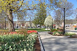 Coe Memorial Park in Torrington | |
 Location within the U.S. state of Connecticut | |
 Connecticut's location within the U.S. | |
| Coordinates: 41°47′N73°14′W / 41.79°N 73.24°W | |
| Country | |
| State | |
| Founded | 1751 |
| Named after | Lichfield, England |
| Seat | none (since 1960) Litchfield (before 1960) |
| Largest city | Torrington (by population) New Milford (by area) |
| Area | |
• Total | 945 sq mi (2,450 km2) |
| • Land | 921 sq mi (2,390 km2) |
| • Water | 24 sq mi (62 km2) 2.5% |
| Population (2020) | |
• Total | 185,186 |
| • Density | 196/sq mi (76/km2) |
| Time zone | UTC−5 (Eastern) |
| • Summer (DST) | UTC−4 (EDT) |
| Congressional districts | 1st, 5th |

Litchfield County is a county in northwestern Connecticut, United States. As of the 2020 census, the population was 185,186. [1] The county was named after Lichfield, in England. [2] Litchfield County has the lowest population density of any county in Connecticut and is the state's largest county by area.
Contents
- History
- Geography
- Adjacent counties
- Demographics
- 2000 census
- 2010 census
- Demographic breakdown by town
- Politics
- Transportation
- Communities
- City
- Towns
- Telephone area codes
- Attractions
- Education
- Full K-12 Districts
- Secondary-school Districts
- Elementary-school Districts
- Private Schools
- See also
- Further reading
- References
Litchfield County comprises the Torrington, CT, Micropolitan Statistical Area, which is included in the New York–Newark, NY–NJ–CT–PA, Combined Statistical Area.
As is the case with the other seven Connecticut counties, there is no county government and no county seat. Each town is responsible for all local services such as schools, snow removal, sewers, and fire and police departments. However, in some cases in rural areas, adjoining towns may agree to jointly provide services or even establish a regional school system. On June 6, 2022, the U.S. Census Bureau formally recognized Connecticut's nine councils of governments as county equivalents instead of the state's eight counties. Connecticut's county governments were disbanded in 1960, and the councils of governments took over some of the local governmental functions. Connecticut's eight historical counties continue to exist in name only, and are no longer considered for statistical purposes. [3]