Terryville, Connecticut

Last updated
Terryville, Connecticut
Terryville CT 2012.jpg
Main Street (U.S. Route 6) in Terryville
Litchfield County Connecticut Incorporated and Unincorporated areas Terryville Highlighted 2010.svg
Location in Litchfield County, Connecticut
Coordinates: 41°40′41″N73°0′39″W / 41.67806°N 73.01083°W / 41.67806; -73.01083
Country Flag of the United States.svg  United States
State Flag of Connecticut.svg  Connecticut
County Litchfield
Town Plymouth
Area
  Total7.22 km2 (2.79 sq mi)
  Land7.15 km2 (2.76 sq mi)
  Water0.07 km2 (0.03 sq mi)
Elevation
187 m (615 ft)
Population
 (2010)
  Total5,387
  Density753.5/km2 (1,952/sq mi)
Time zone UTC-5 (Eastern)
  Summer (DST) UTC-4 (Eastern)
ZIP code
06786
Area code(s) 860

Terryville is a census-designated place (CDP) in Litchfield County, Connecticut, United States, and is the largest village within the town of Plymouth. In the 2010 census, Terryville had a population of 5,387, [1] out of 12,243 in the entire town of Plymouth. The village is named for Eli Terry Jr., the son of the well-known clockmaker Eli Terry Sr. Terryville is also home to the Lock Museum of America. There is a water wheel located in downtown Terryville that is dedicated to the son of Eli Terry Sr.

Contents

Geography

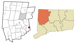
Terryville is in the eastern part of the town of Plymouth and the southeast corner of Litchfield County. The community is bordered to the east by the city of Bristol in Hartford County, and it is 10 miles (16 km) north of Waterbury in New Haven County. U.S. Route 6 passes through the center of Terryville, leading east into Bristol and west into Thomaston.

According to the United States Census Bureau, the Terryville CDP has a total area of 2.8 square miles (7.2 km2), of which 0.03 square miles (0.07 km2), or 0.95%, are water. [1] The Pequabuck River, a tributary of the Farmington River, flows from west to east through the center of town.

Demographics

As of the census of 2010, there were 5,387 people, 2,222 households, and 1,426 families residing in the CDP. The population density was 753.5/km2 (1,952/mi2). There were 2,406 housing units, of which 7.6% were vacant. The racial makeup of the CDP was 95.1% White, 0.9% African American, 0.3% Native American, 1.1% Asian, 0.04% Native Hawaiian or other Pacific Islander, 0.8% some other race, and 1.8% from two or more races. Hispanic or Latino of any race were 3.4% of the population. [2]

Of the 2,222 households, 30.6% had children under the age of 18 living with them, 48.0% were headed by married couples living together, 10.7% had a female householder with no husband present, and 35.8% were non-families. 28.2% of all households were made up of individuals, and 11.3% were someone living alone who was 65 years of age or older. The average household size was 2.42 and the average family size was 2.97. [2]

21.8% of the CDP population were under the age of 18, 8.3% were from 18 to 24, 26.4% were from 25 to 44, 30.8% were from 45 to 64, and 12.6% were 65 years of age or older. The median age was 40.6 years. For every 100 females, there were 95.3 males. For every 100 females age 18 and over, there were 92.6 males. [2]

For the period 2013–17, the estimated median annual income for a household in the CDP was $61,324, and the median income for a family was $84,674. Male full-time workers had a median income of $58,929 versus $51,667 for females. The per capita income for the CDP was $33,286. About 4.6% of families and 7.2% of the population were living below the poverty line, including 5.8% of those under age 18 and 4.8% of those age 65 or over. [3]

Education

Prospect Street School, ca. 1906 PostcardTerryvilleCTProspectStSchool1906.jpg
Prospect Street School, ca. 1906

Terryville has four public schools: two Pre-K to Grade 5 elementary schools, one middle school, and one high school. Its elementary schools are the Harry S. Fisher Elementary School and the Plymouth Center School. Its one middle school is the Eli Terry Middle School. Terryville High School is the only public high school that Plymouth and Terryville residents may attend. A new high school building is located on North Harwinton Avenue in Terryville.

The Prospect Street School was used as the high school up until the 1940s. A new high school building was built on North Main Street and was used until January 2008. Prospect Street School then became an elementary school until its closing in January 2008.

Notable residents

Related Research Articles

<span class="mw-page-title-main">Litchfield County, Connecticut</span> County in Connecticut, United States

Litchfield County is in northwestern Connecticut. As of the 2020 census, the population was 185,186. The county was named after Lichfield, in England. Litchfield County has the lowest population density of any county in Connecticut and is the state's largest county by area.

<span class="mw-page-title-main">Bethlehem, Connecticut</span> Town in Connecticut, United States

Bethlehem is a town in Litchfield County, Connecticut, United States. The population was 3,385 at the 2020 census, down from 3,607 at the 2010 census. The town center is a historic district and a census-designated place (CDP).

<span class="mw-page-title-main">Harwinton, Connecticut</span> Town in Connecticut, United States

Harwinton is a town in Litchfield County, Connecticut, United States. The population was 5,484 at the 2020 census. The high school is Lewis S. Mills.

<span class="mw-page-title-main">New Hartford, Connecticut</span> Town in Connecticut, United States

New Hartford is a town in Litchfield County, Connecticut, United States. The population was 6,658 at the 2020 census. The town center is defined by the U.S. Census Bureau as the New Hartford Center census-designated place (CDP). The town is mainly a rural community consisting of farms, homes, and parks. Brodie Park and Ski Sundown are located in New Hartford.

<span class="mw-page-title-main">North Canaan, Connecticut</span> Town in Connecticut, United States

North Canaan is a town in Litchfield County, Connecticut, United States. The population was 3,211 at the 2020 census. The town center is still called "Canaan", being the main town center of the old town of Canaan prior to North Canaan splitting off as its own town.

<span class="mw-page-title-main">Northwest Harwinton, Connecticut</span> Census-designated place in Connecticut, United States

Northwest Harwinton is a census-designated place (CDP) in the town of Harwinton in Litchfield County, Connecticut, United States. The population was 3,252 at the 2010 census, out of 5,642 in the entire town. The CDP contains the town center.

<span class="mw-page-title-main">Oakville, Connecticut</span> Census-designated place in Connecticut, United States

Oakville is a census-designated place (CDP) and neighborhood section of Watertown, in Litchfield County, Connecticut, United States. The population was 9,047 as of the 2010 census. It is the most populous community in Watertown, with more than twice as many people as the center village of Watertown. The ZIP code for Oakville is 06779.

<span class="mw-page-title-main">Plymouth, Connecticut</span> Town in Connecticut, United States

Plymouth is a town in Litchfield County, Connecticut, United States. It is named after Plymouth, Devon, England. The population was 11,671 at the 2020 census, down from 12,243 at the 2010 census. The town of Plymouth includes the villages of Plymouth Center, Terryville and Pequabuck.

<span class="mw-page-title-main">Thomaston, Connecticut</span> Town in Connecticut, United States

Thomaston is a town in Litchfield County, Connecticut, United States. The population was 7,442 at the 2020 census. The urban center of the town is the Thomaston census-designated place, with a population of 1,928 at the 2020 census.

<span class="mw-page-title-main">Winchester, Connecticut</span> Town in Connecticut, United States

Winchester is a town in Litchfield County, Connecticut, United States. The population was 10,224 at the 2020 census. The city of Winsted is located in Winchester.

<span class="mw-page-title-main">Severn, Maryland</span> Census-designated place in Maryland, United States

Severn is a census-designated place (CDP) in Anne Arundel County, Maryland, United States. The population was 44,231 at the 2010 census, a 26% increase from its population of 35,076 in 2000. The zip code is 21144.

<span class="mw-page-title-main">Lugoff, South Carolina</span> Census-designated place in South Carolina, United States

Lugoff is an unincorporated community and census-designated place (CDP) in Kershaw County, South Carolina, United States. The population was 7,434 at the 2010 census, up from 6,278 at the 2000 census. It is part of the Columbia, South Carolina Metropolitan Statistical Area.

<span class="mw-page-title-main">Frederickson, Washington</span> CDP in Washington, United States

Frederickson is a census-designated place (CDP) in Pierce County, Washington, United States. The population was 24,906 at the 2020 census.

<span class="mw-page-title-main">New Milford (CDP), Connecticut</span> Census-designated place in Connecticut, United States

New Milford is a census-designated place (CDP) in Litchfield County, Connecticut, United States. It comprises the main population center within the town of New Milford. As of the 2010 census, the population of New Milford was 6,523, out of 28,142 in the entire town of New Milford.

<span class="mw-page-title-main">Bethlehem Village, Connecticut</span> Census-designated place in Connecticut, United States

Bethlehem Village is a census-designated place (CDP) within the town of Bethlehem in Litchfield County, Connecticut, United States. The CDP includes the Bethlehem Green Historic District at the town center, as well as surrounding residential and rural land. As of the 2010 census, the CDP had a population of 2,021, out of a population of 3,607 for the entire town of Bethlehem.

<span class="mw-page-title-main">New Hartford Center, Connecticut</span> Census-designated place in Connecticut, United States

New Hartford Center is a census-designated place (CDP) in Litchfield County, Connecticut, United States. It comprises the village of New Hartford, the adjacent Pine Meadow Historic District, and some surrounding forest land, all within the town of New Hartford. As of the 2010 census, the population of New Hartford Center was 1,385, out of 6,970 in the entire town of New Hartford.

<span class="mw-page-title-main">Woodbury Center, Connecticut</span> Census-designated place in Connecticut, United States

Woodbury Center is a census-designated place (CDP) in Litchfield County, Connecticut, United States. It comprises the twin villages of Woodbury and North Woodbury and surrounding residential land in the town of Woodbury. As of the 2010 census, the population of the CDP was 1,294, out of 9,975 in the entire town.

<span class="mw-page-title-main">Canaan (village), Connecticut</span> United States historic place

Canaan is a village and census-designated place (CDP) within the town of North Canaan in Litchfield County, Connecticut, United States. Formerly known as Canaan Depot, the village is more commonly known as Canaan Village to distinguish it from the town of Canaan located to the south of North Canaan. The Canaan Village Historic District is listed on the National Register of Historic Places. As of the 2010 census, the CDP had a population of 1,212, out of a total population of 3,315 in the town of North Canaan.

<span class="mw-page-title-main">Watertown (CDP), Connecticut</span> Census-designated place in Connecticut, United States

Watertown is a census-designated place (CDP) in Litchfield County, Connecticut, United States. It comprises the central village of the town of Watertown. As of the 2010 census, the population of the CDP was 3,574, out of 22,514 in the entire town.

<span class="mw-page-title-main">Thomaston (CDP), Connecticut</span> Census-designated place in Connecticut, United States

Thomaston is a census-designated place (CDP) in Litchfield County, Connecticut, United States. It comprises the downtown portion of the town of Thomaston. As of the 2010 census, the population of the CDP was 1,910, out of 7,887 in the entire town.

References

  1. 1 2 "Geographic Identifiers: 2010 Census Summary File 1 (G001), Terryville CDP, Connecticut". American FactFinder. U.S. Census Bureau. Archived from the original on February 13, 2020. Retrieved October 31, 2019.
  2. 1 2 3 "Profile of General Population and Housing Characteristics: 2010 Census Summary File 1 (DP-1), Terryville CDP, Connecticut". American FactFinder. U.S. Census Bureau. Archived from the original on February 13, 2020. Retrieved October 31, 2019.
  3. "Selected Economic Characteristics: 2013-2017 American Community Survey 5-Year Estimates (DP03), Terryville CDP, Connecticut". American FactFinder. U.S. Census Bureau. Archived from the original on February 13, 2020. Retrieved October 31, 2019.

Coordinates: 41°40′41″N73°00′39″W / 41.67806°N 73.01083°W / 41.67806; -73.01083