Woodbury Center, Connecticut

Last updated
Woodbury Center, Connecticut
Litchfield County Connecticut Incorporated and Unincorporated areas Woodbury Center Highlighted 2010.svg
Location in Litchfield County, Connecticut
Coordinates: 41°32′41″N73°12′31″W / 41.54472°N 73.20861°W / 41.54472; -73.20861
State Connecticut
County Litchfield
Town Woodbury
Area
  Total1.95 sq mi (5.04 km2)
  Land1.95 sq mi (5.04 km2)
  Water0.0 sq mi (0.0 km2)
Elevation
264 ft (80 m)
Population
 (2010)
  Total1,294
  Density665/sq mi (256.8/km2)
ZIP Code
06798
FIPS code 09-87980
GNIS feature ID2377886

Woodbury Center is a census-designated place (CDP) in Litchfield County, Connecticut, United States. It comprises the twin villages of Woodbury and North Woodbury and surrounding residential land in the town of Woodbury. As of the 2010 census, the population of the CDP was 1,294, [1] out of 9,975 in the entire town.

Contents

Geography

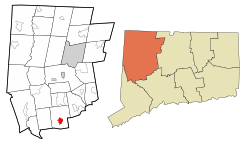
The Woodbury Center CDP is in the south-central part of the town of Woodbury, in the valley of the Pomperaug River. The adjacent villages of Woodbury and North Woodbury occupy the western side of the CDP, and the Orenaug Hills, rising to 509 feet (155 m), occupy the eastern portion. The CDP is bordered to the east by Bacon Pond Road; to the south by Old Sherman Hill Road, South Pomperaug Avenue, and Pomperaug Road; to the west by the Pomperaug River; and to the north by the Nonewaug River, a tributary of the Pomperaug. [2]

U.S. Route 6 passes north to south through the community as Main Street. Route 6 leads northeast 7 miles (11 km) to Watertown and south 5 miles (8 km) to Southbury and an interchange with Interstate 84. Connecticut Route 47 begins in North Woodbury and leads northwest 8 miles (13 km) to Washington. Connecticut Route 317 has its eastern terminus in Woodbury village and leads west 6 miles (10 km) to Roxbury.

According to the U.S. Census Bureau, the Woodbury Center CDP has an area of 1.9 square miles (5.0 km2), all of it recorded as land. [3]

Demographics

As of the census of 2010, there were 1,294 people, 642 households, and 339 families residing in the CDP. The population density was 665 inhabitants per square mile (257/km2). There were 704 housing units, of which 62, or 8.8%, were vacant. The racial makeup of the CDP was 93.6% White, 0.7% African American, 4.3% Asian, 0.4% some other race, and 1.1% from two or more races. Hispanic or Latino of any race were 2.4% of the population. [1]

Of the 642 households in the community, 20.4% had children under the age of 18 living with them, 39.6% were headed by married couples living together, 9.0% had a female householder with no husband present, and 47.2% were non-families. 39.9% of all households were made up of individuals, and 15.1% were someone living alone who was 65 years of age or older. The average household size was 2.02, and the average family size was 2.72. [1]

17.3% of the CDP population were under the age of 18, 6.8% were from 18 to 24, 24.4% were from 25 to 44, 34.2% were from 45 to 64, and 17.3% were 65 years of age or older. The median age was 45.6 years. For every 100 females, there were 84.1 males. For every 100 females age 18 and over, there were 84.8 males. [1]

For the period 2013-17, the estimated median annual income for a household in the CDP was $63,368, and the median income for a family was $75,139. Male full-time workers had a median income of $82,143 versus $37,035 for females. About 5.6% of families and 7.0% of the population were living below the poverty line, including 8.8% of those under age 18. [4]

Related Research Articles

<span class="mw-page-title-main">Northwest Harwinton, Connecticut</span> Census-designated place in Connecticut, United States

Northwest Harwinton is a census-designated place (CDP) in the town of Harwinton in Litchfield County, Connecticut, United States. The population was 3,252 at the 2010 census, out of 5,642 in the entire town. The CDP contains the town center.

<span class="mw-page-title-main">Oakville, Connecticut</span> Census-designated place in Connecticut, United States

Oakville is a census-designated place (CDP) and neighborhood section of Watertown, in Litchfield County, Connecticut, United States. The population was 9,047 as of the 2010 census. It is the most populous community in Watertown, with more than twice as many people as the center village of Watertown. The ZIP code for Oakville is 06779.

<span class="mw-page-title-main">Woodbury, Connecticut</span> Town in Connecticut, United States

Woodbury is a town in Litchfield County, Connecticut, United States. The population was 9,723 at the 2020 census. The town center, comprising the adjacent villages of Woodbury and North Woodbury, is designated by the U.S. Census Bureau as the Woodbury Center census-designated place (CDP). Woodbury was founded in 1673.

Old Saybrook Center is the primary village and a census-designated place (CDP) in the town of Old Saybrook, Middlesex County, Connecticut, United States. The population was 2,278 at the 2020 census, out of 10,481 in the entire town of Old Saybrook. The CDP includes the traditional town center and the peninsula known as Saybrook Point.

Simsbury Center is a census-designated place (CDP) that consists of the central settlement, and the neighborhoods immediately surrounding it, in the town of Simsbury, Connecticut, in the United States. As of the 2010 census, the CDP had a population of 5,836. The core area of the CDP is listed as the Simsbury Center Historic District on the National Register of Historic Places.

<span class="mw-page-title-main">Bethel (CDP), Connecticut</span> Census-designated place in Connecticut, United States

Bethel is a census-designated place (CDP) in Fairfield County, Connecticut, United States. It comprises the primary village and surrounding residential land within the town of Bethel. As of the 2010 census, the population of the CDP was 9,549, out of 18,584 in the entire town.

<span class="mw-page-title-main">Ridgefield (CDP), Connecticut</span> Census-designated place in Connecticut, United States

Ridgefield is a census-designated place (CDP) in Fairfield County, Connecticut, United States. It consists of the primary central village in the town of Ridgefield and surrounding residential areas. As of the 2010 census, the population of the CDP was 7,645, out of 24,638 in the entire town.

<span class="mw-page-title-main">New Milford (CDP), Connecticut</span> Census-designated place in Connecticut, United States

New Milford is a census-designated place (CDP) in Litchfield County, Connecticut, United States. It comprises the main population center within the town of New Milford. As of the 2010 census, the population of New Milford was 6,523, out of 28,142 in the entire town of New Milford.

Hinsdale is a census-designated place (CDP) and the main village in the town of Hinsdale in Cheshire County, New Hampshire, United States. The population of the CDP was 1,485 at the 2020 census, out of 3,948 in the entire town of Hinsdale.

Lancaster is a census-designated place (CDP) and the main village in the town of Lancaster in Coos County, New Hampshire, United States. The population of the CDP was 1,941 at the 2020 census, out of 3,218 in the entire town of Lancaster.

Hanover is a census-designated place (CDP) and the main village in the town of Hanover in Grafton County, New Hampshire, United States. The population of the CDP was 9,078 at the 2020 census, out of 11,870 in the entire town. The CDP includes the campus of Dartmouth College.

<span class="mw-page-title-main">Bethlehem Village, Connecticut</span> Census-designated place in Connecticut, United States

Bethlehem Village is a census-designated place (CDP) within the town of Bethlehem in Litchfield County, Connecticut, United States. The CDP includes the Bethlehem Green Historic District at the town center, as well as surrounding residential and rural land. As of the 2010 census, the CDP had a population of 2,021, out of a population of 3,607 for the entire town of Bethlehem.

<span class="mw-page-title-main">New Hartford Center, Connecticut</span> Census-designated place in Connecticut, United States

New Hartford Center is a census-designated place (CDP) in Litchfield County, Connecticut, United States. It comprises the village of New Hartford, the adjacent Pine Meadow Historic District, and some surrounding forest land, all within the town of New Hartford. As of the 2010 census, the population of New Hartford Center was 1,385, out of 6,970 in the entire town of New Hartford.

Salmon Brook is the name of a census-designated place (CDP) corresponding to the village of Granby, the primary settlement of the town of Granby, Connecticut, in Hartford County. The population of the CDP was 2,324 as of the 2010 census.

Colebrook is a census-designated place (CDP) and the main village in the town of Colebrook, Coös County, New Hampshire, United States. The population of the CDP was 1,201 at the 2020 census, out of 2,084 in the entire town. The CDP population had dropped from 1,394 at the 2010 census.

<span class="mw-page-title-main">Walpole (CDP), New Hampshire</span> Census-designated place in New Hampshire, United States

Walpole is a census-designated place (CDP) and the central village in the town of Walpole in Cheshire County, New Hampshire, United States. The population of the CDP was 573 at the 2020 census, compared to 3,633 in the entire town.

Manchester is a census-designated place (CDP) in Hartford County, Connecticut, United States, comprising the urban center of the town of Manchester. As of the 2010 census, the population of the CDP was 30,577, out of 58,241 in the entire town.

<span class="mw-page-title-main">Watertown (CDP), Connecticut</span> Census-designated place in Connecticut, United States

Watertown is a census-designated place (CDP) in Litchfield County, Connecticut, United States. It comprises the central village of the town of Watertown. As of the 2010 census, the population of the CDP was 3,574, out of 22,514 in the entire town.

<span class="mw-page-title-main">Norfolk (CDP), Connecticut</span> Census-designated place in Connecticut, United States

Norfolk is a census-designated place (CDP) in Litchfield County, Connecticut, United States. It is the central village within the town of Norfolk. As of the 2010 census, the population of the CDP was 553, out of 1,709 in the entire town.

<span class="mw-page-title-main">Thomaston (CDP), Connecticut</span> Census-designated place in Connecticut, United States

Thomaston is a census-designated place (CDP) in Litchfield County, Connecticut, United States. It comprises the downtown portion of the town of Thomaston. As of the 2010 census, the population of the CDP was 1,910, out of 7,887 in the entire town.

References

  1. 1 2 3 4 "Profile of General Population and Housing Characteristics: 2010 Census Summary File 1 (DP-1), Woodbury Center CDP, Connecticut". American FactFinder. U.S. Census Bureau. Archived from the original on February 13, 2020. Retrieved November 1, 2019.
  2. "TIGERweb: Woodbury Center CDP, Connecticut". U.S. Census Bureau Geography Division. Retrieved November 1, 2019.
  3. "U.S. Gazetteer Files: 2019: Places: Connecticut". U.S. Census Bureau Geography Division. Retrieved November 1, 2019.
  4. "Woodbury Center CDP, Connecticut: ACS 5-Year Estimates Subject Tables (2017)". data.census.gov. Retrieved November 1, 2019.