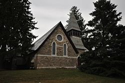
Salisbury is a town situated in Litchfield County, Connecticut, United States. The town is the northwesternmost in the state of Connecticut; the Massachusetts-New York-Connecticut tri-state marker is located at the northwest corner of the town. The population was 4,194 at the 2020 census. The town is part of the Northwest Hills Planning Region.

Butler is a city and the county seat of Butler County, Pennsylvania, United States. It is located 35 miles (56 km) north of Pittsburgh and is part of the Greater Pittsburgh region. As of the 2020 census, the city population was 13,502.
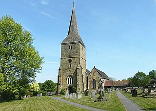
Hartfield is a village and civil parish in the Wealden district of East Sussex, England. The parish also includes the settlements of Colemans Hatch, Hammerwood and Holtye, all lying on the northern edge of Ashdown Forest.

Lime Rock Park is a natural-terrain motorsport road racing venue located in Lakeville, Connecticut, United States, a hamlet in the town of Salisbury, in the state's northwest corner. Built in 1956, it is the nation's third oldest continuously operating road racing venue, behind Road America (1955) and Willow Springs International Motorsports Park (1953). The track was owned by Skip Barber from 1984 to April 2021, a former race car driver who started the Skip Barber Racing School in 1975. Now, it is owned by Lime Rock Group, LLC. It was listed on the National Register of Historic Places in 2009.

Connecticut Avenue is a major thoroughfare in the Northwest quadrant of Washington, D.C., and suburban Montgomery County, Maryland. It is one of the diagonal avenues radiating from the White House, and the segment south of Florida Avenue was one of the original streets in Pierre (Peter) Charles L'Enfant's plan for Washington. A five-mile segment north of Rock Creek was built in the 1890s by a real-estate developer.

Haughville is a neighborhood west of downtown Indianapolis. Its borders are roughly White River Parkway to the east, Tibbs Avenue to the west, 16th Street to the north, and Michigan Street to the south. It was first settled in the 1830s and grew after a bridge over White River was built connecting to Indianapolis, which annexed the town in 1897. The modern version of the bridge is also the connection between Haughville on the west side of the river and the Sidney & Lois Eskenazi Hospital and Indiana University - Purdue University Indianapolis on the east. The population in the late 1890s included Slovenian, German, and Irish immigrants, among other European immigrants. In the 21st century, the neighborhood suffers from a high crime rate and low property values.
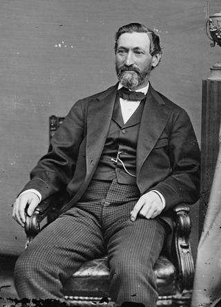
William Henry Barnum was an American politician, serving as a state representative, congressman, U.S. senator, and finally as chairman of the Democratic National Committee. He was also known as "Seven Mule Barnum".
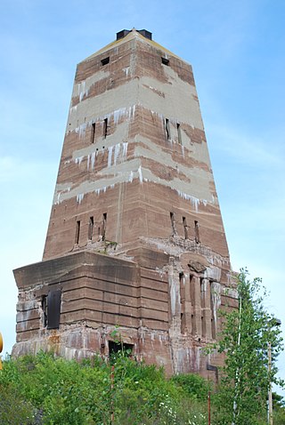
The Cliffs Shaft Mine Museum is a former iron mine, now a heritage museum, located on Euclid Street between Lakeshore Drive and Spruce Street in Ishpeming, Michigan. The museum, operated by "Marquette Range Iron Mining Heritage Theme Park Inc.", celebrates the history of the Marquette Iron Range. The site was designated a state of Michigan historic site in 1973 and placed on the National Register of Historic Places in 1992.
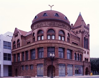
The Barnum Museum is a museum at 820 Main Street in Bridgeport, Connecticut, United States. It has an extensive collection related to P. T. Barnum and the history of Bridgeport, and is housed in a historic building on the National Register of Historic Places.

The history of Bridgeport, Connecticut was, in the late 17th and most of the 18th century, one of land acquisitions from the native inhabitants, farming and fishing. From the mid-18th century to the mid-19th century, Bridgeport's history was one of shipbuilding, whaling and rapid growth. Bridgeport's growth accelerated even further from the mid-19th century to the mid-20th century with the advent of the railroad, Industrialization, massive immigration, labor movements until, at its peak population in 1950, Bridgeport with some 159,000 people was Connecticut's second most populous city. In the late 20th century, Bridgeport's history was one of deindustrialization and declining population, though it overtook Hartford as the state's most populous city by 1980.
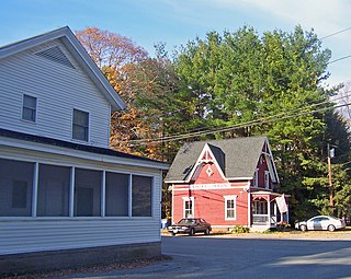
The Sharon Valley Historic District is located around the junction of Kings Hill, Sharon Valley and Sharon Station roads in Sharon, Connecticut, United States. It is a small community that grew up around an iron mining and refining operation during the late 19th century, the first industry in Sharon.

The Oregon Iron Company Furnace, or Oswego Iron Furnace, is an iron furnace used by the Oregon Iron Company, in Lake Oswego, Oregon's George Rogers Park, in the United States. The structure was added to the National Register of Historic Places in 1974 and underwent a major renovation in 2010. The current furnace is the only structure that remains of the original iron company, and is the oldest industrial landmark in the state of Oregon.
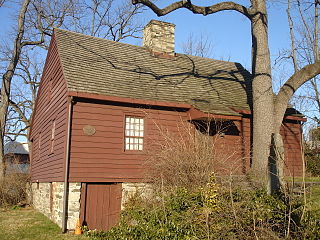
The Hoyt-Barnum House at 1508 High Ridge Road in Stamford, Connecticut, is a Cape Cod cottage style house that was built around 1699, and is the oldest extant house in the city of Stamford.

The Milton Center Historic District encompasses the historic 19th-century village center of Milton in the northwestern part of the town of Litchfield, Connecticut, United States. Basically linear, it stretches from Milton Cemetery in the west to the junction of Milton and Shearshop Roads in the east, including houses, churches, schools, and the remains of industrial sites. The district was listed on the National Register of Historic Places in 1986.
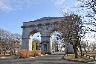
Bridgeport is the most populous city in the U.S. state of Connecticut and the fifth-most populous city in New England, with a population of 148,654 in 2020. Located in eastern Fairfield County at the mouth of the Pequonnock River on Long Island Sound, it is a port city 60 miles (97 km) from Manhattan and 40 miles (64 km) from The Bronx. It borders the towns of Trumbull to the north, Fairfield to the west, and Stratford to the east. Bridgeport and other towns in Fairfield County make up the Greater Bridgeport Planning Region, as well as the Bridgeport–Stamford–Norwalk–Danbury metropolitan statistical area, the second largest metropolitan area in Connecticut. The Bridgeport–Stamford–Norwalk–Danbury metropolis forms part of the New York metropolitan area.

Hallville Mill Historic District is a historic district in the town of Preston, Connecticut, that was listed on the National Register of Historic Places in 1996. Contributing properties in the district are 23 buildings, two other contributing structures, and one other contributing site over a 50-acre (20 ha) area. The district includes the dam that forms Hallville Pond, historic manufacturing buildings and worker housing, and the Hallville Mill Bridge, a lenticular pony truss bridge built circa 1890 by the Berlin Iron Bridge Company.
Milo Barnum Richardson was president of the Barnum Richardson Company. He served as a state representative and a state senator. Richardson was the son of industrialist Leonard Richardson. Milo B. Richardson served on the Connecticut Board of World's Fair Commissioners at the World's Columbian Exposition of 1893. He was also the first cousin of Ada Willard Richardson, the daughter of renowned building contractor William Douglas Richardson, and who married Illinois banker George Wallace Bunn, Sr..

Seaside Park, located in Bridgeport, Connecticut, is a 2.5-mile (4.0 km) long crescent-shaped park bordering Bridgeport Harbor, Long Island Sound, and Black Rock Harbor. The park lies within Bridgeport's South End neighborhood.
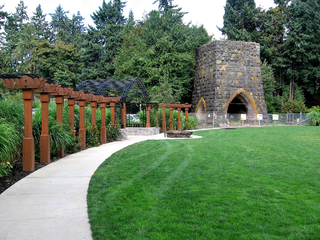
George Rogers Park is a 26-acre (11 ha) public park at intersection of Ladd and South State streets in Lake Oswego, Oregon. This park contains two baseball fields, a soccer field, access to the Willamette River, a memorial garden area, restrooms, a playground, and two outdoor tennis courts. The park also features the Oregon Iron Company Furnace, which was placed on the National Register of Historic Places by the Department of the Interior. The park is named after George Rogers—a City Councilman—in appreciation for his devoted efforts to develop and maintain the grounds.

The East Bridgeport Historic District encompasses one of the best-preserved 19th-century neighborhoods of Bridgeport, Connecticut. Bounded by Arctic Street, East Main Street, the railroad tracks, and the Pequonnock River, this area was a planned development of Bridgeport promoter P.T. Barnum and landowner William H. Noble. Its development prompted the significant growth of industry and economic activity east of the Pequonnock River. The district was listed on the National Register of Historic Places in 1979.
