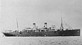
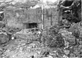
[ 3] Name on the Register Image Date listed [ 4] Location Village Description 1 Agana Historic District Agana Historic District February 8, 1985 (# 85000495 Roughly bounded by South 2nd, South 3rd, and West 9th, Santa Cruz and Legaspi Streets 13°28′27″N 144°45′52″E / 13.474167°N 144.764306°E / 13.474167; 144.764306 (Agana Historic District ) Hagåtña 2 Agana Spanish Bridge Agana Spanish Bridge September 6, 1974 (# 74002300 Aspenall Street and Guam Highway 1 13°28′36″N 144°45′01″E / 13.476667°N 144.750278°E / 13.476667; 144.750278 (Agana Spanish Bridge ) Hagåtña Historic Spanish colonial bridge 3 Agana-Hagatna Pillbox Agana-Hagatna Pillbox March 4, 1991 (# 88001880 West shore of Paseo de Susana 13°28′41″N 144°45′58″E / 13.478056°N 144.766111°E / 13.478056; 144.766111 (Agana-Hagatna Pillbox ) Hagåtña 4 Agana/Hagatna Cliffline Fortifications Agana/Hagatna Cliffline Fortifications March 4, 1991 (# 88001877 Address restricted [ 5] Hagåtña 5 Ayulang Pillbox Upload image March 4, 1991 (# 88001889 Address restricted [ 5] Hagåtña 6 Fort Santa Agueda Fort Santa Agueda August 30, 1974 (# 74002301 Guam Highway 7 13°28′25″N 144°44′52″E / 13.473611°N 144.747778°E / 13.473611; 144.747778 (Fort Santa Agueda ) Hagåtña 7 Guam Congress Building Guam Congress Building February 1, 2007 (# 06001320 Chalan Santo Papa 13°28′30″N 144°45′08″E / 13.475106°N 144.752358°E / 13.475106; 144.752358 (Guam Congress Building ) Hagåtña 8 Guam Institute Guam Institute October 6, 1977 (# 77001568 Off Guam Highway 1 13°28′26″N 144°44′44″E / 13.473889°N 144.745556°E / 13.473889; 144.745556 (Guam Institute ) Hagåtña 9 Mesa House Upload image February 8, 1985 (# 85000408 Maxwell Street 13°28′09″N 144°45′07″E / 13.469167°N 144.751806°E / 13.469167; 144.751806 (Mesa House ) Hagåtña Historic ifil -constructed house 10 Plaza de Espana Plaza de Espana May 1, 1974 (# 74002302 Saylor Street 13°28′26″N 144°45′06″E / 13.473889°N 144.751667°E / 13.473889; 144.751667 (Plaza de Espana ) Hagåtña 11 Spanish Dikes Upload image November 19, 1974 (# 74002303 Northeast of Agana Springs 13°27′48″N 144°45′57″E / 13.463333°N 144.765833°E / 13.463333; 144.765833 (Spanish Dikes ) Hagåtña 12 Toves House Toves House February 8, 1985 (# 85000410 Marine Drive 13°34′55″N 144°51′38″E / 13.581944°N 144.860417°E / 13.581944; 144.860417 (Toves House ) Hagåtña 13 U.S. Naval Cemetery U.S. Naval Cemetery December 1, 2015 (# 15000846 Marine Corps Drive 13°28′39″N 144°45′28″E / 13.477398°N 144.757768°E / 13.477398; 144.757768 (U.S. Naval Cemetery ) Hagåtña 14 War in the Pacific National Historical Park War in the Pacific National Historical Park August 18, 1978 (# 78003198 Marine Drive 13°23′12″N 144°39′28″E / 13.386667°N 144.657639°E / 13.386667; 144.657639 (War in the Pacific National Historical Park ) Hagåtña 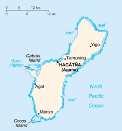


