NHLs in U.S. commonwealths and territories
| [1] | Landmark name | Image | Date designated [2] | Location | Commonwealth/Territory | Description |
|---|---|---|---|---|---|---|
| 1 | Blunts Point Battery |  | May 28, 1987 (#73002128) | Pago Pago 14°17′27″S170°40′30″W / 14.29087°S 170.67493°W | American Samoa | A rare intact Pacific coastal battery, built as part of the fortification of the Samoan Islands after Pearl Harbor |
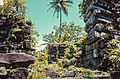
| 2 | Government House |  | December 14, 1990 (#72001443) | Pago Pago 14°16′57″S170°40′54″W / 14.28238°S 170.68171°W | American Samoa | A symbol of United States military and diplomatic relations throughout the South Pacific through World War I and World War II. Now the residence of the governor of American Samoa |
| 3 | World War II Facilities at Midway | 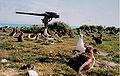 | May 28, 1987 (#87001302) | Midway Atoll 28°12′N177°21′W / 28.2°N 177.35°W | Midway Islands | Site of pivotal Battle of Midway which changed the balance of sea power during World War II |
| 4 | Landing Beaches; Aslito/Isley Field; & Marpi Point, Saipan Island | 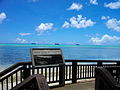 | February 4, 1985 (#85001789) | Saipan 15°06′59″N145°43′41″E / 15.116389°N 145.728056°E | Northern Mariana Islands | |
| 5 | Tinian Landing Beaches, Ushi Point & North Fields, Tinian Island |  | December 30, 1985 (#85003268) | Tinian 15°04′54″N145°37′57″E / 15.081654°N 145.632398°E | Northern Mariana Islands | |
| 6 | Antonio Lopez |  | December 9, 1997 (#93001593) | Dorado 18°28′48″N66°13′50″W / 18.48°N 66.230556°W | Puerto Rico | Shipwreck of the first Spanish-built steel vessel with a complete electrical lighting system, and one of the most important Spanish blockade-runners during the Spanish–American War. The shipwreck is the only known Spanish wreck in American waters from the conflict. |
| 7 | Caguana Site |  | November 4, 1993 (#92001671) | Utuado 18°17′49″N66°46′55″W / 18.2969°N 66.7819°W | Puerto Rico | Taíno archaeological site considered to be one of the most important Pre-Columbian sites in the West Indies. |
| 8 | Caparra Archaeological Site |  | April 19, 1994 (#84003155) | Guaynabo 18°24′18″N66°06′51″W / 18.405°N 66.114167°W | Puerto Rico | Contains the remains of the first Spanish capital of Puerto Rico, settled in 1508 and abandoned in 1521. It represents the oldest known European settlement on United States territory. |
| 9 | Casa Dra. Concha Melendez Ramirez |  | February 27, 2013 (#11000414) | San Juan 18°27′10″N66°04′03″W / 18.4528°N 66.0675°W | Puerto Rico | The home of Dra. Concha Meléndez Ramírez, a writer and critic of the Generación del Treinta (Generation of 1930), a literary movement that shaped Puerto Rico's 20th-century national cultural identity. |
| 10 | La Fortaleza |  | October 9, 1960 (#66000951) | San Juan 18°27′50″N66°07′09″W / 18.463889°N 66.119167°W | Puerto Rico | Built between 1533 and 1540 to defend the harbor of San Juan. Today it serves as the residence of the governor of Puerto Rico, and it is the oldest executive mansion in continuous use in the Americas. |
| 11 | Old San Juan Historic District |  | February 27, 2013 (#13000284) | San Juan 18°26′44″N66°04′33″W / 18.4456°N 66.0758°W | Puerto Rico | A well-preserved Spanish colonial city. Nearly 400 years old, it is the oldest colonial settlement under the United States jurisdiction. |
| 12 | Columbus Landing Site | 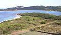 | October 9, 1960 (#66000743) | Saint Croix 17°46′44″N64°45′32″W / 17.778889°N 64.758889°W | Virgin Islands | |
| 13 | Fort Christian |  | May 5, 1977 (#77001329) | Saint Thomas 18°20′27″N64°55′47″W / 18.340833°N 64.929722°W | Virgin Islands | |
| 14 | Fort Frederik | 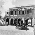 | September 25, 1997 (#97001269) | Saint Croix 17°42′55″N64°53′00″W / 17.715256°N 64.883453°W | Virgin Islands | |
| 15 | St. Thomas Synagogue |  | September 25, 1997 (#97001270) | Saint Thomas 18°20′41″N64°55′59″W / 18.344722°N 64.933056°W | Virgin Islands | |
| 16 | Blackbeard's Castle (Skytsborg) |  | October 12, 1994 (#91001844) | Saint Thomas 18°20′38″N64°55′47″W / 18.343842°N 64.929592°W | Virgin Islands | |
| 17 | Wake Island |  | September 16, 1985 (#85002726) | Wake Island 19°18′00″N166°38′00″E / 19.3°N 166.633333°E | Wake Island |