List of National Historic Landmarks in Kansas

Last updated

This is a list of all National Historic Landmarks designated by the U.S. government in Kansas. There are 26 National Historic Landmarks (NHLs) in Kansas.

Contents

The United States National Historic Landmark program is operated under the auspices of the National Park Service, and recognizes structures, districts, objects, and similar resources according to a list of criteria of national significance. [1]

Map all coordinates using: OpenStreetMap

The state of Kansas is home to 26 of these landmarks, illustrating the state's military and frontier heritage, as well as its contributions to the broader themes of the Civil Rights Movement, the Progressive Movement, and others.

National Historic Landmarks

[2] Landmark nameImageDate designated [3] Location CountyDescription
1 Black Jack Battlefield
Black Jack Battlefield Battle of Black Jack-Surrender Point.JPG
Black Jack Battlefield
October 16, 2012
(#04000365)
Baldwin City
38°45′42″N95°07′50″W / 38.761667°N 95.130556°W / 38.761667; -95.130556 (Black Jack Battlefield)
Douglas The three-hour Battle of Black Jack, fought on June 2, 1856, marked a culmination of escalating violence in "Bleeding Kansas" and the beginning of John Brown's war on slavery, which would culminate in his raid on Harpers Ferry three years later. [4]
2 Council Grove Historic District
Council Grove Historic District CouncilOakatCouncilGrove.jpg
Council Grove Historic District
May 23, 1963
(#66000347)
Council Grove
38°39′38″N96°29′23″W / 38.660678°N 96.489672°W / 38.660678; -96.489672 (Council Grove Historic District)
Morris Here, in 1825, the United States and the Osage Nation negotiated a treaty that guaranteed safe passage through Osage territory to caravans on the Santa Fe Trail. Providing water, feed, and timber, it later became a natural stopping place on the trail.
3 El Cuartelejo
El Cuartelejo CuartelejoKS.jpg
El Cuartelejo
July 19, 1964
(#66000351)
Scott City
38°40′41″N100°54′51″W / 38.67813°N 100.91407°W / 38.67813; -100.91407 (El Cuartelejo)
Scott 
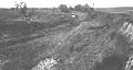
This archeological district consists of more than 20 sites, mostly associated with the Dismal River/Plains Apache culture, dating from c CE 1650 to 1750. The principal site is a pueblo ruin thought to have been built by Taos Indians who sought refuge with the Apache during times of trouble with the Spanish. It is the northeasternmost example of a pueblo in the country. The site also illustrates Spanish explorations in the Great Plains that predates those of the United States.
4 Fort Larned
Fort Larned Fort Larned quartermaster's building.jpg
Fort Larned
December 19, 1960
(#66000107)
Larned
38°10′25″N99°11′56″W / 38.17361°N 99.19889°W / 38.17361; -99.19889 (Fort Larned)
Pawnee From 1860 until 1878, this was the most important fort guarding the northern portion of the Santa Fe Trail. Abandoned, the fort became private property and the center of a large ranching operation. It has been restored to the 1860s period to serve as one of the nation's best-preserved mid-19th century western military posts, consisting of one-story stone buildings are arranged around a quadrangle.
5 Fort Leavenworth
Fort Leavenworth Clocktower-Sherman-Grant-SheridanHalls Nov-2002 0056.jpg
Fort Leavenworth
December 19, 1960
(#66000346)
Leavenworth
39°21′18″N94°55′16″W / 39.35500°N 94.92111°W / 39.35500; -94.92111 (Fort Leavenworth)
Leavenworth This fort has been in continuous occupation by the United States Army since it was first established in 1827 to protect caravans on the Santa Fe Trail. It played pivotal roles in the Mexican and Civil Wars, and it became the temporary capital of the Kansas Territory in 1854.
6 Fort Scott
Fort Scott Fortscottks.JPG
Fort Scott
July 19, 1964
(#66000106)
Fort Scott
37°50′31″N94°42′17″W / 37.8419633225°N 94.7047653434°W / 37.8419633225; -94.7047653434 (Fort Scott)
Bourbon This fort, established in 1842 and abandoned in 1853, served first as a frontier outpost along the "Permanent Indian Frontier", then as a Civil War garrison. During the Civil War, the fort was a major focal point of black troop activity and training.
7 Haskell Institute
Haskell Institute Tecumseh Hall, Haskell Indian Nations University.jpg
Haskell Institute
July 4, 1961
(#66000342)
Lawrence
38°56′23″N95°13′58″W / 38.939722°N 95.232778°W / 38.939722; -95.232778 (Haskell Institute)
Douglas
8 Hollenberg (Cottonwood) Pony Express Station
Hollenberg (Cottonwood) Pony Express Station Hollenberg Pony Express Station, Route 243, 6.9 miles south of Nebraska border, Hanover vicinity (Washington County, Kansas).jpg
Hollenberg (Cottonwood) Pony Express Station
November 5, 1961
(#66000352)
Hanover
39°53′56″N96°50′37″W / 39.8989718876°N 96.8435817529°W / 39.8989718876; -96.8435817529 (Hollenberg (Cottonwood) Pony Express Station)
Washington Built by Gerat H. Hollenberg in 1858, this cabin was associated with the Oregon and California Trails, the Pony Express, and the Butterfield Overland Mail. Hollenberg traded with emigrants on the trails, operated the westernmost Pony Express station in Kansas, and provided relay services for the Overland Mail. The building has never been moved and retains its original dimensions.
9 Lecompton Constitution Hall
Lecompton Constitution Hall Constitution Hall Lecompton.jpg
Lecompton Constitution Hall
May 30, 1974
(#71000312)
Lecompton
39°02′37″N95°23′40″W / 39.0436775381°N 95.3944537582°W / 39.0436775381; -95.3944537582 (Lecompton Constitution Hall)
Douglas
10 Lower Cimarron Spring
Lower Cimarron Spring Lower Cimarron Spring.jpg
Lower Cimarron Spring
December 19, 1960
(#66000344)
Ulysses
37°23′54″N101°22′15″W / 37.3983562°N 101.3707193°W / 37.3983562; -101.3707193 (Lower Cimarron Spring)
Grant
11 Marais des Cygnes Massacre Site
Marais des Cygnes Massacre Site MaraisDesCygnesMassacreSite.png
Marais des Cygnes Massacre Site
May 30, 1974
(#71000317)
Trading Post
38°16′53″N94°37′16″W / 38.281389°N 94.62111°W / 38.281389; -94.62111 (Marais des Cygnes Massacre Site)
Linn
12 Medicine Lodge Peace Treaty Site
Medicine Lodge Peace Treaty Site MedicineLodgePeaceTreatyAmphitheater.png
Medicine Lodge Peace Treaty Site
August 4, 1969
(#69000059)
Medicine Lodge
37°15′55″N98°35′35″W / 37.265406°N 98.593057°W / 37.265406; -98.593057 (Medicine Lodge Peace Treaty Site)
Barber
13 Carrie A. Nation House
Carrie A. Nation House Carry Nation house from NE 1.jpg
Carrie A. Nation House
May 11, 1976
(#71000303)
Medicine Lodge
37°16′32″N98°34′55″W / 37.275620°N 98.581998°W / 37.275620; -98.581998 (Carrie A. Nation House)
Barber
14 Nicodemus Historic District
Nicodemus Historic District Nicodemus.JPG
Nicodemus Historic District
January 7, 1976
(#76000820)
Nicodemus
39°23′40″N99°37′01″W / 39.3944520°N 99.6170555°W / 39.3944520; -99.6170555 (Nicodemus Historic District)
Graham Established by African Americans during the Reconstruction Period following the Civil War, the town of Nicodemus symbolizes the pioneer spirit of people formerly enslaved. Established on homestead land, the town of Nicodemus was officially founded on September 17, 1877. It is the only remaining town of the "Exoduster" movement, which was organized mainly through the efforts of Benjamin "Pap" Singleton, who was responsible for founding 11 colonies in Kansas between 1873 and 1880.
15 Norman No. 1 Oil Well
Norman No. 1 Oil Well NormanNumberOneWell.png
Norman No. 1 Oil Well
December 22, 1977
(#74000846)
Neodesha
37°24′53″N95°40′23″W / 37.414722°N 95.673056°W / 37.414722; -95.673056 (Norman No. 1 Oil Well)
Wilson
16 Parker Carousel
Parker Carousel Lander Park Carousel, Abilene (Dickinson County, Kansas).jpg
Parker Carousel
February 27, 1987
(#87000813)
Abilene
38°54′34″N97°12′31″W / 38.9095081378°N 97.2086375951°W / 38.9095081378; -97.2086375951 (Parker Carousel)
Dickinson One of three surviving carousels of the Abilene-based Charles W. Parker Carousel Company
17 Santa Fe Trail Remains
Santa Fe Trail Remains SanteFeWagonTrailRutsFordCountyKansas.png
Santa Fe Trail Remains
May 23, 1963
(#66000343)
Dodge City
37°47′31″N100°11′49″W / 37.791944°N 100.196944°W / 37.791944; -100.196944 (Santa Fe Trail Remains)
Ford Two mile section of old Santa Fe Trail ruts
18 Shawnee Mission
Shawnee Mission Shawnee Methodist Mission, East Building, Kansas City vicinity (Johnson County, Kansas).jpg
Shawnee Mission
May 23, 1968
(#66000345)
Fairway
39°01′59″N94°37′27″W / 39.033134°N 94.62411°W / 39.033134; -94.62411 (Shawnee Mission)
Johnson
19 Spring Hill Ranch
Spring Hill Ranch Z-bar-ranch-house.JPG
Spring Hill Ranch
February 18, 1997
(#08000828)
Strong City
38°25′58″N96°33′32″W / 38.432777°N 96.55889°W / 38.432777; -96.55889 (Spring Hill Ranch)
Chase Centerpiece of the Tallgrass Prairie National Preserve
20 Sumner Elementary School / Monroe Elementary School
Sumner Elementary School Monroe Elementary School, Topeka, Kansas (early 2000s).png
Sumner Elementary School
May 4, 1987
(#87001283)
Topeka
39°03′30″N95°40′59″W / 39.058422°N 95.683156°W / 39.058422; -95.683156 (Sumner Elementary School)
Shawnee School involved with the Supreme Court Case Brown v. Board of Education
21 Tobias-Thompson Complex
Tobias-Thompson Complex TobiasThompsonComplex1975.jpg
Tobias-Thompson Complex
July 4, 1964
(#66000349)
Geneseo
Rice Archaeological site
22 Warkentin Farm December 14, 1990
(#74000839)
Halstead
38°00′25″N97°30′15″W / 38.006862°N 97.504265°W / 38.006862; -97.504265 (Warkentin Farm)
Harvey Homestead of Bernhard Warkentin.
23 Western Branch, National Home for Disabled Volunteer Soldiers
Western Branch, National Home for Disabled Volunteer Soldiers Western Branch, National Home for Disabled Volunteer Soldiers.jpg
Western Branch, National Home for Disabled Volunteer Soldiers
June 17, 2011
(#99000456)
Leavenworth
39°16′43″N94°53′29″W / 39.278611°N 94.89138°W / 39.278611; -94.89138 (Western Branch, National Home for Disabled Volunteer Soldiers)
Leavenworth
24 William Allen White House
William Allen White House William-allen-white-house.JPG
William Allen White House
May 11, 1976
(#71000318)
Emporia
38°24′32″N96°10′30″W / 38.409017°N 96.175044°W / 38.409017; -96.175044 (William Allen White House)
Lyon Home of influential Progressive journalist William Allen White from 1899 until his death in 1944
25 Whiteford (Price) Site
Whiteford (Price) Site WhitefordPriceSite.png
Whiteford (Price) Site
July 19, 1964
(#66000350)
Salina
38°51′36″N97°31′58″W / 38.860000°N 97.532708°W / 38.860000; -97.532708 (Whiteford (Price) Site)
Saline An archaeological site of human occupation during 1000-1300 AD.
26 Wyandotte National Burying Ground, Eliza Burton Conley Burial Site
Wyandotte National Burying Ground, Eliza Burton Conley Burial Site Lyda Conley Gravesite - Huron Cemetery - Kansas City, KS - July 2015.jpg
Wyandotte National Burying Ground, Eliza Burton Conley Burial Site
December 23, 2016
(#100000794)
Kansas City
39°06′53″N94°37′34″W / 39.114722°N 94.626111°W / 39.114722; -94.626111 (Wyandotte National Burying Ground, Eliza Burton Conley Burial Site)
Wyandotte

See also

Related Research Articles

The National Register of Historic Places (NRHP) is the United States federal government's official list of districts, sites, buildings, structures, and objects deemed worthy of preservation for their historical significance or "great artistic value". A property listed in the National Register, or located within a National Register Historic District, may qualify for tax incentives derived from the total value of expenses incurred in preserving the property.

References

  1. National Park Service. "National Historic Landmarks Program: Questions and Answers" . Retrieved September 21, 2007.
  2. Numbers represent an alphabetical ordering by significant words. Various colorings, defined here, differentiate National Historic Landmarks and historic districts from other NRHP buildings, structures, sites or objects.
  3. The eight-digit number below each date is the number assigned to each location in the National Register Information System database, which can be viewed by clicking the number.
  4. "Interior Designates 27 New National Landmarks". October 17, 2012.
Map all coordinates using: OpenStreetMap