Pottawatomie County, Kansas

Last updated

Pottawatomie County
PottawatomieCoCH.JPG
Pottawatomie County Courthouse in Westmoreland (2009)
Map of Kansas highlighting Pottawatomie County.svg
Location within the U.S. state of Kansas
Kansas in United States.svg
Kansas's location within the U.S.
Coordinates: 39°20′00″N96°18′00″W / 39.3333°N 96.3°W / 39.3333; -96.3
CountryFlag of the United States.svg United States
StateFlag of Kansas.svg  Kansas
FoundedFebruary 20, 1857
Named for Potawatomi tribe
Seat Westmoreland
Largest city Manhattan
Area
  Total862 sq mi (2,230 km2)
  Land841 sq mi (2,180 km2)
  Water21 sq mi (50 km2)  2.4%
Population
 (2020) [1]
  Total25,348
  Estimate 
(2021) [2]
25,790
  Density30.1/sq mi (11.6/km2)
Time zone UTC−6 (Central)
  Summer (DST) UTC−5 (CDT)
Congressional district 1st
Website pottcounty.org

Pottawatomie County is a county located in the U.S. state of Kansas. Its county seat is Westmoreland. [3] As of the 2020 census, the county population was 25,348. [1] The county was named for the Potawatomi tribe.

Contents

History

Early history

For millennia, the Great Plains of North America were inhabited by nomadic Native Americans. From the 16th to 18th centuries, the Kingdom of France claimed ownership of large parts of North America. In 1762, after the French and Indian War, France secretly ceded New France to Spain, by the Treaty of Fontainebleau.

19th century

In 1802, Spain returned most of the land to France, keeping title to about 7,500 square miles. In 1803, most of the land for modern day Kansas was acquired by the United States from France as part of the 828,000 square mile Louisiana Purchase.

In 1854, the Kansas Territory was organized under the provisions of the Kansas–Nebraska Act, then in 1861 Kansas became the 34th U.S. state.

In 1857, Pottawatomie County was established by the Kansas Territorial legislature, out of land formerly included in Riley County. The present county seat of Westmoreland was selected by a vote held in 1882.
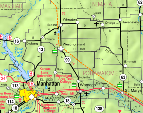
Geography

According to the U.S. Census Bureau, the county has a total area of 862 square miles (2,230 km2), of which 841 square miles (2,180 km2) is land and 21 square miles (54 km2) (2.4%) is water. [4]

Adjacent counties

Demographics

Population pyramid based on 2000 census age data USA Pottawatomie County, Kansas age pyramid.svg
Population pyramid based on 2000 census age data
Historical population
CensusPop.Note
1860 1,529
1870 7,848413.3%
1880 16,350108.3%
1890 17,7228.4%
1900 18,4704.2%
1910 17,522−5.1%
1920 16,154−7.8%
1930 15,862−1.8%
1940 14,015−11.6%
1950 12,344−11.9%
1960 11,957−3.1%
1970 11,755−1.7%
1980 14,78225.8%
1990 16,1289.1%
2000 18,20912.9%
2010 21,60418.6%
2020 25,34817.3%
2023 (est.)26,382 [5] 4.1%
U.S. Decennial Census [6]
1790-1960 [7] 1900-1990 [8]
1990-2000 [9] 2010-2020 [1]

Pottawatomie County is part of the Manhattan Metropolitan Statistical Area.

As of the census [10] of 2000, there were 18,209 people, 6,771 households, and 4,929 families residing in the county. The population density was 22 people per square mile (8.5 people/km2). There were 7,311 housing units at an average density of 9 per square mile (3.5/km2). The racial makeup of the county was 96.32% White, 0.66% Black or African American, 0.59% Native American, 0.32% Asian, 0.01% Pacific Islander, 0.60% from other races, and 1.50% from two or more races. 2.26% of the population were Hispanic or Latino of any race.

There were 6,771 households, out of which 36.40% had children under the age of 18 living with them, 62.40% were married couples living together, 7.20% had a female householder with no husband present, and 27.20% were non-families. 23.20% of all households were made up of individuals, and 9.70% had someone living alone who was 65 years of age or older. The average household size was 2.65 and the average family size was 3.15.

In the county, the population was spread out, with 29.50% under the age of 18, 7.70% from 18 to 24, 27.70% from 25 to 44, 21.60% from 45 to 64, and 13.50% who were 65 years of age or older. The median age was 36 years. For every 100 females, there were 98.00 males. For every 100 females age 18 and over, there were 96.70 males.

The median income for a household in the county was $40,176, and the median income for a family was $47,261. Males had a median income of $31,368 versus $23,238 for females. The per capita income for the county was $17,785. About 6.40% of families and 9.70% of the population were below the poverty line, including 14.10% of those under age 18 and 10.30% of those age 65 or over.

Government

Presidential elections

Presidential election results
United States presidential election results for Pottawatomie County, Kansas [11]
Year Republican Democratic Third party
No.%No.%No.%
2020 9,45272.25%3,31325.32%3182.43%
2016 7,61271.19%2,22520.81%8568.01%
2012 6,80471.78%2,33524.63%3403.59%
2008 6,92970.15%2,59926.31%3493.53%
2004 6,32671.70%2,17624.66%3213.64%
2000 4,98564.48%2,03726.35%7099.17%
1996 4,50458.16%1,99725.79%1,24316.05%
1992 3,10638.87%2,09926.27%2,78534.86%
1988 3,89759.51%2,54438.85%1081.65%
1984 4,59871.09%1,79827.80%721.11%
1980 3,89563.40%1,72428.06%5258.54%
1976 3,48359.06%2,31639.27%981.66%
1972 3,94773.51%1,29824.18%1242.31%
1968 3,26763.68%1,36826.67%4959.65%
1964 2,60651.40%2,43247.97%320.63%
1960 3,66663.16%2,12536.61%130.22%
1956 4,33574.97%1,42224.59%250.43%
1952 4,94477.94%1,38721.87%120.19%
1948 3,70962.64%2,16736.60%450.76%
1944 4,07470.01%1,72729.68%180.31%
1940 5,04569.12%2,22630.50%280.38%
1936 3,97753.76%3,28444.39%1371.85%
1932 3,33945.45%3,91053.23%971.32%
1928 4,45165.30%2,34134.35%240.35%
1924 4,34068.28%1,47123.14%5458.57%
1920 4,48176.95%1,29322.21%490.84%
1916 3,68855.66%2,83442.77%1041.57%
1912 1,05825.09%1,59937.93%1,55936.98%
1908 2,65060.78%1,68038.53%300.69%
1904 2,63269.85%1,04527.73%912.42%
1900 2,55656.41%1,92942.57%461.02%
1896 2,30849.95%2,27649.25%370.80%
1892 2,10749.80%00.00%2,12450.20%
1888 2,41958.94%1,47135.84%2145.21%

Typical of rural Kansas, Pottawatomie County is mostly Republican. The only Democratic presidential candidate to gain a majority in Pottawatomie County has been Franklin D. Roosevelt in 1932, while since 1940 only Lyndon Johnson in 1964 has received so much as forty percent of the county's vote.

Laws

Pottawatomie County was a prohibition, or "dry", county until the Kansas Constitution was amended in 1986 and voters approved the sale of alcoholic liquor by the individual drink with a 30% food sales requirement. [12]

Education

St. Columbkillane Church in Blaine St. Columbkillane Church.JPG
St. Columbkillane Church in Blaine

Unified school districts

The Unified School Districts that serve Pottawatomie County include:

School district office in neighboring county

Private schools

Communities

2005 KDOT Map of Pottawatomie County (map legend) Map of Pottawatomie Co, Ks, USA.png
2005 KDOT Map of Pottawatomie County (map legend)

‡ means a community has portions in an adjacent county.

Cities

Unincorporated communities

Former communities

Prior to the creation of Tuttle Creek Lake, the community of Garrison existed in west central Pottawatomie County.

Townships

Pottawatomie County is divided into twenty-three townships. The city of Manhattan is considered governmentally independent and is excluded from the census figures for the townships. In the following table, the population center is the largest city (or cities) included in that township's population total, if it is of a significant size.

Sources: 2000 U.S. Gazetteer from the U.S. Census Bureau.
Township FIPS Population
center
PopulationPopulation
density
/km2 (/sq mi)
Land area
km2 (sq mi)
Water area
km2 (sq mi)
Water %Geographic coordinates
Belvue059504044 (11)96 (37)1 (0)1.05% 39°14′7″N96°11′21″W / 39.23528°N 96.18917°W / 39.23528; -96.18917
Blue075501,80216 (41)114 (44)14 (5)10.66% 39°13′44″N96°31′49″W / 39.22889°N 96.53028°W / 39.22889; -96.53028
Blue Valley077253393 (8)115 (44)13 (5)9.95% 39°26′22″N96°38′6″W / 39.43944°N 96.63500°W / 39.43944; -96.63500
Center120001041 (3)78 (30)0 (0)0.04% 39°21′4″N96°14′10″W / 39.35111°N 96.23611°W / 39.35111; -96.23611
Clear Creek138001131 (3)93 (36)0 (0)0.03% 39°31′6″N96°23′36″W / 39.51833°N 96.39333°W / 39.51833; -96.39333
Emmett211254786 (16)77 (30)0 (0)0.61% 39°18′11″N96°3′46″W / 39.30306°N 96.06278°W / 39.30306; -96.06278
Grant279502934 (10)77 (30)0 (0)0% 39°31′27″N96°5′4″W / 39.52417°N 96.08444°W / 39.52417; -96.08444
Green284501882 (4)125 (48)14 (5)9.91% 39°21′14″N96°36′6″W / 39.35389°N 96.60167°W / 39.35389; -96.60167
Lincoln410001242 (4)77 (30)0 (0)0.18% 39°25′37″N96°3′26″W / 39.42694°N 96.05722°W / 39.42694; -96.05722
Lone Tree425502393 (7)93 (36)0 (0)0% 39°30′54″N96°18′18″W / 39.51500°N 96.30500°W / 39.51500; -96.30500
Louisville429507358 (20)95 (37)0 (0)0.04% 39°15′40″N96°19′10″W / 39.26111°N 96.31944°W / 39.26111; -96.31944
Mill Creek467001,0009 (24)108 (42)0 (0)0% 39°30′11″N96°10′50″W / 39.50306°N 96.18056°W / 39.50306; -96.18056
Pottawatomie572504993 (8)155 (60)0 (0)0.02% 39°20′5″N96°26′26″W / 39.33472°N 96.44056°W / 39.33472; -96.44056
Rock Creek606256537 (18)93 (36)0 (0)0.19% 39°25′41″N96°24′10″W / 39.42806°N 96.40278°W / 39.42806; -96.40278
St. Clere62150831 (3)77 (30)0 (0)0.21% 39°21′36″N96°5′30″W / 39.36000°N 96.09167°W / 39.36000; -96.09167
St. George622252,62930 (79)87 (33)1 (1)1.69% 39°11′46″N96°24′56″W / 39.19611°N 96.41556°W / 39.19611; -96.41556
St. Marys624252,78928 (73)99 (38)1 (0)0.60% 39°11′58″N96°4′19″W / 39.19944°N 96.07194°W / 39.19944; -96.07194
Shannon643002352 (6)104 (40)0 (0)0.08% 39°26′19″N96°30′50″W / 39.43861°N 96.51389°W / 39.43861; -96.51389
Sherman650501261 (3)94 (36)0 (0)0.02% 39°25′54″N96°17′29″W / 39.43167°N 96.29139°W / 39.43167; -96.29139
Spring Creek67475611 (2)103 (40)0 (0)0.08% 39°31′50″N96°31′19″W / 39.53056°N 96.52194°W / 39.53056; -96.52194
Union722501642 (5)94 (36)0 (0)0.03% 39°20′20″N96°19′34″W / 39.33889°N 96.32611°W / 39.33889; -96.32611
Vienna73875921 (3)78 (30)0 (0)0.03% 39°25′40″N96°10′28″W / 39.42778°N 96.17444°W / 39.42778; -96.17444
Wamego753505,056100 (260)50 (19)2 (1)3.20% 39°12′19″N96°18′20″W / 39.20528°N 96.30556°W / 39.20528; -96.30556

See also

Community information for Kansas

Related Research Articles

<span class="mw-page-title-main">Washington County, Kansas</span> County in Kansas, United States

Washington County is a county located in the U.S. state of Kansas. Its county seat and largest city is Washington. As of the 2020 census, the county population was 5,530. The county was named for George Washington, the 1st president of the United States.

<span class="mw-page-title-main">Wabaunsee County, Kansas</span> County in Kansas, United States

Wabaunsee County is a county located in the U.S. state of Kansas. Its county seat is Alma. As of the 2020 census, the county population was 6,877. The county was named for Chief Waubonsie of the Potawatomi Indians.

<span class="mw-page-title-main">Trego County, Kansas</span> County in Kansas, United States

Trego County is a county located in the U.S. state of Kansas. Its county seat and largest city is WaKeeney. As of the 2020 census, the county population was 2,808. The county was named for Edgar Trego.

<span class="mw-page-title-main">Seward County, Kansas</span> County in Kansas, United States

Seward County is a county of the U.S. state of Kansas. Its county seat and largest city is Liberal. As of the 2020 census, the county population was 21,964. The county was formed on March 20, 1873, and named after William Seward, a politician and Secretary of State under Abraham Lincoln and Andrew Johnson.

<span class="mw-page-title-main">Riley County, Kansas</span> County in Kansas, United States

Riley County is a county located in the U.S. state of Kansas. Its county seat and largest city is Manhattan. As of the 2020 census, the population was 71,959. The county was named after Bennet Riley, the 7th governor of California, and a Mexican–American War hero. Riley County is home to Fort Riley and Kansas State University.

<span class="mw-page-title-main">Phillips County, Kansas</span> County in Kansas, United States

Phillips County is a county located in the U.S. state of Kansas. Its county seat and largest city is Phillipsburg. As of the 2020 census, the county population was 4,981. The county was named after William Phillips, a free-state abolition journalist and colonel in the American Civil War.

<span class="mw-page-title-main">Osage County, Kansas</span> County in Kansas, United States

Osage County is a county located in the U.S. state of Kansas. Its county seat is Lyndon, and its most populous city is Osage City. As of the 2020 census, the county population was 15,766. The county was originally organized in 1855 as Weller County, then renamed in 1859 after the Osage tribe.

<span class="mw-page-title-main">Nemaha County, Kansas</span> County in Kansas, United States

Nemaha County is a county located in the northeastern part of the U.S. state of Kansas. Its county seat is Seneca. As of the 2020 census, the county population was 10,273. The county was named for the Nemaha River.

<span class="mw-page-title-main">Marshall County, Kansas</span> County in Kansas, United States

Marshall County is a county located in the U.S. state of Kansas. Its county seat and largest city is Marysville. As of the 2020 census, the county population was 10,038. The county was named after Frank J. Marshall, a state representative who operated the first ferry over the Big Blue River.

<span class="mw-page-title-main">Jefferson County, Kansas</span> County in Kansas, United States

Jefferson County is a county located in the U.S. state of Kansas. Its county seat and most populous city is Oskaloosa. As of the 2020 census, the county population was 18,368. The county was named after Thomas Jefferson, the 3rd president of the United States.

<span class="mw-page-title-main">Jackson County, Kansas</span> County in Kansas, United States

Jackson County is a county in the U.S. state of Kansas. Its county seat and most populous city is Holton. As of the 2020 census, the county population was 13,232. The county, first named Calhoun County for pro-slavery South Carolina Senator John C. Calhoun, was renamed in 1859 for President Andrew Jackson. The Prairie Band Potawatomi Indian Reservation, near the center of the county, comprises about 18.5% of the county's area.

<span class="mw-page-title-main">Gove County, Kansas</span> County in Kansas, United States

Gove County is a county in the U.S. state of Kansas. Its county seat is Gove City, and its most populous city is Quinter. As of the 2020 census, the county population was 2,718. The county was named for Granville Gove, a captain of Company G of the 11th Kansas Cavalry Regiment Volunteer Cavalry, who died from battle wounds during the American Civil War.

<span class="mw-page-title-main">Geary County, Kansas</span> County in Kansas, United States

Geary County is a county located in the U.S. state of Kansas. Its county seat and most populous city is Junction City. As of the 2020 census, the county population was 36,739. The county is named in honor of John Geary, the first mayor of San Francisco, a governor of the Kansas Territory, and the 16th governor of Pennsylvania.

<span class="mw-page-title-main">Cherokee County, Kansas</span> County in Kansas, United States

Cherokee County is a U.S. county located in Southeast Kansas. Its county seat is Columbus, and its most populous city is Baxter Springs. As of the 2020 census, the county population was 19,362. The county was named for the Cherokee tribe.

<span class="mw-page-title-main">Chautauqua County, Kansas</span> County in Kansas, United States

Chautauqua County is a county located in Southeast Kansas, United States. Its county seat and most populous city is Sedan. As of the 2020 census, the county population was 3,379. The county is named for Chautauqua County, New York, the birthplace of Edward Jaquins, a Kansas politician who was instrumental in getting the county established.

<span class="mw-page-title-main">Louisville, Kansas</span> City in Pottawatomie County, Kansas

Louisville is a city in Pottawatomie County, Kansas, United States. As of the 2020 census, the population of the city was 131.

<span class="mw-page-title-main">Onaga, Kansas</span> City in Pottawatomie County, Kansas

Onaga is a city in Pottawatomie County, Kansas, United States. As of the 2020 census, the population of the city was 679.

<span class="mw-page-title-main">St. George, Kansas</span> City in Pottawatomie County, Kansas

St. George or Saint George is a city in Pottawatomie County, Kansas, United States. As of the 2020 census, the population of the city was 1,054. The name might have been intended to honor several pioneer settlers named George.

<span class="mw-page-title-main">Westmoreland, Kansas</span> City in Pottawatomie County, Kansas

Westmoreland is a city in and the county seat of Pottawatomie County, Kansas, United States. As of the 2020 census, the population of the city was 740.

<span class="mw-page-title-main">Wheaton, Kansas</span> City in Pottawatomie County, Kansas

Wheaton is a city in Pottawatomie County, Kansas, United States. As of the 2020 census, the population of the city was 98.

References

  1. 1 2 3 "QuickFacts; Pottawatomie County, Kansas; Population, Census, 2020 & 2010". United States Census Bureau. Archived from the original on August 19, 2021. Retrieved August 19, 2021.
  2. "County Population Totals: 2020-2021". United States Census Bureau. March 24, 2022. Retrieved June 3, 2022.
  3. "Find a County". National Association of Counties. Retrieved June 7, 2011.
  4. "US Gazetteer files: 2010, 2000, and 1990". United States Census Bureau. February 12, 2011. Retrieved April 23, 2011.
  5. "Annual Estimates of the Resident Population for Counties: April 1, 2020 to July 1, 2023". United States Census Bureau. Retrieved April 3, 2024.
  6. "U.S. Decennial Census". United States Census Bureau. Retrieved July 28, 2014.
  7. "Historical Census Browser". University of Virginia Library. Retrieved July 28, 2014.
  8. "Population of Counties by Decennial Census: 1900 to 1990". United States Census Bureau. Retrieved July 28, 2014.
  9. "Census 2000 PHC-T-4. Ranking Tables for Counties: 1990 and 2000" (PDF). United States Census Bureau. Archived (PDF) from the original on March 27, 2010. Retrieved July 28, 2014.
  10. "U.S. Census website". United States Census Bureau . Retrieved January 31, 2008.
  11. "Dave Leip's Atlas of U.S. Presidential Elections".
  12. "Map of Wet and Dry Counties". Alcoholic Beverage Control, Kansas Department of Revenue. November 2006. Archived from the original on October 8, 2007. Retrieved December 28, 2007.
Notes

    Further reading

    County
    Maps

    39°20′N96°18′W / 39.333°N 96.300°W / 39.333; -96.300