In 1854, the Kansas Territory was organized, then in 1861 Kansas became the 34th U.S. state. In 1855, Douglas County was established. Douglas County was opened for settlement on May 15, 1854, and was named for Stephen A. Douglas,[4] a senator from Illinois. The county was practically at the center of the Bleeding Kansas years as leaders in Lecompton (the territorial capital) wanted Kansas to be a slave state, whereas leaders in Lawrence wanted Kansas to be a free state. The pro- and anti-slavery settlers held great animosity towards one another, leading to many events, such as the drafting of the Lecompton Constitution (which would have admitted Kansas into the Union as a slave state), the Wakarusa War (1855), the Sack of Lawrence (1856), Battle of Black Jack (1856), and the Lawrence Massacre (1863).
The first railroad in Douglas County, the Kansas Pacific, was built through that territory in 1864.[5]
Geography
Lone Star Lake, which is in southwestern Douglas County.
According to the United States Census Bureau, the county has a total area of 475 square miles (1,230km2), of which 456 square miles (1,180km2) is land and 19 square miles (49km2) (4.0%) is water.[6] It is the fifth-smallest county in Kansas by land area. Much of its northern boundary is defined by the Kansas River, which flows through Lawrence and provides hydropower at the Bowersock Dam.
As of the census of 2000, there were 99,962 people, 38,486 households, and 21,167 families residing in the county. The population density was 219 peopleper square mile (85 people/km2). There were 40,250 housing units at an average density of 88 per square mile (34/km2). The racial makeup of the county was 86.1% White, 4.2% Black or African American, 2.6% Native American, 3.1% Asian, 0.1% Pacific Islander, 1.2% from other races, and 2.7% from two or more races. Hispanic or Latino of any race were 3.3% of the population.
There were 38,486 households, out of which 27.4% had children under the age of 18 living with them, 43.1% were married couples living together, 8.5% had a female householder with no husband present, and 45.0% were non-families. 28.5% of all households were made up of individuals, and 5.8% had someone living alone who was 65 years of age or older. The average household size was 2.37 and the average family size was 2.97.
In the county, the population was spread out, with 20.4% under the age of 18, 26.4% from 18 to 24, 28.3% from 25 to 44, 16.9% from 45 to 64, and 7.9% who were 65 years of age or older. The median age was 27 years. For every 100 females there were 98.70 males. For every 100 females age 18 and over, there were 97.70 males.
The median income for a household in the county was $37,547, and the median income for a family was $53,991. Males had a median income of $35,577 versus $27,225 for females. The per capita income for the county was $19,952. About 6.2% of families and 15.9% of the population were below the poverty line, including 9.0% of those under age 18 and 7.3% of those age 65 or over.
Government
County
In recent years, since the 1990s, the Democratic Party has been dominant in Douglas County. Democrats control all County-wide offices in the county. Douglas County is currently served by county commissioners Patrick Kelly, Shannon Reid, Karen Willey, Gene Dorsey, and Erica Anderson, all Democrats.[12] According to the Kansas Secretary of State's office, as of July 2021, there were 35,146 registered Democrats, 22,324 registered Republicans, 900 registered Libertarians, and 21,474 Independents in the county.[13]
Douglas County has a political history more typical of Vermont and Maine than of the Great Plains. This is due to the county's strong New England roots. It voted for the Republican candidate in every presidential election between 1864 and 1960, except in 1912 when the GOP was mortally divided and the county supported ProgressiveTheodore Roosevelt. Roosevelt would later rejoin the GOP. The county reverted to form and gave Republican presidential nominees over 60 percent of the vote in every election between 1920 and 1960 (except 1932 when Herbert Hoover received 58.7 percent). Notably, it was one of the few counties where Franklin D. Roosevelt was shut out in all four of his successful campaigns for president; in FDR's national landslide of 1936, Douglas was his weakest county and the second-best for Republican nominee and Kansas Governor Alf Landon.
This tradition was broken in 1964, when the conservative sentiment and Western origins of Barry Goldwater drove the county into Lyndon B. Johnson's hands, making Johnson the first Democrat ever to carry the county. Even then, however, Goldwater managed 45 percent of the county's vote. With more moderate GOP candidates, the GOP carried the county in every election between 1968 and 1988. During this time, Jimmy Carter in 1976 and Michael Dukakis in 1988 were the only Democrats to come reasonably close to carrying the county.
However, the growing transformation of Lawrence into a liberal academic center has pulled the county into the Democratic column in every election since 1992. This was typical of many counties around the country dominated by college towns. In 2004, John Kerry became only the second Democrat to win a majority of the county's vote. Since then, Douglas County has been one of the most Democratic counties in Kansas; only Wyandotte County has been more Democratic. In 2016, 2020, and 2024, for instance, Donald Trump turned in the worst showings on record for a Republican in the county without the presence of a credible third-party challenger on the ballot.
The Douglas County Sheriff's office has two divisions, Corrections, which operates a 185-bed jail, and Operations. The Operations Division includes a dive team, a patrol, and a warrants unit.[17] The department works with other local police agencies at the University of Kansas, Lawrence Police Department, Eudora, and Baldwin City.[17]As of 2021[update] the sheriff is Jay T. Armbrister.[17]
Education
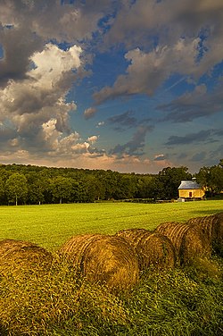
Scenic view of Rural Douglas County
Universities
Baker University, the state's oldest university, is located in Baldwin City.
Clinton Lake, completed in 1980, offers boating, fishing and other water sports and various parks surrounding the lake provides camping and trails for mountain biking, hiking and horseback riding.[19]
Lone Star Lake is a small country lake to the southwest of Lawrence offers fishing, boating and camping. Just northeast of Baldwin City is Douglas State Fishing Lake which provides hunting, fishing and limited camping. Other parks around the county include Black Jack Park which includes the Ivan Boyd Prairie Preserve and Robert Hall Pearson Memorial Park, Broken Arrow Park in Lawrence and Wells Overlook Park just south of Lawrence.[20]
K-10 runs from the I-70 Lecompton Exchange along the south and west border of Lawrence to US-59 then north until 23rd Street where it heads east out of town into Johnson County.
Other major highways include:
US-24 which is in Grant township leading from Leavenworth to Jefferson County.
K-32 starts just outside Lawrence and leads into Leavenworth County.
K-33 is in extreme southeast Douglas County and leads into Franklin County.
Douglas County also maintains an extensive network of county highways to serve the rural areas of the county. None of these county highways is in the Lawrence city limits.
Douglas County is divided into nine townships. The city of Lawrence is considered governmentally independent and is excluded from the census figures for the townships. In the following table, the population center is the largest city (or cities) of significant size included in that township's population total.
Map of Douglas County, 1889, from History of Kansas.
Historic townships
The county originally had only four townships. Lecompton comprised the area of Lecompton, Kanwaka, and Clinton townships; Washington took the place of Marion and Willow Springs townships; Wakarusa comprised both Wakarusa and Eudora townships; and Calhoun was the original name of Palmyra township. Grant township was annexed from Jefferson County in 1874.
Armitage, Katie H., "'Seeking a Home Where He Himself Is Free': African Americans Build a Community in Douglas County, Kansas," Kansas History, 31 (Autumn 2008), 154–75
This page is based on this Wikipedia article Text is available under the CC BY-SA 4.0 license; additional terms may apply. Images, videos and audio are available under their respective licenses.