Wallace County, Kansas

Last updated

Wallace County
Wallace County, Kansas courthouse from S 1.JPG
Wallace County Courthouse in Sharon Springs (2010)
Map of Kansas highlighting Wallace County.svg
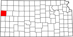
Location within the U.S. state of Kansas
Kansas in United States.svg
Kansas's location within the U.S.
Coordinates: 38°45′52″N101°34′33″W / 38.7644°N 101.5758°W / 38.7644; -101.5758
CountryFlag of the United States.svg United States
StateFlag of Kansas.svg Kansas
Founded1868
Named after W. H. L. Wallace
Seat Sharon Springs
Largest citySharon Springs
Area
  Total
914 sq mi (2,370 km2)
  Land914 sq mi (2,370 km2)
  Water0.05 sq mi (0.1 km2)  0.01%
Population
 (2020) [1]
  Total
1,512
  Estimate 
(2021) [2]
1,508 Decrease2.svg
  Density1.7/sq mi (0.7/km2)
Time zone UTC−7 (Mountain)
  Summer (DST) UTC−6 (MDT)
Congressional district 1st
Website wallacecountyks.gov

Wallace County is a county located in the U.S. state of Kansas. Its county seat is Sharon Springs. [3] As of the 2020 census, the county population was 1,512, [1] making it the second-least populous county in Kansas (Greeley County is the least). The county was created in 1868 and named in honor of Brigadier General W.H.L. Wallace, who had been mortally wounded in combat in the Battle of Shiloh. Wallace County is home to Mount Sunflower, the highest point in Kansas at 4,039 feet (1,231 meters). Mount Sunflower is located approximately 15 miles (24 km) north-northwest of Weskan, less than one mile (1.6 km) from the Colorado state line. It is one of four Kansas counties to use the Mountain Time Zone rather than the Central Time Zone like the remainder of Kansas.

Contents

History

Early history

For many millennia, the Great Plains of North America was inhabited by nomadic Native Americans. From the 16th century to 18th century, the Kingdom of France claimed ownership of large parts of North America. In 1762, after the French and Indian War, France secretly ceded New France to Spain, per the Treaty of Fontainebleau.

19th century

In 1802, Spain returned most of the land to France, but keeping title to about 7,500 square miles. In 1803, most of the land for modern day Kansas was acquired by the United States from France as part of the 828,000 square mile Louisiana Purchase for 2.83 cents per acre.

In 1854, the Kansas Territory was organized, then in 1861 Kansas became the 34th U.S. state. In 1868, Wallace County was established.

Geography

According to the United States Census Bureau, the county has a total area of 914 square miles (2,370 km2), of which 914 square miles (2,370 km2) is land and 0.05 square miles (0.13 km2) (0.01%) is water. [4]

Adjacent counties

Demographics

Population pyramid based on 2000 census age data USA Wallace County, Kansas age pyramid.svg
Population pyramid based on 2000 census age data
Historical population
CensusPop.Note
1870 538
1880 68627.5%
1890 2,468259.8%
1900 1,178−52.3%
1910 2,759134.2%
1920 2,424−12.1%
1930 2,88218.9%
1940 2,216−23.1%
1950 2,50813.2%
1960 2,069−17.5%
1970 2,2157.1%
1980 2,045−7.7%
1990 1,821−11.0%
2000 1,749−4.0%
2010 1,485−15.1%
2020 1,5121.8%
2023 (est.)1,509 [5] −0.2%
U.S. Decennial Census [6]
1790-1960 [7] 1900-1990 [8]
1990-2000 [9] 2010-2020 [1]

As of the census of 2000, there were 1,749 people, 674 households, and 477 families residing in the county. The population density was 2 people per square mile (0.77 people/km2). There were 791 housing units at an average density of 1 per square mile (0.39/km2). The racial makeup of the county was 94.63% White, 0.63% Black or African American, 0.80% Native American, 0.17% Asian, 2.52% from other races, and 1.26% from two or more races. 4.80% of the population were Hispanic or Latino of any race.

There were 674 households, out of which 33.80% had children under the age of 18 living with them, 63.60% were married couples living together, 4.00% had a female householder with no husband present, and 29.20% were non-families. 27.60% of all households were made up of individuals, and 13.60% had someone living alone who was 65 years of age or older. The average household size was 2.56 and the average family size was 3.12.

In the county, the population was spread out, with 29.10% under the age of 18, 6.50% from 18 to 24, 23.60% from 25 to 44, 22.80% from 45 to 64, and 18.10% who were 65 years of age or older. The median age was 40 years. For every 100 females there were 99.00 males. For every 100 females age 18 and over, there were 99.40 males.

The median income for a household in the county was $33,000, and the median income for a family was $42,022. Males had a median income of $25,610 versus $18,333 for females. The per capita income for the county was $17,016. About 10.70% of families and 16.10% of the population were below the poverty line, including 24.50% of those under age 18 and 12.70% of those age 65 or over.

Government

Presidential elections

Presidential election results
United States presidential election results for Wallace County, Kansas [10]
Year Republican Democratic Third party(ies)
No.%No.%No.%
1888 41265.71%19831.58%172.71%
1892 37755.93%00.00%29744.07%
1896 18159.34%12440.66%00.00%
1900 21266.25%10231.88%61.88%
1904 27883.99%3911.78%144.23%
1908 35059.32%20634.92%345.76%
1912 8115.17%15228.46%30156.37%
1916 38139.48%49751.50%879.02%
1920 63270.38%20322.61%637.02%
1924 60353.70%17115.23%34931.08%
1928 73866.19%35631.93%211.88%
1932 56140.27%76154.63%715.10%
1936 65856.68%49242.38%110.95%
1940 75667.08%36132.03%100.89%
1944 72070.80%29228.71%50.49%
1948 63758.23%43940.13%181.65%
1952 94578.82%24920.77%50.42%
1956 68472.69%25126.67%60.64%
1960 72768.20%33931.80%00.00%
1964 51650.69%49648.72%60.59%
1968 60861.54%23523.79%14514.68%
1972 78273.22%21420.04%726.74%
1976 60052.77%48642.74%514.49%
1980 81178.28%16716.12%585.60%
1984 83882.97%15215.05%201.98%
1988 65569.61%25727.31%293.08%
1992 67963.70%16415.38%22320.92%
1996 73876.24%16016.53%707.23%
2000 73785.60%10311.96%212.44%
2004 74284.70%11212.79%222.51%
2008 69085.82%9611.94%182.24%
2012 71990.10%688.52%111.38%
2016 72190.35%465.76%313.88%
2020 77093.33%445.33%111.33%
2024 68691.71%526.95%101.34%

Wallace has long been one of the most overwhelmingly Republican of all the state's counties. Only two Democratic presidential nominees have ever won Wallace County – Woodrow Wilson in 1916 and Franklin D. Roosevelt in 1932. Since 1944 only three Democratic presidential candidates have won 31 percent of Wallace County's vote – Harry S. Truman in 1948, Lyndon Johnson in 1964 and Jimmy Carter in 1976 – whilst since 1980 only Michael Dukakis during the drought-affected 1988 election has obtained so much as seventeen percent for the Democratic Party. Indeed, in the 2016 election Hillary Clinton recorded less than six percent of the county's vote, whilst the last seven Republican nominees have all exceeded 80 percent. In the 2012, 2016, 2020, and 2024 elections, Wallace was the only county in Kansas to give over 90% of the vote to the Republican nominee, namely Mitt Romney followed by Donald Trump.

Laws

Although the Kansas Constitution was amended in 1986 to allow the sale of alcoholic liquor by the individual drink with the approval of voters, Wallace County has remained a prohibition, or "dry", county, the only such county remaining in the state as of March 2023. [11]

Education

Unified school districts

Communities

2005 map of Wallace County (legend) Map of Wallace Co, Ks, USA.png
2005 map of Wallace County (legend)
"Mount Sunflower," the highest point in Kansas, is located in Wallace County Mount Sunflower KS Summit.jpg
"Mount Sunflower," the highest point in Kansas, is located in Wallace County

List of townships / incorporated cities / unincorporated communities / extinct former communities within Wallace County. [12]
† means a community is designated a Census-Designated Place (CDP) by the United States Census Bureau.

Cities

Unincorporated communities

Townships

Wallace County is divided into four townships. None of the cities within the county are considered governmentally independent, and all figures for the townships include those of the cities. In the following table, the population center is the largest city (or cities) included in that township's population total, if it is of a significant size.

Sources: 2000 U.S. Gazetteer from the U.S. Census Bureau.
Township FIPS Population
center
PopulationPopulation
density
/km2 (/sq mi)
Land area
km2 (sq mi)
Water area
km2 (sq mi)
Water %Geographic coordinates
Harrison30450850 (1)210 (81)0 (0)0% 38°45′53″N101°34′34″W / 38.76472°N 101.57611°W / 38.76472; -101.57611
Sharon Springs64400 Sharon Springs 1,0961 (3)885 (342)0 (0)0% 38°54′12″N101°45′3″W / 38.90333°N 101.75083°W / 38.90333; -101.75083
Wallace74775Wallace1750 (1)488 (188)0 (0)0.01% 38°58′15″N101°33′35″W / 38.97083°N 101.55972°W / 38.97083; -101.55972
Weskan76700Weskan3931 (1)784 (303)0 (0)0.01% 38°53′8″N101°56′10″W / 38.88556°N 101.93611°W / 38.88556; -101.93611

See also

Community information for Kansas

References

  1. 1 2 3 "QuickFacts; Wallace County, Kansas; Population, Census, 2020 & 2010". United States Census Bureau. Archived from the original on August 22, 2021. Retrieved August 21, 2021.
  2. "Annual Estimates of the Resident Population for Counties: April 1, 2020 to July 1, 2021" . Retrieved October 23, 2022.
  3. "Find a County". National Association of Counties. Retrieved June 7, 2011.
  4. "US Gazetteer files: 2010, 2000, and 1990". United States Census Bureau. February 12, 2011. Retrieved April 23, 2011.
  5. "Annual Estimates of the Resident Population for Counties: April 1, 2020 to July 1, 2023". United States Census Bureau. Retrieved April 3, 2024.
  6. "U.S. Decennial Census". United States Census Bureau. Retrieved July 29, 2014.
  7. "Historical Census Browser". University of Virginia Library. Retrieved July 29, 2014.
  8. "Population of Counties by Decennial Census: 1900 to 1990". United States Census Bureau. Retrieved July 29, 2014.
  9. "Census 2000 PHC-T-4. Ranking Tables for Counties: 1990 and 2000" (PDF). United States Census Bureau. Archived (PDF) from the original on March 27, 2010. Retrieved July 29, 2014.
  10. "Dave Leip's Atlas of U.S. Presidential Elections".
  11. "Map of Wet and Dry Counties" (PDF). Kansas Department of Revenue Alcoholic Beverage Control. March 1, 2023. Archived (PDF) from the original on October 7, 2023. Retrieved December 4, 2023.
  12. 1 2 "General Highway Map of Wallace County, Kansas" (PDF). Kansas Department of Transportation (KDOT). July 2010. Archived (PDF) from the original on July 23, 2023.

Further reading

County
Maps

38°55′N101°46′W / 38.917°N 101.767°W / 38.917; -101.767