Norton County, Kansas

Last updated

Norton County
Norton Co KS Courthouse.JPG
Map of Kansas highlighting Norton County.svg
Location within the U.S. state of Kansas
Kansas in United States.svg
Kansas's location within the U.S.
Coordinates: 39°48′N99°55′W / 39.800°N 99.917°W / 39.800; -99.917
CountryFlag of the United States.svg United States
StateFlag of Kansas.svg  Kansas
FoundedFebruary 26, 1867
Named for Orloff Norton
Seat Norton
Largest cityNorton
Area
  Total881 sq mi (2,280 km2)
  Land878 sq mi (2,270 km2)
  Water3.2 sq mi (8 km2)  0.4%
Population
 (2020) [1]
  Total5,459
  Density6.2/sq mi (2.4/km2)
Time zone UTC−6 (Central)
  Summer (DST) UTC−5 (CDT)
Area code 785
Congressional district 1st
Website nortoncounty.org

Norton County is a county located in the U.S. state of Kansas. Its county seat and largest city is Norton. [2] As of the 2020 census, the county population was 5,459. [1] The county was established in 1867 and named for Orloff Norton, captain of Company L, 15th Kansas Militia Infantry Regiment. [3]

Contents

History

Early history

For many millennia, the Great Plains of North America was inhabited by nomadic Native Americans. From the 16th century to 18th century, the Kingdom of France claimed ownership of large parts of North America. In 1762, after the French and Indian War, France secretly ceded New France to Spain, per the Treaty of Fontainebleau.

19th century

In 1802, Spain returned most of the land to France, but keeping title to about 7,500 square miles. In 1803, most of the land for modern day Kansas was acquired by the United States from France as part of the 828,000 square mile Louisiana Purchase for 2.83 cents per acre.

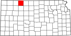
In 1854, the Kansas Territory was organized, then in 1861 Kansas became the 34th U.S. state. Norton County was founded by Noah H. Billings, Thomas Beaumont, Henry Gordon, P. Hansen, and George Cole on August 22, 1872. In 1878 Norton became the county seat. The county gets its name for Civil War soldier Orloff Norton, who was killed at Cane Hill, Arkansas in 1864. [4]

The first county fair, although not official, was held in Leota in October 1878. After 1900 the fair was held yearly in Elmwood Park in Norton. The first school district was formed in Norton in 1872. School was held in a dugout beginning December 1, 1873. [5]

21st century

In 2020, Norton County became a major hotspot in the COVID-19 pandemic. In July, an inmate at the Norton Correctional Facility, a state prison, tested positive for coronavirus. [6] By mid-October, more than 130 cases had been reported at the prison. [7] On October 19, officials announced that all 62 residents of the Andbe Home nursing home in Norton had tested positive for COVID-19, 10 of whom had died. [8] As of October 20, Norton County had the highest rate of infection over the previous 7 and 14 days of any county in the United States. [9] [10]

Geography

According to the U.S. Census Bureau, the county has a total area of 881 square miles (2,280 km2), of which 878 square miles (2,270 km2) is land and 3.2 square miles (8.3 km2) (0.4%) is water. [11]

Adjacent counties

Demographics

Population pyramid based on 2000 census age data USA Norton County, Kansas age pyramid.svg
Population pyramid based on 2000 census age data
Historical population
CensusPop.Note
1880 6,998
1890 10,61751.7%
1900 11,3256.7%
1910 11,6142.6%
1920 11,423−1.6%
1930 11,7012.4%
1940 9,831−16.0%
1950 8,808−10.4%
1960 8,035−8.8%
1970 7,279−9.4%
1980 6,689−8.1%
1990 5,947−11.1%
2000 5,9530.1%
2010 5,671−4.7%
2020 5,459−3.7%
2023 (est.)5,330 [12] −2.4%
U.S. Decennial Census [13]
1790–1960 [14] 1900–1990 [15]
1990–2000 [16] 2010–2020 [1]

As of the 2000 US census, there were 5,953 people, 2,266 households, and 1,470 families residing in the county. The population density was 7 people per square mile (2.7 people/km2). There were 2,673 housing units at an average density of 3 per square mile (1.2/km2). The racial makeup of the county was 93.35% White, 4.05% Black or African American, 0.44% Native American, 0.42% Asian, 0.02% Pacific Islander, 1.02% from other races, and 0.71% from two or more races. 2.37% of the population were Hispanic or Latino of any race.

There were 2,266 households, out of which 28.20% had children under the age of 18 living with them, 55.50% were married couples living together, 7.00% had a female householder with no husband present, and 35.10% were non-families. 32.30% of all households were made up of individuals, and 17.90% had someone living alone who was 65 years of age or older. The average household size was 2.28 and the average family size was 2.89.

In the county, the population was spread out, with 22.00% under the age of 18, 7.70% from 18 to 24, 28.30% from 25 to 44, 22.30% from 45 to 64, and 19.60% who were 65 years of age or older. The median age was 40 years. For every 100 females there were 122.10 males. For every 100 females age 18 and over, there were 122.90 males.

The median income for a household in the county was $31,050, and the median income for a family was $37,036. Males had a median income of $25,983 versus $20,381 for females. The per capita income for the county was $16,835. About 6.10% of families and 10.50% of the population were below the poverty line, including 12.70% of those under age 18 and 8.20% of those age 65 or over.

Government

County

Noah H. Billings was an early county settler, county superintendent of schools, county attorney, and state representative. Keith Sebelius served as a U.S. congressman from 1969 to 1981. [17]

Presidential elections

Presidential election results
United States presidential election results for Norton County, Kansas [18]
Year Republican Democratic Third party
No.%No.%No.%
2020 2,00783.11%36415.07%441.82%
2016 1,84082.36%28112.58%1135.06%
2012 1,87880.77%39817.12%492.11%
2008 1,87877.76%49720.58%401.66%
2004 2,09280.49%47318.20%341.31%
2000 1,74471.15%59824.40%1094.45%
1996 1,81466.42%64023.43%27710.14%
1992 1,46947.88%77925.39%82026.73%
1988 1,92367.54%85530.03%692.42%
1984 2,51579.19%61119.24%501.57%
1980 2,62575.50%66619.15%1865.35%
1976 2,20160.55%1,33736.78%972.67%
1972 2,68875.80%77621.88%822.31%
1968 2,54370.91%84123.45%2025.63%
1964 2,24560.09%1,44938.78%421.12%
1960 2,78168.01%1,30031.79%80.20%
1956 3,05271.58%1,19428.00%180.42%
1952 3,53076.23%1,04722.61%541.17%
1948 2,46160.98%1,41435.03%1613.99%
1944 2,89070.87%1,15928.42%290.71%
1940 3,41570.28%1,37828.36%661.36%
1936 2,82954.83%2,30744.71%240.47%
1932 2,27244.16%2,70552.58%1683.27%
1928 3,36573.99%1,08723.90%962.11%
1924 2,77859.33%1,26126.93%64313.73%
1920 2,28865.24%1,08230.85%1373.91%
1916 1,61634.28%2,87661.01%2224.71%
1912 59823.98%1,08143.34%81532.68%
1908 1,44849.76%1,33745.95%1254.30%
1904 1,57067.18%41717.84%35014.98%
1900 1,32951.67%1,21247.12%311.21%
1896 94142.07%1,26056.33%361.61%
1892 1,05448.26%00.00%1,13051.74%
1888 1,47156.60%63124.28%49719.12%

Like all the High Plains, Norton County is overwhelmingly Republican. In 1964, the last time the Republicans did not carry Kansas’ electoral votes, Norton County was Barry Goldwater’s second-best county in the state behind Clay County. The last Democrat to reach forty percent of the county’s vote was Franklin D. Roosevelt in 1936, ironically against Kansas Governor Alf Landon. Roosevelt in 1932 was the last Democrat to carry Norton County, and the only others are Woodrow Wilson (twice) and William Jennings Bryan in his first 1896 campaign.

Laws

Following amendment to the Kansas Constitution in 1986, the county remained a prohibition, or "dry", county until 1992, when voters approved the sale of alcoholic liquor by the individual drink with a 30 percent food sales requirement. [19]

Education

Unified school districts

Communities

2005 KDOT Map of Norton County (map legend) Map of Norton Co, Ks, USA.png
2005 KDOT Map of Norton County (map legend)

‡ means a community has portions in an adjacent county.

Cities

Unincorporated communities

Ghost towns

Townships

Norton County is divided into four townships. The city of Norton is considered governmentally independent and is excluded from the census figures for the townships. In the following table, the population center is the largest city (or cities) included in that township's population total, if it is of a significant size. The 2010 census shows the area of the former Harrison-District 6 as combined into that of Almena-District 4.

Sources: 2000 U.S. Gazetteer from the U.S. Census Bureau.
Township FIPS Population
center
PopulationPopulation
density
/km2 (/sq mi)
Land area
km2 (sq mi)
Water area
km2 (sq mi)
Water %Geographic coordinates
Almena-District 4014506142 (6)278 (107)0 (0)0% 39°53′10″N99°41′2″W / 39.88611°N 99.68389°W / 39.88611; -99.68389
Center-District 1122601,3822 (5)654 (253)0 (0)0.08% 39°53′43″N99°57′2″W / 39.89528°N 99.95056°W / 39.89528; -99.95056
Harrison-District 6 (defunct [20] )30460120 (0)93 (36)0 (0)0.02% 39°56′54″N99°48′25″W / 39.94833°N 99.80694°W / 39.94833; -99.80694
Highland-District 2320607371 (3)748 (289)9 (3)1.13% 39°41′24″N100°1′49″W / 39.69000°N 100.03028°W / 39.69000; -100.03028
Solomon-District 3664101960 (1)496 (192)0 (0)0.02% 39°40′38″N99°45′56″W / 39.67722°N 99.76556°W / 39.67722; -99.76556

See also

Community information for Kansas

Related Research Articles

<span class="mw-page-title-main">Woodson County, Kansas</span> County in Kansas, United States

Woodson County is a county located in the U.S. state of Kansas. Its county seat is Yates Center. As of the 2020 census, the county population was 3,115. The county was named after Daniel Woodson, a five-time acting governor of the Kansas Territory.

<span class="mw-page-title-main">Trego County, Kansas</span> County in Kansas, United States

Trego County is a county located in the U.S. state of Kansas. Its county seat and largest city is WaKeeney. As of the 2020 census, the county population was 2,808. The county was named for Edgar Trego.

<span class="mw-page-title-main">Thomas County, Kansas</span> County in Kansas, United States

Thomas County is a county located in the U.S. state of Kansas. Its county seat is Colby. As of the 2020 census, the county population was 7,930. The county was named after George Thomas, a general during the American Civil War.

<span class="mw-page-title-main">Stanton County, Kansas</span> County in Kansas, United States

Stanton County is a county located in the U.S. state of Kansas. Its county seat is Johnson City. As of the 2020 census, the county population was 2,084. It was named for Edwin Stanton, the U.S. Secretary of War during most of the American Civil War.

<span class="mw-page-title-main">Sheridan County, Kansas</span> County in Kansas, United States

Sheridan County is a county located in the U.S. state of Kansas. Its county seat is Hoxie. As of the 2020 census, the county population was 2,447. The county was named in honor of Phillip Sheridan, a general during the American Civil War.

<span class="mw-page-title-main">Rush County, Kansas</span> County in Kansas, United States

Rush County is a county located in the U.S. state of Kansas. Its county seat and largest city is La Crosse. As of the 2020 census, the county population was 2,956. The county was named for Alexander Rush.

<span class="mw-page-title-main">Rawlins County, Kansas</span> County in Kansas, United States

Rawlins County is a county located in the U.S. state of Kansas. Its county seat and largest city is Atwood. As of the 2020 census, the county population was 2,561. It was named after John Rawlins, a general in the American Civil War.

<span class="mw-page-title-main">Phillips County, Kansas</span> County in Kansas, United States

Phillips County is a county located in the U.S. state of Kansas. Its county seat and largest city is Phillipsburg. As of the 2020 census, the county population was 4,981. The county was named after William Phillips, a free-state abolition journalist and colonel in the American Civil War.

<span class="mw-page-title-main">Nemaha County, Kansas</span> County in Kansas, United States

Nemaha County is a county located in the northeastern part of the U.S. state of Kansas. Its county seat is Seneca. As of the 2020 census, the county population was 10,273. The county was named for the Nemaha River.

<span class="mw-page-title-main">Lane County, Kansas</span> County in Kansas, United States

Lane County is a county located in the U.S. state of Kansas. Its county seat is Dighton, the only incorporated city in the county. As of the 2020 census, the county population was 1,574, making it the third-least populous county in Kansas. The county was named after James Lane, a leader of the Jayhawker abolitionist movement and served as one of the first U.S. senators from Kansas.

<span class="mw-page-title-main">Kingman County, Kansas</span> County in Kansas, United States

Kingman County is a county located in the U.S. state of Kansas. Its county seat and largest city is Kingman. As of the 2020 census, the county population was 7,470. The county was named for Samuel Kingman, a chief justice of the Kansas Supreme Court during the 1860s and 1870s.

<span class="mw-page-title-main">Hamilton County, Kansas</span> County in Kansas, United States

Hamilton County is a county located in the U.S. state of Kansas. Its county seat and most populous city is Syracuse. As of the 2020 census, the county population was 2,518. The county was founded in 1873 and named for Alexander Hamilton, a founding father of the United States.

<span class="mw-page-title-main">Graham County, Kansas</span> County in Kansas, United States

Graham County is a county located in the U.S. state of Kansas. Its county seat and most populous city is Hill City. As of the 2020 census, the county population was 2,415. The county was named for John Graham, a captain in the American Civil War that died during the Battle of Chickamauga. The county is home to Nicodemus, founded 1877, which is the only remaining western town established by African Americans during the Reconstruction Period following the American Civil War.

<span class="mw-page-title-main">Gove County, Kansas</span> County in Kansas, United States

Gove County is a county in the U.S. state of Kansas. Its county seat is Gove City, and its most populous city is Quinter. As of the 2020 census, the county population was 2,718. The county was named for Granville Gove, a captain of Company G of the 11th Kansas Cavalry Regiment Volunteer Cavalry, who died from battle wounds during the American Civil War.

<span class="mw-page-title-main">Comanche County, Kansas</span> County in Kansas, United States

Comanche County is a county located in the U.S. state of Kansas. Its county seat and most populous city is Coldwater. As of the 2020 census, the county population was 1,689. The county was named after the Comanche tribe.

<span class="mw-page-title-main">Coffey County, Kansas</span> County in Kansas, United States

Coffey County is a county located in Eastern Kansas. Its county seat and most populous city is Burlington. As of the 2020 census, the county population was 8,360. It was named after A.M. Coffey, a territorial legislator and Free-Stater during Bleeding Kansas era.

<span class="mw-page-title-main">Clark County, Kansas</span> County in Kansas, United States

Clark County is a county located in the U.S. state of Kansas. Its county seat and most populous city is Ashland. As of the 2020 census, the county population was 1,991. The county was named after Charles Clarke.

<span class="mw-page-title-main">Almena, Kansas</span> City in Norton County, Kansas, United States

Almena is a city in Norton County, Kansas, United States. As of the 2020 census, the population of the city was 363.

<span class="mw-page-title-main">Norton, Kansas</span> City in Norton County, Kansas

Norton is a city in, and the county seat of, Norton County, Kansas, United States. As of the 2020 census, the population of the city was 2,747.

<span class="mw-page-title-main">Long Island, Kansas</span> City in Phillips County, Kansas

Long Island is a city in Phillips County, Kansas, United States. As of the 2020 census, the population of the city was 137.

References

  1. 1 2 3 "QuickFacts; Norton County, Kansas; Population, Census, 2020 & 2010". United States Census Bureau. Archived from the original on August 18, 2021. Retrieved August 18, 2021.
  2. "Find a County". National Association of Counties. Retrieved June 7, 2011.
  3. Blackmar, Frank Wilson (1912). Kansas: A Cyclopedia of State History, Volume 2. Standard Publishing Company. pp.  374.
  4. "Norton County, Kansas - Kansas Historical Society". www.kshs.org. Kansas Historical Society. Retrieved August 6, 2019.
  5. About nortoncounty.org
  6. "COVID-19 at Norton Prison". Https. Retrieved October 20, 2020.
  7. "REVIEW: COVID-19 outbreak reported at Norton prison". Https. October 19, 2020. Retrieved October 20, 2020.
  8. "All 62 residents at Kansas nursing home have COVID, 10 have died - CBS News". Https. October 20, 2020. Retrieved October 20, 2020.
  9. "Kansas averages 700 new cases a day; county sees top US jump". Https. Retrieved October 20, 2020.
  10. "Covid in the U.S.: Latest Map and Case Count - The New York Times". Https. Retrieved October 20, 2020.
  11. "US Gazetteer files: 2010, 2000, and 1990". United States Census Bureau. February 12, 2011. Retrieved April 23, 2011.
  12. "Annual Estimates of the Resident Population for Counties: April 1, 2020 to July 1, 2023". United States Census Bureau. Retrieved April 3, 2024.
  13. "U.S. Decennial Census". United States Census Bureau. Retrieved July 27, 2014.
  14. "Historical Census Browser". University of Virginia Library. Retrieved July 27, 2014.
  15. "Population of Counties by Decennial Census: 1900 to 1990". United States Census Bureau. Retrieved July 27, 2014.
  16. "Census 2000 PHC-T-4. Ranking Tables for Counties: 1990 and 2000" (PDF). United States Census Bureau. Archived (PDF) from the original on March 27, 2010. Retrieved July 27, 2014.
  17. Norton County, Kansas, Kansas Historical Society
  18. "Dave Leip's Atlas of U.S. Presidential Elections". uselectionatlas.org. Retrieved December 11, 2020.
  19. "Map of Wet and Dry Counties". Alcoholic Beverage Control, Kansas Department of Revenue. November 2006. Archived from the original on October 8, 2007. Retrieved December 26, 2007.
  20. "Norton County, Kansas - Kansas Historical Society". kshs.org. Retrieved December 11, 2020.
Notes

    Further reading

    County
    Maps