Reno County, Kansas

Last updated

Reno County
Reno County Courthouse.jpg
Reno County Courthouse in Hutchinson (2008)
Map of Kansas highlighting Reno County.svg
Location within the U.S. state of Kansas
Kansas in United States.svg
Kansas's location within the U.S.
Coordinates: 37°57′N98°05′W / 37.950°N 98.083°W / 37.950; -98.083
CountryFlag of the United States.svg United States
StateFlag of Kansas.svg  Kansas
FoundedFebruary 26, 1867
Named for Jesse Lee Reno
Seat Hutchinson
Largest cityHutchinson
Area
  Total1,272 sq mi (3,290 km2)
  Land1,255 sq mi (3,250 km2)
  Water17 sq mi (40 km2)  1.3%
Population
 (2020) [1]
  Total61,898
  Estimate 
(2021) [2]
61,414 Decrease2.svg
  Density49.3/sq mi (19.0/km2)
Time zone UTC−6 (Central)
  Summer (DST) UTC−5 (CDT)
Area code 620
Congressional district 1st
Website renogov.org

Reno County is a county located in the U.S. state of Kansas. Its county seat and largest city is Hutchinson. [3] As of the 2020 census, the population was 61,898. [1] The county is named for Jesse Reno, a general during the American Civil War.

Contents

History

1915-1918 railroad map of Reno County Stouffer's Railroad Map of Kansas 1915-1918 Reno County.png
1915–1918 railroad map of Reno County

Early history

For many millennia, the Great Plains of North America was inhabited by nomadic Native Americans. From the 16th century to 18th century, the Kingdom of France claimed ownership of large parts of North America. In 1762, after the French and Indian War, France secretly ceded New France to Spain, per the Treaty of Fontainebleau.

19th century

In 1802, Spain returned most of the land to France, but keeping title to about 7,500 square miles. In 1803, most of the land for modern day Kansas was acquired by the United States from France as part of the 828,000 square mile Louisiana Purchase for 2.83 cents per acre.

In 1854, the Kansas Territory was organized, then in 1861 Kansas became the 34th U.S. state.

In 1867, Reno County was established, named for General Jesse L. Reno.

In 1887, the Chicago, Kansas and Nebraska Railway extended its main line from Herington to Pratt. [4] This main line connected Herington, Ramona, Tampa, Durham, Waldeck, Canton, Galva, McPherson, Groveland, Inman, Medora, Hutchinson, Whiteside, Partridge, Arlington, Langdon, Turon, Preston, Natrona, Pratt. In 1888, this main line was extended to Liberal. Later, this line was extended to Tucumcari, New Mexico and El Paso, Texas. This line is called the "Golden State Limited".

Geography

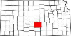
According to the United States Census Bureau, the county has a total area of 1,272 square miles (3,290 km2), of which 1,255 square miles (3,250 km2) is land and 17 square miles (44 km2) (1.3%) is water. [5] It is the third-largest county by area in Kansas.

Adjacent counties

National protected area

Demographics

Population pyramid based on 2000 census age data USA Reno County, Kansas age pyramid.svg
Population pyramid based on 2000 census age data
Historical population
CensusPop.Note
1880 12,826
1890 27,079111.1%
1900 29,0277.2%
1910 37,85330.4%
1920 44,42317.4%
1930 47,7857.6%
1940 52,1659.2%
1950 54,0583.6%
1960 59,0559.2%
1970 60,7652.9%
1980 64,9836.9%
1990 62,389−4.0%
2000 64,7903.8%
2010 64,511−0.4%
2020 61,898−4.1%
2023 (est.)61,497 [6] −0.6%
U.S. Decennial Census [7]
1790-1960 [8] 1900-1990 [9]
1990-2000 [10] 2010-2020 [1]

The Hutchinson Micropolitan Statistical Area includes all of Reno County.

As of the census of 2000, there were 64,790 people, 25,498 households, and 17,313 families residing in the county. The population density was 52 people per square mile (20 people/km2). There were 27,625 housing units at an average density of 22 per square mile (8.5/km2). The racial makeup of the county was 91.56% White, 2.88% Black or African American, 0.58% Native American, 0.45% Asian, 0.04% Pacific Islander, 2.69% from other races, and 1.81% from two or more races. 5.65% of the population were Hispanic or Latino of any race.

There were 25,498 households, out of which 30.30% had children under the age of 18 living with them, 55.90% were married couples living together, 8.70% had a female householder with no husband present, and 32.10% were non-families. 27.90% of all households were made up of individuals, and 12.10% had someone living alone who was 65 years of age or older. The average household size was 2.41 and the average family size was 2.94.

In the county, the population was spread out, with 24.50% under the age of 18, 9.30% from 18 to 24, 26.90% from 25 to 44, 22.90% from 45 to 64, and 16.40% who were 65 years of age or older. The median age was 38 years. For every 100 females there were 100.90 males. For every 100 females age 18 and over, there were 99.00 males.

The median income for a household in the county was $35,510, and the median income for a family was $42,643. Males had a median income of $31,495 versus $21,329 for females. The per capita income for the county was $18,520. About 8.10% of families and 10.90% of the population were below the poverty line, including 13.90% of those under age 18 and 8.50% of those age 65 or over.

Government

Reno County is strongly Republican. The last time a Democratic candidate won the county was in 1976 when Jimmy Carter did so. However, 1988 was somewhat close as Michael Dukakis lost the county by only 5 percentage points due to a persistent drought and farm crisis.

Presidential elections

Presidential election results
United States presidential election results for Reno County, Kansas [11]
Year Republican Democratic Third party
No.%No.%No.%
2020 18,44365.73%8,88631.67%7312.61%
2016 15,51363.23%6,83727.87%2,1868.91%
2012 15,71864.36%8,08533.11%6192.53%
2008 16,11260.57%9,91637.28%5742.16%
2004 17,74864.95%9,11433.36%4621.69%
2000 15,17959.69%9,02535.49%1,2264.82%
1996 14,27554.28%9,10834.63%2,91711.09%
1992 11,37740.10%9,25732.63%7,73827.27%
1988 12,75351.11%11,54546.27%6562.63%
1984 16,56863.34%9,22935.28%3621.38%
1980 13,80452.85%9,61536.81%2,70210.34%
1976 11,21242.29%14,62055.14%6802.56%
1972 15,71463.81%8,18333.23%7312.97%
1968 11,80450.29%9,87242.06%1,7987.66%
1964 8,82936.83%14,93662.30%2080.87%
1960 14,65560.21%9,55739.27%1270.52%
1956 15,05766.56%7,46132.98%1020.45%
1952 15,76268.58%6,55528.52%6662.90%
1948 11,18751.87%9,95746.17%4231.96%
1944 11,00458.71%7,60440.57%1350.72%
1940 12,44853.64%10,54345.43%2170.94%
1936 8,60737.59%14,20362.03%880.38%
1932 8,97247.30%9,35149.29%6473.41%
1928 12,87276.31%3,84322.78%1530.91%
1924 10,33965.23%3,67523.18%1,83711.59%
1920 9,64967.12%4,38530.50%3412.37%
1916 6,87046.05%6,68344.80%1,3669.16%
1912 1,66820.92%3,36042.13%2,94736.95%
1908 4,09252.72%3,38143.56%2893.72%
1904 4,24569.33%1,42323.24%4557.43%
1900 3,76956.02%2,85942.49%1001.49%
1896 3,37351.96%3,05147.00%671.03%
1892 3,16650.00%00.00%3,16650.00%
1888 3,39856.61%1,84130.67%76312.71%

Laws

Reno County was a prohibition, or "dry", county until the Kansas Constitution was amended in 1986 and voters approved the sale of alcoholic liquor by the individual drink with a 30 percent food sales requirement. The food sales requirement was removed with voter approval in 2004. [12]

Education

Colleges

Unified school districts

Private schools

There are three private schools in Hutchinson:

Communities

2005 KDOT map of Reno County (map legend) Map of Reno Co, Ks, USA.png
2005 KDOT map of Reno County (map legend)

† means a community is designated a Census-Designated Place (CDP) by the United States Census Bureau.

Cities

Unincorporated communities

Ghost towns

Townships

Reno County is divided into thirty-one townships. The cities of Hutchinson and Nickerson are considered governmentally independent and are excluded from the census figures for the townships. In the following table, the population center is the largest city (or cities) included in that township's population total, if it is of a significant size.

Sources: 2000 U.S. Gazetteer from the U.S. Census Bureau.
Township FIPS Population
center
PopulationPopulation
density
/km2 (/sq mi)
Land area
km2 (sq mi)
Water area
km2 (sq mi)
Water %Geographic coordinates
Albion00875 Pretty Prairie 8379 (22)97 (38)0 (0)0.02% 37°47′5″N98°0′2″W / 37.78472°N 98.00056°W / 37.78472; -98.00056
Arlington02350 Arlington 6217 (17)94 (36)0 (0)0.03% 37°53′16″N98°11′1″W / 37.88778°N 98.18361°W / 37.88778; -98.18361
Bell05350871 (2)98 (38)0 (0)0.11% 37°46′8″N98°17′30″W / 37.76889°N 98.29167°W / 37.76889; -98.29167
Castleton110002562 (5)140 (54)0 (0)0.01% 37°51′44″N97°57′6″W / 37.86222°N 97.95167°W / 37.86222; -97.95167
Center12050 Partridge 6727 (19)94 (36)0 (0)0.17% 37°57′38″N98°5′23″W / 37.96056°N 98.08972°W / 37.96056; -98.08972
Clay136003,30238 (98)88 (34)1 (0)0.58% 38°3′52″N97°52′11″W / 38.06444°N 97.86972°W / 38.06444; -97.86972
Enterprise214751391 (4)93 (36)0 (0)0.06% 38°3′0″N98°11′34″W / 38.05000°N 98.19278°W / 38.05000; -98.19278
Grant280251,30711 (30)114 (44)1 (1)1.25% 38°8′4″N98°0′27″W / 38.13444°N 98.00750°W / 38.13444; -98.00750
Grove29025641 (2)93 (36)0 (0)0.06% 37°51′47″N98°24′58″W / 37.86306°N 98.41611°W / 37.86306; -98.41611
Haven30750 Haven 1,59211 (29)143 (55)1 (0)0.41% 37°53′56″N97°46′46″W / 37.89889°N 97.77944°W / 37.89889; -97.77944
Hayes310001061 (1)186 (72)0 (0)0.06% 38°3′50″N98°25′38″W / 38.06389°N 98.42722°W / 38.06389; -98.42722
Huntsville335501181 (3)93 (36)0 (0)0.11% 38°3′0″N98°17′54″W / 38.05000°N 98.29833°W / 38.05000; -98.29833
Langdon38525 Langdon 1602 (4)94 (36)0 (0)0.16% 37°51′40″N98°18′57″W / 37.86111°N 98.31583°W / 37.86111; -98.31583
Lincoln410507038 (20)93 (36)0 (0)0.07% 37°57′46″N97°58′7″W / 37.96278°N 97.96861°W / 37.96278; -97.96861
Little River41550 Buhler 1,88120 (52)93 (36)1 (0)0.57% 38°8′15″N97°45′44″W / 38.13750°N 97.76222°W / 38.13750; -97.76222
Loda417001191 (3)98 (38)0 (0)0.27% 37°47′2″N98°12′22″W / 37.78389°N 98.20611°W / 37.78389; -98.20611
Medford454501442 (5)83 (32)0 (0)0.18% 38°8′14″N98°12′24″W / 38.13722°N 98.20667°W / 38.13722; -98.20667
Medora456001,59421 (53)77 (30)0 (0)0% 38°8′40″N97°51′3″W / 38.14444°N 97.85083°W / 38.14444; -97.85083
Miami46125 Turon 5215 (14)98 (38)0 (0)0.15% 37°47′33″N98°25′3″W / 37.79250°N 98.41750°W / 37.79250; -98.41750
Ninnescah507002263 (7)79 (31)27 (10)25.53% 37°47′9″N97°51′27″W / 37.78583°N 97.85750°W / 37.78583; -97.85750
Plevna56750 Plevna 2353 (6)94 (36)0 (0)0.04% 37°58′1″N98°18′36″W / 37.96694°N 98.31000°W / 37.96694; -98.31000
Reno58975 South Hutchinson 4,49650 (129)90 (35)2 (1)1.65% 38°2′31″N97°57′27″W / 38.04194°N 97.95750°W / 38.04194; -97.95750
Roscoe611501081 (3)98 (38)0 (0)0% 37°46′11″N98°4′23″W / 37.76972°N 98.07306°W / 37.76972; -98.07306
Salt Creek628504833 (9)139 (54)1 (0)0.39% 38°3′48″N98°5′57″W / 38.06333°N 98.09917°W / 38.06333; -98.09917
Sumner692005475 (13)106 (41)7 (3)6.13% 37°46′24″N97°45′51″W / 37.77333°N 97.76417°W / 37.77333; -97.76417
Sylvia69825 Sylvia 3934 (11)93 (36)0 (0)0.34% 37°57′24″N98°24′46″W / 37.95667°N 98.41278°W / 37.95667; -98.41278
Troy716001121 (3)94 (36)0 (0)0.16% 37°51′56″N98°5′25″W / 37.86556°N 98.09028°W / 37.86556; -98.09028
Valley730758876 (16)143 (55)1 (0)0.90% 38°0′33″N97°45′2″W / 38.00917°N 97.75056°W / 38.00917; -97.75056
Walnut751001141 (3)94 (36)0 (0)0% 38°7′40″N98°18′7″W / 38.12778°N 98.30194°W / 38.12778; -98.30194
Westminster77175 Abbyville 2433 (7)94 (36)0 (0)0% 37°57′48″N98°12′23″W / 37.96333°N 98.20639°W / 37.96333; -98.20639
Yoder807757428 (20)96 (37)1 (0)1.03% 37°56′54″N97°52′34″W / 37.94833°N 97.87611°W / 37.94833; -97.87611

See also

Community information for Kansas

Related Research Articles

<span class="mw-page-title-main">Thomas County, Kansas</span> County in Kansas, United States

Thomas County is a county located in the U.S. state of Kansas. Its county seat is Colby. As of the 2020 census, the county population was 7,930. The county was named after George Thomas, a general during the American Civil War.

<span class="mw-page-title-main">Sumner County, Kansas</span> County in Kansas, United States

Sumner County is a county located in the U.S. state of Kansas. Its county seat is Wellington. As of the 2020 census, the population was 22,382. The county is named after Charles Sumner, a U.S. Senator from Massachusetts who was a leader of Reconstruction politics.

<span class="mw-page-title-main">Stafford County, Kansas</span> County in Kansas, United States

Stafford County is a county located in the U.S. state of Kansas. Its county seat is St. John. As of the 2020 census, the county population was 4,072. The county is named in honor of Lewis Stafford, a captain of Company E, First Kansas Infantry, who died at the Battle of Young's Point during the American Civil War.

<span class="mw-page-title-main">Sedgwick County, Kansas</span> County in Kansas, United States

Sedgwick County is located in the U.S. state of Kansas. Its county seat is Wichita, the most populous city in the state. As of the 2020 census, the population was 523,824, making it the second-most populous county in Kansas. The county was named for John Sedgwick, the highest ranking Union general killed during the American Civil War.

<span class="mw-page-title-main">Pratt County, Kansas</span> County in Kansas, United States

Pratt County is a county located in the U.S. state of Kansas. Its county seat and largest city is Pratt. As of the 2020 census, the county population was 9,157. The county was named for Caleb Pratt, a U.S. soldier who died in the Battle of Wilson's Creek during the American Civil War and had previously been involved in Bleeding Kansas.

<span class="mw-page-title-main">Neosho County, Kansas</span> County in Kansas, United States

Neosho County is a county located in Southeast Kansas. Its county seat is Erie. As of the 2020 census, the county population was 15,904. The county was named for the Neosho River, which passes through the county.

<span class="mw-page-title-main">Nemaha County, Kansas</span> County in Kansas, United States

Nemaha County is a county located in the northeastern part of the U.S. state of Kansas. Its county seat is Seneca. As of the 2020 census, the county population was 10,273. The county was named for the Nemaha River.

<span class="mw-page-title-main">Morris County, Kansas</span> County in Kansas, United States

Morris County is a county located in the U.S. state of Kansas. Its county seat and largest city is Council Grove. As of the 2020 census, the county population was 5,386. The county was named for Thomas Morris, a U.S. Senator from Ohio and anti-slavery advocate.

<span class="mw-page-title-main">McPherson County, Kansas</span> County in Kansas, United States

McPherson County is a county located in the U.S. state of Kansas. Its county seat and largest city is McPherson. As of the 2020 census, the county population was 30,223. The county was named for James McPherson, a general in the American Civil War.

<span class="mw-page-title-main">Leavenworth County, Kansas</span> County in Kansas, United States

Leavenworth County is located in the U.S. state of Kansas and is part of the Kansas City metropolitan area. Its county seat and most populous city is Leavenworth. As of the 2020 census, the county population was 81,881. The county was named after Henry Leavenworth, a general in the Indian Wars who established Fort Leavenworth.

<span class="mw-page-title-main">Kingman County, Kansas</span> County in Kansas, United States

Kingman County is a county located in the U.S. state of Kansas. Its county seat and largest city is Kingman. As of the 2020 census, the county population was 7,470. The county was named for Samuel Kingman, a chief justice of the Kansas Supreme Court during the 1860s and 1870s.

<span class="mw-page-title-main">Harvey County, Kansas</span> County in Kansas, United States

Harvey County is a county located in the U.S. state of Kansas. Its county seat and most populous city is Newton. As of the 2020 census, the county population was 34,024. The county was named for James Harvey, a U.S. senator and 5th governor of Kansas.

<span class="mw-page-title-main">Edwards County, Kansas</span> County in Kansas, United States

Edwards County is a county located in the U.S. states of Kansas. Its county seat and most populous city is Kinsley. As of the 2020 census, the county population was 2,907, The county was founded in 1874 and named for W. C. Edwards, of Hutchinson, a pioneer settler who owned much land in the area.

<span class="mw-page-title-main">Dickinson County, Kansas</span> County in Kansas, United States

Dickinson County is a county in Central Kansas. Its county seat and most populous city is Abilene. As of the 2020 census, the county population was 18,402. The county was named in honor of Daniel Dickinson, a U.S. Senator from New York that was a Kansas statehood advocate.

<span class="mw-page-title-main">Coffey County, Kansas</span> County in Kansas, United States

Coffey County is a county located in Eastern Kansas. Its county seat and most populous city is Burlington. As of the 2020 census, the county population was 8,360. It was named after A.M. Coffey, a territorial legislator and Free-Stater during Bleeding Kansas era.

<span class="mw-page-title-main">Butler County, Kansas</span> County in Kansas, United States

Butler County is a county in the U.S. state of Kansas and is the largest county in the state by total area. Its county seat is El Dorado and its most populous city is Andover. As of the 2020 census, the county population was 67,380. The county was named for Andrew Butler, a U.S. Senator from South Carolina who coauthored the Kansas–Nebraska Act.

<span class="mw-page-title-main">Nickerson, Kansas</span> City in Reno County, Kansas

Nickerson is a city in Reno County, Kansas, United States. As of the 2020 census, the population of the city was 1,058. It was named in honor of Thomas Nickerson, former president of Atchison, Topeka and Santa Fe Railway.

<span class="mw-page-title-main">South Hutchinson, Kansas</span> City in Reno County, Kansas

South Hutchinson is a city in Reno County, Kansas, United States. As of the 2020 census, the population of the city was 2,521. It is a south suburb of Hutchinson.

<span class="mw-page-title-main">Turon, Kansas</span> City in Reno County, Kansas

Turon is a city in Reno County, Kansas, United States. As of the 2020 census, the population of the city was 309.

<span class="mw-page-title-main">Willowbrook, Kansas</span> City in Reno County, Kansas

Willowbrook is a city in Reno County, Kansas, United States. As of the 2020 census, the population of the city was 71. It is a northwest suburb of Hutchinson.

References

  1. 1 2 3 "QuickFacts; Reno County, Kansas; Population, Census, 2020 & 2010". United States Census Bureau. Archived from the original on August 19, 2021. Retrieved August 19, 2021.
  2. "Annual Estimates of the Resident Population for Counties: April 1, 2020 to July 1, 2021" . Retrieved October 18, 2022.
  3. "Find a County". National Association of Counties. Retrieved June 7, 2011.
  4. "Rock Island Rail History". Archived from the original on June 19, 2011. Retrieved April 18, 2011.
  5. "US Gazetteer files: 2010, 2000, and 1990". United States Census Bureau. February 12, 2011. Retrieved April 23, 2011.
  6. "Annual Estimates of the Resident Population for Counties: April 1, 2020 to July 1, 2023". United States Census Bureau. Retrieved April 3, 2024.
  7. "U.S. Decennial Census". United States Census Bureau. Retrieved July 28, 2014.
  8. "Historical Census Browser". University of Virginia Library. Retrieved July 28, 2014.
  9. "Population of Counties by Decennial Census: 1900 to 1990". United States Census Bureau. Retrieved July 28, 2014.
  10. "Census 2000 PHC-T-4. Ranking Tables for Counties: 1990 and 2000" (PDF). United States Census Bureau. Archived (PDF) from the original on March 27, 2010. Retrieved July 28, 2014.
  11. "Dave Leip's Atlas of U.S. Presidential Elections".
  12. "Map of Wet and Dry Counties". Alcoholic Beverage Control, Kansas Department of Revenue. November 2006. Archived from the original on October 8, 2007. Retrieved December 28, 2007.
Notes

    Further reading

    County
    Other
    Maps