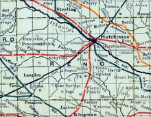
Arlington, Kansas

Last updated

Arlington, Kansas
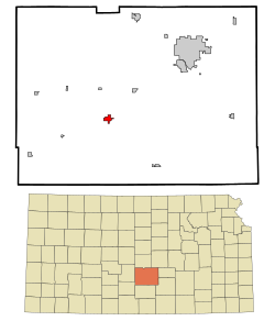
Reno County Kansas Incorporated and Unincorporated areas Arlington Highlighted.svg
Location within Reno County and Kansas
Map of Reno Co, Ks, USA.png
Coordinates: 37°53′47″N98°10′41″W / 37.89639°N 98.17806°W / 37.89639; -98.17806 [1]
Country United States
State Kansas
County Reno
Founded1877
Incorporated 1887
Named for Arlington, Massachusetts
Area
[2]
  Total1.23 sq mi (3.19 km2)
  Land1.23 sq mi (3.19 km2)
  Water0.00 sq mi (0.00 km2)
Elevation
[1]
1,595 ft (486 m)
Population
 (2020) [3]
  Total435
  Density350/sq mi (140/km2)
Time zone UTC-6 (CST)
  Summer (DST) UTC-5 (CDT)
ZIP code
67514
Area code 620
FIPS code 20-02325
GNIS ID 2393987 [1]

Arlington is a city in Reno County, Kansas, United States. [1] As of the 2020 census, the population of the city was 435. [3]

Contents

History

1915 railroad map of Reno County Stouffer's Railroad Map of Kansas 1915-1918 Reno County.png
1915 railroad map of Reno County

Arlington was founded in 1877. [4] It was named after Arlington, Massachusetts. [5] The first post office in Arlington was established in February 1878. [6]

In 1887, the Chicago, Kansas and Nebraska Railway built a main line from Herington through Arlington to Pratt. [7] In 1888, this line was extended to Liberal. Later, it was extended to Tucumcari, New Mexico and El Paso, Texas. It foreclosed in 1891 and taken over by Chicago, Rock Island and Pacific Railway, which shut down in 1980, reorganized as Oklahoma, Kansas and Texas Railroad, merged in 1988 with Missouri Pacific Railroad, and merged in 1997 with Union Pacific Railroad. Most locals still refer to this railroad as the "Rock Island".

In 1980, Arlington (with 503 residents at the time) was profiled by the Associated Press as a town that "has not had a murder in its entire history". The police chief at the time, Ralph Almquist, had been hired in 1974, marking the first time that Arlington had had a full-time police force, and boasted that "We don't have any murders here because I don't allow crime." [8]

Geography

According to the United States Census Bureau, the city has a total area of 1.07 square miles (2.77 km2), all land. [9]

Demographics

Historical population
CensusPop.Note
1900 312
1910 45044.2%
1920 50011.1%
1930 5010.2%
1940 440−12.2%
1950 405−8.0%
1960 46615.1%
1970 5037.9%
1980 63125.4%
1990 457−27.6%
2000 4590.4%
2010 4733.1%
2020 435−8.0%
U.S. Decennial Census

2020 census

The 2020 United States census counted 435 people, 196 households, and 116 families in Arlington. [10] [11] The population density was 352.8 per square mile (136.2/km2). There were 230 housing units at an average density of 186.5 per square mile (72.0/km2). [11] [12] The racial makeup was 91.72% (399) white or European American (89.43% non-Hispanic white), 0.69% (3) black or African-American, 0.46% (2) Native American or Alaska Native, 0.0% (0) Asian, 0.0% (0) Pacific Islander or Native Hawaiian, 1.61% (7) from other races, and 5.52% (24) from two or more races. [13] Hispanic or Latino of any race was 5.06% (22) of the population. [14]

Of the 196 households, 27.6% had children under the age of 18; 43.4% were married couples living together; 26.0% had a female householder with no spouse or partner present. 33.7% of households consisted of individuals and 17.3% had someone living alone who was 65 years of age or older. [11] The average household size was 2.5 and the average family size was 3.1. [15] The percent of those with a bachelor’s degree or higher was estimated to be 9.9% of the population. [16]

23.0% of the population was under the age of 18, 6.2% from 18 to 24, 23.7% from 25 to 44, 26.9% from 45 to 64, and 20.2% who were 65 years of age or older. The median age was 39.8 years. For every 100 females, there were 99.5 males. [11] For every 100 females ages 18 and older, there were 95.9 males. [11]

The 2016-2020 5-year American Community Survey estimates show that the median household income was $31,058 (with a margin of error of +/- $5,969) and the median family income was $31,250 (+/- $18,039). [17] Males had a median income of $35,167 (+/- $29,983) versus $30,469 (+/- $16,890) for females. The median income for those above 16 years old was $31,125 (+/- $13,969). [18] Approximately, 31.5% of families and 32.8% of the population were below the poverty line, including 40.2% of those under the age of 18 and 18.8% of those ages 65 or over. [19] [20]

2010 census

As of the census [21] of 2010, there were 473 people, 200 households, and 124 families residing in the city. The population density was 442.1 inhabitants per square mile (170.7/km2). There were 231 housing units at an average density of 215.9 per square mile (83.4/km2). The racial makeup of the city was 98.3% White, 0.6% African American, 0.2% Native American, and 0.8% from two or more races. Hispanic or Latino people of any race were 1.3% of the population.

There were 200 households, of which 31.0% had children under the age of 18 living with them, 48.0% were married couples living together, 11.0% had a female householder with no husband present, 3.0% had a male householder with no wife present, and 38.0% were non-families. 32.5% of all households were made up of individuals, and 12% had someone living alone who was 65 years of age or older. The average household size was 2.37 and the average family size was 3.02.

The median age in the city was 37.4 years. 26.6% of residents were under the age of 18; 7.8% were between the ages of 18 and 24; 22.8% were from 25 to 44; 25.4% were from 45 to 64; and 17.5% were 65 years of age or older. The gender makeup of the city was 50.1% male and 49.9% female.

2000 census

As of the census [22] of 2000, there were 459 people, 202 households, and 136 families residing in the city. The population density was 383.1 inhabitants per square mile (147.9/km2). There were 218 housing units at an average density of 182.0 per square mile (70.3/km2). The racial makeup of the city was 97.60% White, 0.22% African American, 0.22% Native American, 0.44% from other races, and 1.53% from two or more races. Hispanic or Latino people of any race were 1.31% of the population.

There were 202 households, out of which 29.7% had children under the age of 18 living with them, 58.4% were married couples living together, 6.9% had a female householder with no husband present, and 32.2% were non-families. 30.2% of all households were made up of individuals, and 18.3% had someone living alone who was 65 years of age or older. The average household size was 2.27 and the average family size was 2.82.

In the city, the population was spread out, with 25.3% under the age of 18, 4.6% from 18 to 24, 23.1% from 25 to 44, 23.5% from 45 to 64, and 23.5% who were 65 years of age or older. The median age was 41 years. For every 100 females, there were 98.7 males. For every 100 females age 18 and over, there were 84.4 males.

The median income for a household in the city was $29,453, and the median income for a family was $38,571. Males had a median income of $26,250 versus $20,250 for females. The per capita income for the city was $14,289. About 4.4% of families and 8.8% of the population were below the poverty line, including 10.0% of those under age 18 and 11.1% of those age 65 or over.

Education

The community is served by Fairfield USD 310 public school district. Before the creation of USD 310, the old Arlington High School mascot was the Warriors. In 2015, there was a fire at the Arlington School.

Related Research Articles

<span class="mw-page-title-main">Atlanta, Kansas</span> City in Cowley County, Kansas

Atlanta is a city in Cowley County, Kansas, United States. As of the 2020 census, the population of the city was 168.
<span class="mw-page-title-main">Arcadia, Kansas</span> City in Crawford County, Kansas

Arcadia is a city in northeast Crawford County, Kansas, United States. As of the 2020 census, the population of the city was 254.

<span class="mw-page-title-main">Hepler, Kansas</span> City in Crawford County, Kansas

Hepler is a city in Crawford County, Kansas, United States. As of the 2020 census, the population of the city was 90.

<span class="mw-page-title-main">McCune, Kansas</span> City in Crawford County, Kansas

McCune is a city in Crawford County, Kansas, United States. As of the 2020 census, the population of the city was 370.

<span class="mw-page-title-main">Mulberry, Kansas</span> City in Crawford County, Kansas

Mulberry is a city in Crawford County, Kansas, United States. As of the 2020 census, the population of the city was 409.

<span class="mw-page-title-main">Gove City, Kansas</span> City in Gove County, Kansas

Gove City, more commonly known as Gove, is a city in and the county seat of Gove County, Kansas, United States. As of the 2020 census, the population of the city was 80.

<span class="mw-page-title-main">Edgerton, Kansas</span> City in Kansas, United States

Edgerton is a city in Johnson County, Kansas, United States, and part of the Kansas City metropolitan area. As of the 2020 census, the population of the city was 1,748. It is home to a large BNSF intermodal train facility named Logistics Park Kansas City.

<span class="mw-page-title-main">Admire, Kansas</span> City in Lyon County, Kansas

Admire is a city in Lyon County, Kansas, United States. As of the 2020 census, the population of the city was 130.

<span class="mw-page-title-main">Meade, Kansas</span> City in Meade County, Kansas

Meade is a city in and the county seat of Meade County, Kansas, United States. As of the 2020 census, the population of the city was 1,505.

<span class="mw-page-title-main">Ness City, Kansas</span> City in Ness County, Kansas

Ness City is a city in and the county seat of Ness County, Kansas, United States. As of the 2020 census, the population of the city was 1,329. Ness City is famous for its four-story Old Ness County Bank Building located downtown, and nicknamed Skyscraper of the Plains.

<span class="mw-page-title-main">Lyndon, Kansas</span> City in Osage County, Kansas

Lyndon is a city in, and the county seat of Osage County, Kansas, United States. As of the 2020 census, the population of the city was 1,037.

<span class="mw-page-title-main">Agra, Kansas</span> City in Phillips County, Kansas

Agra is a city in Phillips County, Kansas, United States. As of the 2020 census, the population of the city was 208.

<span class="mw-page-title-main">Atwood, Kansas</span> City in Rawlins County, Kansas

Atwood is a city in and the county seat of Rawlins County, Kansas, United States. As of the 2020 census, the population of the city was 1,290.
<span class="mw-page-title-main">Belleville, Kansas</span> City in Republic County, Kansas

Belleville is a city in and the county seat of Republic County, Kansas, United States. As of the 2020 census, the population of the city was 2,007.

<span class="mw-page-title-main">Alden, Kansas</span> City in Rice County, Kansas

Alden is a city in Rice County, Kansas, United States. As of the 2020 census, the population of the city was 122.

<span class="mw-page-title-main">Assaria, Kansas</span> City in Saline County, Kansas

Assaria is a city in Saline County, Kansas, United States. As of the 2020 census, the population of the city was 428.
<span class="mw-page-title-main">Andale, Kansas</span> City in Sedgwick County, Kansas

Andale is a city in Sedgwick County, Kansas, United States. As of the 2020 census, the population of the city was 941.

<span class="mw-page-title-main">Mount Hope, Kansas</span> City in Sedgwick County, Kansas

Mount Hope is a city in Sedgwick County, Kansas, United States. As of the 2020 census, the population of the city was 806.

<span class="mw-page-title-main">Argonia, Kansas</span> City in Sumner County, Kansas

Argonia is a city in Sumner County, Kansas, United States. As of the 2020 census, the population of the city was 456.
<span class="mw-page-title-main">Alma, Kansas</span> City in Wabaunsee County, Kansas

Alma is a city in and the county seat of Wabaunsee County, Kansas, United States. As of the 2020 census, the population of the city was 802.
References

  1. 1 2 3 4 U.S. Geological Survey Geographic Names Information System: Arlington, Kansas
  2. "2019 U.S. Gazetteer Files". United States Census Bureau. Retrieved July 24, 2020.
  3. 1 2 "Profile of Arlington, Kansas in 2020". United States Census Bureau. Archived from the original on March 28, 2022. Retrieved March 28, 2022.
  4. Kansas State Historical Society (1916). Biennial Report of the Board of Directors of the Kansas State Historical Society. Kansas State Printing Plant. pp.  268.
  5. "Profile for Arlington, Kansas". ePodunk . Retrieved June 22, 2014.
  6. "Kansas Post Offices, 1828-1961". Kansas Historical Society. Retrieved June 22, 2014.
  7. "Rock Island Rail History". Archived from the original on June 19, 2011. Retrieved April 17, 2011.
  8. "Peaceful Town in Kansas Has Never Had a Murder", Los Angeles Times, April 20, 1980, p2
  9. "US Gazetteer files 2010". United States Census Bureau. Archived from the original on January 25, 2012. Retrieved July 6, 2012.
  10. "US Census Bureau, Table P16: HOUSEHOLD TYPE". data.census.gov. Retrieved December 31, 2023.
  11. 1 2 3 4 5 "US Census Bureau, Table DP1: PROFILE OF GENERAL POPULATION AND HOUSING CHARACTERISTICS". data.census.gov. Retrieved December 31, 2023.
  12. Bureau, US Census. "Gazetteer Files". Census.gov. Retrieved December 30, 2023.
  13. "US Census Bureau, Table P1: RACE". data.census.gov. Retrieved December 31, 2023.
  14. "US Census Bureau, Table P2: HISPANIC OR LATINO, AND NOT HISPANIC OR LATINO BY RACE". data.census.gov. Retrieved December 31, 2023.
  15. "US Census Bureau, Table S1101: HOUSEHOLDS AND FAMILIES". data.census.gov. Retrieved December 31, 2023.
  16. "US Census Bureau, Table S1501: EDUCATIONAL ATTAINMENT". data.census.gov. Retrieved December 31, 2023.
  17. "US Census Bureau, Table S1903: MEDIAN INCOME IN THE PAST 12 MONTHS (IN 2020 INFLATION-ADJUSTED DOLLARS)". data.census.gov. Retrieved December 31, 2023.
  18. "US Census Bureau, Table S2001: EARNINGS IN THE PAST 12 MONTHS (IN 2020 INFLATION-ADJUSTED DOLLARS)". data.census.gov. Retrieved December 31, 2023.
  19. "US Census Bureau, Table S1701: POVERTY STATUS IN THE PAST 12 MONTHS". data.census.gov. Retrieved December 31, 2023.
  20. "US Census Bureau, Table S1702: POVERTY STATUS IN THE PAST 12 MONTHS OF FAMILIES". data.census.gov. Retrieved December 31, 2023.
  21. "U.S. Census website". United States Census Bureau . Retrieved July 6, 2012.
  22. "U.S. Census website". United States Census Bureau . Retrieved January 31, 2008.

Further reading