
Colony is a city in Anderson County, Kansas, United States. As of the 2020 census, the population of the city was 381.

Muscotah is a city in Atchison County, Kansas, United States. As of the 2020 census, the population of the city was 155. Muscotah was named after the Kickapoo Native American word for "prairie".
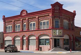
Ashland is a city in and the county seat of Clark County, Kansas, United States. As of the 2020 census, the population of the city was 783.

Burlington is a city in and the county seat of Coffey County, Kansas, United States. As of the 2020 census, the population of the city was 2,634.

Jennings is a city in Decatur County, Kansas, United States. As of the 2020 census, the population of the city was 81.

Belpre is a city in Edwards County, Kansas, United States. As of the 2020 census, the population of the city was 97. It is located along Highway 50.

Princeton is a city in Franklin County, Kansas, United States. As of the 2020 census, the population of the city was 248.

Circleville is a city in Jackson County, Kansas, United States. As of the 2020 census, the population of the city was 153.

Prairie Village is a city in Johnson County, Kansas, United States, and located within the Kansas City Metropolitan Area. As of the 2020 census, the population of the city was 22,957.

Lansing is a city in Leavenworth County, Kansas, United States. It is situated along the west side of the Missouri River and Kansas-Missouri state border. As of the 2020 census, the population of the city was 11,239. It is the second most populous city of Leavenworth County and is a part of the Kansas City metropolitan area. The Lansing Correctional Facility, which includes the state's main maximum-security prison, is located in Lansing.

La Cygne is a city in Linn County, Kansas, United States, and situated along the Marais des Cygnes River. As of the 2020 census, the population of the city was 1,050. The city is named after the Marais des Cygnes River which is a French translation of an Osage appellation meaning "marsh of the swans".
Parker is a city in Linn County, Kansas, United States. As of the 2020 census, the population of the city was 241.

Axtell is a city in Marshall County, Kansas, United States. As of the 2020 census, the population of the city was 399.

Meade is a city in and the county seat of Meade County, Kansas, United States. As of the 2020 census, the population of the city was 1,505.
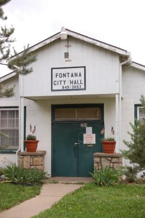
Fontana is a city in south central Miami County, Kansas, United States, and is part of the Kansas City metropolitan area. As of the 2020 census, the population of the city was 210. The name Fontana comes from the French word fontaine, meaning fountain or a spring-like water source. It was given to the small city from a spring near the town site.

Lyndon is a city in, and the county seat of Osage County, Kansas, United States. As of the 2020 census, the population of the city was 1,037.

Prairie View is a city in Phillips County, Kansas, United States. As of the 2020 census, the population of the city was 106.

Palco is a city in Rooks County, Kansas, United States. As of the 2020 census, the population of the city was 208.

Lebanon is a city in Smith County, Kansas, United States. As of the 2020 census, the population of the city was 178.

Leoti is a city in and the county seat of Wichita County, Kansas, United States. As of the 2020 census, the population of the city was 1,475.


