Wilson County, Kansas

Last updated

Wilson County
Brown Hotel, Neodesha, KS.jpg
Map of Kansas highlighting Wilson County.svg
Location within the U.S. state of Kansas
Kansas in United States.svg
Kansas's location within the U.S.
Coordinates: 37°34′00″N95°44′00″W / 37.5667°N 95.7333°W / 37.5667; -95.7333
CountryFlag of the United States.svg United States
StateFlag of Kansas.svg  Kansas
Founded1855
Named for Hiero T. Wilson
Seat Fredonia
Largest city Neodesha
Area
  Total575 sq mi (1,490 km2)
  Land570 sq mi (1,500 km2)
  Water4.7 sq mi (12 km2)  0.8%
Population
 (2020) [1]
  Total8,624
  Density15.1/sq mi (5.8/km2)
Time zone UTC−6 (Central)
  Summer (DST) UTC−5 (CDT)
Congressional district 2nd
Website wilsoncountykansas.org

Wilson County is a county located in Southeast Kansas. Its county seat is Fredonia. [2] As of the 2020 census, the county population was 8,624. [1] The county was named after Hiero Wilson, a colonel in the American Civil War.

Contents

History

Early history

For many millennia, the Great Plains of North America was inhabited by nomadic Native Americans. From the 16th century to 18th century, the Kingdom of France claimed ownership of large parts of North America. In 1762, after the French and Indian War, France secretly ceded New France to Spain, per the Treaty of Fontainebleau.

19th century

In 1802, Spain returned most of the land to France, but keeping title to about 7,500 square miles. In 1803, most of the land for modern day Kansas was acquired by the United States from France as part of the 828,000 square mile Louisiana Purchase for 2.83 cents per acre.

In 1854, the Kansas Territory was organized. In 1855, Wilson County was established and included what is now Wilson County and Montgomery County. It was named for Colonel Hiero T. Wilson. He was a successful Indian trader who had been the first white settler of Fort Scott, Kansas and had served as postmaster and sutler at the fort. He could speak Cherokee, Creek, and Osage and the Osage called him "Big White Chief". He was a delegate to the Lecompton Constitutional Convention. [3]

Geography

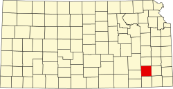
According to the U.S. Census Bureau, the county has a total area of 575 square miles (1,490 km2), of which 570 square miles (1,500 km2) is land and 4.7 square miles (12 km2) (0.8%) is water. [4]

Adjacent counties

Demographics

Population pyramid based on 2000 census age data USA Wilson County, Kansas age pyramid.svg
Population pyramid based on 2000 census age data
Historical population
CensusPop.Note
1860 27
1870 6,69424,692.6%
1880 13,775105.8%
1890 15,28611.0%
1900 15,6212.2%
1910 19,81026.8%
1920 21,1576.8%
1930 18,646−11.9%
1940 17,723−5.0%
1950 14,815−16.4%
1960 13,077−11.7%
1970 11,317−13.5%
1980 12,1287.2%
1990 10,289−15.2%
2000 10,3320.4%
2010 9,409−8.9%
2020 8,624−8.3%
2023 (est.)8,382 [5] −2.8%
U.S. Decennial Census [6]
1790-1960 [7] 1900-1990 [8]
1990-2000 [9] 2010-2020 [1]

As of the census [10] of 2000, there were 10,332 people, 4,203 households, and 2,849 families residing in the county. The population density was 18 people per square mile (6.9 people/km2). There were 4,937 housing units at an average density of 9 per square mile (3.5/km2). The racial makeup of the county was 96.78% White, 0.37% Black or African American, 0.88% Native American, 0.26% Asian, 0.04% Pacific Islander, 0.48% from other races, and 1.19% from two or more races. 1.67% of the population were Hispanic or Latino of any race.

There were 4,203 households, out of which 29.60% had children under the age of 18 living with them, 57.10% were married couples living together, 7.80% had a female householder with no husband present, and 32.20% were non-families. 29.10% of all households were made up of individuals, and 15.80% had someone living alone who was 65 years of age or older. The average household size was 2.40 and the average family size was 2.96.

In the county, the population was spread out, with 25.40% under the age of 18, 7.40% from 18 to 24, 23.80% from 25 to 44, 23.40% from 45 to 64, and 19.90% who were 65 years of age or older. The median age was 41 years. For every 100 females there were 94.20 males. For every 100 females age 18 and over, there were 89.60 males.

The median income for a household in the county was $29,747, and the median income for a family was $36,990. Males had a median income of $27,255 versus $18,670 for females. The per capita income for the county was $14,910. About 7.50% of families and 11.30% of the population were below the poverty line, including 13.40% of those under age 18 and 11.80% of those age 65 or over.

Government

Presidential elections

Presidential election results
United States presidential election results for Wilson County, Kansas [11]
Year Republican Democratic Third party
No.%No.%No.%
2020 3,15379.74%72318.29%781.97%
2016 2,78877.64%59416.54%2095.82%
2012 2,82576.00%81822.01%741.99%
2008 2,85069.16%1,17028.39%1012.45%
2004 3,26374.19%1,06024.10%751.71%
2000 2,74867.11%1,18628.96%1613.93%
1996 2,45856.41%1,29729.77%60213.82%
1992 1,92541.53%1,33128.72%1,37929.75%
1988 2,74363.12%1,54535.55%581.33%
1984 3,66372.23%1,34426.50%641.26%
1980 3,32869.32%1,20525.10%2685.58%
1976 2,68255.67%2,04742.49%891.85%
1972 3,56874.80%1,04321.87%1593.33%
1968 3,34063.35%1,27624.20%65612.44%
1964 2,91952.54%2,59246.65%450.81%
1960 4,33367.77%2,03431.81%270.42%
1956 4,50273.00%1,64526.67%200.32%
1952 5,18073.18%1,84526.07%530.75%
1948 3,86859.45%2,53839.01%1001.54%
1944 4,24868.57%1,91230.86%350.56%
1940 5,28864.42%2,85934.83%620.76%
1936 4,82955.59%3,81643.93%420.48%
1932 3,42244.93%4,00152.53%1932.53%
1928 5,60378.46%1,46520.52%731.02%
1924 4,59665.00%1,73624.55%73910.45%
1920 4,02466.23%1,76829.10%2844.67%
1916 2,97041.81%3,49449.18%6409.01%
1912 84919.92%1,30430.60%2,10849.47%
1908 2,42853.14%1,77738.89%3647.97%
1904 2,58363.37%1,03425.37%45911.26%
1900 2,19355.58%1,71143.36%421.06%
1896 1,85248.38%1,95951.18%170.44%
1892 1,80351.80%00.00%1,67848.20%
1888 2,19155.48%1,03526.21%72318.31%

Wilson County is overwhelmingly Republican. No Democratic presidential candidate has carried Wilson County since Franklin D. Roosevelt in 1932, and none have passed 36 percent since Jimmy Carter in 1976.

Laws

Following amendment to the Kansas Constitution in 1986, the county remained a prohibition, or "dry", county until 1998, when voters approved the sale of alcoholic liquor by the individual drink with a 30 percent food sales requirement. [12]

Education

Unified school districts

Communities

2005 KDOT Map of Wilson County from KDOT (map legend) Map of Wilson Co, Ks, USA.png
2005 KDOT Map of Wilson County from KDOT (map legend)

† means a community is designated a Census-Designated Place (CDP) by the United States Census Bureau.

Cities

Unincorporated communities

Townships

Wilson County is divided into fifteen townships. The cities of Fredonia and Neodesha are considered governmentally independent and are excluded from the census figures for the townships. In the following table, the population center is the largest city (or cities) included in that township's population total, if it is of a significant size.

Sources: 2000 U.S. Gazetteer from the U.S. Census Bureau.
Township FIPS Population
center
PopulationPopulation
density
/km2 (/sq mi)
Land area
km2 (sq mi)
Water area
km2 (sq mi)
Water %Geographic coordinates
Cedar113757018 (19)93 (36)0 (0)0.11% 37°31′21″N95°40′14″W / 37.52250°N 95.67056°W / 37.52250; -95.67056 (Cedar Twp.)
Center122256186 (16)103 (40)0 (0)0.14% 37°31′5″N95°49′11″W / 37.51806°N 95.81972°W / 37.51806; -95.81972 (Center Twp.)
Chetopa130001882 (5)93 (36)0 (0)0.11% 37°30′28″N95°34′14″W / 37.50778°N 95.57056°W / 37.50778; -95.57056 (Chetopa Twp.)
Clifton142504144 (12)93 (36)0 (0)0.53% 37°41′56″N95°42′23″W / 37.69889°N 95.70639°W / 37.69889; -95.70639 (Clifton Twp.)
Colfax148254524 (10)123 (47)0 (0)0.17% 37°40′55″N95°36′20″W / 37.68194°N 95.60556°W / 37.68194; -95.60556 (Colfax Twp.)
Duck Creek188001031 (3)93 (36)0 (0)0.23% 37°26′14″N95°54′58″W / 37.43722°N 95.91611°W / 37.43722; -95.91611 (Duck Creek Twp.)
Fall River228253983 (8)131 (51)0 (0)0.16% 37°32′21″N95°55′33″W / 37.53917°N 95.92583°W / 37.53917; -95.92583 (Fall River Twp.)
Guilford292002052 (6)93 (36)0 (0)0.06% 37°36′32″N95°43′22″W / 37.60889°N 95.72278°W / 37.60889; -95.72278 (Guilford Twp.)
Neodesha496755836 (17)90 (35)0 (0)0.52% 37°25′29″N95°40′52″W / 37.42472°N 95.68111°W / 37.42472; -95.68111 (Neodesha Twp.)
Newark502002262 (6)92 (36)0 (0)0.18% 37°25′30″N95°34′56″W / 37.42500°N 95.58222°W / 37.42500; -95.58222 (Newark Twp.)
Pleasant Valley566502012 (4)123 (47)0 (0)0.09% 37°36′25″N95°36′21″W / 37.60694°N 95.60583°W / 37.60694; -95.60583 (Pleasant Valley Twp.)
Prairie574251182 (4)78 (30)0 (0)0.28% 37°36′17″N95°49′26″W / 37.60472°N 95.82389°W / 37.60472; -95.82389 (Prairie Twp.)
Talleyrand699002323 (7)92 (36)0 (0)0.06% 37°25′19″N95°48′25″W / 37.42194°N 95.80694°W / 37.42194; -95.80694 (Talleyrand Twp.)
Verdigris735003944 (10)103 (40)0 (0)0.27% 37°39′29″N95°53′51″W / 37.65806°N 95.89750°W / 37.65806; -95.89750 (Verdigris Twp.)
Webster76300511 (2)77 (30)0 (0)0.15% 37°42′0″N95°50′1″W / 37.70000°N 95.83361°W / 37.70000; -95.83361 (Webster Twp.)

See also

Community information for Kansas

Notes

    Related Research Articles

    <span class="mw-page-title-main">Montgomery County, Kansas</span> County in Kansas, United States

    Montgomery County is a county located in Southeast Kansas. Its county seat is Independence, and its most populous city is Coffeyville. As of the 2020 census, the county population was 31,486. The county was named after Richard Montgomery, a major general during the American Revolutionary War.

    <span class="mw-page-title-main">Thomas County, Kansas</span> County in Kansas, United States

    Thomas County is a county located in the U.S. state of Kansas. Its county seat is Colby. As of the 2020 census, the county population was 7,930. The county was named after George Thomas, a general during the American Civil War.

    <span class="mw-page-title-main">Rooks County, Kansas</span> County in Kansas, United States

    Rooks County is a county located in the U.S. state of Kansas. Its county seat is Stockton, and its largest city is Plainville. As of the 2020 census, the county population was 4,919. The county was named for John Rooks, a private in Company I of the 11th Kansas Cavalry Regiment, who died at the Battle of Prairie Grove during the American Civil War.

    <span class="mw-page-title-main">Pottawatomie County, Kansas</span> County in Kansas, United States

    Pottawatomie County is a county located in the U.S. state of Kansas. Its county seat is Westmoreland. As of the 2020 census, the county population was 25,348. The county was named for the Potawatomi tribe.

    <span class="mw-page-title-main">Phillips County, Kansas</span> County in Kansas, United States

    Phillips County is a county located in the U.S. state of Kansas. Its county seat and largest city is Phillipsburg. As of the 2020 census, the county population was 4,981. The county was named after William Phillips, a free-state abolition journalist and colonel in the American Civil War.

    <span class="mw-page-title-main">Ness County, Kansas</span> County in Kansas, United States

    Ness County is a county located in the U.S. state of Kansas. Its county seat and largest city is Ness City. As of the 2020 census, the county population was 2,687. The county was named for Noah Ness, a corporal of the 7th Kansas Cavalry.

    <span class="mw-page-title-main">Logan County, Kansas</span> County in Kansas, United States

    Logan County is a county located in the U.S. state of Kansas. Its county seat and largest city is Oakley. As of the 2020 census, the county population was 2,762. The county was named for John Logan, a general during the American Civil War. One of the county's distinctive features is a mile-long stretch of Smoky Hill Chalk bluffs that tower 100 feet (30 m) high over the Smoky Hill River and are dubbed "Little Jerusalem" for resemblance to the ancient walled city. The formation is mostly on private land. In 2016, The Nature Conservancy purchased the property and the Little Jerusalem Badlands State Park opened to the public in October 2019.

    <span class="mw-page-title-main">Linn County, Kansas</span> County in Kansas, United States

    Linn County is a county in the U.S. state of Kansas, located in along the eastern edge of Kansas, and is part of the Kansas City metropolitan area. Its county seat is Mound City, and its most populous city is Pleasanton. As of the 2020 census, the county population was 9,591. The county was named for Lewis Linn, a U.S. Senator from Missouri.

    <span class="mw-page-title-main">Harper County, Kansas</span> County in Kansas, United States

    Harper County is a county located in the U.S. state of Kansas. Its county seat and most populous city is Anthony. As of the 2020 census, the county population was 5,485. The county was named for Sergeant Marion Harper of the 2nd Kansas Cavalry, who died in battle during the American Civil War.

    <span class="mw-page-title-main">Greenwood County, Kansas</span> County in Kansas, United States

    Greenwood County is a county located in the southeast portion of the U.S. state of Kansas. Its county seat and most populous city is Eureka. As of the 2020 census, the county population was 6,016. The county was named for Alfred Greenwood, a U.S. congressman from Arkansas that advocated Kansas statehood.

    <span class="mw-page-title-main">Gove County, Kansas</span> County in Kansas, United States

    Gove County is a county in the U.S. state of Kansas. Its county seat is Gove City, and its most populous city is Quinter. As of the 2020 census, the county population was 2,718. The county was named for Granville Gove, a captain of Company G of the 11th Kansas Cavalry Regiment Volunteer Cavalry, who died from battle wounds during the American Civil War.

    <span class="mw-page-title-main">Finney County, Kansas</span> County in Kansas, United States

    Finney County is a county located in the U.S. state of Kansas. Its county seat and most populous city is Garden City. As of the 2020 census, the county population was 38,470. The county was named for David Finney, the Lieutenant Governor of Kansas from 1881 and 1885. In 2020, 51.4 percent of the population in the county was Hispanic, one of a few counties in Kansas with a Hispanic majority population.

    <span class="mw-page-title-main">Elk County, Kansas</span> County in Kansas, United States

    Elk County is a county located in the U.S. state of Kansas. Its county seat and most populous city is Howard. As of the 2020 census, the county population was 2,483. The county was named for the Elk River.

    <span class="mw-page-title-main">Cherokee County, Kansas</span> County in Kansas, United States

    Cherokee County is a U.S. county located in Southeast Kansas. Its county seat is Columbus, and its most populous city is Baxter Springs. As of the 2020 census, the county population was 19,362. The county was named for the Cherokee tribe.

    <span class="mw-page-title-main">Chautauqua County, Kansas</span> County in Kansas, United States

    Chautauqua County is a county located in Southeast Kansas, United States. Its county seat and most populous city is Sedan. As of the 2020 census, the county population was 3,379. The county is named for Chautauqua County, New York, the birthplace of Edward Jaquins, a Kansas politician who was instrumental in getting the county established.

    <span class="mw-page-title-main">Brown County, Kansas</span> County in Kansas, United States

    Brown County is a county located in the northeast portion of the U.S. state of Kansas. Its county seat and most populous city is Hiawatha. As of the 2020 census, the county population was 9,508. The county was named after Albert G. Brown, a U.S. Senator from Mississippi and Kansas statehood advocate. The Kickapoo Indian Reservation of Kansas, the majority of the Sac and Fox Reservation, and the majority of the Iowa Reservation of Kansas and Nebraska are located within the county.

    <span class="mw-page-title-main">Wetmore, Kansas</span> City in Nemaha County, Kansas

    Wetmore is a city in Nemaha County, Kansas, United States. As of the 2020 census, the population of the city was 348.

    <span class="mw-page-title-main">Altoona, Kansas</span> City in Wilson County, Kansas

    Altoona is a city in Wilson County, Kansas, United States, along the Verdigris River. As of the 2020 census, the population of the city was 354.

    <span class="mw-page-title-main">Fredonia, Kansas</span> City in Wilson County, Kansas

    Fredonia is a city in and the county seat of Wilson County, Kansas, United States. As of the 2020 census, the population of the city was 2,151. The city was founded in 1868, and saw considerable expansion in the early 20th century, with a fossil fuel boom.

    <span class="mw-page-title-main">Neodesha, Kansas</span> City in Wilson County, Kansas

    Neodesha is a city in Wilson County, Kansas, United States. As of the 2020 census, the population of the city was 2,275. The name is derived from the Osage Indian word, Ni-o-sho-de, and is translated as The-Water-Is-Smoky-With-Mud.

    References

    1. 1 2 3 "QuickFacts; Wilson County, Kansas; Population, Census, 2020 & 2010". United States Census Bureau. Archived from the original on August 22, 2021. Retrieved August 21, 2021.
    2. "Find a County". National Association of Counties. Retrieved June 7, 2011.
    3. Rydjord, p 317
    4. "US Gazetteer files: 2010, 2000, and 1990". United States Census Bureau. February 12, 2011. Retrieved April 23, 2011.
    5. "Annual Estimates of the Resident Population for Counties: April 1, 2020 to July 1, 2023". United States Census Bureau. Retrieved April 3, 2024.
    6. "U.S. Decennial Census". United States Census Bureau. Retrieved July 29, 2014.
    7. "Historical Census Browser". University of Virginia Library. Retrieved July 29, 2014.
    8. "Population of Counties by Decennial Census: 1900 to 1990". United States Census Bureau. Retrieved July 29, 2014.
    9. "Census 2000 PHC-T-4. Ranking Tables for Counties: 1990 and 2000" (PDF). United States Census Bureau. Archived (PDF) from the original on March 27, 2010. Retrieved July 29, 2014.
    10. "U.S. Census website". United States Census Bureau . Retrieved January 31, 2008.
    11. "Dave Leip's Atlas of U.S. Presidential Elections".
    12. "Map of Wet and Dry Counties". Alcoholic Beverage Control, Kansas Department of Revenue. November 2006. Archived from the original on October 8, 2007. Retrieved December 26, 2007.
    13. Altoona-Midway USD 387
    14. Neodesha USD 461
    15. Fredonia USD 484

    Further reading

    County
    Maps

    37°34′N95°44′W / 37.567°N 95.733°W / 37.567; -95.733