Coyville, Kansas

Last updated

Coyville, Kansas
Coyville Kansas.JPG
Community center in Coyville (2015)
Wilson County Kansas Incorporated and Unincorporated areas Coyville Highlighted.svg
Location within Wilson County and Kansas
Map of Wilson Co, Ks, USA.png
Coordinates: 37°41′14″N95°53′45″W / 37.68722°N 95.89583°W / 37.68722; -95.89583 [1]
Country United States
State Kansas
County Wilson
Platted 1886
Incorporated 1906
Named for Oscar Coy
Area
[2]
  Total0.27 sq mi (0.70 km2)
  Land0.27 sq mi (0.70 km2)
  Water0.00 sq mi (0.00 km2)
Elevation
[1]
879 ft (268 m)
Population
 (2020) [3]
  Total60
  Density220/sq mi (86/km2)
Time zone UTC-6 (CST)
  Summer (DST) UTC-5 (CDT)
ZIP codes
66727, 66736
Area code 620
FIPS code 20-16150
GNIS ID 2393658 [1]

Coyville is a city in Wilson County, Kansas, United States. [1] As of the 2020 census, the population of the city was 60. [3]

Contents

History

Coyville was laid out in 1886 when the Atchison, Topeka and Santa Fe Railway was extended to that point. [4] The town was named for Oscar Coy, a store owner who in 1866 served as the first postmaster. [5]

Currently, the only business is a small vehicle-body repair shop; services consist of a community hall and a church. The remainder of the community consist of several roads, mostly white gravel, with an assortment of homes, plus a cemetery.

Geography

According to the United States Census Bureau, the city has a total area of 0.28 square miles (0.73 km2), all land. [6]

Climate

The climate in this area is characterized by hot, humid summers and generally mild to cool winters. According to the Köppen Climate Classification system, Coyville has a humid subtropical climate, abbreviated "Cfa" on climate maps. [7]

Demographics

Historical population
CensusPop.Note
1910 227
1920 2322.2%
1930 196−15.5%
1940 175−10.7%
1950 106−39.4%
1960 13325.5%
1970 93−30.1%
1980 985.4%
1990 78−20.4%
2000 71−9.0%
2010 46−35.2%
2020 6030.4%
U.S. Decennial Census

2020 census

The 2020 United States census counted 60 people, 24 households, and 17 families in Coyville. [8] [9] The population density was 223.0 per square mile (86.1/km2). There were 34 housing units at an average density of 126.4 per square mile (48.8/km2). [9] [10] The racial makeup was 90.0% (54) white or European American (90.0% non-Hispanic white), 0.0% (0) black or African-American, 0.0% (0) Native American or Alaska Native, 0.0% (0) Asian, 0.0% (0) Pacific Islander or Native Hawaiian, 0.0% (0) from other races, and 10.0% (6) from two or more races. [11] Hispanic or Latino of any race was 0.0% (0) of the population. [12]

Of the 24 households, 29.2% had children under the age of 18; 54.2% were married couples living together; 12.5% had a female householder with no spouse or partner present. 29.2% of households consisted of individuals and 16.7% had someone living alone who was 65 years of age or older. [9] The average household size was 2.0 and the average family size was 3.1. [13] The percent of those with a bachelor’s degree or higher was estimated to be 0.0% of the population. [14]

13.3% of the population was under the age of 18, 3.3% from 18 to 24, 18.3% from 25 to 44, 28.3% from 45 to 64, and 36.7% who were 65 years of age or older. The median age was 59.0 years. For every 100 females, there were 93.5 males. [9] For every 100 females ages 18 and older, there were 92.6 males. [9]

The 2016-2020 5-year American Community Survey estimates show that the median income for those above 16 years old was $31,875 (+/- $6,803). [15] Approximately, 10.0% of families and 11.6% of the population were below the poverty line, including 0.0% of those under the age of 18 and 18.8% of those ages 65 or over. [16] [17]

2010 census

As of the census [18] of 2010, there were 46 people, 26 households, and 8 families residing in the city. The population density was 164.3 inhabitants per square mile (63.4/km2). There were 34 housing units at an average density of 121.4 per square mile (46.9/km2). The racial makeup of the city was 80.4% White, 2.2% Native American, 8.7% from other races, and 8.7% from two or more races. Hispanic or Latino of any race were 2.2% of the population.

There were 26 households, of which 19.2% had children under the age of 18 living with them, 26.9% were married couples living together, 3.8% had a male householder with no wife present, and 69.2% were non-families. 65.4% of all households were made up of individuals, and 23.1% had someone living alone who was 65 years of age or older. The average household size was 1.77 and the average family size was 3.38.

The median age in the city was 49.6 years. 23.9% of residents were under the age of 18; 8.6% were between the ages of 18 and 24; 6.6% were from 25 to 44; 43.5% were from 45 to 64; and 17.4% were 65 years of age or older. The gender makeup of the city was 45.7% male and 54.3% female.

2000 census

As of the census [19] of 2000, there were 71 people, 28 households, and 18 families residing in the city. The population density was 257.9 inhabitants per square mile (99.6/km2). There were 39 housing units at an average density of 141.7 per square mile (54.7/km2). The racial makeup of the city was 98.59% White, and 1.41% from two or more races.

There were 28 households, out of which 35.7% had children under the age of 18 living with them, 57.1% were married couples living together, 7.1% had a female householder with no husband present, and 35.7% were non-families. 32.1% of all households were made up of individuals, and 7.1% had someone living alone who was 65 years of age or older. The average household size was 2.54 and the average family size was 3.17.

In the city, the population was spread out, with 35.2% under the age of 18, 2.8% from 18 to 24, 25.4% from 25 to 44, 16.9% from 45 to 64, and 19.7% who were 65 years of age or older. The median age was 39 years. For every 100 females, there were 77.5 males. For every 100 females age 18 and over, there were 91.7 males.

The median income for a household in the city was $19,792, and the median income for a family was $59,375. Males had a median income of $47,750 versus $18,750 for females. The per capita income for the city was $15,012. There were no families and 6.7% of the population living below the poverty line, including no under eighteens and 28.6% of those over 64.

See also

Related Research Articles

<span class="mw-page-title-main">Latham, Kansas</span> City in Butler County, Kansas

Latham is a city in Butler County, Kansas, United States. As of the 2020 census, the population of the city was 96.

<span class="mw-page-title-main">Cedar Vale, Kansas</span> City in Chautauqua County, Kansas

Cedar Vale is a city in Chautauqua County, Kansas, United States. As of the 2020 census, the population of the city was 476.

<span class="mw-page-title-main">Burlington, Kansas</span> City in Coffey County, Kansas, United States

Burlington is a city in and the county seat of Coffey County, Kansas, United States. As of the 2020 census, the population of the city was 2,634.

<span class="mw-page-title-main">Mulberry, Kansas</span> City in Crawford County, Kansas

Mulberry is a city in Crawford County, Kansas, United States. As of the 2020 census, the population of the city was 409.

<span class="mw-page-title-main">Jennings, Kansas</span> City in Decatur County, Kansas

Jennings is a city in Decatur County, Kansas, United States. As of the 2020 census, the population of the city was 81.

<span class="mw-page-title-main">Gove City, Kansas</span> City in Gove County, Kansas

Gove City, more commonly known as Gove, is a city in and the county seat of Gove County, Kansas, United States. As of the 2020 census, the population of the city was 80.

<span class="mw-page-title-main">Edgerton, Kansas</span> City in Kansas, United States

Edgerton is a city in Johnson County, Kansas, United States, and part of the Kansas City metropolitan area. As of the 2020 census, the population of the city was 1,748. It is home to a large BNSF intermodal train facility named Logistics Park Kansas City.

<span class="mw-page-title-main">Cunningham, Kansas</span> City in Kingman County, Kansas

Cunningham is a city in Kingman County, Kansas, United States. As of the 2020 census, the population of the city was 444. The city was named in honor of J.D. Cunningham, a pioneer settler.

<span class="mw-page-title-main">Kingman, Kansas</span> City in Kingman County, Kansas

Kingman is a city in and the county seat of Kingman County, Kansas, United States. As of the 2020 census, the population of the city was 3,105.

<span class="mw-page-title-main">Lansing, Kansas</span> City in Kansas, United States

Lansing is a city in Leavenworth County, Kansas, United States. It is situated along the west side of the Missouri River and Kansas-Missouri state border. As of the 2020 census, the population of the city was 11,239. It is the second most populous city of Leavenworth County and is a part of the Kansas City metropolitan area. The Lansing Correctional Facility, which includes the state's main maximum-security prison, is located in Lansing.

<span class="mw-page-title-main">Oketo, Kansas</span> City in Marshall County, Kansas

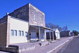
Oketo is a city in Marshall County, Kansas, United States. As of the 2020 census, the population of the city was 64.

<span class="mw-page-title-main">Meade, Kansas</span> City in Meade County, Kansas

Meade is a city in and the county seat of Meade County, Kansas, United States. As of the 2020 census, the population of the city was 1,505.

<span class="mw-page-title-main">Oneida, Kansas</span> City in Nemaha County, Kansas

Oneida is a city in Nemaha County, Kansas, United States. As of the 2020 census, the population of the city was 61.

<span class="mw-page-title-main">Lyndon, Kansas</span> City in Osage County, Kansas

Lyndon is a city in, and the county seat of Osage County, Kansas, United States. As of the 2020 census, the population of the city was 1,037.

<span class="mw-page-title-main">Onaga, Kansas</span> City in Pottawatomie County, Kansas

Onaga is a city in Pottawatomie County, Kansas, United States. As of the 2020 census, the population of the city was 679.

<span class="mw-page-title-main">Belleville, Kansas</span> City in Republic County, Kansas

Belleville is a city in and the county seat of Republic County, Kansas, United States. As of the 2020 census, the population of the city was 2,007.

<span class="mw-page-title-main">Clearwater, Kansas</span> City in Sedgwick County, Kansas

Clearwater is a city in Sedgwick County, Kansas, United States. As of the 2020 census, the population of the city was 2,653.

<span class="mw-page-title-main">Mount Hope, Kansas</span> City in Sedgwick County, Kansas

Mount Hope is a city in Sedgwick County, Kansas, United States. As of the 2020 census, the population of the city was 806.

<span class="mw-page-title-main">Mayfield, Kansas</span> City in Sumner County, Kansas

Mayfield is a city in Sumner County, Kansas, United States. As of the 2020 census, the population of the city was 75.

<span class="mw-page-title-main">Lake Quivira, Kansas</span> City in Kansas, United States

Lake Quivira is a city in Johnson and Wyandotte counties in the State of Kansas, and part of the Kansas City Metropolitan Area. As of the 2020 census, the population of the city was 1,014.

References

  1. 1 2 3 4 U.S. Geological Survey Geographic Names Information System: Coyville, Kansas
  2. "2019 U.S. Gazetteer Files". United States Census Bureau. Retrieved July 24, 2020.
  3. 1 2 "Profile of Coyville, Kansas in 2020". United States Census Bureau. Archived from the original on May 30, 2022. Retrieved May 29, 2022.
  4. Duncan, L. Wallace (1902). History of Neosho and Wilson Counties, Kansas. Monitor Printing Company. p. 912.
  5. Blackmar, Frank Wilson (1912). Kansas: A Cyclopedia of State History, Embracing Events, Institutions, Industries, Counties, Cities, Towns, Prominent Persons, Etc. Standard Publishing Company. pp.  470.
  6. "US Gazetteer files 2010". United States Census Bureau. Archived from the original on January 12, 2012. Retrieved July 6, 2012.
  7. Climate Summary for Coyville, Kansas
  8. "US Census Bureau, Table P16: HOUSEHOLD TYPE". data.census.gov. Retrieved January 2, 2024.
  9. 1 2 3 4 5 "US Census Bureau, Table DP1: PROFILE OF GENERAL POPULATION AND HOUSING CHARACTERISTICS". data.census.gov. Retrieved January 2, 2024.
  10. Bureau, US Census. "Gazetteer Files". Census.gov. Retrieved December 30, 2023.
  11. "US Census Bureau, Table P1: RACE". data.census.gov. Retrieved January 2, 2024.
  12. "US Census Bureau, Table P2: HISPANIC OR LATINO, AND NOT HISPANIC OR LATINO BY RACE". data.census.gov. Retrieved January 2, 2024.
  13. "US Census Bureau, Table S1101: HOUSEHOLDS AND FAMILIES". data.census.gov. Retrieved January 2, 2024.
  14. "US Census Bureau, Table S1501: EDUCATIONAL ATTAINMENT". data.census.gov. Retrieved January 2, 2024.
  15. "US Census Bureau, Table S2001: EARNINGS IN THE PAST 12 MONTHS (IN 2020 INFLATION-ADJUSTED DOLLARS)". data.census.gov. Retrieved January 2, 2024.
  16. "US Census Bureau, Table S1701: POVERTY STATUS IN THE PAST 12 MONTHS". data.census.gov. Retrieved January 2, 2024.
  17. "US Census Bureau, Table S1702: POVERTY STATUS IN THE PAST 12 MONTHS OF FAMILIES". data.census.gov. Retrieved January 2, 2024.
  18. "U.S. Census website". United States Census Bureau . Retrieved July 6, 2012.
  19. "U.S. Census website". United States Census Bureau . Retrieved January 31, 2008.

Further reading