Sumner County, Kansas

Last updated

Sumner County
Oxford Mill - front.jpg
Map of Kansas highlighting Sumner County.svg
Location within the U.S. state of Kansas
Kansas in United States.svg
Kansas's location within the U.S.
Coordinates: 37°14′N97°29′W / 37.233°N 97.483°W / 37.233; -97.483
CountryFlag of the United States.svg United States
StateFlag of Kansas.svg  Kansas
FoundedDecember 20, 1870
Named for Charles Sumner
Seat Wellington
Largest cityWellington
Area
  Total1,185 sq mi (3,070 km2)
  Land1,182 sq mi (3,060 km2)
  Water3.0 sq mi (8 km2)  0.3%
Population
 (2020) [1]
  Total22,382
  Density18.9/sq mi (7.3/km2)
Time zone UTC−6 (Central)
  Summer (DST) UTC−5 (CDT)
Area code 620
Congressional district 4th
Website County website

Sumner County is a county located in the U.S. state of Kansas. Its county seat is Wellington. [2] As of the 2020 census, the population was 22,382. [1] The county is named after Charles Sumner, a U.S. Senator from Massachusetts who was a leader of Reconstruction politics.

Contents

History

Early history

For many millennia, the Great Plains of North America was inhabited by nomadic Native Americans. From the 16th century to 18th century, the Kingdom of France claimed ownership of large parts of North America. In 1762, after the French and Indian War, France secretly ceded New France to Spain, per the Treaty of Fontainebleau. In 1802, Spain returned most of the land to France, but keeping title to about 7,500 square miles.

In 1803, most of the land for modern day Kansas was acquired by the United States from France as part of the 828,000 square mile Louisiana Purchase for 2.83 cents per acre. In 1848, after the Mexican–American War, the Treaty of Guadalupe Hidalgo with Spain brought into the United States all or part of land for ten future states, including southwest Kansas. In 1854, the Kansas Territory was organized, then in 1861 Kansas became the 34th U.S. state.

19th century

On February 26, 1867, Sumner County was created from parts of Marion County and Butler County. It was named in honor of Charles Sumner, a U.S. Senator from Massachusetts (1811–74), who was a strong advocate of Kansas becoming a free state.

In 1887, the Chicago, Kansas and Nebraska Railway built a branch line north–south from Herington to Caldwell. [3] This branch line connected Herington, Lost Springs, Lincolnville, Antelope, Marion, Aulne, Peabody, Elbing, Whitewater, Furley, Kechi, Wichita, Peck, Corbin, Wellington, Caldwell. By 1893, this branch line was incrementally built to Fort Worth, Texas. This line is called the "OKT". The Chicago, Kansas and Nebraska Railway was foreclosed in 1891 and was taken over by Chicago, Rock Island and Pacific Railway, which shut down in 1980 and reorganized as Oklahoma, Kansas and Texas Railroad, merged in 1988 with Missouri Pacific Railroad, and finally merged in 1997 with Union Pacific Railroad. Most locals still refer to this railroad as the "Rock Island".

21st century

In December 2011, the Kansas Star Casino opened approximately 4.5 miles (7.2 km) west of the center of Mulvane, adjacent to an exit on the Kansas Turnpike that was added in the mid-1980s. The casino is located a couple blocks west of the turnpike exit. [4]

Geography

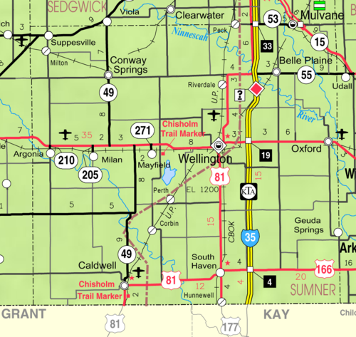
According to the U.S. Census Bureau, the county has a total area of 1,185 square miles (3,070 km2), of which 1,182 square miles (3,060 km2) is land and 3.0 square miles (7.8 km2) (0.3%) is water. [5]

Adjacent counties

Demographics

Population pyramid based on 2000 census age data USA Sumner County, Kansas age pyramid.svg
Population pyramid based on 2000 census age data
Historical population
CensusPop.Note
1870 22
1880 20,81294,500.0%
1890 30,27145.4%
1900 25,631−15.3%
1910 30,65419.6%
1920 29,213−4.7%
1930 28,960−0.9%
1940 26,163−9.7%
1950 23,646−9.6%
1960 25,3167.1%
1970 23,553−7.0%
1980 24,9285.8%
1990 25,8413.7%
2000 25,9460.4%
2010 24,132−7.0%
2020 22,382−7.3%
2023 (est.)22,334 [6] −0.2%
U.S. Decennial Census [7]
1790-1960 [8] 1900-1990 [9]
1990-2000 [10] 2010-2020 [1]

Sumner County is part of the Wichita, KS Metropolitan Statistical Area.

As of the census [11] of 2000, there were 25,946 people, 9,888 households, and 7,089 families residing in the county. The population density was 22 people per square mile (8.5 people/km2). There were 10,877 housing units at an average density of 9 per square mile (3.5/km2). The racial makeup of the county was 94.62% White, 0.71% Black or African American, 1.05% Native American, 0.22% Asian, 0.05% Pacific Islander, 1.29% from other races, and 2.06% from two or more races. 3.58% of the population were Hispanic or Latino of any race.

There were 9,888 households, out of which 34.50% had children under the age of 18 living with them, 59.90% were married couples living together, 8.00% had a female householder with no husband present, and 28.30% were non-families. 25.60% of all households were made up of individuals, and 12.40% had someone living alone who was 65 years of age or older. The average household size was 2.58 and the average family size was 3.10.

In the county, the population was spread out, with 28.50% under the age of 18, 7.50% from 18 to 24, 26.20% from 25 to 44, 22.40% from 45 to 64, and 15.50% who were 65 years of age or older. The median age was 38 years. For every 100 females, there were 96.80 males. For every 100 females age 18 and over, there were 93.90 males.

The median income for a household in the county was $39,415, and the median income for a family was $46,739. Males had a median income of $36,616 versus $23,020 for females. The per capita income for the county was $18,305. About 7.20% of families and 9.50% of the population were below the poverty line, including 11.20% of those under age 18 and 6.80% of those age 65 or over.

Government

Presidential elections

Sumner County, like many neighboring counties, often votes for the Republican Party in presidential elections. However, in 1992 independent candidate Ross Perot came within two percent of winning the county against George H. W. Bush. The last time the county voted for a Democratic candidate was Jimmy Carter in 1976.

Presidential election results
United States presidential election results for Sumner County, Kansas [12]
Year Republican Democratic Third party
No.%No.%No.%
2020 8,10574.17%2,59123.71%2322.12%
2016 6,98471.84%2,07621.35%6626.81%
2012 6,26068.48%2,65829.08%2232.44%
2008 6,73765.17%3,35332.44%2472.39%
2004 7,09267.62%3,21730.67%1791.71%
2000 6,17660.36%3,54934.69%5074.96%
1996 5,95254.22%3,63833.14%1,38712.64%
1992 4,08735.27%3,56430.76%3,93733.97%
1988 5,39453.71%4,41743.99%2312.30%
1984 6,94264.32%3,70834.36%1431.32%
1980 6,03857.53%3,76135.83%6976.64%
1976 4,64544.92%5,38552.08%3103.00%
1972 6,94168.08%2,68526.34%5695.58%
1968 5,62254.48%3,56234.52%1,13611.01%
1964 4,76045.55%5,57453.34%1161.11%
1960 7,21961.51%4,46238.02%550.47%
1956 7,02462.95%4,08836.64%460.41%
1952 8,13468.95%3,56730.24%960.81%
1948 5,92255.42%4,57142.78%1921.80%
1944 6,34359.87%4,18739.52%640.60%
1940 6,58551.86%5,98847.16%1250.98%
1936 4,94638.23%7,96661.57%270.21%
1932 4,92642.40%6,35354.68%3402.93%
1928 8,95179.64%2,10818.75%1811.61%
1924 5,55254.93%2,55625.29%2,00019.79%
1920 5,83060.49%3,45435.84%3543.67%
1916 4,07939.37%5,51953.27%7637.36%
1912 78112.21%2,55739.97%3,06047.83%
1908 3,23551.30%2,77243.96%2994.74%
1904 3,26461.61%1,48928.10%54510.29%
1900 3,18450.61%2,98247.40%1251.99%
1896 2,51544.76%3,04854.24%561.00%
1892 3,50345.52%00.00%4,19254.48%
1888 3,49949.72%2,13930.39%1,40019.89%

Laws

Following amendment to the Kansas Constitution in 1986, Sumner County remained a prohibition, or "dry", county until 1992, when voters approved the sale of alcoholic liquor by the individual drink with a 30 percent food sales requirement. [13]

Education

Unified school districts

Communities

2005 KDOT Map of Sumner County (map legend) Map of Sumner Co, Ks, USA.png
2005 KDOT Map of Sumner County (map legend)

‡ means a community has portions in an adjacent county. † means a community is designated a Census-Designated Place (CDP) by the United States Census Bureau.

Cities

Unincorporated communities

Ghost towns

Townships

1915 Railroad Map of Sumner County Stouffer's Railroad Map of Kansas 1915-1918 Sumner County.png
1915 Railroad Map of Sumner County

Sumner County is divided into thirty townships. The cities of Caldwell and Wellington are considered governmentally independent and are excluded from the census figures for the townships. In the following table, the population center is the largest city (or cities) included in that township's population total, if it is of a significant size.

Sources: 2000 U.S. Gazetteer from the U.S. Census Bureau.
Township FIPS Population
center
PopulationPopulation
density
/km2 (/sq mi)
Land area
km2 (sq mi)
Water area
km2 (sq mi)
Water %Geographic coordinates
Avon035753193 (9)93 (36)0 (0)0.03% 37°15′58″N97°18′56″W / 37.26611°N 97.31556°W / 37.26611; -97.31556
Belle Plaine055253,50433 (87)105 (40)1 (0)0.69% 37°24′33″N97°17′19″W / 37.40917°N 97.28861°W / 37.40917; -97.28861
Bluff07750741 (1)136 (53)0 (0)0% 37°3′19″N97°44′18″W / 37.05528°N 97.73833°W / 37.05528; -97.73833
Caldwell099252001 (4)136 (52)0 (0)0.02% 37°3′42″N97°37′52″W / 37.06167°N 97.63111°W / 37.06167; -97.63111
Chikaskia13150691 (2)94 (36)0 (0)0.02% 37°10′4″N97°38′4″W / 37.16778°N 97.63444°W / 37.16778; -97.63444
Conway153001,28614 (35)94 (36)0 (0)0% 37°24′33″N97°39′4″W / 37.40917°N 97.65111°W / 37.40917; -97.65111
Creek163002413 (7)95 (37)0 (0)0.05% 37°20′10″N97°44′18″W / 37.33611°N 97.73833°W / 37.33611; -97.73833
Dixon182007388 (20)94 (36)0 (0)0% 37°15′55″N97°45′44″W / 37.26528°N 97.76222°W / 37.26528; -97.76222
Downs185251592 (5)91 (35)0 (0)0% 37°10′43″N97°31′12″W / 37.17861°N 97.52000°W / 37.17861; -97.52000
Eden198004525 (12)95 (37)0 (0)0% 37°25′45″N97°45′36″W / 37.42917°N 97.76000°W / 37.42917; -97.76000
Falls228751871 (3)139 (54)0 (0)0% 37°4′48″N97°31′52″W / 37.08000°N 97.53111°W / 37.08000; -97.53111
Gore269752,22027 (70)83 (32)1 (1)1.69% 37°26′56″N97°12′28″W / 37.44889°N 97.20778°W / 37.44889; -97.20778
Greene28525801 (2)93 (36)0 (0)0.10% 37°10′28″N97°18′26″W / 37.17444°N 97.30722°W / 37.17444; -97.30722
Guelph291751641 (3)141 (55)0 (0)0% 37°4′10″N97°19′21″W / 37.06944°N 97.32250°W / 37.06944; -97.32250
Harmon301252773 (9)79 (31)0 (0)0% 37°21′31″N97°19′6″W / 37.35861°N 97.31833°W / 37.35861; -97.31833
Illinois338001782 (5)94 (36)0 (0)0.05% 37°25′20″N97°31′6″W / 37.42222°N 97.51833°W / 37.42222; -97.51833
Jackson349251532 (4)94 (36)0 (0)0.02% 37°10′36″N97°24′38″W / 37.17667°N 97.41056°W / 37.17667; -97.41056
London424007747 (19)107 (41)1 (0)0.93% 37°26′4″N97°24′32″W / 37.43444°N 97.40889°W / 37.43444; -97.40889
Morris48375350 (1)94 (36)0 (0)0% 37°10′35″N97°44′17″W / 37.17639°N 97.73806°W / 37.17639; -97.73806
Osborne533352733 (8)92 (35)1 (0)1.30% 37°15′11″N97°32′9″W / 37.25306°N 97.53583°W / 37.25306; -97.53583
Oxford538751,40314 (37)99 (38)1 (0)1.08% 37°16′29″N97°10′31″W / 37.27472°N 97.17528°W / 37.27472; -97.17528
Palestine541752493 (9)72 (28)1 (0)1.26% 37°21′7″N97°13′5″W / 37.35194°N 97.21806°W / 37.35194; -97.21806
Ryan619502393 (7)92 (36)0 (0)0% 37°15′37″N97°38′51″W / 37.26028°N 97.64750°W / 37.26028; -97.64750
Seventy Six640002383 (7)93 (36)0 (0)0% 37°21′15″N97°24′40″W / 37.35417°N 97.41111°W / 37.35417; -97.41111
South Haven666756705 (12)140 (54)0 (0)0% 37°2′44″N97°24′51″W / 37.04556°N 97.41417°W / 37.04556; -97.41417
Springdale675757618 (21)93 (36)0 (0)0% 37°21′57″N97°38′54″W / 37.36583°N 97.64833°W / 37.36583; -97.64833
Sumner692251502 (4)94 (36)0 (0)0% 37°21′8″N97°31′12″W / 37.35222°N 97.52000°W / 37.35222; -97.52000
Valverde733501472 (4)93 (36)1 (0)0.76% 37°11′5″N97°12′13″W / 37.18472°N 97.20361°W / 37.18472; -97.20361
Walton753004313 (8)139 (54)0 (0)0% 37°4′43″N97°11′36″W / 37.07861°N 97.19333°W / 37.07861; -97.19333
Wellington765003444 (11)81 (31)0 (0)0.06% 37°16′17″N97°25′16″W / 37.27139°N 97.42111°W / 37.27139; -97.42111

See also

Community information for Kansas

Related Research Articles

<span class="mw-page-title-main">Seward County, Kansas</span> County in Kansas, United States

Seward County is a county of the U.S. state of Kansas. Its county seat and largest city is Liberal. As of the 2020 census, the county population was 21,964. The county was formed on March 20, 1873, and named after William Seward, a politician and Secretary of State under Abraham Lincoln and Andrew Johnson.

<span class="mw-page-title-main">Sedgwick County, Kansas</span> County in Kansas, United States

Sedgwick County is located in the U.S. state of Kansas. Its county seat is Wichita, the most populous city in the state. As of the 2020 census, the population was 523,824, making it the second-most populous county in Kansas. The county was named for John Sedgwick, the highest ranking Union general killed during the American Civil War.

<span class="mw-page-title-main">Pottawatomie County, Kansas</span> County in Kansas, United States

Pottawatomie County is a county located in the U.S. state of Kansas. Its county seat is Westmoreland. As of the 2020 census, the county population was 25,348. The county was named for the Potawatomi tribe.

<span class="mw-page-title-main">Phillips County, Kansas</span> County in Kansas, United States

Phillips County is a county located in the U.S. state of Kansas. Its county seat and largest city is Phillipsburg. As of the 2020 census, the county population was 4,981. The county was named after William Phillips, a free-state abolition journalist and colonel in the American Civil War.

<span class="mw-page-title-main">Osage County, Kansas</span> County in Kansas, United States

Osage County is a county located in the U.S. state of Kansas. Its county seat is Lyndon, and its most populous city is Osage City. As of the 2020 census, the county population was 15,766. The county was originally organized in 1855 as Weller County, then renamed in 1859 after the Osage tribe.

<span class="mw-page-title-main">Neosho County, Kansas</span> County in Kansas, United States

Neosho County is a county located in Southeast Kansas. Its county seat is Erie. As of the 2020 census, the county population was 15,904. The county was named for the Neosho River, which passes through the county.

<span class="mw-page-title-main">Nemaha County, Kansas</span> County in Kansas, United States

Nemaha County is a county located in the northeastern part of the U.S. state of Kansas. Its county seat is Seneca. As of the 2020 census, the county population was 10,273. The county was named for the Nemaha River.

<span class="mw-page-title-main">Kingman County, Kansas</span> County in Kansas, United States

Kingman County is a county located in the U.S. state of Kansas. Its county seat and largest city is Kingman. As of the 2020 census, the county population was 7,470. The county was named for Samuel Kingman, a chief justice of the Kansas Supreme Court during the 1860s and 1870s.

<span class="mw-page-title-main">Jackson County, Kansas</span> County in Kansas, United States

Jackson County is a county in the U.S. state of Kansas. Its county seat and most populous city is Holton. As of the 2020 census, the county population was 13,232. The county, first named Calhoun County for pro-slavery South Carolina Senator John C. Calhoun, was renamed in 1859 for President Andrew Jackson. The Prairie Band Potawatomi Indian Reservation, near the center of the county, comprises about 18.5% of the county's area.

<span class="mw-page-title-main">Greenwood County, Kansas</span> County in Kansas, United States

Greenwood County is a county located in the southeast portion of the U.S. state of Kansas. Its county seat and most populous city is Eureka. As of the 2020 census, the county population was 6,016. The county was named for Alfred Greenwood, a U.S. congressman from Arkansas that advocated Kansas statehood.

<span class="mw-page-title-main">Coffey County, Kansas</span> County in Kansas, United States

Coffey County is a county located in Eastern Kansas. Its county seat and most populous city is Burlington. As of the 2020 census, the county population was 8,360. It was named after A.M. Coffey, a territorial legislator and Free-Stater during Bleeding Kansas era.

<span class="mw-page-title-main">Chautauqua County, Kansas</span> County in Kansas, United States

Chautauqua County is a county located in Southeast Kansas, United States. Its county seat and most populous city is Sedan. As of the 2020 census, the county population was 3,379. The county is named for Chautauqua County, New York, the birthplace of Edward Jaquins, a Kansas politician who was instrumental in getting the county established.

<span class="mw-page-title-main">Butler County, Kansas</span> County in Kansas, United States

Butler County is a county in the U.S. state of Kansas and is the largest county in the state by total area. Its county seat is El Dorado and its most populous city is Andover. As of the 2020 census, the county population was 67,380. The county was named for Andrew Butler, a U.S. Senator from South Carolina who coauthored the Kansas–Nebraska Act.

<span class="mw-page-title-main">Barber County, Kansas</span> County in Kansas, United States

Barber County is a county located in the south-central portion of the U.S. state of Kansas. Its county seat and most populous city is Medicine Lodge. As of the 2020 census, the county population was 4,228. The county was named for Thomas Barber, an abolitionist who was killed in Douglas County in 1855 during the Wakarusa War.

<span class="mw-page-title-main">Caldwell, Kansas</span> City in Sumner County, Kansas

Caldwell is a city in Sumner County, Kansas, United States. As of the 2020 census, the population of the city was 1,025.

<span class="mw-page-title-main">Hunnewell, Kansas</span> City in Sumner County, Kansas

Hunnewell is a city in Sumner County, Kansas, United States. As of the 2020 census, the population of the city was 44.

<span class="mw-page-title-main">Wellington, Kansas</span> City in Sumner County, Kansas

Wellington is a city in and the county seat of Sumner County, Kansas, United States. As of the 2020 census, the population of the city was 7,715.

<span class="mw-page-title-main">Mulvane, Kansas</span> City in Sedgwick and Sumner County, Kansas

Mulvane is a city in Sedgwick and Sumner counties in the U.S. state of Kansas. As of the 2020 census, the population of the city was 6,286.

<span class="mw-page-title-main">Peck, Kansas</span> Unincorporated community in Sedgwick and Sumner Counties of Kansas

Peck is an unincorporated community on the Sedgwick and Sumner County border in Kansas, United States. As of the 2020 census, the population of the community and nearby areas was 162. It is located about 2 miles west of the Kansas Star Casino at Meridian Ave and 119th St S, next the Union Pacific Railroad.

<span class="mw-page-title-main">Milton, Kansas</span> Unincorporated community in Sumner County, Kansas

Milton is an unincorporated community in Sumner County, Kansas, United States. As of the 2020 census, the population of the community and nearby areas was 155. It is located 4.5 miles (7.2 km) southeast of Norwich at the intersection of N Argonia Rd and W 120th Ave N, next to the railroad.

References

  1. 1 2 3 "QuickFacts; Sumner County, Kansas; Population, Census, 2020 & 2010". United States Census Bureau. Archived from the original on August 20, 2021. Retrieved August 20, 2021.
  2. "Find a County". National Association of Counties. Retrieved June 7, 2011.
  3. "Rock Island Rail History". Archived from the original on June 19, 2011. Retrieved April 18, 2011.
  4. Kansas Star Casino Plans To Open; The Wichita Eagle; December 7, 2011.
  5. "US Gazetteer files: 2010, 2000, and 1990". United States Census Bureau. February 12, 2011. Retrieved April 23, 2011.
  6. "Annual Estimates of the Resident Population for Counties: April 1, 2020 to July 1, 2023". United States Census Bureau. Retrieved April 3, 2024.
  7. "U.S. Decennial Census". United States Census Bureau. Retrieved July 29, 2014.
  8. "Historical Census Browser". University of Virginia Library. Retrieved July 29, 2014.
  9. "Population of Counties by Decennial Census: 1900 to 1990". United States Census Bureau. Retrieved July 29, 2014.
  10. "Census 2000 PHC-T-4. Ranking Tables for Counties: 1990 and 2000" (PDF). United States Census Bureau. Archived (PDF) from the original on March 27, 2010. Retrieved July 29, 2014.
  11. "U.S. Census website". United States Census Bureau . Retrieved January 31, 2008.
  12. "Dave Leip's Atlas of U.S. Presidential Elections".
  13. "Map of Wet and Dry Counties". Alcoholic Beverage Control, Kansas Department of Revenue. November 2006. Archived from the original on October 8, 2007. Retrieved December 26, 2007.
Notes

    Further reading

    County
    Historical
    Maps