Whitewater, Kansas

Last updated

Whitewater, Kansas
Butler County Kansas Incorporated and Unincorporated areas Whitewater Highlighted.svg
Location within Butler County and Kansas
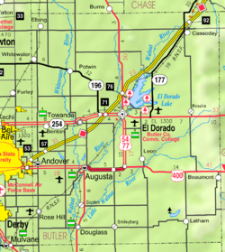
Map of Butler Co, Ks, USA.png
Coordinates: 37°57′49″N97°08′46″W / 37.96361°N 97.14611°W / 37.96361; -97.14611 [1]
Country United States
State Kansas
County Butler
Founded1870s
Platted 1885
Incorporated 1890
Government
  Type Mayor–Council
   Mayor Brady Gragg [2] [3]
Area
[4]
  Total0.41 sq mi (1.06 km2)
  Land0.41 sq mi (1.06 km2)
  Water0.00 sq mi (0.00 km2)
Elevation
[1]
1,365 ft (416 m)
Population
 (2020) [5]
  Total661
  Density1,600/sq mi (620/km2)
Time zone UTC-6 (CST)
  Summer (DST) UTC-5 (CDT)
ZIP code
67154
Area code 316
FIPS code 20-78050
GNIS ID 2397303 [1]
Website whitewaterks.gov

Whitewater is a city in Butler County, Kansas, United States. [1] As of the 2020 census, the population of the city was 661. [5]

Contents

History

Early history

For many millennia, the Great Plains of North America was inhabited by nomadic Native Americans. From the 16th century to 18th century, the Kingdom of France claimed ownership of large parts of North America. In 1762, after the French and Indian War, France secretly ceded New France to Spain, per the Treaty of Fontainebleau.

19th century

In 1802, Spain returned most of the land to France. In 1803, most of the land for modern day Kansas was acquired by the United States from France as part of the 828,000 square mile Louisiana Purchase for 2.83 cents per acre.

In 1854, the Kansas Territory was organized, then in 1861 Kansas became the 34th U.S. state. In 1855, Butler County was established within the Kansas Territory, which included the land for modern day Whitewater.

The city originally formed several miles to the east. A post office was established as White Water (as two words) on August 7, 1871. The post office was renamed to Ovo on July 7, 1882.

In 1887, the Chicago, Kansas and Nebraska Railway built a branch line north–south from Herington through Whitewater to Caldwell. [6] It foreclosed in 1891 and was taken over by Chicago, Rock Island and Pacific Railway, which shut down in 1980 and reorganized as Oklahoma, Kansas and Texas Railroad, merged in 1988 with Missouri Pacific Railroad, merged in 1997 with Union Pacific Railroad. Most locals still refer to this railroad as the "Rock Island".

Between 1885 and 1888, several buildings were moved to the present location on the Whitewater River after the Missouri Pacific railroad came through the area. The city was established where the Missouri Pacific and Rock Island railroads intersected. [7] The post office was renamed to White Water on May 15, 1888. [8]

20th century

The historic Oak Lawn Farm Dairy Barn was built near Whitewater in 1926.

On November 1, 1950, the post office name was changed to Whitewater (one word).

In 1961, Frederic Remington High School was built immediately north of Brainerd. Leading up to this new school, Whitewater, Potwin, Brainerd, Elbing, Furley, Countryside, and Golden Gate schools merged to form a joint rural high school. Heated opposition between Whitewater and Potwin occurred during the discussion for the location of the new high school. Rural voters pushed for a centralized location in neither town. A public vote was passed to build the new school near Brainerd. [9]

Geography

Whitewater is located along the West Branch of the Whitewater River.

According to the United States Census Bureau, the city has a total area of 0.40 square miles (1.04 km2), all of it land. [10]

Demographics

Historical population
CensusPop.Note
1890 184
1900 26745.1%
1910 51894.0%
1920 5567.3%
1930 5560.0%
1940 515−7.4%
1950 453−12.0%
1960 49910.2%
1970 5204.2%
1980 75144.4%
1990 683−9.1%
2000 653−4.4%
2010 71810.0%
2020 661−7.9%
U.S. Decennial Census

2010 census

As of the census [11] of 2010, there were 718 people, 254 households, and 189 families living in the city. The population density was 1,795.0 inhabitants per square mile (693.1/km2). There were 267 housing units at an average density of 667.5 per square mile (257.7/km2). The racial makeup of the city was 93.3% White, 1.8% Native American, 0.1% Asian, 0.8% Pacific Islander, 0.4% from other races, and 3.5% from two or more races. Hispanic or Latino of any race were 2.6% of the population.

There were 254 households, of which 37.8% had children under the age of 18 living with them, 60.2% were married couples living together, 8.7% had a female householder with no husband present, 5.5% had a male householder with no wife present, and 25.6% were non-families. 23.6% of all households were made up of individuals, and 9.5% had someone living alone who was 65 years of age or older. The average household size was 2.60 and the average family size was 3.05.

The median age in the city was 42.7 years. 25.6% of residents were under the age of 18; 5.1% were between the ages of 18 and 24; 22.4% were from 25 to 44; 27% were from 45 to 64; and 19.8% were 65 years of age or older. The gender makeup of the city was 47.8% male and 52.2% female.

2000 census

As of the census [12] of 2000, there were 653 people, 232 households, and 171 families living in the city. The population density was 1,976.0 inhabitants per square mile (762.9/km2). There were 255 housing units at an average density of 771.6 per square mile (297.9/km2). The racial makeup of the city was 96.78% White, 0.31% Native American, 0.15% Asian, 0.15% from other races, and 2.60% from two or more races. Hispanic or Latino of any race were 0.46% of the population.

There were 232 households, out of which 36.6% had children under the age of 18 living with them, 62.5% were married couples living together, 8.2% had a female householder with no husband present, and 25.9% were non-families. 23.3% of all households were made up of individuals, and 11.6% had someone living alone who was 65 years of age or older. The average household size was 2.53 and the average family size was 2.99.

In the city, the population was spread out, with 24.3% under the age of 18, 5.5% from 18 to 24, 25.4% from 25 to 44, 20.8% from 45 to 64, and 23.9% who were 65 years of age or older. The median age was 41 years. For every 100 females, there were 89.3 males. For every 100 females age 18 and over, there were 83.0 males.

The median income for a household in the city was $42,813, and the median income for a family was $43,984. Males had a median income of $33,958 versus $21,417 for females. The per capita income for the city was $20,078. About 3.3% of families and 5.4% of the population were below the poverty line, including 5.0% of those under age 18 and 4.2% of those age 65 or over.

Government

The Whitewater government consists of a mayor and five council members. The council meets the 4th Monday of each month at 7PM. [2] [3]

Education

Public

The community is served by Remington USD 206 public school district. The Remington High School mascot is a Bronco.

Library

Media

Print

Radio

Whitewater is served by numerous radio stations of the Wichita-Hutchinson listening market area, [14] and satellite radio. See Media in Wichita, Kansas .

Television

Whitewater is served by over-the-air ATSC digital TV of the Wichita-Hutchinson viewing market area, [15] cable TV, and satellite TV. See Media in Wichita, Kansas .

Infrastructure

1914 railroad map Kansas Map 1914 Chase Dickinson Marion Morris.jpg
1914 railroad map

Transportation

K-196 highway runs along the south side of the city. The Oklahoma Kansas Texas (OKT) [16] line of the Union Pacific Railroad runs through the north-west side of the city.

Notable person

See also

Related Research Articles

<span class="mw-page-title-main">Sumner County, Kansas</span> County in Kansas, United States

Sumner County is a county located in the U.S. state of Kansas. Its county seat is Wellington. As of the 2020 census, the population was 22,382. The county is named after Charles Sumner, a U.S. Senator from Massachusetts who was a leader of Reconstruction politics.

<span class="mw-page-title-main">Butler County, Kansas</span> County in Kansas, United States

Butler County is a county in the U.S. state of Kansas and is the largest county in the state by total area. Its county seat is El Dorado and its most populous city is Andover. As of the 2020 census, the county population was 67,380. The county was named for Andrew Butler, a U.S. Senator from South Carolina who coauthored the Kansas–Nebraska Act.

<span class="mw-page-title-main">Andover, Kansas</span> City in Butler County, Kansas

Andover is a city in Butler County, Kansas, United States, and a suburb of Wichita. As of the 2020 census, the population of the city was 14,892. Andover is the most populated city in Butler County.

<span class="mw-page-title-main">Augusta, Kansas</span> City in Butler County, Kansas

Augusta is a city in Butler County, Kansas, United States. As of the 2020 census, the population of the city was 9,256.

<span class="mw-page-title-main">El Dorado, Kansas</span> City in Butler County, Kansas

El Dorado is a city and county seat of Butler County, Kansas, United States. It is situated along the Walnut River in the central part of Butler County and located in south-central Kansas. As of the 2020 census, the population of the city was 12,870. It is home to Butler Community College.

<span class="mw-page-title-main">Elbing, Kansas</span> City in Butler County, Kansas

Elbing is a city in Butler County, Kansas, United States. It is named after the city Elbląg in northern Poland, formerly Prussia. As of the 2020 census, the population of the city was 226. It is located about 10.7 miles east of Interstate 135 in Newton, along the Union Pacific Railroad.

<span class="mw-page-title-main">Potwin, Kansas</span> City in Butler County, Kansas

Potwin is a city in Butler County, Kansas, United States. It is named after the town site land owner Charles Potwin. As of the 2020 census, the population of the city was 421.

<span class="mw-page-title-main">Ellis, Kansas</span> City in Ellis County, Kansas

Ellis is a city in Ellis County, Kansas, United States. As of the 2020 census, the population of the city was 1,958.

<span class="mw-page-title-main">Hesston, Kansas</span> City in Harvey County, Kansas

Hesston is a city in Harvey County, Kansas, United States. As of the 2020 census, the population of the city was 3,505. Large manufacturing facilities for AGCO and Excel Industries are located in Hesston. It is home of Hesston College.

<span class="mw-page-title-main">Walton, Kansas</span> City in Harvey County, Kansas

Walton is a city in Harvey County, Kansas, United States. It is named in honor of one of the 19th century stockholders of Atchison, Topeka and Santa Fe Railway. As of the 2020 census, the population of the city was 219.

<span class="mw-page-title-main">Burns, Kansas</span> City in Marion County, Kansas

Burns is a city in Marion County, Kansas, United States. As of the 2020 census, the population of the city was 234. The city name came from a nearby train station, which was named prior to the city being incorporated. It is located between El Dorado and Florence along the west side of U.S. Route 77 highway. The south edge of the city is the border of Marion and Butler counties.

<span class="mw-page-title-main">Lehigh, Kansas</span> City in Marion County, Kansas

Lehigh is a city in Marion County, Kansas, United States. As of the 2020 census, the population of the city was 161. It is located between Hillsboro and Canton on the north side of U.S. Route 56.

<span class="mw-page-title-main">Marion, Kansas</span> City in Marion County, Kansas

Marion is a city in, and the county seat of, Marion County, Kansas, United States. As of the 2020 census, the population of the city was 1,922. The city was named in honor of Francis Marion, a brigadier general of the American Revolutionary War, known as the "Swamp Fox".

<span class="mw-page-title-main">Hutchinson, Kansas</span> City in Reno County, Kansas

Hutchinson is the largest city and county seat in Reno County, Kansas, United States, and located on the Arkansas River. It has been home to salt mines since 1887, thus its nickname of "Salt City", but locals call it "Hutch". As of the 2020 census, the population of the city was 40,006.

<span class="mw-page-title-main">Haysville, Kansas</span> City in Sedgwick County, Kansas

Haysville is a city in Sedgwick County, Kansas, United States, and a suburb of Wichita. As of the 2020 census, the population of the city was 11,262. Haysville is known as the "Peach Capital of Kansas".

<span class="mw-page-title-main">Mulvane, Kansas</span> City in Sedgwick and Sumner County, Kansas

Mulvane is a city in Sedgwick and Sumner counties in the U.S. state of Kansas. As of the 2020 census, the population of the city was 6,286.

<span class="mw-page-title-main">Frederic Remington High School</span> High school in Whitewater, Kansas, United States

Frederic Remington High School is a public secondary school in rural Butler County, Kansas between the cities of Whitewater and Potwin. It is located north of K-196 highway, along the north side of the unincorporated community of Brainerd and southeast of the intersection of NW Meadowlark Rd and NW 90th St. It is one of three schools operated by Remington USD 206 public school district. This school is also commonly known as Remington High School as the shorter name, and Whitewater-Remington High School on KSHSAA sport lists.

<span class="mw-page-title-main">Brainerd, Kansas</span> Unincorporated community in Butler County, Kansas

Brainerd is an unincorporated community in Butler County, Kansas, United States. It is located on the north side of K-196 highway between the cities of Whitewater and Potwin.

<span class="mw-page-title-main">Furley, Kansas</span> Unincorporated community in Sedgwick County, Kansas

Furley is an unincorporated community in Sedgwick County, Kansas, United States. As of the 2020 census, the population of the community and nearby areas was 39. It is located northwest of the intersection of Greenwich Road and 101st Street N, along the Union Pacific Railroad.

<span class="mw-page-title-main">Plum Grove, Kansas</span> Ghost town in Kansas, United States

Plum Grove is a ghost town in Butler County, Kansas, United States. It was located in a rural area north of modern-day Potwin. No buildings remain at this former community site.

References

  1. 1 2 3 4 U.S. Geological Survey Geographic Names Information System: Whitewater, Kansas
  2. 1 2 Whitewater - Directory of Public Officials
  3. 1 2 Whitewater - Government
  4. "2019 U.S. Gazetteer Files". United States Census Bureau. Retrieved July 24, 2020.
  5. 1 2 "Profile of Whitewater, Kansas in 2020". United States Census Bureau. Archived from the original on November 12, 2021. Retrieved November 12, 2021.
  6. Rock Island Rail History
  7. http://skyways.lib.ks.us/genweb/archives/butler/history/1916/11.html History of Butler County, pp. 175-176
  8. "Kansas Post Offices, 1828-1961, page 2 (archived)". Kansas Historical Society. Archived from the original on October 9, 2013. Retrieved June 5, 2014.
  9. USD 206 History
  10. "US Gazetteer files 2010". United States Census Bureau . Retrieved July 6, 2012.
  11. "U.S. Census website". United States Census Bureau . Retrieved July 6, 2012.
  12. "U.S. Census website". United States Census Bureau . Retrieved January 31, 2008.
  13. Whitewater Memorial Library
  14. Wichita-Hutchinson Radio market.
  15. Wichita-Hutchinson TV market.
  16. "UP Railroad Common Line Names" (PDF). Union Pacific Railroad . Retrieved August 2, 2010.

Further reading