Brainerd, Kansas

Last updated

Brainerd, Kansas
Map of Butler Co, Ks, USA.png
USA Kansas location map.svg
Red pog.svg
Brainerd
Usa edcp location map.svg
Red pog.svg
Brainerd
Coordinates: 37°57′04″N97°05′43″W / 37.95111°N 97.09528°W / 37.95111; -97.09528 [1]
Country United States
State Kansas
County Butler
Township Milton
Platted 1885
Named for Elisha B. Brainerd (landowner)
Elevation
[1]
1,385 ft (422 m)
Time zone UTC-6 (CST)
  Summer (DST) UTC-5 (CDT)
ZIP code
67154
Area code 316
FIPS code 20-08200
GNIS ID 473721 [1]

Brainerd is an unincorporated community in Butler County, Kansas, United States. [1] It is located on the north side of K-196 highway between the cities of Whitewater and Potwin.

Contents

History

Early history

For many millennia, the Great Plains of North America was inhabited by nomadic Native Americans. From the 16th century to 18th century, the Kingdom of France claimed ownership of large parts of North America. In 1762, after the French and Indian War, France secretly ceded New France to Spain, per the Treaty of Fontainebleau.

19th century

In 1802, Spain returned most of the land to France. In 1803, most of the land for modern day Kansas was acquired by the United States from France as part of the 828,000 square mile Louisiana Purchase for 2.83 cents per acre.

In 1854, the Kansas Territory was organized, then in 1861 Kansas became the 34th U.S. state. In 1855, Butler County was established within the Kansas Territory, which included the land for modern day Brainerd.

A post office was established in Holden on December 14, 1870, then renamed to Brainerd on January 25, 1886. The post office closed on August 31, 1907. [2]

Brainerd was platted in 1885 around a depot along the McPherson branch of the Missouri Pacific Railroad. [3] The community was named for Elisha B. Brainerd, an original landowner. [4] It quickly grew, including some businesses and houses from nearby community of Plum Grove. [5]

20th century

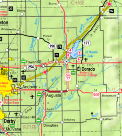
In 1961, Frederic Remington High School was built immediately north of Brainerd. Leading up to this new school, Whitewater, Potwin, Brainerd, Elbing, Furley, Countryside, and Golden Gate schools merged to form a joint rural high school. Heated opposition between Whitewater and Potwin occurred during the discussion for the location of the new high school. Rural voters pushed for a centralized location in neither town. A public vote was passed to build the new school near Brainerd. [6]

21st century

In 2006, the Remington Rock monument was built near the Frederic Remington High School.

Geography

Brainerd is located at 37°57′4″N97°5′43″W / 37.95111°N 97.09528°W / 37.95111; -97.09528 (37.9511267, -97.0953122), [7] which is the north side of K-196 highway between the cities of Whitewater and Potwin.

Education

The community is served by Remington USD 206 public school district. The Remington High School mascot is a Bronco.

Media

Print

Radio

Goessel is served by numerous radio stations of the Wichita-Hutchinson listening market area, [8] and satellite radio. See Media in Wichita, Kansas .

Television

Goessel is served by over-the-air ATSC digital TV of the Wichita-Hutchinson viewing market area, [9] cable TV, and satellite TV. See Media in Wichita, Kansas .

Infrastructure

Transportation

K-196 highway runs along the south side of the community.

Related Research Articles

<span class="mw-page-title-main">Marion County, Kansas</span> County in Kansas, United States

Marion County is a county located in the U.S. state of Kansas. Its county seat is Marion and its most populous city is Hillsboro. As of the 2020 census, the county population was 11,823. The county was named in honor of Francis Marion, a brigadier general of the American Revolutionary War, known as the "Swamp Fox".

<span class="mw-page-title-main">Butler County, Kansas</span> County in Kansas, United States

Butler County is a county in the U.S. state of Kansas and is the largest county in the state by total area. Its county seat is El Dorado and its most populous city is Andover. As of the 2020 census, the county population was 67,380. The county was named for Andrew Butler, a U.S. Senator from South Carolina who coauthored the Kansas–Nebraska Act.

<span class="mw-page-title-main">Elbing, Kansas</span> City in Butler County, Kansas

Elbing is a city in Butler County, Kansas, United States. It is named after the city Elbląg in northern Poland, formerly Prussia. As of the 2020 census, the population of the city was 226. It is located about 10.7 miles east of Interstate 135 in Newton, along the Union Pacific Railroad.

<span class="mw-page-title-main">Potwin, Kansas</span> City in Butler County, Kansas

Potwin is a city in Butler County, Kansas, United States. It is named after the town site land owner Charles Potwin. As of the 2020 census, the population of the city was 421.

<span class="mw-page-title-main">Whitewater, Kansas</span> City in Butler County, Kansas

Whitewater is a city in Butler County, Kansas, United States. As of the 2020 census, the population of the city was 661.

<span class="mw-page-title-main">Walton, Kansas</span> City in Harvey County, Kansas

Walton is a city in Harvey County, Kansas, United States. It is named in honor of one of the 19th century stockholders of Atchison, Topeka and Santa Fe Railway. As of the 2020 census, the population of the city was 219.

<span class="mw-page-title-main">Burns, Kansas</span> City in Marion County, Kansas

Burns is a city in Marion County, Kansas, United States. As of the 2020 census, the population of the city was 234. The city name came from a nearby train station, which was named prior to the city being incorporated. It is located between El Dorado and Florence along the west side of U.S. Route 77 highway. The south edge of the city is the border of Marion and Butler counties.

<span class="mw-page-title-main">Goessel, Kansas</span> City in Marion County, Kansas

Goessel is a city in Marion County, Kansas, United States. As of the 2020 census, the population of the city was 556. The city was named after Captain Kurt von Goessel (1852–1895) who went down with his ship, the Elbe, in the English Channel after it was rammed. It is located about 11 miles north of North Newton on the west side of K-15 highway.

<span class="mw-page-title-main">Hillsboro, Kansas</span> City in Marion County, Kansas

Hillsboro is a city in Marion County, Kansas, United States. As of the 2020 census, the population of the city was 2,732. The city was named after John Hill, who homesteaded in the area in 1871. Hillsboro is home of Tabor College.

<span class="mw-page-title-main">Lehigh, Kansas</span> City in Marion County, Kansas

Lehigh is a city in Marion County, Kansas, United States. As of the 2020 census, the population of the city was 161. It is located between Hillsboro and Canton on the north side of U.S. Route 56.

<span class="mw-page-title-main">Peabody, Kansas</span> City in Marion County, Kansas

Peabody is a city in Marion County, Kansas, United States. As of the 2020 census, the population of the city was 937. The city was named after F.H. Peabody of Boston, former vice-president of the Atchison, Topeka and Santa Fe Railway. Peabody is well known in the region for its Independence Day Celebration on July 4, and its historic 1880s downtown main street. It is located between Newton and Florence along U.S. Route 50 highway.

<span class="mw-page-title-main">K-196 (Kansas highway)</span> State highway in Kansas, United States

K-196 is a 28.474-mile-long (45.824 km) east–west state highway in Harvey and Butler Counties in the U.S. state of Kansas. K-196's western terminus is at Interstate 135 (I-135), U.S. Route 81 (US-81) and K-15 just south of Newton and the eastern terminus is at K-254 just east of El Dorado, Kansas. The highway runs along the south border the town of Whitewater and bypasses Potwin to the south.

<span class="mw-page-title-main">Plum Grove Township, Butler County, Kansas</span> Township in Kansas, United States

Plum Grove Township is a township in Butler County, Kansas, United States. As of the 2000 census, its population was 661.

<span class="mw-page-title-main">Wichita metropolitan area, Kansas</span> Metropolitan area in the United States

The Wichita, Kansas Metropolitan Statistical Area, as defined by the United States Office of Management and Budget, is an area consisting of four counties in south central Kansas, its only principal city is Wichita and its only central county is Sedgwick County. As of the 2013 American Community Survey, the MSA had a population of 637,989.

<span class="mw-page-title-main">Frederic Remington High School</span> High school in Whitewater, Kansas, United States

Frederic Remington High School is a public secondary school in rural Butler County, Kansas between the cities of Whitewater and Potwin. It is located north of K-196 highway, along the north side of the unincorporated community of Brainerd and southeast of the intersection of NW Meadowlark Rd and NW 90th St. It is one of three schools operated by Remington USD 206 public school district. This school is also commonly known as Remington High School as the shorter name, and Whitewater-Remington High School on KSHSAA sport lists.

<span class="mw-page-title-main">Furley, Kansas</span> Unincorporated community in Sedgwick County, Kansas

Furley is an unincorporated community in Sedgwick County, Kansas, United States. As of the 2020 census, the population of the community and nearby areas was 39. It is located northwest of the intersection of Greenwich Road and 101st Street N, along the Union Pacific Railroad.

The Butler County Times-Gazette is an American daily newspaper published in El Dorado, Kansas. It is owned by CherryRoad Media after being sold to the company from Gannett in 2021.

<span class="mw-page-title-main">Plum Grove, Kansas</span> Ghost town in Kansas, United States

Plum Grove is a ghost town in Butler County, Kansas, United States. It was located in a rural area north of modern-day Potwin. No buildings remain at this former community site.

Remington USD 206 is a public unified school district headquartered in Whitewater, Kansas, United States. Depending on the historic use, it may also have the word "Whitewater" either before or after "Remington". The district includes the communities of Whitewater, Potwin, Brainerd, Elbing, Furley, and nearby rural areas in Butler, Harvey, Sedgwick counties.

References

  1. 1 2 3 4 "Brainerd, Kansas", Geographic Names Information System , United States Geological Survey, United States Department of the Interior
  2. "Kansas Post Offices, 1828-1961 (archived)". Kansas Historical Society. Archived from the original on October 9, 2013. Retrieved June 5, 2014.
  3. Mooney, Vol. P. (1916). History of Butler County Kansas. Standard Publishing Company. pp.  175.
  4. "Profile for Brainerd, Kansas". ePodunk . Retrieved June 5, 2014.
  5. New town of Brainerd and Potwin; The Peabody Gazette; Page 4 of June 11, 1885.
  6. USD 206 History
  7. U.S. Geological Survey Geographic Names Information System: Brainerd
  8. "Wichita-Hutchinson Radio market". Archived from the original on October 22, 2011. Retrieved October 21, 2011.
  9. Wichita-Hutchinson TV market.

Further reading