Towanda, Kansas

Last updated

Towanda, Kansas
Butler County Kansas Incorporated and Unincorporated areas Towanda Highlighted.svg
Location within Butler County and Kansas
Map of Butler Co, Ks, USA.png
Coordinates: 37°47′43″N96°59′47″W / 37.79528°N 96.99639°W / 37.79528; -96.99639 [1]
Country United States
State Kansas
County Butler
Founded1870
Incorporated 1905
Named for "big village"
Government
  Type Council-Mayor
   Mayor Jennifer Shaults [2]
Area
[3]
  Total0.92 sq mi (2.38 km2)
  Land0.91 sq mi (2.37 km2)
  Water0.01 sq mi (0.01 km2)
Elevation
[1]
1,293 ft (394 m)
Population
 (2020) [4]
  Total1,447
  Density1,600/sq mi (610/km2)
Time zone UTC-6 (CST)
  Summer (DST) UTC-5 (CDT)
ZIP code
67144
Area code 316
FIPS code 20-71125
GNIS ID 2397041 [1]
Website cityoftowanda.com

Towanda is a city in Butler County, Kansas, United States. [1] As of the 2020 census, the population of the city was 1,447. [4]

Contents

History

Towanda was established in 1870 [5] [6] and incorporated in 1905. [7] Towanda is an Osage-language name meaning "big village".

An F4 tornado devastated the town on March 31, 1892, killing at least nine people and injuring 60. [8] [9]

21st century

In 2010, the Keystone-Cushing Pipeline (Phase II) was constructed a few blocks west of Towanda (immediately west of SW River Valley Rd), running north to south through Butler County. [10] [11] With much controversy over tax exemption and environmental concerns (if a leak ever occurs).[ citation needed ]

Geography

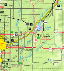
Towanda is located along the Whitewater River.

According to the United States Census Bureau, the city has a total area of 1.06 square miles (2.75 km2), all of it land. [12]

Demographics

Historical population
CensusPop.Note
1880 53
1890 156194.3%
1910 275
1920 718161.1%
1930 424−40.9%
1940 374−11.8%
1950 41711.5%
1960 1,031147.2%
1970 1,19015.4%
1980 1,33211.9%
1990 1,289−3.2%
2000 1,3383.8%
2010 1,4508.4%
2020 1,447−0.2%
U.S. Decennial Census

2010 census

As of the census [13] of 2010, there were 1,450 people, 524 households, and 397 families living in the city. The population density was 1,367.9 inhabitants per square mile (528.1/km2). There were 577 housing units at an average density of 544.3 per square mile (210.2/km2). The racial makeup of the city was 95.3% White, 0.3% African American, 1.1% Native American, 0.5% Asian, 0.4% Pacific Islander, 0.5% from other races, and 1.9% from two or more races. Hispanic or Latino of any race were 2.7% of the population.

There were 524 households, of which 39.9% had children under the age of 18 living with them, 59.9% were married couples living together, 9.4% had a female householder with no husband present, 6.5% had a male householder with no wife present, and 24.2% were non-families. 20.4% of all households were made up of individuals, and 7.2% had someone living alone who was 65 years of age or older. The average household size was 2.77 and the average family size was 3.15.

The median age in the city was 34.5 years. 30% of residents were under the age of 18; 8.9% were between the ages of 18 and 24; 24.4% were from 25 to 44; 25.1% were from 45 to 64; and 11.7% were 65 years of age or older. The gender makeup of the city was 50.0% male and 50.0% female.

2000 census

As of the census [14] of 2000, there were 1,338 people, 492 households, and 383 families living in the city. The population density was 1,804.8 inhabitants per square mile (696.8/km2). There were 537 housing units at an average density of 724.3 per square mile (279.7/km2). The racial makeup of the city was 96.79% White, 0.37% African American, 0.37% Native American, 0.22% Asian, 0.22% from other races, and 2.02% from two or more races. Hispanic or Latino of any race were 0.75% of the population.

There were 492 households, out of which 39.2% had children under the age of 18 living with them, 66.1% were married couples living together, 8.3% had a female householder with no husband present, and 22.0% were non-families. 20.7% of all households were made up of individuals, and 8.1% had someone living alone who was 65 years of age or older. The average household size was 2.72 and the average family size was 3.14.

In the city, the population was spread out, with 29.3% under the age of 18, 9.2% from 18 to 24, 29.0% from 25 to 44, 20.5% from 45 to 64, and 12.0% who were 65 years of age or older. The median age was 34 years. For every 100 females, there were 96.2 males. For every 100 females age 18 and over, there were 92.7 males.

The median income for a household in the city was $41,875, and the median income for a family was $47,188. Males had a median income of $32,250 versus $24,167 for females. The per capita income for the city was $17,815. About 5.1% of families and 6.5% of the population were below the poverty line, including 9.0% of those under age 18 and 5.0% of those ages 65 or over.

Education

The community is served by Circle USD 375 public school district.

Circle High School, located in Towanda, has one of the top graphic arts departments in the state. They are the top computer art school recognized at the Scholastics Art and Writing Awards, since 2005.[ citation needed ] The Circle High School mascot is the Thunderbirds.

Notable people

See also

Related Research Articles

<span class="mw-page-title-main">Washington County, Kansas</span> County in Kansas, United States

Washington County is a county located in the U.S. state of Kansas. Its county seat and largest city is Washington. As of the 2020 census, the county population was 5,530. The county was named for George Washington, the 1st president of the United States.

<span class="mw-page-title-main">Butler County, Kansas</span> County in Kansas, United States

Butler County is a county in the U.S. state of Kansas and is the largest county in the state by total area. Its county seat is El Dorado and its most populous city is Andover. As of the 2020 census, the county population was 67,380. The county was named for Andrew Butler, a U.S. Senator from South Carolina who coauthored the Kansas–Nebraska Act.

<span class="mw-page-title-main">Keystone, Iowa</span> City in Iowa, United States

Keystone is a city in Benton County, Iowa, United States. The population was 599 at the time of the 2020 census. It is part of the Cedar Rapids Metropolitan Statistical Area.

<span class="mw-page-title-main">Allison, Iowa</span> City in Iowa, United States

Allison is a city in, and the county seat of, Butler County, Iowa, United States. The population was 966 at the 2020 census. Allison is home to the Butler County Fair. The city was named for U.S. Senator William B. Allison in 1881.

<span class="mw-page-title-main">Augusta, Kansas</span> City in Butler County, Kansas

Augusta is a city in Butler County, Kansas, United States. As of the 2020 census, the population of the city was 9,256. It is located east of Wichita along U.S. Route 54 / 400 highway.

<span class="mw-page-title-main">Benton, Kansas</span> City in Butler County, Kansas

Benton is a city in Butler County, Kansas, United States. As of the 2020 census, the population of the city was 943. It is located northeast of Wichita along K-254 highway.

<span class="mw-page-title-main">Cassoday, Kansas</span> City in Butler County, Kansas

Cassoday is a city in Butler County, Kansas, United States. It is known as the "Prairie Chicken Capital of the World". As of the 2020 census, the population of the city was 113.

<span class="mw-page-title-main">Douglass, Kansas</span> City in Butler County, Kansas

Douglass is a city in Butler County, Kansas, United States. As of the 2020 census, the population of the city was 1,555.

<span class="mw-page-title-main">El Dorado, Kansas</span> City in Butler County, Kansas

El Dorado is a city in and the county seat of Butler County, Kansas, United States. It is situated along the Walnut River in the central part of Butler County and located in south-central Kansas. As of the 2020 census, the population of the city was 12,870. It is home to Butler Community College.

<span class="mw-page-title-main">Latham, Kansas</span> City in Butler County, Kansas

Latham is a city in Butler County, Kansas, United States. As of the 2020 census, the population of the city was 96.

<span class="mw-page-title-main">Leon, Kansas</span> City in Butler County, Kansas

Leon is a city in Butler County, Kansas, United States. As of the 2020 census, the population of the city was 669.

<span class="mw-page-title-main">Potwin, Kansas</span> City in Butler County, Kansas

Potwin is a city in Butler County, Kansas, United States. It is named after the town site land owner Charles Potwin. As of the 2020 census, the population of the city was 421.

<span class="mw-page-title-main">Rose Hill, Kansas</span> City in Butler County, Kansas

Rose Hill is a city in Butler County, Kansas, United States. As of the 2020 census, the population of the city was 4,185. it is located southeast of Wichita.

<span class="mw-page-title-main">Fall River, Kansas</span> City in Greenwood County, Kansas

Fall River is a city in Greenwood County, Kansas, United States. As of the 2020 census, the population of the city was 131.

<span class="mw-page-title-main">Burns, Kansas</span> City in Marion County, Kansas

Burns is a city in Marion County, Kansas, United States. As of the 2020 census, the population of the city was 234. The city name came from a nearby train station, which was named prior to the city being incorporated. It is located between El Dorado and Florence along the west side of U.S. Route 77 highway. The south edge of the city is the border of Marion and Butler counties.

<span class="mw-page-title-main">Ramona, Kansas</span> City in Marion County, Kansas

Ramona is a city in Marion County, Kansas, United States. As of the 2020 census, the population of the city was 78. The city name is a Spanish name. It is located southwest of Herington next to a railroad.

<span class="mw-page-title-main">Steele City, Nebraska</span> Village in Nebraska, United States

Steele City is a village in Jefferson County, Nebraska, United States. The population was 47 at the 2020 census.

<span class="mw-page-title-main">Walhalla, North Dakota</span> City in North Dakota, United States

Walhalla is a city in Pembina County, North Dakota, United States. It sits on the banks of the Pembina River, five miles from the border with Manitoba (Canada) and approximately 45 mi (72 km) from the border with Minnesota. The population was 893 at the 2020 census.

<span class="mw-page-title-main">Franklin Township, Bradford County, Pennsylvania</span> Township in Pennsylvania, United States

Franklin Township is a township in Bradford County, Pennsylvania, United States. It is part of Northeastern Pennsylvania. The population was 723 at the 2010 census.

<span class="mw-page-title-main">Monroe, Pennsylvania</span> Borough in Pennsylvania, United States

Monroe is a borough in Bradford County, Pennsylvania, United States. It is part of Northeastern Pennsylvania. The population was 482 at the 2020 census.

References

  1. 1 2 3 4 U.S. Geological Survey Geographic Names Information System: Towanda, Kansas
  2. "Directory of Kansas Public Officials - Towanda". League of Kansas Municipalities. Archived from the original on May 27, 2015. Retrieved May 27, 2015.
  3. "2019 U.S. Gazetteer Files". United States Census Bureau. Retrieved July 24, 2020.
  4. 1 2 "Profile of Towanda, Kansas in 2020". United States Census Bureau. Archived from the original on November 13, 2021. Retrieved November 12, 2021.
  5. Kansas State Historical Society (1916). Biennial Report of the Board of Directors of the Kansas State Historical Society. Kansas State Printing Plant. pp.  152.
  6. "History of Towanda Township". Towanda Area Historical Museum. Retrieved November 7, 2019.
  7. "City of Towanda, Kansas". City of Towanda Official Website. Retrieved November 7, 2019.
  8. Mooney, Vol. P. (1916). History of Butler County Kansas. Standard Publishing Company. pp.  224.
  9. Grazulis, Thomas P. (1993). Significant tornadoes, 1680-1991: A Chronology and Analysis of Events. St. Johnsbury, Vermont: Environmental Films. p. 656. ISBN   1-879362-03-1.
  10. Keystone Pipeline - Marion County Commission calls out Legislative Leadership on Pipeline Deal; April 18, 2010. Archived October 22, 2011, at the Wayback Machine
  11. Keystone Pipeline - TransCanada inspecting pipeline; December 10, 2010.
  12. "US Gazetteer files 2010". United States Census Bureau. Archived from the original on July 2, 2012. Retrieved July 6, 2012.
  13. "U.S. Census website". United States Census Bureau . Retrieved July 6, 2012.
  14. "U.S. Census website". United States Census Bureau . Retrieved January 31, 2008.

Further reading