History
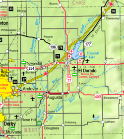
A post office named Plum Grove was established on July 1, 1870 in northwestern Butler County. [1] The postmaster (and landowner) was John R. Wentworth and the post office was named for the established plum bushes near his homestead. This post office was located next to the East Branch of the Whitewater River near the modern day intersection of NW 110th Street and NW Buffalo Road. Over the next two years, some businesses were started at Plum Grove. [2]
On October 7, 1872 a county election passed, funding bonds for a proposed railroad through the Whitewater River valley. The route was close to Plum Grove, so it was decided to move the tiny community 1.5 miles (2.4 km) west to ensure it would be next to the future railroad. The financial panic of 1873 caused the rail project to be abandoned. Though it was a setback, the community continued to grow while it kept trying to get a rail depot. [3] At its peak, Plum Grove had a maximum population of 60 or 100 (depending on source), several general stores, drug store, tree nursery, boarding house, blacksmith shop / livery barn / hog pens, saw mill, and a community water well. [4] [2]
In the spring of 1885, the McPherson branch of the Missouri Pacific Railroad was built east/west, a few miles south of Plum Grove. [4] Again a railroad failed to route through Plum Grove, after which the community started to dissolve. Merchants, houses, people moved over time to one of the nearby new communities of Brainerd or Potwin, [5] and a small number to Whitewater and Peabody. In 1887, the Chicago, Kansas and Nebraska Railway was built north/south approximately five miles west of Plum Grove, [6] and it was the "final straw". The post office closed on October 31, 1888 [1] and most lots were vacated by 1889. [2]
Afterward, the rural school was the only thing that remained. A new school was rebuilt at the site in 1895, and it served until 1955, when it was discontinued and the building was moved. The school water well was filled in the late 1960s, thus erasing the last evidence of Plum Grove. [2] Today, it is active farmland.
This page is based on this
Wikipedia article Text is available under the
CC BY-SA 4.0 license; additional terms may apply.
Images, videos and audio are available under their respective licenses.