Beaumont, Kansas

Last updated

Beaumont, Kansas
Beaumont-tower-caboose.jpg
Historic Beaumont water tower and Santa Fe caboose (2015)
Map of Butler Co, Ks, USA.png
USA Kansas location map.svg
Red pog.svg
Beaumont
Usa edcp location map.svg
Red pog.svg
Beaumont
Coordinates: 37°39′29″N96°31′58″W / 37.65806°N 96.53278°W / 37.65806; -96.53278 [1]
Country United States
State Kansas
County Butler
Elevation
[1]
1,608 ft (490 m)
Population
 (2020) [2]
  Total36
Time zone UTC-6 (CST)
  Summer (DST) UTC-5 (CDT)
Area code 620
FIPS code 20-04925
GNIS ID 474851 [1]

Beaumont is an unincorporated community in Butler County, Kansas, United States. [1] As of the 2020 census, the population of the community and nearby areas was 36. [2]

Contents

History

Beaumont Water Tower (2012) Beaumont Kansas Water Tower.jpg
Beaumont Water Tower (2012)

The surrounding area is farm land, settled by ranchers and farmers after the Civil War. Homesteaders from Missouri, Iowa, Tennessee, and other eastern states came because of an abundance of cheap land.

The town site was first a stop on the stagecoach route between Fredonia and Wichita. In 1879 Edwin and Emma Russell built the Summit Hotel, later renamed as the Beaumont Hotel. In 1885 the St. Louis and San Francisco Railroad, better known as the Frisco, established Beaumont as a railroad town. One line of tracks ran east and west, connecting St. Louis with Wichita. A spur was added later going south from Beaumont though Latham and on to the Oklahoma border. [3] A roundhouse was built in 1890 across from the Summit Hotel, and employed 90 people. The water tower, built in 1885, stands across from the hotel and is on the National Register of Historic Places. [4] Because of the rich bluestem grass, the area was used as staging area to ship cattle back east.

The railroad supported several businesses in Beaumont. These included a hardware store and lumber yard, as well as a pharmacy owned by the town's only physician and surgeon, Dr. William James Phillips. [5] The population of Beaumont has never been large. In 1910 the population was 200. Today, fewer than 50 people live there. [6]

A post office was opened in Beaumont on June 3, 1880, and remained in operation until it was discontinued on August 16, 1997. [7]

The Beaumont St. Louis and San Francisco Railroad Water Tank in Beaumont is on the National Register of Historic Places.

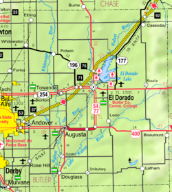
Beaumont maintains a private airfield directly next to the town.

The community is featured in the storyline of the 1998 film "The Long Way Home" starring Jack Lemmon. However, the actual locations filmed were in British Columbia, Canada and not in Kansas. [8]

Geography

The climate in this area is characterized by hot, humid summers and generally mild to cool winters. According to the Köppen Climate Classification system, Beaumont has a humid subtropical climate, abbreviated "Cfa" on climate maps. [9]

Demographics

Historical population
CensusPop.Note
2020 36
U.S. Decennial Census

For statistical purposes, the United States Census Bureau has defined Beaumont as a census-designated place (CDP).

2020 census

The 2020 United States census counted 36 people, 16 households, and 12 families in Beaumont. [10] [11] The population density was 65.0 per square mile (25.1/km2). There were 28 housing units at an average density of 50.5 per square mile (19.5/km2). [11] [12] The racial makeup was 91.67% (33) white or European American (91.67% non-Hispanic white), 0.0% (0) black or African-American, 5.56% (2) Native American or Alaska Native, 0.0% (0) Asian, 0.0% (0) Pacific Islander or Native Hawaiian, 0.0% (0) from other races, and 2.78% (1) from two or more races. [13] Hispanic or Latino of any race was 0.0% (0) of the population. [14]

Of the 16 households, 25.0% had children under the age of 18; 56.2% were married couples living together; 31.2% had a female householder with no spouse or partner present. 25.0% of households consisted of individuals and 6.2% had someone living alone who was 65 years of age or older. [11] The percent of those with a bachelor’s degree or higher was estimated to be 0.0% of the population. [15]

16.7% of the population was under the age of 18, 11.1% from 18 to 24, 22.2% from 25 to 44, 16.7% from 45 to 64, and 33.3% who were 65 years of age or older. The median age was 49.0 years. For every 100 females, there were 80.0 males. [11] For every 100 females ages 18 and older, there were 100.0 males. [11]

Education

The community is served by Bluestem USD 205 public school district.

See also

Related Research Articles

<span class="mw-page-title-main">Moran, Kansas</span> City in Allen County, Kansas

Moran is a city in Allen County, Kansas, United States. As of the 2020 census, the population of the city was 466.

<span class="mw-page-title-main">Leon, Kansas</span> City in Butler County, Kansas

Leon is a city in Butler County, Kansas, United States. As of the 2020 census, the population of the city was 669.

<span class="mw-page-title-main">Columbus, Kansas</span> City in Cherokee County, Kansas

Columbus is the second largest city and county seat of Cherokee County, Kansas, United States. As of the 2020 census, the population of the city was 2,929. It is located approximately 15 miles south-southwest of Pittsburg.

<span class="mw-page-title-main">McCune, Kansas</span> City in Crawford County, Kansas

McCune is a city in Crawford County, Kansas, United States. As of the 2020 census, the population of the city was 370.

<span class="mw-page-title-main">Eureka, Kansas</span> City in Greenwood County, Kansas

Eureka is a city in and the county seat of Greenwood County, Kansas, United States. As of the 2020 census, the population of the city was 2,332.

<span class="mw-page-title-main">Mound Valley, Kansas</span> City in Labette County, Kansas

Mound Valley is a city in Labette County, Kansas, United States. As of the 2020 census, the population of the city was 348.

<span class="mw-page-title-main">Durham, Kansas</span> City in Marion County, Kansas

Durham is a city in Marion County, Kansas, United States. As of the 2020 census, the population of the city was 89. The city took its name from Durham cattle. It is located about 8.5 miles (14 km) north of Hillsboro on the west side of K-15 highway next to a railroad.

<span class="mw-page-title-main">Florence, Kansas</span> City in Marion County, Kansas

Florence is a city in Marion County, Kansas, United States. As of the 2020 census, the population of the city was 394. The city was named after the daughter of the third Governor of Kansas Samuel J. Crawford. It is located at the intersection of U.S. Route 50 and U.S. Route 77 highways.

<span class="mw-page-title-main">Marion, Kansas</span> City in Marion County, Kansas

Marion is a city in, and the county seat of, Marion County, Kansas, United States. As of the 2020 census, the population of the city was 1,922. The city was named in honor of Francis Marion, a brigadier general of the American Revolutionary War, known as the "Swamp Fox".

<span class="mw-page-title-main">Cherryvale, Kansas</span> City in Montgomery County, Kansas

Cherryvale is a city in Montgomery County, Kansas, United States. As of the 2020 census, the population of the city was 2,192.

<span class="mw-page-title-main">Chanute, Kansas</span> City in Neosho County, Kansas

Chanute is a city in Neosho County, Kansas, United States. Founded on January 1, 1873, it was named after railroad engineer and aviation pioneer Octave Chanute. As of the 2020 census, the population of the city was 8,722. Chanute is home of Neosho County Community College.

<span class="mw-page-title-main">Pratt, Kansas</span> City in Pratt County, Kansas

Pratt is a city in and the county seat of Pratt County, Kansas, United States. As of the 2020 census, the population of the city was 6,603. It is home to Pratt Community College.

<span class="mw-page-title-main">Partridge, Kansas</span> City in Reno County, Kansas

Partridge is a city in Reno County, Kansas, United States. As of the 2020 census, the population of the city was 209.

<span class="mw-page-title-main">Lyons, Kansas</span> City in Rice County, Kansas

Lyons is a city in and the county seat of Rice County, Kansas, United States. As of the 2020 census, the population of the city was 3,611.

<span class="mw-page-title-main">Palco, Kansas</span> City in Rooks County, Kansas

Palco is a city in Rooks County, Kansas, United States. As of the 2020 census, the population of the city was 208.

<span class="mw-page-title-main">Peck, Kansas</span> Unincorporated community in Sedgwick and Sumner Counties of Kansas

Peck is an unincorporated community on the Sedgwick and Sumner County border in Kansas, United States. As of the 2020 census, the population of the community and nearby areas was 162. It is located about 2 miles west of the Kansas Star Casino at Meridian Ave and 119th St S, next the Union Pacific Railroad.

<span class="mw-page-title-main">Farlington, Kansas</span> Unincorporated community in Crawford County, Kansas

Farlington is an unincorporated community in Crawford County, Kansas, United States. As of the 2020 census, the population of the community and nearby areas was 68. Farlington is located near K-7, 8 miles (13 km) north of Girard.

<span class="mw-page-title-main">Greenwich, Kansas</span> Unincorporated community in Sedgwick County, Kansas

Greenwich is an unincorporated community in Sedgwick County, Kansas, United States. As of the 2020 census, the population of the community and nearby areas was 64. It is located northeast of 53rd St North and Greenwich Rd.

<span class="mw-page-title-main">Edson, Kansas</span> Unincorporated community in Sherman County, Kansas

Edson is an unincorporated community in Sherman County, Kansas, United States. As of the 2020 census, the population of the community and nearby areas was 17. Edson is located near Interstate 70, 9 miles (14 km) east of Goodland.

<span class="mw-page-title-main">Pierceville, Kansas</span> Unincorporated community in Finney County, Kansas

Pierceville is an unincorporated community in Finney County, Kansas, United States. As of the 2020 census, the population of the community and nearby areas was 98. It is located along U.S. Routes 50 and 400, 12 miles (19 km) southeast of Garden City.

References

  1. 1 2 3 4 "Beaumont, Kansas", Geographic Names Information System , United States Geological Survey, United States Department of the Interior
  2. 1 2 "Profile of Beaumont, Kansas (CDP) in 2020". United States Census Bureau. Archived from the original on November 13, 2021. Retrieved November 12, 2021.
  3. "The Frisco: A Look Back at the St. Louis-San Francisco Railway". thelibrary.springfield.missouri.org. Archived from the original on May 15, 2009.
  4. "National Register of Historic Places Registration Form" (PDF). kshs.org. Retrieved March 30, 2024.
  5. "William James Phillips". Archived from the original on October 14, 2012. Retrieved November 6, 2010.
  6. "The Beaumont Hotel - Beaumont, Kansas".
  7. "Kansas Post Offices, 1828-1961 (archived)". Kansas Historical Society. Archived from the original on October 9, 2013. Retrieved June 5, 2014.
  8. "The Long Way Home". IMDb .
  9. Climate Summary for Beaumont, Kansas
  10. "US Census Bureau, Table P16: HOUSEHOLD TYPE". data.census.gov. Retrieved January 16, 2024.
  11. 1 2 3 4 5 "US Census Bureau, Table DP1: PROFILE OF GENERAL POPULATION AND HOUSING CHARACTERISTICS". data.census.gov. Retrieved January 16, 2024.
  12. Bureau, US Census. "Gazetteer Files". Census.gov. Retrieved December 30, 2023.
  13. "US Census Bureau, Table P1: RACE". data.census.gov. Retrieved January 16, 2024.
  14. "US Census Bureau, Table P2: HISPANIC OR LATINO, AND NOT HISPANIC OR LATINO BY RACE". data.census.gov. Retrieved January 16, 2024.
  15. "US Census Bureau, Table S1501: EDUCATIONAL ATTAINMENT". data.census.gov. Retrieved January 16, 2024.

Further reading