Rose Hill, Kansas

Last updated

Rose Hill, Kansas
Rose hill water tower.jpg
Water tower in Rose Hill (2015)
Butler County Kansas Incorporated and Unincorporated areas Rose Hill Highlighted.svg
Location within Butler County and Kansas
Map of Butler Co, Ks, USA.png
Coordinates: 37°34′13″N97°08′10″W / 37.57028°N 97.13611°W / 37.57028; -97.13611 [1]
Country United States
State Kansas
County Butler
Founded1892
Incorporated 1955
Government
  Type Mayor–Council
   Mayor Gary Weaver
Area
[2]
  Total2.26 sq mi (5.84 km2)
  Land2.26 sq mi (5.84 km2)
  Water0.00 sq mi (0.00 km2)
Elevation
[1]
1,319 ft (402 m)
Population
 (2020) [3]
  Total4,185
  Density1,900/sq mi (720/km2)
Time zone UTC-6 (CST)
  Summer (DST) UTC-5 (CDT)
ZIP code
67133
Area code 316
FIPS code 20-61250
GNIS ID 2396429 [1]
Website cityofrosehill.com

Rose Hill is a city in Butler County, Kansas, United States. [1] It is part of the Wichita metropolitan area, Kansas. As of the 2020 census, the population of the city was 4,185. [3]

Contents

History

Early history

For many millennia, the Great Plains of North America was inhabited by nomadic Native Americans. From the 16th century to 18th century, the Kingdom of France claimed ownership of large parts of North America. In 1762, after the French and Indian War, France secretly ceded New France to Spain, per the Treaty of Fontainebleau.

19th century

In 1802, Spain returned most of the land to France. In 1803, most of the land for modern day Kansas was acquired by the United States from France as part of the 828,000 square mile Louisiana Purchase for 2.83 cents per acre.

In 1854, the Kansas Territory was organized, then in 1861 Kansas became the 34th U.S. state. In 1855, Butler County was established within the Kansas Territory, which included the land for modern day Rose Hill.

The first post office in Rose Hill was established in 1874. [4] Rose Hill was founded in 1892.

Geography

According to the United States Census Bureau, the city has a total area of 2.20 square miles (5.70 km2), all of it land. [5]

Demographics

Historical population
CensusPop.Note
1960 273
1970 38741.8%
1980 1,557302.3%
1990 2,39954.1%
2000 3,43243.1%
2010 3,93114.5%
2020 4,1856.5%
U.S. Decennial Census

2010 census

As of the census [6] of 2010, there were 3,931 people, 1,288 households, and 1,045 families living in the city. The population density was 1,786.8 inhabitants per square mile (689.9/km2). There were 1,355 housing units at an average density of 615.9 per square mile (237.8/km2). The racial makeup of the city was 95.5% White, 0.3% African American, 0.8% Native American, 0.7% Asian, 0.5% from other races, and 2.3% from two or more races. Hispanic or Latino of any race were 2.9% of the population.

There were 1,288 households, of which 46.3% had children under the age of 18 living with them, 67.5% were married couples living together, 10.0% had a female householder with no husband present, 3.6% had a male householder with no wife present, and 18.9% were non-families. 15.0% of all households were made up of individuals, and 6.5% had someone living alone who was 65 years of age or older. The average household size was 2.99 and the average family size was 3.33.

The median age in the city was 35.4 years. 30.7% of residents were under the age of 18; 8% were between the ages of 18 and 24; 26.1% were from 25 to 44; 25.7% were from 45 to 64; and 9.5% were 65 years of age or older. The gender makeup of the city was 49.1% male and 50.9% female.

2000 census

As of the census of 2000, there were 3,432 people, 1,039 households, and 906 families living in the city. The population density was 2,151.0 inhabitants per square mile (830.5/km2). There were 1,098 housing units at an average density of 688.2 per square mile (265.7/km2). The racial makeup of the city was 96.91% White, 0.26% African American, 0.67% Native American, 0.41% Asian, 0.12% Pacific Islander, 0.35% from other races, and 1.28% from two or more races. 1.81% of the population were Hispanic or Latino of any race.

There were 1,039 households, out of which 59.4% had children under the age of 18 living with them, 74.5% were married couples living together, 9.9% had a female householder with no husband present, and 12.8% were non-families. 11.3% of all households were made up of individuals, and 3.7% had someone living alone who was 65 years of age or older. The average household size was 3.25 and the average family size was 3.51.

In the city, the population was spread out, with 37.7% under the age of 18, 6.6% from 18 to 24, 33.4% from 25 to 44, 17.0% from 45 to 64, and 5.3% who were 65 years of age or older. The median age was 31 years. For every 100 females, there were 99.7 males. For every 100 females age 18 and over, there were 91.6 males.

As of 2000 the median income for a household in the city was $75,040. Males had a median income of $47,019 versus $31,082 for females. The per capita income for the city was $20,221. About 2.6% of families and 3.3% of the population were below the poverty line, including 4.1% of those under age 18 and 11.6% of those age 65 or over.

Education

The community is served by Rose Hill USD 394 public school district.

Rose Hill High School is a 4A high school with an enrollment of 610 students.[ citation needed ] Rose Hill High School is located on the southern edge of Rose Hill. Students moved into the current facility in October 1995.[ citation needed ] Rose Hill High School offers a general education program alongside several dual-credit college college courses and early associate degree programs offered by the wing of Butler Community College attached at the southeast end. Rose Hill High School sponsors a wide range of student activities for the purpose of providing students with additional opportunities to develop into leaders and citizens. Also as of 2005 Rose Hill High School has become one of the few schools in Kansas to give a laptop to every pupil in the school.[ citation needed ]

Notable people

Related Research Articles

<span class="mw-page-title-main">Garnett, Kansas</span> City in Anderson County, Kansas

Garnett is a city in and the county seat of Anderson County, Kansas, United States. As of the 2020 census, the population of the city was 3,242.

<span class="mw-page-title-main">Morrill, Kansas</span> City in Brown County, Kansas

Morrill is a city in Brown County, Kansas, United States. As of the 2020 census, the population of the city was 218.

<span class="mw-page-title-main">Oak Hill, Kansas</span> City in Clay County, Kansas

Oak Hill is a city in Clay County, Kansas, United States. As of the 2020 census, the population of the city was 24.

<span class="mw-page-title-main">Burden, Kansas</span> City in Cowley County, Kansas

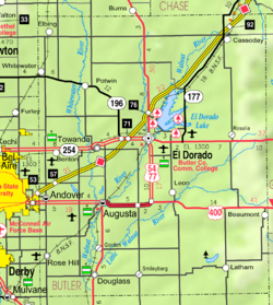
Burden is a city in Cowley County, Kansas, United States. As of the 2020 census, the population of the city was 512.

<span class="mw-page-title-main">Carlton, Kansas</span> City in Dickinson County, Kansas

Carlton is a city in Dickinson County, Kansas, United States. As of the 2020 census, the population of the city was 40.

<span class="mw-page-title-main">Enterprise, Kansas</span> City in Dickinson County, Kansas

Enterprise is a city in Dickinson County, Kansas, United States. As of the 2020 census, the population of the city was 708.

<span class="mw-page-title-main">Manchester, Kansas</span> City in Dickinson County, Kansas

Manchester is a city in Dickinson County, Kansas, United States. As of the 2020 census, the population of the city was 47.

<span class="mw-page-title-main">Hill City, Kansas</span> City in Graham County, Kansas

Hill City is a city and county seat of Graham County, Kansas, United States. As of the 2020 census, the population of the city was 1,403.

<span class="mw-page-title-main">Webber, Kansas</span> City in Jewell County, Kansas

Webber is a city in Jewell County, Kansas, United States. As of the 2020 census, the population of the city was 30.

<span class="mw-page-title-main">Westwood Hills, Kansas</span> City in Kansas, United States

Westwood Hills is a city in Johnson County, Kansas, United States. As of the 2020 census, the population of the city was 400. It is the most densely populated city in the Kansas City Metropolitan Area at 6,240 people per square mile. It borders Kansas City, Missouri.

<span class="mw-page-title-main">Bern, Kansas</span> City in Nemaha County, Kansas

Bern is a city in Nemaha County, Kansas, United States. As of the 2020 census, the population of the city was 161.

<span class="mw-page-title-main">Natoma, Kansas</span> City in Osborne County, Kansas

Natoma is a city in Osborne County, Kansas, United States. As of the 2020 census, the population of the city was 302.

<span class="mw-page-title-main">Andale, Kansas</span> City in Sedgwick County, Kansas

Andale is a city in Sedgwick County, Kansas, United States. As of the 2020 census, the population of the city was 941.

<span class="mw-page-title-main">Mount Hope, Kansas</span> City in Sedgwick County, Kansas

Mount Hope is a city in Sedgwick County, Kansas, United States. As of the 2020 census, the population of the city was 806.

<span class="mw-page-title-main">Alma, Kansas</span> City in Wabaunsee County, Kansas

Alma is a city in and the county seat of Wabaunsee County, Kansas, United States. As of the 2020 census, the population of the city was 802.

<span class="mw-page-title-main">Maple Hill, Kansas</span> City in Wabaunsee County, Kansas

Maple Hill is a city in Wabaunsee County, Kansas, United States. As of the 2020 census, the population of the city was 631.

<span class="mw-page-title-main">Greenleaf, Kansas</span> City in Washington County, Kansas

Greenleaf is a city in Washington County, Kansas, United States. As of the 2020 census, the population of the city was 350.

<span class="mw-page-title-main">Gladstone, Missouri</span> City in Missouri, United States

Gladstone is a city in Clay County, Missouri, United States and a suburb of Kansas City. The City of Gladstone is located about 10–20 minutes from downtown Kansas City, and about 10–20 minutes from Kansas City International Airport. As of the 2020 census, the city population was 27,063. It is part of the Kansas City metropolitan area.

<span class="mw-page-title-main">Clarkton, Missouri</span> City in Missouri, United States

Clarkton is a city in Dunklin County, Missouri, United States. The population was 1,288 at the 2010 census. Clarkton is the oldest city in Dunklin County.

<span class="mw-page-title-main">Vining, Kansas</span> City in Clay and Washington Counties in Kansas

Vining is a city in Clay and Washington counties in Kansas, United States. As of the 2020 census, the population of the city was 43.

References

  1. 1 2 3 4 U.S. Geological Survey Geographic Names Information System: Rose Hill, Kansas
  2. "2019 U.S. Gazetteer Files". United States Census Bureau. Retrieved July 24, 2020.
  3. 1 2 "Profile of Rose Hill, Kansas in 2020". United States Census Bureau. Archived from the original on November 13, 2021. Retrieved November 12, 2021.
  4. "Kansas Post Offices, 1828-1961, page 2 (archived)". Kansas Historical Society. Archived from the original on October 9, 2013. Retrieved June 5, 2014.
  5. "US Gazetteer files 2010". United States Census Bureau. Archived from the original on January 25, 2012. Retrieved July 6, 2012.
  6. "U.S. Census website". United States Census Bureau . Retrieved July 6, 2012.

Further reading