Anson, Kansas | |
---|---|
![]() | |
Coordinates: 37°21′55″N97°31′47″W / 37.36528°N 97.52972°W [1] | |
Country | United States |
State | Kansas |
County | Sumner |
Elevation | 1,303 ft (397 m) |
Time zone | UTC-6 (CST) |
• Summer (DST) | UTC-5 (CDT) |
Area code | 620 |
FIPS code | 20-01925 |
GNIS ID | 470174 [1] |
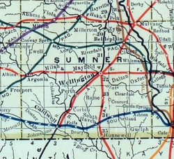
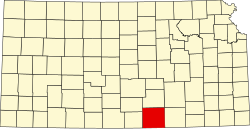
Anson is an unincorporated community in Sumner County, Kansas, United States. [1] It is located about 6 miles east of Conway Springs at 1.5 miles south of the intersection of N Anson Rd and W 90th St N, next to an abandoned railroad. It currently contains a small number of homes, but no businesses or services.
A post office was opened in Anson in 1887, and remained in operation until it was discontinued in 1958. [2]
A railroad previously passed through the community, east to west, from Belle Plaine to Conway Springs.
The community is served by Conway Springs USD 356 public school district.
Grant County is a county located on the northern border of the U.S. state of Oklahoma. As of the 2020 census, the population was 4,169. Its county seat is Medford. Originally designated as part of the Cherokee Outlet, it was named County L in Oklahoma Territory at the time of its opening to non-Indian settlement. A county election renamed it for U.S. President Ulysses S. Grant.
Sumner County is a county located in the U.S. state of Kansas. Its county seat is Wellington. As of the 2020 census, the population was 22,382. The county is named after Charles Sumner, a U.S. Senator from Massachusetts who was a leader of Reconstruction politics.
Marion County is a county located in the U.S. state of Kansas. Its county seat is Marion and its most populous city is Hillsboro. As of the 2020 census, the county population was 11,823. The county was named in honor of Francis Marion, a brigadier general of the American Revolutionary War, known as the "Swamp Fox".
Corbin is an unincorporated community in Sumner County, Kansas, United States. It is located about 6.5 miles northeast of Caldwell near the intersection of S Mayfield Rd and W 110th St S, next to the railroad.
Peck is an unincorporated community on the Sedgwick and Sumner County border in Kansas, United States. As of the 2020 census, the population of the community and nearby areas was 162. It is located about 2 miles west of the Kansas Star Casino at Meridian Ave and 119th St S, next the Union Pacific Railroad.
Burdick is an unincorporated community in Morris County, Kansas, United States. It was named after Ms. Burdick, the sweetheart of a Santa Fe Railroad official in 1887. As of the 2020 census, the population of the community and nearby areas was 62. It is located southeast of Herington, about 5.6 miles (9.0 km) east of the intersection of U.S. Route 77 highway and 340th Street, or about 6.5 miles (10.5 km) east of Lost Springs.
Milton is an unincorporated community in Sumner County, Kansas, United States. As of the 2020 census, the population of the community and nearby areas was 155. It is located 4.5 miles (7.2 km) southeast of Norwich at the intersection of N Argonia Rd and W 120th Ave N, next to the railroad.
Antelope is an unincorporated community in Marion County, Kansas, United States. Antelope got its name from antelope grazing near where the first school was being built. It is located northeast of Marion, about 0.9 miles west of the intersection of U.S. Route 77 highway and 250th Street along the Union Pacific Railroad.
Ashton is an unincorporated community in Walton Township, Sumner County, Kansas, United States. It is located about halfway between South Haven and Arkansas City at 1.75 miles north of the intersection of S Rock Rd and U.S. Route 166, which is 5.5 miles east of I-35, next to an abandoned railroad.
Drury is an unincorporated community in Falls Township, Sumner County, Kansas, United States. It is located between South Haven and Caldwell near the intersection of S Drury Rd and W 175th St S, next to the Chikaskia River and next to an abandoned railroad.
Adamsville is an unincorporated community in Sumner County, Kansas, United States. It is located about 4 miles north of Geuda Springs at 0.5 mile west of the intersection of S Oxford Rd and E 80th St, next to an abandoned railroad.
Cicero is an unincorporated community in Sumner County, Kansas, United States. It is located about 4 miles northeast of Wellington at about 2.5 miles east of the intersection of U.S. Route 81 and E 50th Ave N, next to the railroad.
Ewell is a ghost town in Sumner County, Kansas, United States. It is located about 3.5 miles southwest of Conway Springs at 0.25 mile southeast of the intersection of N Bluff Rd and W 60th Ave N, next to an abandoned railroad.
Millerton is an unincorporated community in Sumner County, Kansas, United States. It is located about 5 miles northeast of Conway Springs at the intersection of N Maple Rd and W 123rd Ave N, next to the railroad.
Portland is an unincorporated community in Sumner County, Kansas, United States. It is located about 5 miles northeast of South Haven at 1.5 miles north of the intersection of S Hydraulic Rd and U.S. Route 166, next to an abandoned railroad. It is 1.5 miles east of I-35.
Riverdale is an unincorporated community in Sumner County, Kansas, United States. It is located about 6 miles southwest of Belle Plaine at the intersection of N Sand Plum Rd and 77th Ave N, or west of U.S. Route 81 next to the railroad.
Zyba is an unincorporated community in Sumner County, Kansas, United States. It is located about 4 miles southwest of the Kansas Star Casino at N West St and E 120th Ave N, next to the railroad and Ninnescah River.
K-49 is a 35.354-mile-long (56.897 km) north–south state highway in the U.S. state of Kansas. K-49 begins at U.S. Route 81 (US-81) in Caldwell, and runs north to K-42 in Viola. Along the way, K-49 has a brief overlap with US-160 south of Conway Springs. The majority of the route exists in Sumner County, with only a mile existing in Sedgwick County.
Plum Grove is a ghost town in Butler County, Kansas, United States. It was located in a rural area north of modern-day Potwin. No buildings remain at this former community site.
Rome is an unincorporated community in Sumner County, Kansas, United States. It is located about 6.5 miles south of Wellington at about 0.5 miles east of the intersection of U.S. Route 81 and E 90th St, next to the railroad.