Peck, Kansas

Last updated

Peck, Kansas
CDP
Stouffer's Railroad Map of Kansas 1915-1918 Sedgwick County.png
1915 Railroad Map of Sedgwick County
Map of Sedgwick Co, Ks, USA.png
USA Kansas location map.svg
Red pog.svg
Peck
Usa edcp location map.svg
Red pog.svg
Peck
Coordinates: 37°28′39″N97°22′20″W / 37.47750°N 97.37222°W / 37.47750; -97.37222 [1]
Country United States
State Kansas
County Sedgwick
Elevation
[1]
1,260 ft (380 m)
Population
 (2020) [2]
  Total162
Time zone UTC-6 (CST)
  Summer (DST) UTC-5 (CDT)
ZIP code
67120
Area code 316
FIPS code 20-55175
GNIS ID 470233 [1]

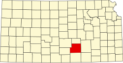
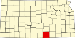
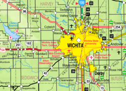
Peck is a census-designated place (CDP) in Sedgwick and Sumner counties in the U.S. state of Kansas. [1] As of the 2020 census, the population areas was 162. [2] It is located about 2 miles west of the Kansas Star Casino at Meridian Ave and 119th St S, next to the Union Pacific Railroad.

Contents

History

19th century

In 1887, the Chicago, Kansas and Nebraska Railway built a branch line north–south from Herington through Peck to Caldwell. [3] It foreclosed in 1891 and was taken over by Chicago, Rock Island and Pacific Railway, which shut down in 1980 and reorganized as Oklahoma, Kansas and Texas Railroad, merged in 1988 with Missouri Pacific Railroad, merged in 1997 with Union Pacific Railroad. Most locals still refer to this railroad as the "Rock Island".

The first post office in Peck was established in October 1887. [4] The town was named for George Peck, who owned a hotel there. [5]

Geography

Climate

The climate in this area is characterized by hot, humid summers and generally mild to cool winters. According to the Köppen Climate Classification system, Peck has a humid subtropical climate, abbreviated "Cfa" on climate maps. [6]

Demographics

Historical population
CensusPop.Note
2020 162
U.S. Decennial Census

The 2020 United States census counted 162 people, 66 households, and 52 families in Peck. [7] [8] The population density was 457.6 per square mile (176.7/km2). There were 68 housing units at an average density of 192.1 per square mile (74.2/km2). [8] [9] The racial makeup was 79.63% (129) white or European American (75.93% non-Hispanic white), 1.23% (2) black or African-American, 4.32% (7) Native American or Alaska Native, 0.0% (0) Asian, 0.0% (0) Pacific Islander or Native Hawaiian, 0.62% (1) from other races, and 14.2% (23) from two or more races. [10] Hispanic or Latino of any race was 10.49% (17) of the population. [11]

Of the 66 households, 36.4% had children under the age of 18; 63.6% were married couples living together; 6.1% had a female householder with no spouse or partner present. 13.6% of households consisted of individuals and 6.1% had someone living alone who was 65 years of age or older. [8] The average household size was 2.3 and the average family size was 4.9. [12] The percent of those with a bachelor’s degree or higher was estimated to be 9.9% of the population. [13]

22.2% of the population was under the age of 18, 5.6% from 18 to 24, 29.0% from 25 to 44, 31.5% from 45 to 64, and 11.7% who were 65 years of age or older. The median age was 42.0 years. For every 100 females, there were 74.2 males. [8] For every 100 females ages 18 and older, there were 63.6 males. [8]

Education

The community is served by Mulvane USD 263 public school district.

Community Center

Community events such as Car Shows and Dinners are typically hosted at The Peck Community Center; a former school building of USD 263. [14]

Related Research Articles

<span class="mw-page-title-main">Moran, Kansas</span> City in Allen County, Kansas

Moran is a city in Allen County, Kansas, United States. As of the 2020 census, the population of the city was 466.

<span class="mw-page-title-main">Caldwell, Kansas</span> City in Sumner County, Kansas

Caldwell is a city in Sumner County, Kansas, United States. As of the 2020 census, the population of the city was 1,025.

<span class="mw-page-title-main">Navarre, Kansas</span> Unincorporated community in Dickinson County, Kansas

Navarre is a census-designated place (CDP) in Dickinson County, Kansas, United States. As of the 2020 census, the population was 52.

<span class="mw-page-title-main">Beaumont, Kansas</span> Unincorporated community in Butler County, Kansas

Beaumont is a census-designated place (CDP) in Butler County, Kansas, United States. As of the 2020 census, the population was 36.

<span class="mw-page-title-main">Piqua, Kansas</span> Unincorporated community in Woodson County, Kansas, United States

Piqua is a census-designated place (CDP) in Woodson County, Kansas, United States. As of the 2020 census, the population was 90.

<span class="mw-page-title-main">Healy, Kansas</span> Unincorporated community in Lane County, Kansas

Healy is a census-designated place (CDP) in Lane County, Kansas, United States. As of the 2020 census, the population was 195.

<span class="mw-page-title-main">Baileyville, Kansas</span> Unincorporated community in Nemaha County, Kansas

Baileyville is a census-designated place (CDP) in western Nemaha County, Kansas, United States. As of the 2020 census, the population was 182. It is located six miles west of Seneca on U.S. Route 36.

<span class="mw-page-title-main">Neal, Kansas</span> Unincorporated community in Greenwood County, Kansas

Neal is a census-designated place (CDP) in eastern Greenwood County, Kansas, United States. As of the 2020 census, the population was 37. It is located approximately 10 miles east of the city of Eureka along U.S. Route 54 highway.

<span class="mw-page-title-main">Bridgeport, Kansas</span> Unincorporated community in Saline County, Kansas

Bridgeport is a census-designated place (CDP) in Smoky View Township, Saline County, Kansas, United States. As of the 2020 census, the population was 64. It is located south of Salina, along K-4 near Interstate 135.

<span class="mw-page-title-main">Centerville, Kansas</span> CDP in Kansas, United States

Centerville is a census-designated place (CDP) in Linn County, Kansas, United States. As of the 2020 census, the population was 78. It is located 8.5 miles (13.7 km) north of the city of Blue Mound.

<span class="mw-page-title-main">Garland, Kansas</span> CDP in Kansas, United States

Garland is a census-designated place (CDP) in Bourbon County, Kansas, United States. As of the 2020 census, the population was 31. It is located along the Missouri state line 8.5 miles (13.7 km) southeast of Fort Scott.

<span class="mw-page-title-main">Greenwich, Kansas</span> Unincorporated community in Sedgwick County, Kansas

Greenwich is a census-designated place (CDP) in Sedgwick County, Kansas, United States. As of the 2020 census, the population was 64. It is located northeast of 53rd St North and Greenwich Rd.

<span class="mw-page-title-main">Milton, Kansas</span> Unincorporated community in Sumner County, Kansas

Milton is a census-designated place (CDP) in Sumner County, Kansas, United States. As of the 2020 census, the population was 155. It is located 4.5 miles (7.2 km) southeast of Norwich at the intersection of N Argonia Rd and W 120th Ave N, next to the railroad.

<span class="mw-page-title-main">Edson, Kansas</span> Unincorporated community in Sherman County, Kansas

Edson is a census-designated place (CDP) in Sherman County, Kansas, United States. As of the 2020 census, the population was 17. Edson is located near Interstate 70, 9 miles (14 km) east of Goodland.

<span class="mw-page-title-main">Levant, Kansas</span> Unincorporated community in Thomas County, Kansas

Levant is a census-designated place (CDP) in Thomas County, Kansas, United States. As of the 2020 census, the population was 68. It is located approximately 7.5 miles (12.1 km) west of Colby.

<span class="mw-page-title-main">Pierceville, Kansas</span> Unincorporated community in Finney County, Kansas

Pierceville is a census-designated place (CDP) in Finney County, Kansas, United States. As of the 2020 census, the population was 98. It is located along U.S. Routes 50 and 400, 12 miles (19 km) southeast of Garden City.

<span class="mw-page-title-main">Monument, Kansas</span> Unincorporated community in Logan County, Kansas

Monument is a census-designated place (CDP) in northeastern Logan County, Kansas, United States. As of the 2020 census, the population was 56. It is located along U.S. Route 40 west of Oakley.

<span class="mw-page-title-main">Furley, Kansas</span> Unincorporated community in Sedgwick County, Kansas

Furley is a census-designated place (CDP) in Sedgwick County, Kansas, United States. As of the 2020 census, the population was 39. It is located northwest of the intersection of Greenwich Road and 101st Street N, along the Union Pacific Railroad.

<span class="mw-page-title-main">Idana, Kansas</span> CDP in Kansas, United States

Idana is a census-designated place (CDP) in Clay County, Kansas, United States. As of the 2020 census, the population was 54. It is located approximately 6.5 miles west of Clay Center, and 1.5 miles south of US Route 24 along 16th Rd.

<span class="mw-page-title-main">Keats, Kansas</span> Unincorporated community in Riley County, Kansas

Keats is a census-designated place (CDP) in Wildcat Township, Riley County, Kansas, United States. As of the 2020 census, the population was 96. It is located five miles west of Manhattan.

References

  1. 1 2 3 4 "Peck, Kansas", Geographic Names Information System , United States Geological Survey, United States Department of the Interior
  2. 1 2 "Profile of Peck, Kansas (CDP) in 2020". United States Census Bureau. Archived from the original on April 3, 2022. Retrieved April 3, 2022.
  3. "Rock Island Rail History". Archived from the original on July 23, 2011. Retrieved April 17, 2011.
  4. "Kansas Post Offices, 1828-1961, page 2". Kansas Historical Society. Retrieved June 23, 2014.
  5. "Profile for Peck, Kansas". ePodunk . Retrieved June 27, 2014.
  6. Climate Summary for Peck, Kansas
  7. "US Census Bureau, Table P16: HOUSEHOLD TYPE". data.census.gov. Retrieved January 3, 2024.
  8. 1 2 3 4 5 "US Census Bureau, Table DP1: PROFILE OF GENERAL POPULATION AND HOUSING CHARACTERISTICS". data.census.gov. Retrieved January 3, 2024.
  9. Bureau, US Census. "Gazetteer Files". Census.gov. Retrieved December 30, 2023.
  10. "US Census Bureau, Table P1: RACE". data.census.gov. Retrieved January 3, 2024.
  11. "US Census Bureau, Table P2: HISPANIC OR LATINO, AND NOT HISPANIC OR LATINO BY RACE". data.census.gov. Retrieved January 3, 2024.
  12. "US Census Bureau, Table S1101: HOUSEHOLDS AND FAMILIES". data.census.gov. Retrieved January 3, 2024.
  13. "US Census Bureau, Table S1501: EDUCATIONAL ATTAINMENT". data.census.gov. Retrieved January 3, 2024.
  14. "Peck Community Center" . Retrieved June 27, 2024.

Further reading