External links
Municipalities and communities of Sedgwick County, Kansas, United States | ||
|---|---|---|
| Cities | 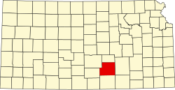 | |
| CDPs | ||
| Unincorporated communities | ||
| Townships | ||
| Footnotes | ‡This community also has portions in an adjacent county or counties. | |
Bayneville is an unincorporated community in Ohio Township, Sedgwick County, Kansas, United States. [1] It is located on S 87th W between W 71st S and W 79st S.
Bayneville had its start by the building of the Missouri Pacific Railroad through that territory. [2] [3] It was named for Judge Bayne, a railroad promoter. [3]
A post office was opened in Bayneville in 1884, and remained in operation until it was discontinued in 1934. [4]
The community is served by Clearwater USD 264 public school district.
Municipalities and communities of Sedgwick County, Kansas, United States | ||
|---|---|---|
| Cities | | |
| CDPs | ||
| Unincorporated communities | ||
| Townships | ||
| Footnotes | ‡This community also has portions in an adjacent county or counties. | |