In 1870, settlers John Haufbauer and J.H. Minich built the first houses, smithies, and general stores on the site that would become Derby.[5] In 1871, the community was named El Paso, after El Paso, Illinois, and was laid out and platted. In 1880, the Atchison, Topeka and Santa Fe Railway changed the name of its rail station to Derby, after railroad official C.F. Derby, to avoid confusion with El Paso, Texas.
In 1903, the city incorporated with the name El Paso,[6] but the city remained largely a rural community until after World War II.
The aviation industry had begun its growth in Wichita during the 1920s, and when the demands of the war required more airplanes, businesses such as Boeing, Cessna and Beechcraft flourished.[7] Boeing was located a few miles north of the city, which provided a close place for workers to live. Throughout the Cold War, Boeing maintained military contracts and kept jobs nearby.[8] In 1952, the Air Force took over Wichita Municipal Airport and founded McConnell Air Force Base between Wichita and Derby. Many airmen found homes in Derby when space on base became occupied.[9] From 1950 to 1956, the city population grew from 432 to approximately 5000 people.[9]
In 1956, the city name was officially changed to Derby.[10]
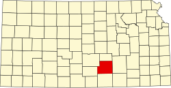
Geography
According to the United States Census Bureau, the city has a total area of 9.60 square miles (24.86km2), of which 9.56 square miles (24.76km2) is land and 0.04 square miles (0.10km2) is water.[11]
Climate
The climate in this area is characterized by hot, humid summers and generally mild to cool winters. According to the Köppen Climate Classification system, Derby has a humid subtropical climate, abbreviated "Cfa" on climate maps.[12]
Of the 9,991 households, 34.2% had children under the age of 18; 54.2% were married couples living together; 24.2% had a female householder with no spouse or partner present. 26.2% of households consisted of individuals and 10.6% had someone living alone who was 65 years of age or older.[17] The average household size was 2.7 and the average family size was 3.2.[21] The percent of those with a bachelor's degree or higher was estimated to be 24.8% of the population.[22]
25.9% of the population was under the age of 18, 8.8% from 18 to 24, 26.5% from 25 to 44, 22.3% from 45 to 64, and 16.5% who were 65 years of age or older. The median age was 36.2 years. For every 100 females, there were 104.9 males.[17] For every 100 females ages 18 and older, there were 108.5 males.[17]
The 2016-2020 5-year American Community Survey estimates show that the median household income was $74,447 (with a margin of error of +/- $4,647) and the median family income was $87,805 (+/- $7,613).[23] Males had a median income of $51,492 (+/- $3,241) versus $32,018 (+/- $3,530) for females. The median income for those above 16 years old was $41,332 (+/- $3,327).[24] Approximately, 5.6% of families and 6.4% of the population were below the poverty line, including 7.9% of those under the age of 18 and 6.9% of those ages 65 or over.[25][26]
2010 census
As of the census[27] of 2010, there were 22,158 people, 8,300 households, and 6,226 families residing in the city.[28] The population density was 2,317.8 inhabitants per square mile (894.9/km2). There were 8,774 housing units at an average density of 917.8 per square mile (354.4/km2). The racial makeup of the city was 91.6% White, 1.9% African American, 1.0% Native American, 1.6% Asian, 0.1% Pacific Islander, 0.8% from other races, and 3.0% from two or more races. Hispanic or Latino residents of any race were 5.2% of the population.
There were 8,300 households, of which 38.9% had children under the age of 18 living with them, 60.5% were married couples living together, 10.6% had a female householder with no husband present, 4.0% had a male householder with no wife present, and 25.0% were non-families. 21.3% of all households were made up of individuals, and 8.3% had someone living alone who was 65 years of age or older. The average household size was 2.66 and the average family size was 3.11.
The median age in the city was 34.7 years. 28.1% of residents were under the age of 18; 8.7% were between the ages of 18 and 24; 26.3% were from 25 to 44; 25.7% were from 45 to 64; and 11.4% were 65 years of age or older. The gender makeup of the city was 48.8% male and 51.2% female.
Economy
Derby supports more than 532 businesses, ranging from modest home-based businesses to large manufacturing companies like BRG Precision Products, manufacturer of custom digital electronic clocks and emergency messaging systems, and Mid Continent Controls, manufacturer of cabin management and in-flight entertainment systems for business jets. The city's economy is strongest in construction, retail, finance/insurance/real estate, and health-care related activities. Aircraft manufacturers Spirit AeroSystems, Textron Aviation, and Bombardier Learjet provide jobs for a significant portion of the community's residents, as do Derby Public Schools and McConnell Air Force Base.[29]
Arts and culture
The Derby Public Library has over 100,000 items, and houses the Derby Business Center, which provides electronic business resources and services to Kansas residents.[29][30]
Parks and recreation
The city has bike and walking paths.
High Park features fishing, soccer fields, softball diamonds, walking paths, and an amphitheatre.
The Derby Historical Museum, located in a 1923 school building, featuring historical artifacts including an 1870 log cabin, one of the largest displayed collections of arrowheads in Kansas, a school room, a general store that has a collection of antique pharmaceutical items, and an original two-horse covered wagon that traveled to the Derby area from North Carolina in the 1860s.[33]
↑City of Derby, Kansas. "Comprehensive Plan"(PDF). City of Derby, Kansas. pp.1-1 –1-2. Archived from the original(PDF) on June 15, 2013. Retrieved July 17, 2012.
This page is based on this Wikipedia article Text is available under the CC BY-SA 4.0 license; additional terms may apply. Images, videos and audio are available under their respective licenses.