Salem Township Sedgwick County, Kansas | |
|---|---|
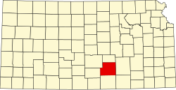
 Location within Sedgwick County | |
 Salem Township Location within state of Kansas | |
| Coordinates: 37°31′15″N97°18′56″W / 37.52083°N 97.31556°W [1] | |
| Country | United States |
| State | Kansas |
| County | Sedgwick |
| Area | |
• Total | 32.27 sq mi (83.6 km2) |
| • Land | 31.97 sq mi (82.8 km2) |
| • Water | 0.3 sq mi (0.8 km2) |
| Elevation | 1,240 ft (380 m) |
| Population (2000) | |
• Total | 8,411 |
| • Density | 260/sq mi (100/km2) |
| Time zone | UTC-6 (CST) |
| • Summer (DST) | UTC-5 (CDT) |
| Area code | 620 |
| FIPS code | 20-62675 [1] |
| GNIS ID | 474324 [1] |
Salem Township is a township in Sedgwick County, Kansas, United States. [1] As of the 2000 United States census, it had a population of 8,411, with a density of 263.1 people per square mile. [2] It located south of Wichita.