Anness, Kansas

Last updated

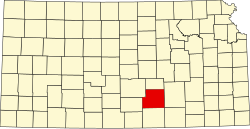
Anness is an unincorporated community in Sedgwick County, Kansas, United States, [1] about 4.75 miles west of Viola, between W 111th St S and W 119th St S, and between S 327th St W and S 343rd St W.

Contents

History

Anness had its start by the building of the Atchison, Topeka and Santa Fe Railway through that territory. [2] [3] The original owner of the site named the town in honor of his wife, Ann S. Wilson. [3]

Anness was founded in the 1880s by WH Wilson, in what is now Sedgwick County. The first post office in Anness was established in February 1887. [4]

Education

The community is served by Kingman–Norwich USD 331 public school district.

Related Research Articles

<span class="mw-page-title-main">Sedgwick County, Kansas</span> County in Kansas, United States

Sedgwick County is located in the U.S. state of Kansas. Its county seat is Wichita, the most populous city in the state. As of the 2020 census, the population was 523,824, making it the second-most populous county in Kansas. The county was named for John Sedgwick, the highest ranking Union general killed during the American Civil War.

<span class="mw-page-title-main">Andale, Kansas</span> City in Sedgwick County, Kansas

Andale is a city in Sedgwick County, Kansas, United States. As of the 2020 census, the population of the city was 941.

<span class="mw-page-title-main">Viola, Kansas</span> City in Sedgwick County, Kansas

Viola is a city in Sedgwick County, Kansas, United States. As of the 2020 census, the population of the city was 115.

The Sedgwick County Extension Arboretum is located in Sedgwick County, Kansas, United States, at 7001 W. 21st North Wichita, Kansas. It was established in 1994 and formally dedicated on Thursday, October 23, 2003.

Lucerne is an unincorporated community and a U.S. Post Office in Weld County, Colorado, United States. The Lucerne Post Office has the ZIP Code 80646.

<span class="mw-page-title-main">Brainerd, Kansas</span> Unincorporated community in Butler County, Kansas

Brainerd is an unincorporated community in Butler County, Kansas, United States. It is located on the north side of K-196 highway between the cities of Whitewater and Potwin.

<span class="mw-page-title-main">Furley, Kansas</span> Unincorporated community in Sedgwick County, Kansas

Furley is a census-designated place (CDP) in Sedgwick County, Kansas, United States. As of the 2020 census, the population was 39. It is located northwest of the intersection of Greenwich Road and 101st Street N, along the Union Pacific Railroad.

<span class="mw-page-title-main">Cheney Reservoir</span> Reservoir in Sedgwick / Kingman /, Reno counties in Kansas

Cheney Reservoir is a reservoir on the North Fork Ninnescah River in Reno, Kingman, and Sedgwick counties of Kansas in the United States. Built and managed by the U.S. Bureau of Reclamation for local water supply, it is also used for flood control and recreation. Cheney State Park is located on its shore.

Buxton is an unincorporated community in Wilson County, Kansas, United States.

Floral is an unincorporated community in Cowley County, Kansas, United States.

<span class="mw-page-title-main">Ashton, Kansas</span> Unincorporated community in Sumner County, Kansas

Ashton is an unincorporated community in Walton Township, Sumner County, Kansas, United States. It is located about halfway between South Haven and Arkansas City at 1.75 miles north of the intersection of S Rock Rd and U.S. Route 166, which is 5.5 miles east of I-35, next to an abandoned railroad.

Bayneville is an unincorporated community in Ohio Township, Sedgwick County, Kansas, United States. It is located on S 87th W between W 71st S and W 79st S.

<span class="mw-page-title-main">Clonmel, Kansas</span> Unincorporated community in Sedgwick County, Kansas

Clonmel is an unincorporated community in Illinois Township, Sedgwick County, Kansas, United States. It is located at Highway K42 and W 71st St S.

Darlow is an unincorporated community in Lincoln Township, Reno County, Kansas, United States. It is located several miles west of Yoder along Red Rock Road.

Hooser is an unincorporated community in Dexter Township, Cowley County, Kansas, United States. It is located at 37°08′18″N96°37′48″W.

Sunnydale is an unincorporated community in Sedgwick County, Kansas, United States. It is located at Hillside St and 101st St N.

<span class="mw-page-title-main">Adamsville, Kansas</span> Unincorporated community in Sumner County, Kansas

Adamsville is an unincorporated community in Sumner County, Kansas, United States. It is located about 4 miles north of Geuda Springs at 0.5 mile west of the intersection of S Oxford Rd and E 80th St, next to an abandoned railroad.

<span class="mw-page-title-main">Ewell, Kansas</span> Ghost town in Kansas, U.S.

Ewell is a ghost town in Sumner County, Kansas, United States. It is located about 3.5 miles southwest of Conway Springs at 0.25 mile southeast of the intersection of N Bluff Rd and W 60th Ave N, next to an abandoned railroad.

Wingate is a ghost town in Butler County, Kansas, United States. No buildings remain at this former community site.

<span class="mw-page-title-main">St. Marks, Kansas</span> Unincorporated community in Sedgwick County, Kansas

St. Marks is a census-designated place (CDP) in Sedgwick County, Kansas, United States. As of the 2020 census, the population was 124. It is located about 4 miles (6 km) southwest of Colwich along "W 29th St N" between "N 183rd St W" and "N 199th St W", also it is located 5 miles (8 km) north of Goddard.

References

  1. "Anness, Kansas", Geographic Names Information System , United States Geological Survey, United States Department of the Interior
  2. Blackmar, Frank Wilson (1912). Kansas: A Cyclopedia of State History, Embracing Events, Institutions, Industries, Counties, Cities, Towns, Prominent Persons, Etc. Standard Publishing Company. p. 77. ISBN   9780722249055.
  3. 1 2 Bentley, Orsemus Hills (1910). History of Wichita and Sedgwick County, Kansas: Past and Present. Windmill Publications. p. 618.
  4. "Kansas Post Offices, 1828-1961". Kansas Historical Society. Archived from the original on October 9, 2013. Retrieved June 23, 2014.

Further reading

37°28′55″N97°43′43″W / 37.48194°N 97.72861°W / 37.48194; -97.72861