Aulne, Kansas | |
|---|---|
 | |
 Aulne  Aulne | |
| Coordinates: 38°16′34″N97°04′36″W / 38.2761266°N 97.0766933°W [1] | |
| Country | United States |
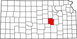
| State | Kansas |
| County | Marion |
| Township | Wilson |
| Founded | 1887 |
| Platted | 1887 |
| Elevation | 1,408 ft (429 m) |
| Time zone | UTC-6 (CST) |
| • Summer (DST) | UTC-5 (CDT) |
| ZIP Code | 66861 |
| Area code | 620 |
| FIPS code | 20-03400 [1] |
| GNIS ID | 477370 [1] |
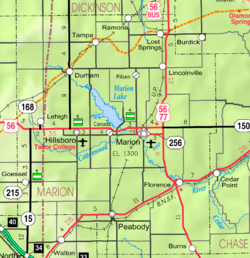
Aulne is an unincorporated community in Marion County, Kansas, United States. [1] The Aulne name was suggested by officials of the railroad when it was built through Aulne during the 19th century. [2] It is located southwest of Marion at the intersection of Pawnee Road and 140th Street, adjacent to the Union Pacific Railroad.
