Sherman County, Kansas

Last updated

Sherman County
Sherman County, Kansas courthouse from W 1.JPG
Sherman County Courthouse in Goodland (2012)
Map of Kansas highlighting Sherman County.svg
Location within the U.S. state of Kansas
Kansas in United States.svg
Kansas's location within the U.S.
Coordinates: 39°21′N101°43′W / 39.35°N 101.72°W / 39.35; -101.72
CountryFlag of the United States.svg United States
StateFlag of Kansas.svg  Kansas
FoundedSeptember 20, 1886
Named for William Tecumseh Sherman [1]
Seat Goodland
Largest cityGoodland
Area
  Total1,056 sq mi (2,740 km2)
  Land1,056 sq mi (2,740 km2)
  Water0.2 sq mi (0.5 km2)  0.02%
Population
 (2020) [2]
  Total5,927
  Density5.6/sq mi (2.2/km2)
Time zone UTC−7 (Mountain)
  Summer (DST) UTC−6 (MDT)
Congressional district 1st
Website shermancountyks.gov

Sherman County is a county located in the U.S. state of Kansas. Its county seat is Goodland. [3] As of the 2020 census, the county population was 5,927. [2] Sherman County was created by the Legislature of 1873, and named after general William Sherman, a general during the American Civil War. [4]

Contents

History

Early history

For many millennia, the Great Plains of North America was inhabited by nomadic Native Americans. From the 16th century to 18th century, the Kingdom of France claimed ownership of large parts of North America. In 1762, after the French and Indian War, France secretly ceded New France to Spain, per the Treaty of Fontainebleau.

19th century

In 1802, Spain returned most of the land to France, but keeping title to about 7,500 square miles. In 1803, most of the land for modern day Kansas was acquired by the United States from France as part of the 828,000 square mile Louisiana Purchase for 2.83 cents per acre.

In 1854, the Kansas Territory was organized, then in 1861 Kansas became the 34th U.S. state. In 1886, Sherman County was established.
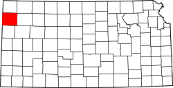
Geography

According to the U.S. Census Bureau, the county has a total area of 1,056 square miles (2,740 km2), of which 1,056 square miles (2,740 km2) is land and 0.2 square miles (0.52 km2) (0.02%) is water. [5]

Sherman County is one of only four Kansas counties to observe Mountain Time. Since Sherman County is part of the Wichita media market and the local broadcast stations are repeat signals of Wichita affiliates, prime-time programming in the county is aired from 6 to 9 p.m. local time, rather than 7 to 10 p.m. as is normal in the Central and Mountain time zones. However, cable providers carry the ABC and NBC affiliates from both Wichita and Denver, affording viewers the opportunity to view programs on those networks at the normal prime-time hours.

Adjacent counties

Major highways

Demographics

Population pyramid based on 2000 census age data USA Sherman County, Kansas age pyramid.svg
Population pyramid based on 2000 census age data
Historical population
CensusPop.Note
1880 13
1890 5,26140,369.2%
1900 3,341−36.5%
1910 4,54936.2%
1920 5,59222.9%
1930 7,40032.3%
1940 6,421−13.2%
1950 7,37314.8%
1960 6,682−9.4%
1970 7,79216.6%
1980 7,759−0.4%
1990 6,926−10.7%
2000 6,760−2.4%
2010 6,010−11.1%
2020 5,927−1.4%
2023 (est.)5,844 [6] −1.4%
U.S. Decennial Census [7]
1790-1960 [8] 1900-1990 [9]
1990-2000 [10] 2010-2020 [2]

As of the census [11] of 2000, there were 6,760 people, 2,758 households, and 1,781 families residing in the county. The population density was 6 people per square mile (2.3 people/km2). There were 3,184 housing units at an average density of 3 per square mile (1.2/km2). The racial makeup of the county was 93.83% White, 0.36% Black or African American, 0.33% Native American, 0.19% Asian, 0.16% Pacific Islander, 4.14% from other races, and 0.99% from two or more races. 8.45% of the population were Hispanic or Latino of any race.

There were 2,758 households, out of which 29.20% had children under the age of 18 living with them, 55.80% were married couples living together, 6.00% had a female householder with no husband present, and 35.40% were non-families. 29.20% of all households were made up of individuals, and 14.40% had someone living alone who was 65 years of age or older. The average household size was 2.40 and the average family size was 3.00.

In the county, the population was spread out, with 24.60% under the age of 18, 11.80% from 18 to 24, 23.90% from 25 to 44, 22.80% from 45 to 64, and 17.10% who were 65 years of age or older. The median age was 38 years. For every 100 females there were 104.50 males. For every 100 females age 18 and over, there were 101.40 males.

The median income for a household in the county was $32,684, and the median income for a family was $38,824. Males had a median income of $28,012 versus $20,927 for females. The per capita income for the county was $16,761. About 9.70% of families and 12.90% of the population were below the poverty line, including 16.90% of those under age 18 and 7.30% of those age 65 or over.

Government

Sherman County is predominantly carried by Republican candidates at the presidential level, as with the majority of rural counties. However, Lyndon B. Johnson narrowly carried the county in 1964, the only Democrat to do so since 1936.

Presidential elections

Presidential election results
United States presidential election results for Sherman County, Kansas [12]
Year Republican Democratic Third party
No.%No.%No.%
2020 2,26983.20%39614.52%622.27%
2016 2,08979.58%34713.22%1897.20%
2012 1,97675.33%57722.00%702.67%
2008 1,95972.45%68825.44%572.11%
2004 2,08875.60%63222.88%421.52%
2000 1,89470.62%68125.39%1073.99%
1996 2,11068.42%73623.87%2387.72%
1992 1,63049.73%81024.71%83825.56%
1988 1,92962.94%1,08235.30%541.76%
1984 2,70278.02%71420.62%471.36%
1980 2,31568.86%77923.17%2687.97%
1976 1,67150.15%1,57347.21%882.64%
1972 2,22569.92%78524.67%1725.41%
1968 1,80357.53%95430.44%37712.03%
1964 1,46348.60%1,52250.56%250.83%
1960 2,03065.08%1,07434.43%150.48%
1956 1,82564.97%96234.25%220.78%
1952 2,40370.41%94127.57%692.02%
1948 1,38050.00%1,28946.70%913.30%
1944 1,60860.07%1,02138.14%481.79%
1940 1,56952.16%1,39946.51%401.33%
1936 1,15938.26%1,81459.89%561.85%
1932 1,11232.19%2,11061.09%2326.72%
1928 2,02874.61%63023.18%602.21%
1924 1,12245.89%52821.60%79532.52%
1920 1,06654.33%78940.21%1075.45%
1916 58230.83%1,19663.35%1105.83%
1912 12913.11%46547.26%39039.63%
1908 43943.64%50850.50%595.86%
1904 46560.55%23130.08%729.38%
1900 38046.51%41851.16%192.33%
1896 29139.81%43759.78%30.41%
1892 57143.16%00.00%75256.84%
1888 80355.69%48133.36%15810.96%

Laws

Sherman County was a prohibition, or "dry", county until the Kansas Constitution was amended in 1986 and voters approved the sale of alcoholic liquor by the individual drink with a 30 percent food sales requirement. [13]

Education

Colleges

Unified school districts

Communities

2005 map of Sherman County (map legend) Map of Sherman Co, Ks, USA.png
2005 map of Sherman County (map legend)

List of townships / incorporated cities / unincorporated communities / extinct former communities within Sherman County. [14]
† means a community is designated a Census-Designated Place (CDP) by the United States Census Bureau.

Cities

Unincorporated communities

Townships

Sherman County is divided into thirteen townships. The city of Goodland is considered governmentally independent and is excluded from the census figures for the townships. Geographically, Goodland is located at the juncture of Voltaire, Itasca, and Logan Townships. In the following table, the population center is the largest city (or cities) included in that township's population total, if it is of a significant size.

Sources: 2000 U.S. Gazetteer from the U.S. Census Bureau.
Township FIPS Population
center
PopulationPopulation
density
/km2 (/sq mi)
Land area
km2 (sq mi)
Water area
km2 (sq mi)
Water %Geographic coordinates
Grant 281501150 (1)355 (137)0 (0)0.02% 39°28′26″N101°54′41″W / 39.47389°N 101.91139°W / 39.47389; -101.91139
Iowa 34450440 (0)279 (108)0 (0)0% 39°15′27″N101°29′38″W / 39.25750°N 101.49389°W / 39.25750; -101.49389
Itasca 346003214 (10)87 (34)0 (0)0% 39°19′33″N101°40′29″W / 39.32583°N 101.67472°W / 39.32583; -101.67472
Lincoln 41175951 (1)186 (72)0 (0)0.03% 39°19′5″N101°53′3″W / 39.31806°N 101.88417°W / 39.31806; -101.88417
Llanos 41650430 (1)185 (71)0 (0)0% 39°28′31″N101°28′29″W / 39.47528°N 101.47472°W / 39.47528; -101.47472
Logan 422502462 (5)138 (53)0 (0)0% 39°19′15″N101°46′55″W / 39.32083°N 101.78194°W / 39.32083; -101.78194
McPherson 44025520 (1)174 (67)0 (0)0% 39°10′18″N101°56′12″W / 39.17167°N 101.93667°W / 39.17167; -101.93667
Shermanville 65175510 (1)185 (71)0 (0)0% 39°29′54″N101°34′25″W / 39.49833°N 101.57361°W / 39.49833; -101.57361
Smoky 65950870 (1)280 (108)0 (0)0.12% 39°11′48″N101°46′11″W / 39.19667°N 101.76972°W / 39.19667; -101.76972
Stateline 68150 Kanorado 3442 (5)165 (64)0 (0)0.03% 39°19′6″N102°0′17″W / 39.31833°N 102.00472°W / 39.31833; -102.00472
Union 72425560 (1)140 (54)0 (0)0% 39°20′25″N101°27′24″W / 39.34028°N 101.45667°W / 39.34028; -101.45667
Voltaire 741752521 (2)411 (159)0 (0)0% 39°27′12″N101°43′4″W / 39.45333°N 101.71778°W / 39.45333; -101.71778
Washington 757501061 (2)139 (54)0 (0)0% 39°20′0″N101°32′59″W / 39.33333°N 101.54972°W / 39.33333; -101.54972

See also

Community information for Kansas

Related Research Articles

<span class="mw-page-title-main">Wichita County, Kansas</span> County in Kansas, United States

Wichita County is a county located in the U.S. state of Kansas. Its county seat is Leoti. As of the 2020 census, the county population was 2,152. The county was named after the Wichita tribe.

<span class="mw-page-title-main">Washington County, Kansas</span> County in Kansas, United States

Washington County is a county located in the U.S. state of Kansas. Its county seat and largest city is Washington. As of the 2020 census, the county population was 5,530. The county was named for George Washington, the 1st president of the United States.

<span class="mw-page-title-main">Wallace County, Kansas</span> County in Kansas, United States

Wallace County is a county located in the U.S. state of Kansas. Its county seat is Sharon Springs. As of the 2020 census, the county population was 1,512, making it the second-least populous county in Kansas. The county was created in 1868 and named in honor of Brigadier General W.H.L. Wallace, who had been mortally wounded in combat in the Battle of Shiloh. Wallace County is home to Mount Sunflower, the highest point in Kansas at 4,039 feet. Mount Sunflower is located approximately 15 miles (24 km) north-northwest of Weskan, less than one mile (1.6 km) from the Colorado state line. It is one of four Kansas counties to use the Mountain Time Zone rather than the Central Time Zone like the remainder of Kansas.

<span class="mw-page-title-main">Trego County, Kansas</span> County in Kansas, United States

Trego County is a county located in the U.S. state of Kansas. Its county seat and largest city is WaKeeney. As of the 2020 census, the county population was 2,808. The county was named for Edgar Trego.

<span class="mw-page-title-main">Thomas County, Kansas</span> County in Kansas, United States

Thomas County is a county located in the U.S. state of Kansas. Its county seat is Colby. As of the 2020 census, the county population was 7,930. The county was named after George Thomas, a general during the American Civil War.

<span class="mw-page-title-main">Sumner County, Kansas</span> County in Kansas, United States

Sumner County is a county located in the U.S. state of Kansas. Its county seat is Wellington. As of the 2020 census, the population was 22,382. The county is named after Charles Sumner, a U.S. Senator from Massachusetts who was a leader of Reconstruction politics.

<span class="mw-page-title-main">Stanton County, Kansas</span> County in Kansas, United States

Stanton County is a county located in the U.S. state of Kansas. Its county seat is Johnson City. As of the 2020 census, the county population was 2,084. It was named for Edwin Stanton, the U.S. Secretary of War during most of the American Civil War.

<span class="mw-page-title-main">Sedgwick County, Kansas</span> County in Kansas, United States

Sedgwick County is located in the U.S. state of Kansas. Its county seat is Wichita, the most populous city in the state. As of the 2020 census, the population was 523,824, making it the second-most populous county in Kansas. The county was named for John Sedgwick, the highest ranking Union general killed during the American Civil War.

<span class="mw-page-title-main">Rooks County, Kansas</span> County in Kansas, United States

Rooks County is a county located in the U.S. state of Kansas. Its county seat is Stockton, and its largest city is Plainville. As of the 2020 census, the county population was 4,919. The county was named for John Rooks, a private in Company I of the 11th Kansas Cavalry Regiment, who died at the Battle of Prairie Grove during the American Civil War.

<span class="mw-page-title-main">Rawlins County, Kansas</span> County in Kansas, United States

Rawlins County is a county located in the U.S. state of Kansas. Its county seat and largest city is Atwood. As of the 2020 census, the county population was 2,561. It was named after John Rawlins, a general in the American Civil War.

<span class="mw-page-title-main">Logan County, Kansas</span> County in Kansas, United States

Logan County is a county located in the U.S. state of Kansas. Its county seat and largest city is Oakley. As of the 2020 census, the county population was 2,762. The county was named for John Logan, a general during the American Civil War. One of the county's distinctive features is a mile-long stretch of Smoky Hill Chalk bluffs that tower 100 feet (30 m) high over the Smoky Hill River and are dubbed "Little Jerusalem" for resemblance to the ancient walled city. The formation is mostly on private land. In 2016, The Nature Conservancy purchased the property and the Little Jerusalem Badlands State Park opened to the public in October 2019.

<span class="mw-page-title-main">Lane County, Kansas</span> County in Kansas, United States

Lane County is a county located in the U.S. state of Kansas. Its county seat is Dighton, the only incorporated city in the county. As of the 2020 census, the county population was 1,574, making it the third-least populous county in Kansas. The county was named after James Lane, a leader of the Jayhawker abolitionist movement and served as one of the first U.S. senators from Kansas.

<span class="mw-page-title-main">Labette County, Kansas</span> County in Kansas, United States

Labette County is a county located in Southeast Kansas. Its county seat is Oswego, and its most populous city is Parsons. As of the 2020 census, the county population was 20,184. The county was named after LaBette creek, the second-largest creek in the county, which runs roughly NNW-SSE from near Parsons to Chetopa. The creek in turn was named after French-Canadian fur trapper Pierre LaBette who had moved to the area, living along the Neosho River, and marrying into the Osage tribe in the 1830s and 1840s.

<span class="mw-page-title-main">Kearny County, Kansas</span> County in Kansas, United States

Kearny County is a county located in the U.S. state of Kansas. Its county seat and most populous city is Lakin. As of the 2020 census, the county population was 3,983. The county is named in honor of Philip Kearny, a general during the American Civil War that died during the Battle of Chantilly.

<span class="mw-page-title-main">Harvey County, Kansas</span> County in Kansas, United States

Harvey County is a county located in the U.S. state of Kansas. Its county seat and most populous city is Newton. As of the 2020 census, the county population was 34,024. The county was named for James Harvey, a U.S. senator and 5th governor of Kansas.

<span class="mw-page-title-main">Hamilton County, Kansas</span> County in Kansas, United States

Hamilton County is a county located in the U.S. state of Kansas. Its county seat and most populous city is Syracuse. As of the 2020 census, the county population was 2,518. The county was founded in 1873 and named for Alexander Hamilton, a founding father of the United States.

<span class="mw-page-title-main">Grant County, Kansas</span> County in Kansas, United States

Grant County is a county located in the U.S. state of Kansas. Its county seat and only city is Ulysses. As of the 2020 census, the county population was 7,352. Both the county and its seat are named after Ulysses Grant, the 18th President of the United States.

<span class="mw-page-title-main">Cherokee County, Kansas</span> County in Kansas, United States

Cherokee County is a U.S. county located in Southeast Kansas. Its county seat is Columbus, and its most populous city is Baxter Springs. As of the 2020 census, the county population was 19,362. The county was named for the Cherokee tribe.

<span class="mw-page-title-main">Goodland, Kansas</span> City and County seat in Sherman County, Kansas, United States

Goodland is a city in and the county seat of Sherman County, Kansas, United States. As of the 2020 census, the population of the city was 4,465. It was named after Goodland, Indiana. Goodland is home to Northwest Kansas Technical College.

<span class="mw-page-title-main">Leoti, Kansas</span> City in Wichita County, Kansas

Leoti is a city in and the county seat of Wichita County, Kansas, United States. As of the 2020 census, the population of the city was 1,475.

References

  1. "Welcome To the Official Sherman County Website". Sherman County, Kansas. Archived from the original on February 18, 2009. Retrieved November 4, 2012.
  2. 1 2 3 "QuickFacts; Sherman County, Kansas; Population, Census, 2020 & 2010". United States Census Bureau. Archived from the original on August 20, 2021. Retrieved August 20, 2021.
  3. "Find a County". National Association of Counties. Retrieved June 7, 2011.
  4. William G. Cutler's History of the State of Kansas, published 1883 by A. T. Andreas, Chicago, Il., http://www.kancoll.org/books/cutler/unorganized/unorganized-co-p1.html
  5. "US Gazetteer files: 2010, 2000, and 1990". United States Census Bureau. February 12, 2011. Retrieved April 23, 2011.
  6. "Annual Estimates of the Resident Population for Counties: April 1, 2020 to July 1, 2023". United States Census Bureau. Retrieved April 3, 2024.
  7. "U.S. Decennial Census". United States Census Bureau. Retrieved July 29, 2014.
  8. "Historical Census Browser". University of Virginia Library. Retrieved July 29, 2014.
  9. "Population of Counties by Decennial Census: 1900 to 1990". United States Census Bureau. Retrieved July 29, 2014.
  10. "Census 2000 PHC-T-4. Ranking Tables for Counties: 1990 and 2000" (PDF). United States Census Bureau. Archived (PDF) from the original on March 27, 2010. Retrieved July 29, 2014.
  11. "U.S. Census website". United States Census Bureau . Retrieved January 31, 2008.
  12. "Dave Leip's Atlas of U.S. Presidential Elections".
  13. "Map of Wet and Dry Counties". Alcoholic Beverage Control, Kansas Department of Revenue. November 2006. Archived from the original on October 8, 2007. Retrieved December 28, 2007.
  14. 1 2 "General Highway Map of Sherman County, Kansas" (PDF). Kansas Department of Transportation (KDOT). November 2011. Archived (PDF) from the original on September 11, 2023.

Further reading

County
Maps

39°21′N101°43′W / 39.350°N 101.717°W / 39.350; -101.717